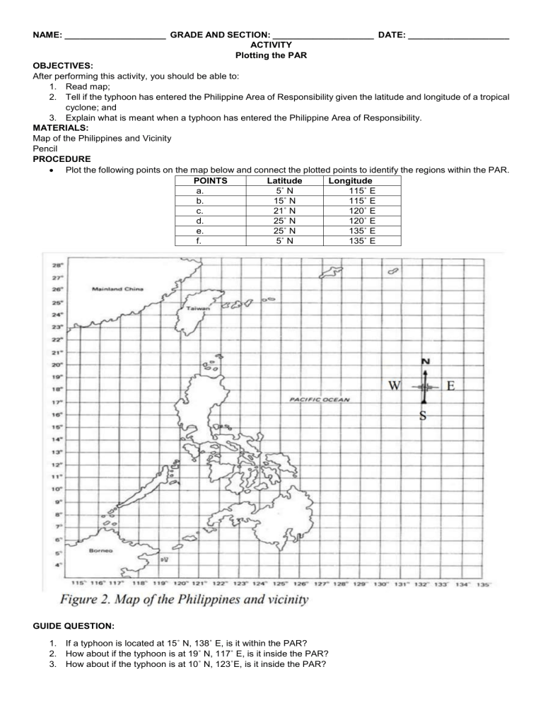
NAME: ____________________ GRADE AND SECTION: ____________________ DATE: ____________________ ACTIVITY Plotting the PAR OBJECTIVES: After performing this activity, you should be able to: 1. Read map; 2. Tell if the typhoon has entered the Philippine Area of Responsibility given the latitude and longitude of a tropical cyclone; and 3. Explain what is meant when a typhoon has entered the Philippine Area of Responsibility. MATERIALS: Map of the Philippines and Vicinity Pencil PROCEDURE Plot the following points on the map below and connect the plotted points to identify the regions within the PAR. POINTS Latitude Longitude a. 5˚ N 115˚ E b. 15˚ N 115˚ E c. 21˚ N 120˚ E d. 25˚ N 120˚ E e. 25˚ N 135˚ E f. 5˚ N 135˚ E GUIDE QUESTION: 1. If a typhoon is located at 15˚ N, 138˚ E, is it within the PAR? 2. How about if the typhoon is at 19˚ N, 117˚ E, is it inside the PAR? 3. How about if the typhoon is at 10˚ N, 123˚E, is it inside the PAR?

