Earth's Surface: Topography Maps
advertisement
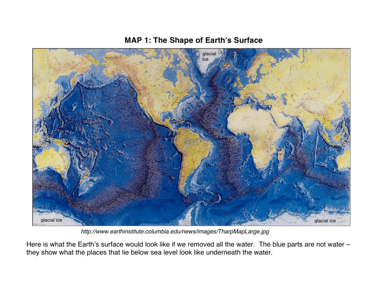
MAP 1: The Shape of Earth’s Surface glacial ice glacial ice glacial ice http://www.earthinstitute.columbia.edu/news/images/TharpMapLarge.jpg Here is what the Earth’s surface would look like if we removed all the water. The blue parts are not water – they show what the places that lie below sea level look like underneath the water. MAP 2: Global Topography - Elevations Above and Below Sea-level glacier glacier Here is a false-color image showing elevations of the surface of the Earth above and below sea level. The key to the colors is given to the right in meters (0 is sea level). Ocean basins and above sea level lakes are shown in shades of blue, and range from dark blue-black (deepest areas below sea level) to light blue (shallowest areas below sea level). Land elevations range from green (lowest elevation) to red (highest elevation above sea level). The red in Greenland and Antarctica shows the surface of the glaciers. Image courtesy of NASA/NGDC; http://www.ngdc.noaa.gov/mgg/image/2minrelief.html


