• Question Papers
advertisement
•
Question Papers
Exa mCod e: RA_CEO_I 62015
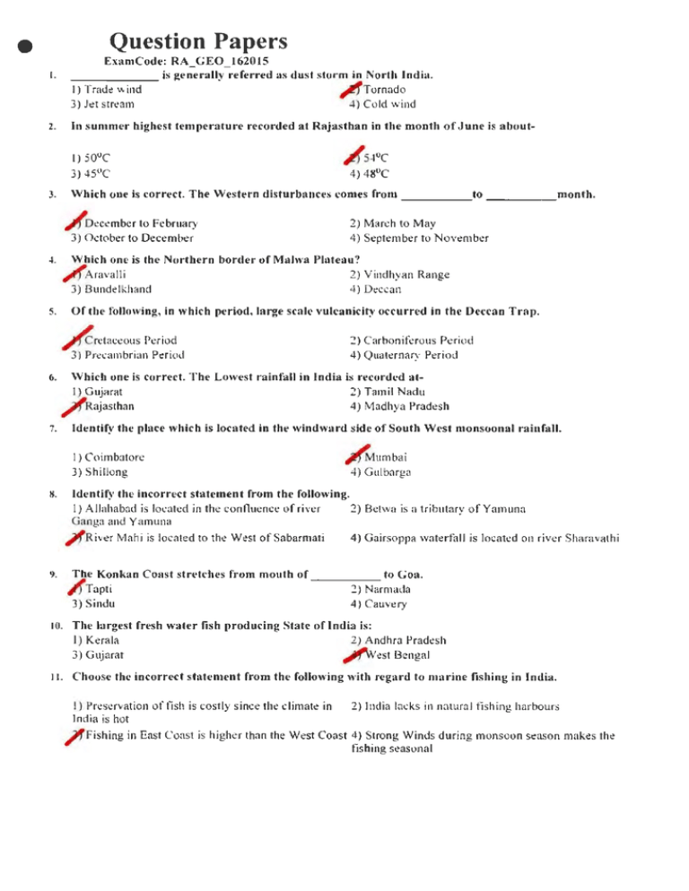
_ _ _ _ __ is generally referred as dust storm in North India.
I) Tract~ wind
,_trTornado
3) Jt!t str~am
4) Cold wind
I.
2.
In summer highest temperature recorded at Rajas than in the month of June is about-
3.
Which one is con ·ect. The W estern disturbances comes from _ _ _ __ to _ _ _ _ _month.
~Dec~mber to February
3) October to December
~.
Which one is the Northern border of Malwa Plateau?
~Aravalli
3) Bundelkhand
2) Yindhyan Range
4) Deccan
Of the following , in which period, large scale vulcanicity occurred in the Deccan Trap.
5.
/ cretaceous Period
3) Precambrian Period
6.
2) March to May
4) September to November
2) Carboniferous Period
4) Quaternary Period
Whicb one is correct. The Lowest rainfa ll in India is recorded at1) Gujarat
2) Tamil Nadu
/
Rajasthan
4) Madhya Pradesh
7.
Identify the place which is located in the windward side of South West monsoonal rainfall.
I} Coimbatore
3) Shillong
~umbai
4) G ulbarga
M.
Identify the incorrect statement from the following.
I) A llahabad is located in the confluence of river
2) Betwa is a tributary of Yamuna
Ganga and Yamuna
~River Mahi is located to the West of Sabarmati
4) Gairsoppa waterfall is located on river Sharavathi
9.
T he Konkan Coast stretches from mouth of _ _ _ _ _ to Goa.
~Tapti
2) Narmada
3) Sindu
4) Cauwry
10.
The largest fres h water fish producing State of India is:
I) Kerala
2) Andhra Pradesh
3) Gujarat
ttl'fwest Bengal
11.
C hoose the incorrect statement from the following with rega rd to m a rine fishing in India .
I) Preservation offish is costly since the c limate in
India is hot
2) India lacks in na tural fishing harbours
~ Fishing in East Coast is higher th<m the West Coast 4) Strong Winds during monsoon season makes the
fishing seasona l
•
Of the following, the yield per hectare of Sugarcane is highest in1) Uttar Pradesh
2) Karnataka
/ fTam il Nadu
4) Andhra Pradesh
12.
IJ. Identify the d ra ught breed of India from the following:
I) Gir
3) Deoni
2) Sahiwal
~ Nagori
F rom the given s tates, identify the o ne in which the ave rage size of land holding is la rge.
14.
2) Bihar
~ Nagaland
I) Kerala
3} West Bengal
15.
T he part of India which benefited much from the initia l phase of g reen r evolution was:
2) South and SouthEast
I ) South
3) West
16.
r
orth and NorthWest
Among the following the region ofvery low sheep po~ lation in India is:
I) Tempe rate Himalayas
,r) Ganga Plain
3) NorthWest India
....,. 4) Semi-arid Deccan
Comma nd Area Development Programmc(CA DP) la unched in India during 1975 ma inly aimed at the
development of:
2) Dry farming
~ Irrigation projects
4) Rural electrification
3) Land reforms
17.
18.
The Centra l Ins titute of Fisheries Nautical and Engineering Trading is located a tI) Goa
3) Mumbai
2) Kolkata
~ Koc hi
Asscrtion(A): North East Indian States produce 75% of tea in India. Reason(R): Tea is grown in estates
of ove r 100 hectares.
2) Both A and R are true and R is not the correct
A s oth A and R are true a nd R is the correct
explanation of A
/e~planation of A
4) A is false but R is true
3) A is true but R is false
19.
20.
::VIatch the following
Mines/Area
S tate
a) Sirigao
1. Nladhya Pradesh
b) Rowgbat
2. Goa
c) Kurband
3. Bihar
d) Noamundi
4. Orissa
a
b
c
d
A.
4
3
1
2
4~
C.
2
1
4
3
3
2
1
4
D.
1
3
4
:!
.....
•
21. High grade Mica is known as-
1) Ruby Mica
3) Potash Mica
~oney Mica
4) Phlogoplite Mica
22. Most of the Coal seams in India are located along the banks of the river-
!) Brahmaputra
, ro amodar
23.
2) Godavari
4) Ganga
Match the following
Manganese ore
mines
a. Ram kola
b. Tu·odi
District
1. BalaghaL
2. Bhandara
c. Tumsar
d. Ramtek
-l. Cbhindwa t·a
3. Nagpur
a
b
c
d
A.
3
1
-l
2
B.
4
2
3
1
C.
1
4
2
3
"
4
1
2
3
24. The largest Lignite reserve in India is located at-
1) Ram pur in Orissa
3) Bandala in Andhra Pradesh
25.
Leading producer of lron ore in India is:
I) Karnataka
/ 'O rissa
2) Jharkhand
4) Goa
is the first Coal forming stage.
26.
2) Lignite
4) Anthracite
I) Bituminous
Peat
,If
27.
2) Ramkho la in Madhya Pradesh
,
Neyveli in Tami l Nadu
~latch
the following
State
1) Madhya Pradesh
2) Bihar
Mines
a) Palamau
b) Durg
c) Kolhapur 3) Karnataka
d) Belgaum 4) Maharashtra
a
b
c
A.
,
3
2
4
1
B.
4
1
2
3
2
1
4
3
D.
1
4
3
2
d
28. Major Iron ore reserves in India occur in the peninsular plateau within _ _ _ __ _ of Dharwar
and Cuddapa systems.
~Crystalline schist
3) C rystalline diorite
2) Crystalline granite
4) Crystalline basalt
•
29. Arcording to Central Mine Planning and Design Institute (CMPDI) estimate total Coal reserve of the
country is about-
162,359 mi llion tonnes
3) 182,459 million tonnes
!)
2) 172.259 million tonnes
~ 192,359 million tonnes
30. Indian Iron and Steel company was setup in the state of-
1) Maharashtra
2) Gujarat
4) Karnataka
_;~{West Bengal
In which part of the Earth, earthquakes are frequently occuring?
31.
Circum- Atlantic Belt
Circum- Pa~:itic Belt
I)
/
2) Circum-
Artie Belt
4) Circum- India Belt
32. Which of the following property of Iron and Steel is used in all durable goods like machines,
automobiles, locomotives, tankers, ships etc?
Strength
I)
~lasticity
3) Ducti I ity
33.
I) Luck now
is known as Manchester of North India.
2) Allahabad
~Kanpur
Varanasi
3)
34.
4) Alloyabi lity
~latch
the following
Iron and Steel
lndustn·
al lndtan Iron and Steel
compa nv
bl v~,.•,vara)"8 Iron and
Steel wor k•
d Rourkela Ste•l Plant
dl Bokaro Steel Plant
f- ·
Sour ce of
Limeston e
1 Bhund1gunda
~
Bhag\\antpur
3 Pa t aghat
4 Hauban
a
b
c
d
~~
B.
3
1
4
~
4
3
1
~
c.
2
1
D.
1
.j
":3
3
.01111
~
35. Steel authority of India was established in the year-
1)1970
3) 1972
2) 1971
~1973
is one ofthe most important textile markt>ting centres of India.
36.
I) Ahmedabad
~ Mumbai
2) Aurangabad
4) Surat
37. Which of the following is corre,·tly mMched? I. Tata Iron and Steel Compan~' - 1957 II. Bhilai Steel
Plant- 1960 Ill. Durgapur Steel Plant- 1907 IV. Bokaro S teel Plant- 1964
I)
I
3)
Ill
2) Jl
~I V
38. A hmedabad, the leading cotton textile manufacturing centre of India is kJtown :1s-
~Boston of East
3) Boston of West
Boston of South
4) Boston ofNorth
2)
•
39. The Southern Pesticides Corporation Limited is located at1) Chennai
2) Bengaluru
3) Kottayam
~yde ra bad
40.
The growth rate of population in India is
listed. ~1a tch Lis t I with List II
List I
a) 1891- 19 21
h) 19 21 - 1951
c) 1951 - 1981
d ) 1981 - 20 11
Listll
High growth with
definite signs of slowing
down
2. Rapid growth
3. Staanaut population
.J. Steady growt h
l.
a
b
c
A.
2
1
4
d
3
"
3
4
2
1
C.
4
2
1
3
D.
4
3
2
1
41.
Which one of the following is not related to National Population Policy 2000?
I) Universallmmunisaton
~To promote the welfare of fi shermen and their
households in the coasta l belt
3) lncentiw to adopt two-child small family norm
4) Health Insurance Cover for those below the poverty
line who undergo sterilisation after having two
children
42.
Which of tht: following state has the highest Urban Population oflndia in 2011?
I) Tamil Nadu
2) West Bengal
3) Uttar Pradesh
.,..,Maharashtra
~1a tch
the follo\vi.ng
Chemical Company
a) Union Carbide I ndia
limited
b) National Organic
Chemicals limited
c) Udex Plam
d) Indian Petroleum
Corporation limited
a
b
c
d
,
3
1
4
2
4
3
1
2
c.
2
4
3
1
D.
1
2
4
3
A.
-14.
Place
1. Koyali
2. Vadodara
3. Thane
4. Trombay
Consider the following pairs: J. Hindustan Copper- Debad II. The Fertilizers and Chemicals
Travancore Limited (FACT)- Alwaye III. Hindustan Zinc- Khetri Which of the pair given above
is/are correct?
I) I Only
3) II and Ill
2) I and II
ttl"ll Only
•
45.
The Schedule Ttibes in India are listed in
List I and List II.
Schedule Tribe
State
1. Gujjar
a) Nagala.nd
2. Rawat
bl Jhark.hand
3. Sema
c) Rajasthan
4. Munda
dl Jammu and
Kashnm
d
a
b
c
A.
3
1
2
4
B.
2
3
4
]
c.
4
1
2
s
~
3
4
2
1
46. The Metropolita n region of Delhi is linked with the urban core of-
~ haziabad, Gurgaon, Faridabad
3) Kanpur, Mathura, Ambala
2) Modi Nagar, Saharanpur. Yamuna Nagar
4) Yamuna Nagar, Lucknow, Ludhiana
47. Which one of the following is the four leading populous states in India based on census 2011 ?
I)
Madhya Pradesh, West Bengal, Bihar, Tamil Nadu }!Uttar Pradesh. Maharashtra, Bihar. West Bengal
3) Maharashtra. Bihar. West Bengal. Andhra Pradesh 4) Uttar Pradesh. Andhra Pradesh. Bihar, Tamil Nadu
48. T he houses constructed by private la nd lords for the indust rial worker s in Calcutta a re called as-
l ) Chaw is
3) Ahatas
49.
/
sustees
4) Cheries
Union Carbide India limited- giant pl'trolcum factory was established in1) 1956
jlli!ft966
3) 1976
4) 1986
so. The Border Road Organisation was esta blished in1) 1940
3)1975
51.
,
1960
4)1965
W hich of the dis tr ict is noted fo r the lowest literacy rate in Tamil Nadu?
I) Karur
2) Ariya lur
Dharmapuri
4) Puuukkottai
/J
52.
/
Eutrophication isAbnormal growth of water plants
3) Leaching of water
2) Excess growth of fish
4) Endangeri ng urbanisation
53. Nationa l Ship Design a nd Researc h Centre (NSDRC) was se tu p at-
Chennai
3) Kolkata
1)
~Visakhapatnam
4) Cochin
54. W hich po rt ofl ndia expo rts Iron ore?
I) New Mangalore
~ M ormugao
2) Kochi
4) Chennai
•
S5. Vayudoot Airlines was set up in I) 1971
3) 1961
~981
4) 1991
56. T~ southern railway was formed between-
.lf l4.04. 1951 and 14.04.1952
3) 14.10.1951 and 14. 10.1952
2) 05.11.1951 and 05.1 1.1952
4) 15.01.1951 and 15.01. 1952
River Navigable by Brahmaputra distance is_ _ _.
I) 1290 km
~1 384 km
3)1190km
4)15l2km
S7.
58. The oldest artificial harbour in East Coast of India is
~Chennai
3) Kolkata
2)_M
_u_n_1b-a""""i
4) Visakhapatnam
59. The National Highway No.3 passes through the Pass of-
1) Bhor ghat
3) Pal ghat
, rThal gh<~t
4) Shipki Ia
Rolling plans in India was introduced first by:
60.
~anata Government
3) Bharatiya Janata Government
Rolling pla n bas-
61.
Two tier system
3) Four tier system
I)
2) Congress Government
4) Janata Dal Government
~Three tier system
4)
Five tier syst~:rn
l. Growth rate of ninth plan was
lower th~1n the eighth plan. II. Growth rate of ninth plan was lower than the target fixed. HI. There
was a marginal decline in the growth of service-sector than the previous five year plans. IV.
Formulation and approval of the ninth plan was d elayed by 2 yea r s.
62. C hoose the correct answer in respect of the following statements:
I) Only I & II are correct
~nly I. II & IV are correct
2) Only II & Ill are co rrect
4) Only Ill & IV are correct
63. C hoose the one from the following which is not ::1ssociated with the Pove r ty Alleviation and
Employment Generation Programmes.
lnd ira Awaas Yojana
3) Va lmiki Arnbedkar Awaas Yojana
l)
2) Sampoorna Grameen Rozgar Yojana
~ ational Capital Region Plan
6~.
The obj ective which is not a part of Swa•·najayanti G nmJ Swarozgar Yojana is:
I) To promote se If emp l oy m~:nt
2) To eradicate poverty in three years
4) The inco me of the assisted family should be >2000
/
To concentrate on command areas
per month
65. Identify the programme which does not come under Integrated Rural Development .P rogramme
(IRDP)-
I)NRDP
3) TRYSEM
2)MNP
/J CAD
•
66. T he numbe r of districts in the country where National Food for wo rk progra mme im plemented is:
I) 125
3) 175
~50
4) 200
67. T he Integra ted Rura l Develo pme nt Progra mme in India was la unched in the year~ 1972
2) 1975
1977
4) 1979
/>
68. P ick o ut the one fro m the following whic h is not s ponsored by sta te governmen t unde r T ribal Area
Development Progra mme!)
3)
Triba l developm ent blocks
Pre-matric sc holarships
2) Drinking water supply
~ Post-matric scholarships
i de ntify the correc t stateme nt in rt>spect of the VInth five year pla n.
69.
I) Growth rate in the initial period is higher than its
later part
3) Industrial sector registered a high growth during
1991 -92
70. T he dry southe rn pla ins of Ta mil Nadu includ es-
!) Coromandal plains covering Chengalpattu &
Vellore
3) Tiruchirappalli and Karur districts
~ 996-97 emerged as one of the best years in food
grain production
4) The current account deficit was reduced
~Pudukkottai, Madurai. Ramanathapuram and
Tirunelveli districts
4) Dharmapuri and Sa lem stretch
71. T he Kolli hills in Ta mil Nadu is located in the dist rict of:
I) Sa lem
3) Vilupuram
J" Narnakkal
4) Cuddalore
In South India, Tamil Nadu is th e la rgest producer of _ _ __ _
~Tea
2) Cotton
72.
3) Coffee
4) Rubber
73. T he range of annua l rain fall of the Tamil Na d u state _;.pa tially varies between :
I) 240- 1000 mm
"
3) 360 - 800 mm
640 - 1910 mm
4) I 000- 1500 mm
74. O f the following, w hic h river is known as Poruna i-
1) Bhavani
3) Thenpennai
2) Manimuthar
~ Tamiraparani
75. Which one of the foll owing river o f Tamil Nadu typically gets largest a mount from Southwest monsoon
show H?
I) Palar
~ Tamiraparani
76.
2) Pennaiyar
4) Vaigai
'The Pa lghat Gap' in the Wes te rn gha ts between Tamil Nndu and Ke ra la is a bout:
~ 25 km
3) !Okm
2) 50 km
4) I krn
•
77. The traditional indigenous variety of cotton known for black cotton soil in th e regions of Tamil Nadu
is:
~Tinnys
2) Cambodia
4) Uppam
3) Karunganni
78. 1Jtc first railway tnu-k in Tamil Nadu was laid between:
~ Royapuram and Walaja
3) Chenna i Egmore and Vi llupuram
2) Chennai Central and T a mbaram
4) Cht:nna i centra l to Katpadi
79. The required temperature for sugarcane cultivation is:
~0-35°C
I) 20-25°C
3) Below 20°C
4) Above 40°C
80. The test which is used to identify that the two population samples drawn are normally dis tributedI) t-test
2) Chi-square
/1 F-tt:st
3) Z-test
81.
Match the Minerals with their Districts
Minerals
a) Talc
b) Titanium
c) Dolomite
d) Tungsten
Districts
1. Tirunelveli
:::!. Dindigul
3. Vellore
4. Kanyakumari
a
b
c
d
,Jj~
3
4
1
2
B.
2
3
4
1
C.
1
2
3
4
D.
..1
1
,.,
3
S2. Tuticorin thermal power station star·ted-
1) June 20th 1978
3) July 20th 1979
SJ.
84.
~ uly lOth 1979
4)June lOth 1980
In 1986 Tamil Nadu consh·ucted the first wind mill at:
1) Tuticorin
2) Tirunelveli
r
anyakumari
4) Theni
Arrange the thermal power stations of Tamil Nadu on the basis of the installed capacity in ascending
order- a. Mettur b. Tuticorin c. North Chennai d. Ennore
I) Mettur. Tuticorin, North Chennai, Ennore
2) North Chennai, Ennore. Mettur, Tuticorin
3) Ermore, North Chennai. Tuticorin, Mettur
~Tuticorin, Mettur, North Chennai, Er111ore
•
85.
:\~la tch
t he sugar Factory with theu· district
I. Tha njavur
al Sakthi Sugar
Factory
b\ Subra.maniya Siva
S uaar factory
c) Na tiona l Sugar
Factory
d) Thiru Arooran Sugar
Factory
c
b
a
2. Madurai
3. Dhannapuri
4. Erode
d
A.
I
2
3
4
B.
2
3
4
1
~
4
3
2
1
3
4
1
2
D.
86. Of the following, districts of Tamil Nadu which one is not producing wind energy-
2) Kanyak umari
4) Thoothuk udi
Coimbatore
~Pudukkottai
I)
87.
Assertive (A) : The centre Kancheepuram is expert in the production of silk t.ex tiles. Reason (R) : The
district Kancheepuram is noted for sericulture that s upplies silk yarn.
I) Both A and R are true
3) A is false, R is true
/(A is true, R is false
4) Both A and R are fa lse
88. India n oil and natural gas corporation found petroleum potential at Ca uvery river basin in:
I) 2009- 20 I 0
3) 20 I I - 20 12
A 2o ro - 2011
4) 201 2 - 20 13
89. Only _ __ _ _ of the total weight of Copper ore is converted to Copper.
;!(2 to 3 %
I ) I to 2 %
3) 3 to4%
4) 4 to5 %
90. The total net area irriga ted in the Tamil Nadu in 2012-13 is:
I) 20. I 5 lakhs hectares
3) 24 .44 lakhs hectares
91.
~1atch
the following statement as:
a) Crude B1rtb
Ra~
I Total numbor of dutb per
year. per tbow.and
popula h on
2 ~umber of !J,.•, btrtb
dun ua year per tbousa.nd
populouon
3 ~u mbel' of women of
reproduetl\'o ago d''Uig
4 1\:uwbor o( eluldnn born
to women dunna M r ent1n:
bl Crude Death Rate
tl Tot al fe rtility rat@
d) Maternal
ruort W t)' ra~
,..
~producbon
a
b
c
d
2
1
4
3
4
B.
3
2
1
C.
4
I
3
2
D.
I
2
4
3
,i"f26.43 lakhs hectares
4) 29.64 lakhs hectares
92. The period of eleventh five year plan w~ls-
•
2) 2005-20 I 0
4) 2002-2007
ti'f2007-20 12
3) 20 12-2017
93.
Which of the following is not correctly
matched in Rural and Urban population of
2011?
Rural
U1·ban
Kane hip uram
63.5
36.5
B.
Salem
49.0
51.0
C.
Chennai
0.0
100.0
D.
Trichy
50.8
49.2
~
The Tamil N<ldu state achieved and received Krishi Karman award from Government of India during
the yt!ar-
94.
1) 2007-2008
~ 20 11 -2012
2) 2009-20 I 0
4) 2010-2011
95. Find the correct answer· in S upt!r National Highways?
I) SN H 1..-. Patna- Guwahati
3) SN H3 ...... Delhi - Kanyakumari
;if SNH2+-+ Chennai- Kanyakumari
4) SN H4+-+ Pathankot - Jalandhar
96. Railway system started between Chennai and Arakonam in _ _ __
I) 1840
2) 1846
""'1856
97.
4) 1890
The highest number of Scheduled Caste recorded in India in 2011 census:
~ U ttar Pradesh
2) Bihar
3) Orissa
4) Tamil Nadu
98. The number of districts which are identified as backward districts in India by the planning
commission to implement the drought pr·one area programme is:
I) 145
~ 238
2) 206
4) 321
The Scthn-Samudram S hip Channel Project (SSCP) place located at _ _ _ _ __
99.
/
I) Arabian sea
Adam's bridge or Ram setur
2) Bay of Bengal
4) Rameswaram
100. The distinct feature of graded strea m is:
~e ither eros ion nor deposition
3) Intensive depos ition
2) Intensive erosion
4) Both erosion and deposition
10 I. In cycle of erosion theor-y, the active factors structure, process and time are termed as:
I) Endogenic process
3) Exogenic process
tJ'f'rrio of Davis
4) Natural agents
•
102. A relatively smooth surface, low relief with inselbergs is known as:
~ediplain
2) Peneplain
3) Panplain
4) Alluvial plain
103.
'Oust-well' is a surface feature associated with2) Karst
Ji"G lac iers
I) Marine
3) Fluvial
104.
Pick out the correct order of karst landform from larger to smaller in size:
I) Do lines, Polje, Sinkho le, Uvala
Uvala, Dolines, S inkho le
~ Polje.
2) Do lines, Uvala, Polje, Sinkhole
4) Polje, Dolines, Uvala, Sinkhole
105. :Vlatch the following :
Erosional
process
a. Frost action
b. Exfoliation
c. Crys tallization
d. Chemical
weatherin"'
a
b
c
~
106.
3
Climate Region
1. Dese1·t areas
2. Arid climate
3. Cold climate
4. Hot and humid
climate
d
1
:.?
.t
B.
3
1
.t
:.?
c.
4
3
1
-~
D.
2
1
3
4
'Sheeting' is a physical weathering process associated with!) Stocks
~atholiths
3) Si ll
107.
Which one of the statement is NOT true as in the case of mature stage of cycle of erosion?
I) Lateral eros ion and valley widening
~ F lood plains
108.
4) U neroded relief feature
4) Pediments
In the fluvial processes, rejuvenation indicates:
I) Decreasing erosive power
3) Increasing depositional power
110.
2) Graded main river
In the mature stagt' of Pediplanation lnselbergs are weathered into:
I) Regoliths
~oppies
3) Debris
109.
4) Dikes
,(J"ncreasing erosive power
4) Decreasing depos itiona l power
Which one of the following is NOT true'?
I) Tropopause shows a gradual s lope from equator to 2) Height of the tropopause varies according to the
po les
seasons
3) The tropopause is the upper Iim it of most c louds
41There is no temperature inversion
and storms
, , .
•
Ill. :v!atch the foUowing and pick the con-ecr
option
a. D- Layer
1. Ultraviolet
photons
2. Appleton layer
b. E. Layer
3. Low frequency
radio waves
4. Free electrons
c. F. Layer
d. G. Layer
a
b
c
d
3
1
2
4
B.
2
3
4
1
c.
4
1
2
3
D.
3
4
1
2
~
112.
The atmospheric layer lying between 50 and 80 km is called _ _.
I) lonosphl!re
Mesosphere
2) Exosphere
4) Tropopause
/J
113.
Conduction is the process of heat transfer through matter by:
A'Mo lecular activity
3) Movement of a mass
114.
Atmosphere absorbs large part of the terrestrial radiation and conserve the heat energy of the earth is
called:
I) Black body radiation
3) G lobal warm ing
I IS.
2) Straight lines
4) Movement of a s ubstance
~ reen
house effect
4) Energy cycle
'Squall line' related with!) Dry weather
3) Clear sky
; {Heavy showers
4) Fog line
116. Match the following :
a. Cold front
b. Warm front
1. Friction effect
2. Precipitation is
Likely to be
prod uced
3. Colder dense air
c. Occluded frout
mass
d. Starionat-y front 4. Rapidly moving
cold front
a
b
c
d
,
3
1
2
4
1
3
4
2
3
1
4
2
D.
3
2
i
4
A.
B.
117.
The destruction or dying of a front is:
I) Fron to genesis
3) Orogenesis
~Frontolysis
.
4) Morphogenesis
•
118. C hoose the correct order of principal zones of frontoge nesis based on their importa nce.
I) Atlantic polar front, Mediterranean front, Atlantic- 2) Atlantic polar front, Atlantic-Arctic front, Pacific
Arctic front, Pacific Arctic front
Arctic front, Mediterranean front
~tlantic polar fron t, Atlantic-Arctic front.
4) Atlant ic po lar front, Med iterranean front, Pacific
Arctic fron t, Atlant ic-Arctic front
Mediterranean front. Pacific Arctic front
11 9.
Which one of the following is a n indicator for frontolysis?
2) Increasing temperature contrast
3) Convergent movement of air mass
4) Occlusion of air mass
~Diminishing temperature contrast
Cos mogenous ocean sediments a re of _ _ _ _ origin.
I) Volcanic
2) Tectonic
~Extra terrestria l
4) Continental
120.
121.
G ulf stream is the largest current of ______ ocean .
I) Pacific
~North At lantic
3) South Atlantic
4) Arctic
122. The highest salinity is found between:
~20° N to 40° N
4) 5° S to I 0° S
I) 5° N to I 0° N
3} 20° S to 40° S
123. i\Jatch the following :
Deeps/Trench
a. Roma nche
Trench
b. Nares Trench
c. Aldnch Trench
Location
1. Central South
Pacific
2. South Atlamic
3. East Indian
Ocean
4. ~E>a r West IndlE'S
Island
d Sunda Trench
a
b
c
d
~
2
4
I
3
B.
2
1
4
3
c.
2
4
D.
l
2
3
3
4
1
Sediments which a re of extra te rrestria l origin:
I) Terrigenous
/ f Cosmogenous
124.
125.
A dense fog produced a long the Newfoundland coast that restricts navigation due to the meeting of
kurile cold current with
warm current.
I) Hwnholdt current
3) West wind drift
126.
2) Biogenous
4) Hydrogenous
T_je other name for Humboldt current is:
'i Peru current
3} Kurile current
/
Kuroshio current
4) East Australian current
2) Cali fornia current
4) Kuroshio current
•
The desert of Kalahari is largely inOutmced by this ocean current:
I) Falkland current
2) South Atlantic drift
; (Benguela current
4) Peru current
127.
The gradients of continental slopes varies between:
I) 1-3 degrees
2} 1-10 degrees
~ 2- 5 degrees
4) 1-2 degrees
128.
The percentile share of Pacific ocean in the Ea rth 's ocean a rea is:
~48%
2) 40%
3} 45%
4) 43%
129.
130. ~e
term 'NRDMS' stands / ) National Resource Data Management System
3) National Resource Data Manipul ation System
131.
2 ) Nodal Resource Data Management System
4) National River Data Manageme nt System
Northwest Atla ntic provides a good breeding ground for fis h which lies nt the la titude:
~5°N to55°N
2) 20° N to 30° N
4) 60° S to 70° S
3) 20° S to 30° N
132.
Of tbe following, which is the recycla ble natura l resource:
I) Coal
~Gold
3) Oil
4) Gas
133.
Fill in the blank: Maharas htra is second largest producer of _ _ _ _.
I) Iron-ore
p
anganese
4) Aluminium
3) Bauxite
134.
~atch
the fo llowing ;
Hy dro power
station
a. Pykara
b. Kadamparai
c. Suruliyar
d. Periyar PH
a
135.
Dis trict
1. Theni
~. Tiru nelveli
3. Coi.mbatore
4. Nilgris
b
c
d
A.
3
4
2
1
11'
.t
3
2
1
C.
1
2
3
-t
D.
2
3
l
4
Ra nk the countries on the basis of their rice production : 1. Vietnam 2. Indo nesia 3. C hina 4. India
I) Vietna m. India, Indones ia, China
3) India, Indonesia. Vietna m, China
~China, India, Indones ia, Vietnam
4 ) Indones ia, India, Vietnam. China
136. Arrange the following countries from th e highest to the lowest in suga rcane production : C hina, India,
Thailand, Brazil
I) China. Thailand. India. Brazil
3) Thailand. India. China. Brazil
2) Brazil, China, India, Thailand
J'fBrazii. India, China. Thailand
137. Of the following countries, which one is the largest producer of wheat:
I) C hina
,j/fEuropean union
3) India
4) Russia
138. Rank the countries o f the basis of their Sheep/Goat meat export. a. Austra lia b. United Kingdom c.
Irela nd d . New Z eala nd
l) Australia, Ireland, New Zealand, United Kingdom 2) United Kingdom, Australia, Ire land, New Zealand
/ u nited K ingdom, l reland, New Zea land, Austra lia 4) Ireland, New Zealand, Austra lia, Un ited Kingdom
139. T he world's most extensive continental shelves a re loca ted in the:
~Mid latitudes in Nonhern Hemisphere
2) Tropical latitude in Northern Hemisphere
4) Equatorial region
3) Polar in Northern Hemisphere
1-'0.
14 1.
~1atch
the following :
Pollutant
Effect on human
Health
a . Oxides of
1. Chest troubles.
mtrogen
headache. \"Onllti~
2. Respiratory
b. Oxides of
Sulphur
ailments luna d.iseases
c. Ammonia
3. Bone cancer
d. Benzopyrene 4. Inflames upper
respira~ry svstem
a
c
d
b
A
3
2
4
1
B.
4
3
2
1
lji'
2
1
4
3
D.
1
4
3
2
Benzidine polluta nt causes:
I) Blood cancer
3) Bone cancer
~latc h
a . Urea
b. Ammonia
c. Ammonium
sulphate
d. Calcium
ammoruum n.itrate
a
b
c
2
3
4
143.
4) Breast cancer
the following :
F e rtilizer plant
i'
~ladder cancer
Dust emitting
p:u·t.icle
1. Limestone dust
2. Coke dust
3. Coal dust
4 . Sulphur dust
d
1
B.
3
2
1
c.
4
1
3
2
D.
1
4
2
3
4
Radioactive pollution comes under :
I) Air po llution
3) Therma l po llution
/
2) Noise po llution
Water pollution
•
•
Metallic pollutants are the sources of:
144.
2) Agricultural po llutio n
4) Noise po llution
1) Water pollution
~ Soil pollution
145. ).latclJ thP followmg :
1\ormal composition of dean air at or near
s.>a
Gases
Percent (by volwne)
1. 20.9476
a . :\iu"Ogen
2. 0 .0314
b. Oxygen
c. Carbon
dioxide
d. Hydrogen
,
A.
B.
D.
3. 0.00005
4. 78.084
c
d
2
1
-l
3
2
1
1
2
3
3
1
4
a
b
3
4
-l
2
146. Match the following :
Composition of polluted air
l. G•·o
a . co~
2. 52°o
b. S01
c. >Jiu"Ogen
3. l2°o
oxides
d . Hydro carbons 4. 18%
,
a
b
c
d
3
2
4
1
2
4
1
3
c.
1
3
2
4
D.
4
1
3
2
A.
147.
~atch
the following :
River
a. Yamuna
b. Gomti
Source of pollution
1. Paper mills
a
b
2. Sewage, tanneries,
distilleries
3. DDT factory.
sewage. power s ta tion
4 . Paper a nd pulp
uulls sewa~e
c
d
c. Godavari
d . Kaveri
148.
A.
1
3
2
B.
,
-l
2
3
1
c.
2
3
l
4
3
4
1
:!
4
How many people were affected at the time of Tsunami 2004, according to World Food Programme?
~More than
1.3 million
3) More than 3.2 million
149.
2) More than 2.1 million
4) More than 4.1 million
"Siri Siri" bags usage is a threat to urban environment which is related to1) Leather bags
3) Denim bags
,..rPolythene bags
4) Jute bags
150. The E uropeans emigration is tropical coastal lands of America after 17th century was caused for the:
I) Political instability in Europe
2) Insecurity caused by religious group
High previlage of commercial production of exotic 4) Seeking of high techno logy
crops
/J
The fifth stage in the demogra phic transitio n theory of population is:
I) High birth rate and declining death rate and rapid 2) High and fluctuating birth and death rate and slow
population growth
population growth
~ Birth and death rate approximately equa l, which
4) Low birth rate and high death rate and low
result in zero population gro\\1h
population growth
151.
15Z.
The "Mobility Tra nsition Model" was propounded by:
I) Everett lee
~elinsky
3) Ravenstein
4) Thompson
153.
T he positive checks to control popuiMion growth indica ted in Malthusian theo ry of population growth
comprise:
/J War. disease and poverty
3) Technology and Socio economic development
2) Postponement of marriage and Birth control
measures
4) Industrialization and Urbanization
154.
The demographic transition theory was given by:
I) Lee and Zelinsky
2) Spencer and Sadler
3) Ricardo and Dumont
~ W .S. Thompson and Frank W. Notestein
155.
A country is said to have au optimum population when the:
umber of people is in balance with the available 2) Birth rate is equal to death rate
resources
3) Demand and supply of labour are equal
4) Food supply is balance with population
p
1!'6.
The migration of s killed workers to seek better jobs in other co untries is:
I) Chain migration
~rain tlrain
4) Voluntary mi gration
3) Compulsory migration
The tia·st gro up of lndian labo urer s emigration in 1815 consisted of (.' Onvicts a nd criminals were
transported :
I) From Bombay to Mauritius
2) From Chennai to Malaysia
4) From Calcutt a to Malaysia
~ From Ca lcutta to Mauritius
157.
ISS. Cons id er the following statements and choose the correct a nswe r: Asse rtion (A): Western ma rgins of
continents a long Tropic of Cance r and Tropic of Capricorn are sparsely po pulated regions. Reason
(R): High mounta ins arc located in these regions.
I) Both (A ) and (R) are true and (R) is the co rrect
explanation of(A )
~ (A) is true but (R ) is false
159.
2) Both (A) and (R) are true but (R) is not the correct
explanation of(A)
4) (R) is true but (A) is false
Popula tio n explosion took place in this stage of demographic trans ition:
I) Stage - I
.,ilfStage- II
3) Stage- Ill
4) Stage - IV
•
•
Compleh.' diffusion of farmsteads over the entire agricultural land (Mauza) are characterized in:
160.
I)
S~:attered
settlements
~ Dis persed settlements
2) Compact settlements
4) Hamleted settlements
The term "Central place" was first coined by:
161.
I ) Harris and ullman
Jlwalter Christaller
2) Mark Jefferson
4) Von- Thunen
The concept of rural-urban fringe was proposed by-
162.
1) Alice cole man
3) Mark Jefferson
163.
4) Walter C hristaller
Historical town ofPahlliputra was built by1) Chandragupta Maurya
Ajatshatru
/f
16-4.
~Von- Thunen
2) Ashoka
4) Purosothaman
Accor·lling to the cens us of India, n metropolitan city is one which has the population ofI) 50000 or more
3) 500000 or more
2) I00000 or more
Jlf'l000000 or more
Towns located on the river estuaries is a common feature in the region of~ Western Europe
2) SE India
165.
3) South Africa
166.
As per the classification of towns by Cens us of India, the settlement with the population of20000 to
49999 falls under the category ofI) C lass I town
C lass Ill town
/1
167.
2) Middle class residence
4) Wholesale business
Which is wrongly matched?
I) Anaximander- Prepared first map of th~ world
3) Hipparchus - Compi led table of latitude
171.
2) Northl!rn Canada
4) Southwes t Asia
As per the multiple nuclei model, the land use which is not lol·ated adjoining to CBD is:
J (High class residence
3) Low class residen~e
170.
;I{Lower Himalayas
4) Rajasthan Desert
Identify the region which has ('Ornpact settlement from the following-
!j,Central Australia
/ > Nile Valley
169.
2) Class 11 town
4) C lass IV town
Nebular pattern of settlement in India is seen in the region of1) Indo-Gangetic Plains
3) East coastal plain
168.
4} Northern Australia
#-tecataeus- Wrote the second book of geography
4) lonians - Deve Jo pme nt of scie ntific thought in
cartography
The principles of mathematical l'artognlphy and methods of r·e presenting a spherical surface on a
plane s ur·face deals was postulated by·
I) Eratrosthenes
~ C laudius ptolemy
2) Hippa rchus
4) Pliny
J12.
The famous orbis Terra rum of 'Survey of the world' prepared by Marcus Vipasanians Agrippa in 12
BC was the contribution or·
I) Primitive Cartography
3} Greek Cartography
2) Indian Cartography
Roman Cartography
/J
173. Who discovered the relative movement of the earth and sun , before Copernicus?
I) Vara hamihira
2) Bhaskara
4) Aitareya Brahmana
~ Arya Bhatta
174. _ _ _of a map is usually placed in a corner enclosed within a line.
I) Title
3) Source
/
2) Direction
Legend
175. :\1arch !he follo-w·mg :
~1"1' p lac~
Map
c omponent!II
L. b sbo\\ n m on~ oft he
a Ta le
corners by an • uow pomt101 to
the north
2. Shou ld be lr\\"OD outnde
frame of the map on the bottom
rll!bt
3 Should be placed at
b Du-ectton
c Source
proounent place
d SCAle
4 Gen er•ll>· placed in tho rop
n oht of the map frame
a
b
2
1
c
3
B.
1
3
4
2
"
4
1
2
3
3
2
l
4
A.
D
d
4
176. _ _ _ _ _ _ _ _ _ _.is based on the principle of similar triangles and squares.
I) Projectional method
3) Photographic method
2) Mechanical method
~ Geometrica l method
177. In which method, Proportional compass is used for reduction or enlargement of maps?
l) Photographic method
3) Projectional method
~Mechanica l method
4) Geometrical method
178. Which is wrongly matched?
I) Photosat - Photographic method
3) Sim ilar triangles method- Geometrical method
2) Pro portiona l compass- Mechanical method
~ Pantograph - Projectional method
179. In which method, an e pidioscope has a built in mechanism to reduce or enlarge an image-
I) Mechanical method
3) Geometrical method
~Projectional method
4) Photographic method
180. The sampling tec hnique in which the rese~ucher can identify additional res pondents fr·orn existing
respondents known as1) Q uota Sampling
3) Judgement Sampling
/ snowball Sampling
4) Double Sampling
•
•
181.
Choose the one from the following which is not a scale of me:lsurement of geographical datal) Nom inal
3) Internal
182.
l) Observation
Unrestricted rando m sampling
J) System atic Sampl ing
A
185.
ystematic Sampling
3) Multi stage Sampling
~ inimum oftwo inde pende nt variables
4) One variable from each
In a case ·w here the values of both the d c.pendent and independent va riables decreases s imultaneously,
the kind of correlation exists is:
2) Multiple Corre lation
4) Negative Corre latio n
T he statistical technique which is not a measure of central tendency is:
l) Mean
3) Mode
188.
2) Strati fied Sampling
4) Area Sampling
For multiple correlation, the number ofvariables required is :
I) Partial Corrdation
~Positiw. Corre lation
187.
2) Stratified Sampling
4) Cluster Sampling
The method of sa mpling in which the smnpling units are selected at fixed inter-val is:
I) Minimum of two depende nt variables
J) M ini mum of two from both the Categories
186.
2) In terview
/ f Schedu le
Pick out the method of sampling in which each item of the population s btuds equal chance of selection-
A
II!~.
/> Frequency
The method of data collection in which the profo.r ma containing a set of questions is filled by the
enumerators is:
J) Questionnaire
183.
2) Ordina l
2) Median
J /Range
The correlation co-efficient in Pearson's product moment correlation is indica ted by-
~r
2) rs
J) p
4) s
189.
Data collected from the internet sea rch engines rightly classified as1) Primary Sources
2) Secondary Sources
,~'!Tertiary Sources
190.
Tbe inve nto r of 't' test1) S .M . Rattiullah
3) B.L.J. Berry
4) Q uarternary Sources
~W.S. Gosset
4) M.C. Kendall
•
191. :v!atch the following :
Mode h
a Binary
b. Index
Uses
1 Vulnerability analysts
2. Sitting Analysis
c. Regression
3. Quantifying the phys1cal
process
-1. Prediction
d Process
,.
a
b
c
d
2
1
4
3
B.
2
4
1
3
c.
2
1
3
4
D.
1
2
3
4
192. In which five year plan e mphasis was laid for Area Development Programme-
~Fifth five year plan
)) Fourth five year plan
3) Thi rd five year plan
4) Seventh five year plan
193. NRSA was esta blished in _ _ _ _ _under the Department of space, Government of India.
~1974
2) 1975
4) I 972
3) 1973
194. What is the ra nge of diffe rent intensities of radiation the sensor able to distinguis h?
As
2) 0- 5 bits
4) 26- 30 bits
to 14 bits
3) 20- 25 bits
195. Match the following :
Mappin(
a
b
Analysill
1. Hydrological studies
2. Vector
DE~ f
TI~
c Terrain
mapping
d Surface
curvature
"
3 Raster
.j
Z scale
a
b
c
d
3
2
4
1
B.
3
2
1
4
c.
3
1
2
4
D.
2
3
]
4
196. A local operation of Raster D~lta set that creates a new simplified raster is called-
I) Spline
Rec lass ification
/J
2) Masking
4) Autocorrelation
197. Which one of the following is NOT a Data component?
I) Attribute
3) Raster
2) Vector
SYMAP
/J
•
198. Match the following and pick the correct
code
a. Discrete feature
b. Continuous featw-e
c. TIN
1. Data model
2. Node
3. Dwells
d. Point
4. Rainfall
d
3
b
1
c
A
4
2
:jl'
3
4
1
2
C.
3
4
2
1
D.
2
4
1
3
a
199.
Based on the Rank-Size rule, the descending sequence of the selected metropolis of India will be-
l) Chennai. Kanpur, Ahmedabad, Jaipur, Nagpur
~Chennai, Ahmedabad, Kanpur. Nagpur, Jaipur
3) Ahmedabad, Chennai, Kanpur, Nagpur, Jaipur
4) Ahmedabad, Nagpur, Chennai, Kanpur. Jaipur
zoo. Name the model which integrates existing knowledge about environmental process in the real world
into a set of relationship and equations for qualifying the processes.
I) Binary Model
3) Statistical Model
A Process Model
4) Regression Model
