Review 34 GeoInformation Forum Japan 2001
advertisement
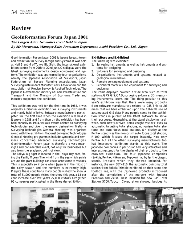
34 VOL. 6, NO 4 DECEMBER 2001 Review Review GeoInformation Forum Japan 2001 The Largest Asian Geomatics Event Held in Japan By Mr Maruyama, Manager Sales Promotion Department, Asahi Precision Co., Ltd., Japan GeoInformation Forum Japan 2001 is Japan’s largest forum and exhibition for Survey, Design and Systems. It was held at Hall 3 and 4 of Tokyo Big Sight, the international exhibition centre from 20th to 22nd June. On display were the latest surveying instruments, design equipment and systems.The exhibition was sponsored by four organisations, namely the Japanese Association of Surveyors, Japan Federation of Survey Planning Associations, Japan Surveying Instruments Manufacturers’ Association and the Association of Precise Survey & Applied Technology. The Japanese Government Ministry of Land, Infrastructure and Transport and the Ministry of Economy, Trade and Industry supported the exhibition. This exhibition was held for the first time in 1984. It was originally a biannual exhibition for surveying instruments and mainly held in Tokyo. Software manufacturers participated for the first time when the exhibition was held in Nagoya in 1988 and from then on the exhibition has been held annually. In 1994, various events related to surveying technologies and given the generic designation ‘National Surveying Technologies General Meeting’ was organised along with the exhibition. National Surveying Technologies General Meeting programmes include symposia and seminars concerning advanced surveying technologies. GeoInformation Forum Japan is therefore a very meaningful and considerable event, not only for businesses but also from the academic point of view. The Tokyo Big Sight is located in the Tokyo Bay area, facing the Pacific Ocean.The wind from the sea which swirls around the giant buildings can cause annoyance to visitors. This is especially so in June when Japan is in the midst of the rainy season and the humidity is extremely high. Despite these conditions, many people visited the show.A total of 31,000 people visited the show this year, a 13 per cent increase over last year’s 27,000 visitors. Altogether, 95 companies participated in the three day exhibition. Exhibitors and Exhibited The following was exhibited: 1. Surveying instruments, as well as instruments and systems for designing 2. Software for surveying and designing 3. Organisations, instruments and systems related to geological information 4. Remote sensing equipment and systems 5. Peripheral materials and equipment for surveying and designing The items displayed covered a wide area, such as total stations, GPS, GIS, CAD, surveying software, 3D measuring instruments, lasers, etc. The thing peculiar to this year’s exhibition was that there were many products from software manufacturers related to GIS. This could mean that we have embarked upon the full-scale use of accumulated GIS data. Many people came to the exhibition stands in pursuit of the latest software to serve their purposes. Meanwhile, at the stand displaying hardware, such newly-arrived items caught visitors’ eyes as automatic targeting total stations, non-prism total stations and auto focus total stations. On display at the Pentax stand was the non-prism auto focus total station, R-100, which focuses the target instantly. Not only Pentax but all the other surveying manufacturers too had impressive exhibition stands at this event. The Japanese companies in particular had very attractive and interesting stands for the display of their products to the crowded exhibition. The four Japanese companies (Sokkia, Pentax, Nikon and Topcon) had by far the biggest stands. Products which they showed included, for instance, the new SET4110, the automatic pointing total station from Sokkia.Trimble exhibited on their stand the toolbox line, with the (re)newed products introduced after the completion of the mergers with Spectra Precision and Zeiss. These included the new GPS Total Station 5700. Topcon Corporation showed, besides its Review VOL. 6, NO 4 DECEMBER 2001 35 surveying instruments, the GPS product line from Topcon Positioning Systems (formerly Javad Positioning Systems). Symposia and Seminars The National Surveying Technologies General Meeting consisted of a special lecture, symposiums, technical seminars and a vendor forum. The special lecture, entitled ‘Earth As Seen From Space’, was delivered by Japanese astronaut Mr. Mouri.This lecture was given on the second day of the exhibition and attracted a large audience, many of whom had to stand as all seats were filled. Mr. Mouri used 3D geographic earth data from the U.S. spacecraft, which covers about eighty per cent of the earth’s surface. The symposia handled such themes as ‘Requests to surveyors’, ‘Construction of digital national terrain using 3D image sensing’, ‘Tendency of GIS in Asia’, ‘GIS service for citizens’,‘Management seminar on strategic deployment of construction industry’, ‘Real-time GPS positioning and tentative station point’ and ‘Prospect of increased demand for cadastral survey.’ As regards technical seminars, presentations were given by the Association of Precise Survey & Applied Technology and there were presentations on advanced survey technologies by prestigious universities and enterprises. View on the Future Japanese ‘Surveying and Designing’ has made rapid progress in recent years and this has been accompanied by the advancement in electronic technology. There is absolutely no pause in the progress of absorbing of this information and communication technology. Backed by such a situation in surveying and designing, GeoInformation Forum Japan receives more and more visitors every year. The wave of electronic technologies which connect various surveying activities and minimise the amount of work needed will contribute greatly to the progress in survey technology. CALS and EC will be used in public construction works and a large amount of information exchanged electronically. Survey data obtained from a survey point may be electronically transferred immediately to any place in the world thanks to information technology. This will help accelerate the instant and rapid flow of survey information on a world-wide basis. Under such circumstances, survey work, which forms the fundamental part of survey information, will have to be rationalised in speed and efficiency. As a tool for rationalisation, the surveying instrument will have to be further improved. Progress in GPS, as well as automation by means of robotisation, will become more and more important.Advancement in software applications and associated cost reductions will also make surveying instruments accessible for purposes other than survey and construction. With all these factors taken into consideration, there will be ceaseless development and progress in surveying instruments and associated tools and systems.We are certain that next year’s GeoInformation Forum Japan will see a cornucopia of products and a record number of visitors.

