Huaca
advertisement
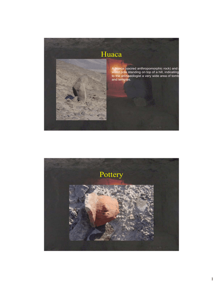
Huaca A huaca (sacred anthropomorphic rock) and a wood pole standing on top of a hill, indicating to the archaeologist a very wide area of tomb and temples. Pottery 1 Sampling Strategy Site/Region Architectural Detail Geometry GPS Aerial LIDAR Laser Scanning Photogrammetry Close Range Scanning Imagery Aerial Photography Satellite Imagery Digital Photography Kite Photography High Resolution Digital Photography Survey 2 3 Kite Aerial Photography 4 5 6 Digital Photography Panoramic Photography 7 8 9 Long-Range Laser Scanning 10 Leica HDS 2500 • Range: From 2m to 300m. • Accuracy: 6mm Accuracy. • Field of View: 40 Degree in the Horizontal and Vertical. • Scan Time: Approximately 1000 points collected per second. 11 Meshed Scan Data Plan and Section Cuts 12 Close Range Laser Scanning Type Laser light-stripe triangulation rangefinder Distance to object 0.6 to 2.5m (2m for WIDE) Scanned area (x,y) 1200 x 903 x 400 mm (@ 2 m) X, Y Resolution 0.35mm (0.6m) to 5.50mm (2.5m) Accuracy +- 0.008mm Camera Resolution 400 x 400 Pixel Scanning time 0.6s Weight 11kg Dimensions 210mm x 367mm x 326mm 13 14 Cirax 2400 • • • • • • • • • • Dimensions: 15,8'D x 13,25'W x 16,9'H. Weight: 20,5 Kg Resolution: 6 mm Spot laser: 6 mm Scanning time: 1000 points per second Acquisition: 50-100 m Vertical field of view: 40° Horizontal: 40° Integrated digital camera: 480 x 480 pixel. Software: Cyclone, Rapidform 15 16 DTM OF THE INCA’S PALACE: 60.000 POINTS 17 Appia Antica Project CNR-ITABC Soprintendenza Archeologica Comunale -3000 -2000 -1000 0 500 1000 2000 18 Ikonos, 1mt of resolution Caffarella DGPS double frequency (Leica 530) Accuracy: < 1cm Permanent Ground station 19 REAL 3D modelling from laser scanner 8,5 millions of points in 6 hours 20 Real time landscape Reality 21 Meta-reality Meta-reconstruction Meta-reality Meta-reconstruction 22 OpenSceneGraph www.openscenegraph.org • Open Scene Graph is a toolkit to develop graphic applications such as flight simulator, scientific visualisation, agumented reality environments. – Born in 1998, become Open project in 1999 – Based on OpenGL • Features: – – – – – Crossplattform (Windows, Linux, Irix) Real Time optimisation Wide range of input format support(flt, 3ds, obj, osg) Extensible through-plug-in architecture Built in support of paged lod terrain generation and navigation • OSG already provides both a tool to generate hierarchical paged terrains from Geoimages and Digital Elevation Models and a network loader capable of providing browsing of such hierarchies with reasonable bandwidth requirements. Virtual Terrain Project www.vterrain.org • VTP originally was a project on the creation of a comunity interested in the 3d digital creation of territories • VTP has developed software for real-time visualisation of territories (ENVIRO) and a series of other tools for geospatial data elaboration and the creation of models (VTBuilder, CManager…) • With these tools it’s possible to prepare geospecific data, such as vectorial, geoimage, DEM, etc (with VTBuilder) and to visualise and modify them dynamically in 3D (with Enviro). 23 The new VTP tools • Modified version of the two principal tools available from the VT project: – VT Builder – VT Enviro • Modifications: – Import different terrain databases (FLT, TXP) – Capabilities of importing different 3d models format inside Enviro (FLT, TXP, OSG, IVE) Appia Antica Project • Final Goal of the project: Creation of a 2d and 3d digital spatial archive for the Roman Superintendence on the Appia Park. In the future VR system for a visitor center that will be realized in the park • Goal of the OpenSource project 1)Creation of a shared, open, web-based, interactive system to reconstruct the territory and modify dynamically in 3d the landscape; 2)enable a restrict access to the acquired 3d data through the web for the teams (during the processing phase). • Source Data: GIS data; Satellite images; Historical Maps; Digital Pictures; Scanner Laser data; Laser total station data; DGPS data.. • Tool used and developed: GIS software; GDALlibrary; OSGdem; VT Builder; VT Enviro; ActiveX. 24 GIS data are used to build a three-dimensional terrain through a powerful tool, OSGdem, that generates paged and hierarchy terrain databases. Elevation data OSGdem Data acquisition: . on the field . in archives . other sources Geoimages Vectorial Data (Culture) VTbuilder Web publication VT ENVIRO VR application Results Realisation of an useful system for the Public Administration and the Research teams involved, but also for the worldwide community. In fact it let any user not only to navigate in real time through the Web even large territories, but also to interact dynamically with them: . adding point of views . activating or deactivating vectorial layers that can be added on the terrain, better understanding in this way the landscape. . switching different models of the same terrain 25 Future developments > A GIS repository based on an OpenSource WebGIS such as MapServer • A 3D Models repository based on OSG, PhP and PostgreSQL • A plug-in viewer for Internet Explorer for .ive (and .txp) formats, and either a stand alone application for other browsers. > An editing client with more functions such as the possibility to add new models or trees in geographical position, taking them from the repositories. • A server component to which is demanded the task of data distribution and validation • A rebuilding tool that activates a terrain re-generation procedure in order to apply the modified elements. We would like to continue the project inside an OpenSource perspective We are open to co-operation and to exchange ideas within this framework Aksum Project (part of the project was supported by CNR Agenzia 2000) Istituto Universitario Orientale Boston University CNR-ITABC CINECA -3000 -2000 -1000 0 500 1000 2000 26 LANDSAT TM Region of interest SPOT XS AERIAL PHOTO N Beta Giyorgis (Ethiopia) from SPOT XS (20 mt) N 27 Visibility and identification of a feature by aerial photo (3 mt) N The same feature from SPOT XS image (20 mt) N 28 The same feature from LANDSAT image (30 mt) N Identification of features by aerial photo 150 mt N 29 30 Compound Beta Gyorgis (Etiopia): DEM created with DGPS, 30.000 points acquired TR 2 Clay 31 Supervised classification: results • green:: NB_SB1-3, TR 1, TR 7, TR 4, BA, GA, OAZ3, TR 3, TR 6, G(uadguad) A(gazien) • yellow: TR 3, GN, TR 1, TR 5, TR 4, TR 7, O(na) E(nda) A(boi) Z(ewge) X-XII. • blu: OAZ9, OAZVT2, OAZ2 • red: OAZVT2, OAZ1, OAZ2 • dark red: OAZ7, TR 10, TR 7, TR 8, TR 9, ONA NAGAST AREA • light blu: TR 3 • orange: TR 3, T(ukul) E(meni) 32 Mindscape 33 34 35

