Document 11787396
advertisement
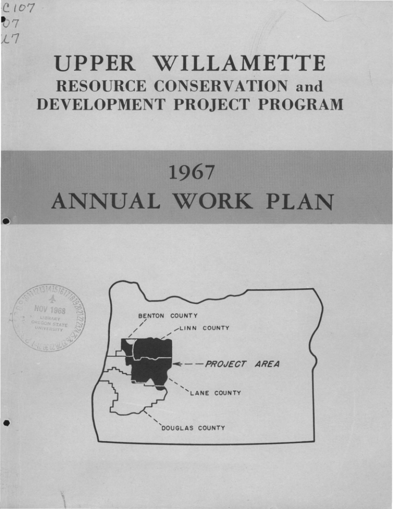
UPPER WILLAMETTE RESOURCE CONSERVATION and DEVELOPMENT PROJECT PROGRAM 1967 ANNUAL WORK PLAN ·~~~------------------------~ BENTON / / COUNTY / ....-LINN / COUNTY / --PROJECT AREA ' • '' 'LANE COUNTY ' DOUGLAS COUNTY t ANNUAL WORK PLAN Index Page No. Introduction • l Resource Committee Objectives and Goals • • Water Development • Agriculture Woodland Recreation Wildlife Town and Community Planning Countryside Beautification • Overall Objectives and Goals 2 8 10 13 18 19 21 22 • 1.221 ANNUAL WORK PLAN ( It gives me great pleasure to present our second Annual Work Plan which includes the objectives and goals of the Upper Willamette Resource Conserva­ tion and Development Project. It was developed by the seven Resource Com­ mittees, and was approved at a Coordinating Board meeting on March 22, 1967. It is expected that each Chairman will take such action as is necessary to accomplish the Committees' goals. I would like to thank all those who have participated in our program and in developing this • W. G. NASH Chairman • 1 WATER DEVELOPEENT RESGURCE COMNITTEE Paul Blazer, Chairman INTRODUCTION The Water Development Resource Committee of the Upper Willamette Re­ source Conservation and Development Project presents the following pro­ gram for 1967. The program will consist of water-resource-related acti­ vities and is in line with the responsibilities assigned the committee by the Sponsors as follows: l. Water resource problems a. b. c. d. e. f. 2. Flooding Irrigation Drainage Recreation Municipal use Industrial use Review the water resource program and keep projects, problems, and objectives u¢ated. • 3. Develop specific projects and programs as they are brought to the attention of the Committee. Some of these responsibilities are inter-related to other Resource Com­ mittees and we intend to cooperate with these committees in developing water resource programs. Following our Objectives and Goals is a listing of presently identified water resource project measures. OBJECTIVES AND GOALS l. Review all RCD construction type project applications related to water development when received, and recommend priorities to the RCD Project Sponsors. 2. Encourage the local Soil and Water Conservation Districts to set up and conduct meetings with local groups to explain local legal requirements necessary to utilize available Federal assistance. 3. Cooperate and coordinate with the Willamette Basin Project Committee in setting up one or more workshops on the need and methods of maintenance of revetment projects in the RCD area. 4. Encourage coordination and correlation of irrigation project development in the project area between interested groups and assisting agencies. 2 .. 5. Update the water-related measures in the Project Program. 6. Compile data and information that is needed for flood plain zoning and the effects of House Document 465 on structural project measures. 7. Encourage the state and counties to accelerate zoning of poten­ tial reservoir sites to reduce the possibility of highly intense industrial or urban development before the site can be utilized for storage. REOOMMENDATIONS 1. Recommend that Soil and Water Conservation Districts take the lead in the collecting of basic data during the early stages of project consideration. 2. Recommend that the Sponsors instruct each SWCD to establish priorities for projects within their District. Ig~ntifieg W~ter-Relateg Project~:~ • >:. ~~ 8ro (/) '0 •rl ti-l H 0 ti-l +' ~ Q) •rl Q) Q) @ :z; +' 0 Q) .,..., 0 H P-. oM ~ '0 H Q) 0 ~ ·;;, ~ ~P-. § P...!.1l P....--1 ~P-. 0 .--1 ell •rl '0 !.1l ~ !.1l P-. +' 0 oM 0 Q) 0'0 •rl § Q) Q) > +' !.1l 0 ~~ ~ BENTON OOUNTY: • Marys River West Muddy Creek Benton County Area Gleason-Beaver Creek Upper Muddy Creek Evergreen Creek Bull Run Creek Long Tom - Monroe Oliver Creek Reese Creek Marys River Division Irrigation Lewellyn Road Flood Whitley Ditch Flood West Long Tom Irrigation Winkle Butte Flood M F F F F F F F I I I F F I F CE CE X X scs SCS SCS SCS SCS & & & & scs CE CE CE CE SCS & CE X scs X BR scs scs BR scs X X X X 3 ~ 0 •rl +' ell .--1 fJJ ell ~ 0 •rl fJJ ~ •rl ~ ~ ~ +' bO H 0 0 p.., bO H 0 p.., m& 0 Q) Q) +' z X X ~ fJJ ~ 0 0 ~ H ~ +' !.1l H Q) p.., 0 ~£> H ;::$"0 "0 m H 0 •rl m ~ z +" 0 .m....., 0 H P-t m Cl) 4-i 4-i •rl ~ "0 H m Ul 0 OP. ~ H 0 •....., H £~ ~ ...-i ~& Ul +" bD Qj •rl p, ~ 0 •rl m ~ H 0 0 ~ +" bD +" m ~ •rl § P,Ql P,,..-i <!lP-t P-t -rl"' ~ Qj § m Qj > o m •rl +" 0 <!l 0"0 &:2 ~ 0 •rl +" 0 ...-i +" 0 -rl ~ Ul ~ 0 0 ~ H ~ +" Qj H p, 0 m LINN OJUNTY: Harrisburg Area Lower North Santiam Mainstream Santiam Millersburg-Dever Bear Branch Sucker Slough Thomas Creek Scio Division Irrigation Upper North Santiam Crabtree Creek South Santiam Grand Prairie Oak Creek Little Oak Creek Calapooya River Willamette River East Muddy Creek Walton Slough Lake Creek Hamilton Creek McDowell Creek Middle Santiam Upper South Santiam Brush Creek North Lake Creek (Tangent) Little Muddy Creek Upper Camas "B" Lateral "D" Lateral "E" Lateral Harrisburg Area Drainage China Ditch Dry Muddy Lower Camas Cochran Creek Spoon Creek Holley Reservoir Gaines Stock Ditch scs F F SCS SCS M F F F F SCS X SCS M F F F X M M X F F F F F X M M F F F F F F F F F F F F F M & CE • BR I F F CE CE scs scs scs SCS X & & X & CE & CE scs scs scs scs SCS & X X CE CE CE X X X scs CE scs scs X SCS SCS X & & CE CE SC3 scs SCS X X X X X X X & CE X CE scs scs scs scs scs scs scs scs scs scs scs F 4 X X X X X X X X • :>.. Q) :>.. ~a::1 ::::1'0 Cl) '0 H 0 Q) •rl Q) ~ 4--t 4--t ·rl s:: ~ s::Q) ~ '0 H Q) .,...., H 0 0 p. .,...., H C) 0 H p.. Q) Ul ::;;aj~ aj C) •rl tlD s:: s:: s::aj ·rl Ul r-i ~& 0 •rl ~ Q) ~ a> H C) 0 s:: p. tlD s:: •rl s:: ~§ P.r-i <IJP.. p.. •rl '0 aj § s:: s::0 ·rl ~ C) ~ ~ Ul Q) aj l> 0 Q) CJ'O •rl +> C) & :?;;aj s s:: 0 0 s:: H r-i ~ 0 •rl ~ aj H Q) p. 0 LINN COUNTY (Continued) : • Lacomb Irrigation Project Golden Valley Irrig. Proj. Scio Bank Protection Proj. Gate Creek Reservoir Detroit Reservoir Big Cliff Reservoir Green Peter Reservoir Foster Reservoir Cascadia Reservoir Beaver Creek Channel Albany Division Irrigation Calapooya Division Irrig. I I F M M M M M M F I I scs scs scs X X X X X z CE CE CE CE CE CE CE BR BR X X X X X X X X X X X X X X X X X X X X LANE COUNTY: • High Prairie Irrig. Proj. Goshen Coast Fork Willamette Upper Coast Fork Willamette Camas Swale Lynx Hollow Cloverdale Gettings Creek Silk Creek Martin Creek Mosby Creek Row River Upper Row River Pleasant Hill Middle Fork Willamette Hills Creek Rattlesnake Creek Lost Creek Little Fall Creek Bennet-Hall Creek Wallace Creek Edenvale I F F F F F F F M F X SCS & CE SCS & CE scs scs scs scs scs scs X X X H M F F F F F F F F F F scs scs X X X X X X 5 SCS SCS SCS SCS SCS SCS & & & & & & scs scs scs scs scs scs X CE CE CE BR CE CE X X 4 >. Q) >. :>C:O H ;:j'O '0 (/) H 0 Q) •rl z~ +' () Q) .,...., 0 H p.. ~ ~ •rl ~ 0 •rl Q) '0 H Q) til o H 0 p.. ·;;;o ~ ;:E:P.. ~ § +' () ;:j til 0 Q) 0'0 P..ttl P..rl C:X:P.. ~ al rl p.. §@ ttl ~ () •rl ~ § •rl '0 +' tllJ tllJ •rl m& ~ +' Q) +' H () 0 ~ p.. Q) &:2 Q) > 0 •rl H +' til ~ •rl 0 0 ex: H +' () ~ rl ~ 0 •rl +' ttl H Q) p.. 0 LANE OOUNTY (Continued) : Lane County Flood Plain Study Central Flood Protection Project Central Irrigation Project City of Cottage Grove ­ Silk Creek Flood Prot. Project Perkins Road Irrigation Proj. (Central District Imp. Co.) Spencer Creek Channel Improvement Berkshire Slough Irrig. Project Coburg Area McKenzie Area Peaceful Valley Erosion Project Fern Ridge Irrigation Project Dearborn Island Flood Project Willakenzie Area Camp Creek Mohawk River Lower Long Tom Upper Long Tom Lower Amazon-Flat Creek Ferguson Creek Bear Creek Coyote-Spencer Creek Fern Ridge Reservoir En­ largement Fall Creek Reservoir Blue River Reservoir Cloverdale Irrigation (Hendricks Road) F F I X X X CE and Lane County X scs X scs, BR & CE X X X • F X scs I X scs X F X scs X I F F X F X scs I X scs F F F M F F F F I_ M X M M M X I X X X X X X X scs SCS & BR scs X scs, scs scs scs X BR & CE SCS & CE SCS & CE X X X scs X X X SCS & CE SCS & CE SCS & CE X X X X X X X CE CE CE X X X SCS & BR X X 6 • ~~ ~ ;j'O CD tl) '0 CD H 0 ori 4-t +> s::0 CD •rl z s::CD ~ +> C) H .... CD Ul H CD .~ 0 H 0 e- Qj ;:I 8:1 C) s:: Ul bO +> Qj s:: C) ~ p.. m~ ori '0 +> CD H 0 4-t ori'O Qj Qj 0 CD s •rl s 0'0 P..IU P...--i :iii:E!:I se:s I I I X F X s:: ~ Qj ~ ~ ori ~ rl P-t Q) I> ori +> C) < s:: 0 ori +> C) ~ +> Ul s:: 0 0 s:: H rl ~ 0 ori +> Qj H CD p.. 0 LANE COUNTY (Continued) : • Cottage Grove Division Irrigation Saginaw Irrigation Creswell Irrigation Creswell Pump & Coast Fork Revetments Willamette City Flood Protection Project Cougar Reservoir Dorena Reservoir Cottage Grove Reservoir Dexter Reservoir Fern Ridge Lookout Point Reservoir Hills Creek Reservoir Waldo Lake Developments Hannavin Creek Brice Creek F M M M M M M M R F F X X X BR BR & PP&L BR & PP&L Lane County, SCS & CE Lane County, & scs X X X X X X X X X X X X X X X X X X X X X X X X X X X X X SCS & FS X X X scs X X X FS & CE X X X X CE CE CE CE CE CE CE X X NOTE: Some projects identi£ied above are definable units of a larger project which could possibly be developed. Reference Symbols: scs CE BR FS • Soil Conservation Service Corps of Engineers Bureau of Reclamation Forest Service M F IR z Multiple Use Flood Control Irrigation Recreation Report to Local Sponsors Source Data: Volume V, House Document 531 Middle and Upper Willamette River Basin Reports, Soil Conserva­ tion Service Oregon Cooperative Studies, Willamette River Basins East Long Tom, Coburg, and Cottage Grove Projects, Bureau of Reclamation 7 AGRICULTURE RESOURCE COMMITTEE Keith Crocker, Chairman INTRODUCTION The Agriculture Resource Committee presents the following as its annual program for 1967. RESPONSIBILITIES 1. Plan for intensified land use as a result of permanent land im­ provements brought about by providing flood prevention and irrigation measures. 2. Search out new market outlets to make better, more profitable use of our improved land resources. 3. Study feasibility and help in establishment of needed agricul­ tural processing plants. 4. Encourage adequate zoning of agricultural land. • OBJECTIVES AND GOALS 1. Continue feasibility studies of an alfalfa dehydrating plant in the RC&D area a. Request further assistance of ERS - RC&D Economist b. Sponsor field trip to Sauvies Island to see operations of alfalfa dehydrating mill c. Check on local pelleting operations now underway by individual assignments of Committee members 2. Representatives of the Agriculture Committee meet with the Planning Commission of the three counties and urge the adoption of zoning regulations permitting farmers to band together on a voluntary basis and apply for exclusive farm zone status within the meaning of Oregon Law. 3. Sponsor the preparation and printing of a brochure explaining the need for exclusive farm zoning and the advantages and disadvantages to farmers of their inclusion in such a district. 4. Set up field trials using bark as a backfill material for tile drains installed on neavy soils. 5. Set up field trials using bark as a vertical mulch if an adaptable machine can be located. 8 • t 6. Take action in starting a research project to evaluate the benefit of bark in field drainage. 7. Encourage the RC&D farm forester to study other uses for bark in agriculture. 8. Compile into one report the information gathered by the Tech­ nical Action Panels of the three counties including a generalized soil map. 9. Develop an informational brochure on agriculture for the RC&D area. 10. Have all members of the Agriculture Committee be alert for possible interest o f new agricultural processing companies and to supply them with all possible agricultural resource information that might influence them in developing facilities here. RECOMMENDATION: • The Agriculture Committee supports the Bureau of Reclamation irri­ gation projects both established and proposed and agrees that multi­ purpose use of our reservoirs be encouraged. In any reallocation of stored water, however, the needs of the land for irrigation water must be provided before converting to other types of uses • • 9 WOODLAND RESOURCE COMMITTEE R. G. Kintigh, Chairman INTRODUCTION It is recognized that nearly 80% of the area is in forests and woodland. Intensive management of this land is essential to full resource develop­ ment, and in turn to the economy of the area. Since timber is a long time crop, the future timber economy is dependent on today•s management. These lands are in several classes of ownership, both private and public, each of which has specific management objectives and problems. LONG RANGE OBJECTIVES 1. Support measures that will contribute to the acceleration of the development of the forest lands, to the end that forest lands pro­ duce their fair share of benefits to the overall economy, on all forest land in all ownerships by whatever means are available. 2. Awaken the awareness of owners and managers to the potential values and productiveness of their forest lands, and encourage them to make sound land use decisions. Management features needing acceler­ ation include proper treatment of young stands, orderly harvesting, and reforestation of understocked areas. tt 3. Take steps to inform and enlist the support of all groups in the area leading to the understanding of the development of the resource by compiling and publishing resource data, tours, demon­ strations, news releases, etc. 4. Support close coordination of agencies assisting woodland owners. Owners should be encouraged to develop their individual conservation and development plans for their ownership. Coordinate technical assi~tance to the owner in assisting him in carrying out his plan. 5. Development of additional markets to utilize all of the materials not now saleable that can be harvested from forest lands, Investigate such things as concentration yards, central location of chipping facilities, and special studies leading to improvement of specific markets, raw materials inventory, capital investment and costs of harvesting and manufacture. 6. Increase forest management and marketing assistance to small woodland owner class who generally need such facilities. 10 • t 7. Develop and keep current forest resource statistics in sufficient detail to meet the need for development of this project, and make this information available to woo~land owners and processors. 8. Investigate need and seek out interest in cooperative manage­ ment and marketing. 9. Accelerate soil surveys useful for the intensification of forest management and as a sound basis for making wise land use decisions. 10. Encourage forest resource agencies to study soil-plant nutrient relationships for raising production levels of forest lands. Such studies may also find useful data about specific Christmas tree growing problems. 11. Encourage the availability of some specialized equipment on a pilot basis such as post peelers, poisoning hatchets, etc. • 12. Encourage development of suitable recreational sites. Assist landowners to recognize these possibilities as a means to supplement forest land income. Cooperate in furthering a green way along the Willamette River . 13. Support adequate funding for soil surveys, stand improvement measures, land treatment, and recreational projects on public lands. 14. Promote tree farm certification, woodland owner associations, 1,000 board ft. clubs, and 1/4 century tree farms to encourage growers to adopt better tree cropping systems. 15. It is recognized that services of consulting foresters are needed to get the total job done, particularly in the field of marketing and management. Encourage landowners to use these services to the fullest extent. IMMEDIATE GOALS 1. Develop adequate news media to reach interested people through­ out the entire RC&D area. Begin publication of and RC&D newsletter. 2. Posts and allied use of small round products will be studied and summarized in depth. Make an inventory of existing post processing facilities in the state. Collect available cost price data from such facilities. Study market outlets in greater depth. Appoint and get in operation a market promotion committee. • 3. Begin studies of hardwoods in preparation for rapidly expanding markets. Encourage development of chipping centers. 4. Begin survey of forest resources on individual ownifrship through an appropriate agency. 11 t 5. Accelerate efforts to rehabilitate 100 acres of understocked forest brush land on small ownerships. 6. Encourage SCS to add one soil scientist in the RC&D area to speed soil surveys on forest land. Encourage industrial forest owner­ ship involvement in soil surveys. Help sponsor soil survey tours as surveys of new areas are initiated. Expand such tours to Benton and Linn Counties. 7. Encourage the assembling and publication, at earliest practical date, information on forest fertilization. 8. Stimulate greater participation of woodland owners on this committee. • • 12 RECREATION RESOURCE COMMITTEE Ben Christensen, Chairman INTRODUCTION The Recreation Resource Committee has been charged with the responsi­ bility of seeking to improve the quality and quantity of recreational opportunities on public and private lands. The committee has the following general objectives for the coming year: 1. Support and promote recreational developments throughout the area. 2. Continue to actively promote the development of the Willamette River Recreational Greenway proposal. OBJECTIVES AND GOALS 1. Encourage public and private recreational development by ­ • a. Completing the appraisal of potential for Outdoor Recreational development in the three RC&D counties. b. Actively support the efforts of federal, state, and local governments for public recreational development. c. Identify and promote opportunities for private recrea­ tional development. 2. Support and promote interest i~ and development of the Willamette River Recreational Greenway. a. Develop informational color slide program to promote interest in the Greenway concept. b. Prepare and provide appropriate map for use of recre­ ational boaters on the Willamette River. c. Coordinate promotional efforts with other groups or contacts interested in recreational development of the Willamette River. d. Public access to the Willamette ·River for recreational use is poor. Encourage new access developments • • 13 RECOMMENDATIONS The Coordinating Board added the following recommendations to the Recreation Committee's plan of work: 1. That any laws passed by the Oregon Legislature in connection with the Willamette River Greenway Proposal include the following: a. Consideration be given to proper policing of greenway areas. b. Landowners adjoining recreational developments be compensated for property damage caused by vandals. 2. That the RC&D Coordinating Board is opposed to the idea that a continuous strip of publicly owned land is necessary for the proper development of the Willamette River. CURRENT DEVELOPMENTS The Recreation Committee supports the current outdoor recreational developments being carried on by the various organizations and agencies in the project area and stands ready to assist in whatever way it can. Some of these activities are listed below for general information. It is not intended that these are all inclusive; in fact, they make up only a small portion of the work carried on by most of the organizations. ., Forest Service Waldo Lake - located in the Cascade Range in Lane County is the second largest natural lake in Oregon. 1. Access Road - 12.2 mile, two-lane road scheduled for paving this summer. 2. North Waldo Campground - This small 10-unit campground will be enlarged to 63 modern units. 3. Shadow Bay Campground - 103-unit campground to be completed this year. 4. Islet Campground - 60-unit campground - plans to be completed this year. Construction to be completed 1968. Oregon State Dame· Commission Completed plans for access sites and boat launching sites along the Willamette River and its tributaries. These plans are available to any group who wish to proceed with access developments. 14 4t Benton County 1. Bellfountain Park - Continued improvement of this site is planned. This park has an 85-foot picnic table constructed from one Douglas Fir log. Other facilities include shelter and kitchen, backstop, spring development, comfort stations, and access road. 2. North Albany Park - This park is in the early development stage. The county park board hopes to begin some development this year. Lane County 1. Orchard Point Recreation Area - Continued development is pJa nned on this park which is located on Fern Ridge Reservoir. The following developments are planned: 66 - 67 4t Rockfill breakwater jetty, 1500' concrete shore revetment, 22.5 acres irrigated lawn, 100 picnic units, park light system 25 acres, and plant 150 trees. 67 - 68 Remodel concession, parking lot 180 cars, and landscape park entrances. 2. Lowell Park - This excellent park located on Dexter Reservoir will be further improved with the following developments: 66 - 67 125' marina seawall, 54-unit permanent moorage, fuel dock, caretaker.1 s residence, and park landscaping. 67 - 68 22-unit moorage, 160 1 courtesy dock. 3. Baker Bay - Baker Bay on Dorena Reservoir will be further developed by: 66 - 67 Remodel concession building and construct curbs on boat ramps and parking lot. 67 - 68 Construct 25 picnic units. 4- River access program 66-67, 67-68­ • Willamette River ­ Whiteley Landing - ramp and parking Marshall Slough - acquisition, ramp and parking Detering Landing - ramp and parking Jasper Landing - acquisition, ramp and parking McKenzie River Deerhorn Landing- acquisition, ramp und · parking 15 Linn County. 1. Peoria Boat Landing - Expand and improve this boat landing site on the Willamette River at Peoria by adding picnic facilities and comfort stations, paving the parking lot and building docking facilities. 2. McKercher Park - Develop this park site west of Crawfordsville on Highway 228 with picnic and swimming facilities. 3. Laurelwood Wayside - Develop swimming and picnicking facilities at this site where Roaring River and Crabtree Creek join. 4. Tangent Community Center - Prepare this site for a community center including picnic facilities, comfort stations, and a ball field. 5. Gedneyck Boat Landing - A new development at Foster Dam to provide access to the new lake. 45 boats and trailers will be accommodated. Albany The City has recently completed a park and recreation plan. They in­ tend to develop and carry out this plan as fast as possible. • 1. Bowman Park - Complete development plans for this 20-acre waterfront park. 2. Maple Lawn Park - Develop a community picnic areas. center building and 3. Lehigh Park - Complete the acquisition of lands for this new park and construct a children's play area. 4. Sunrise Park - Complete land acquisition and develop the park adjacent to the Sunrise Elementary School. Corvallis 1. Pioneer Park - This badley needed park is located at the confluence of the Marys and Willamette Rivers. Plans are to construct a boat ramp, parking lot, boat basin and picnic area, and to dredge Marys River to the new ramp. Long-range plans also include a club house. 2. Willamette Park - Plans this year include the addition of more picnic tables and a general cleanup. 3. Avery Park - Riprap river banks to prevent eroding valuable park property. 16 • Eugene Eugene City Parks and Recreation Department supervises 46 recreation facilities. Over 12 major projects are planned this year; two are listed here for special comment. 1. Skinner Butte Park - Playground, picnic area, and walkways have recently been added to the vest end. Plans are to expand the park with emphasis on Willamette River frontage developments. 2. North Bank Park - Cooperate with the University of Oregon, and Lane County on plans for the development of this rather large park area fronting on the Willamette River. River Road Park and Recreation District 1. Emerald Park - The park area will be expanded and improved when a neighborhood flood control project is completed. • 2. The district has recently received a parcel of land in the Mohawk area from the Willamette Valley Lumber Company. Plans are to develop a primitive day camp, picnic facilities, and gun range. Willamalane Park and Recreation District 1. Island Park - Improvement and expansion of this park, which fronts on the Willamette River, with the goal of joining it to the North Bank Park in the Eugene Park system. 2. Willamette River Greenway - To purchase river frontage lands where possible and consistent with District objectives for future public use • • 17 WILDLIFE RESOURCE COMMITTEE Robert Strada, Chairman INTRODUCTION The Fish and Wildlife Committee has been charged with the responsi­ bility of seeking means for promoting and improving the valuable Fish and Wildlife Resources in the area. Important considerations include habitat improvement, farmer-sportsman relationships, improved access and pollution abatement. Coordination is needed where conflicts of interest involving fish and game populations and other uses occur. The following are our general objectives. 1. Promotion of the study of the the Willamette River. 11 Green Strip 11 concept along 2. Support efforts to amend the RC&D program in Congress to provide cost-sharing funds for fish and wildlife and recreational purposes. Companion bills have been introduced in Congress for this purpose, House of Representatives Bill #6575 and Senate Bill #1709. 3. Seek means to correct pollution in the Willamette River. The turbid and polluted waters seriously impair fish and wildlife and recreational values downstream. • OBJECTIVES AND GOALS l. Continue to promote and support the Willamette River Recre­ ational Greenway with other Resource Committees. 2. Explore legal problems involved in landowner-sportsman relationships. 3. Encourage game habitat food plantings by landowners and operators. Plant Sudangrass strip around grass seed fields for wild­ life food. 4. Seek means to correct pollution caused by gravel operators and others in the Willamette River. To do this we intend to: a. Identify and publicize the problem with special emphasis on turbidity. b. Seek cooperation of industries involved. c. Support legislation which will strengthen pollution laws and enforcement. 18 • TOWN AND COMMUNITY PLANNING RESOURCE COMMITTEE William F. Gwinn, Chairman INTRODUCTION The Town and Community Planning Resource Committee presents the following program for 1967. This program is in line with responsibilities assigned to it by the Sponsors and Coordinating Board as follows: 1. Water Resource problems as they relate to towns and communities in the area for a. Flooding b. Domestic water supplies including arsenic problems in some areas c. Sewage treatment d. Stream pollution • 2. Planned and orderly growth of urban developments 3. Economic development Some of these responsibilities are also of interest to other Resource Committees and we intend to cooperate with these committees in the de­ velopment of our program. OBJECTIVES AND GOALS 1. To take such steps as necessary to extend the Flood Plain information study as proposed on page 43 of the Project Program to include Benton and Linn Counties. To do this we propose this year to ­ a. Discuss with Linn and Benton County Courts the status of this project at the present time b. Take such action by way of supporting legislation or adequate appropriations as may be necessary 2. Cooperate with city and county governments, the Farmers Horne Administration and Extension Service in a study of rural communities regarding their need for community services. 3. • Work with leaders of communities throughout the project area to ­ a. Request they have a representative act on the Town and Community Planning Committee b. Furnish them information on services available through various federal and other programs. 19 4. Support the work of city and county planning boards by holding a series of meetings throughout the area on the need for and advantages of planning for orderly growth. 5. Request that the Cooperative Extension Service, Oregon State University, pursue ways of providing a Community Development Specialist to serve the Upper Willamette Resource Conservation and Development Project area. 6. Encourage county boards of commissioners in the three counties in the project area to add a soil scientist to their staff to ­ a. Work closely with SCS soil scientists in accelerating the completion of field mapping b. Provide county and city planning boards with basic soil surveys and interpretative data to be used in comprehensive planning c. Provide planning boards with on-the-spot inter­ pretations of small inclusions in soil mapping units d. Assist public works director and others in establishing specifications for roads and other construction projects • e. Assist county sanitarian in determining feasibility of proposed developments. 7. Assist and support other Resource Committees in their work on the Willamette River Greenway Proposal by doing whatever possible to make multiple-purpose use of lands administered by the State Land Board reality. • 20 •• COUNTRYSIDE BEAUTIFICATION COMMITTEE Ronel Paddock, Chairman INTRODUCTION The Beautification Committee has been charged with the responsibility of making our Valley more beautiful; of seeing that resource and land de­ velopment programs have planned into them elements of natural beauty; and of cooperating with interested citizen groups in beautification projects now underway. OBJECTIVES AND GOALS 1. There is a need to ascertain interest and action already ini­ tiated towards beautificati on. We propose to survey community interest and efforts toward beautification by sending letters and contacting appropriate civic bodies and private organizations. 2. • Closer contact with communities in the project area is essen­ tial in all aspects of project activity. This can best be done by a Community Development Specialist. The Beautification Committee requests that the Cooperative Extension Service ­ Oregon State University, provide a Community Development Spe­ cialist to the project. 3. Some of our new highways need landscape plantings. We intend to work with Lane County on beautification plantings on the beltline highway. 4. We, as a Committee, need to become better informed on beauti­ fication and to encourage the public to do the same. pose to: We pro­ a . Set up a reading list on beautification and make thi s list available to others. b. Develop a slide and tape program on beautification for use by civic clubs and groups in the area. c. Have speakers at future meetings to address the committee on beautification, litter control, etc. 5. • Because many desirable goals involve changes in our laws, the chairman is to set up a legislative committee to study and act on such matters • 6. For a long-range goal, we intend to study proposals for con­ tests in home beautification and improvement. 21 OVERALL OBJECTIVES AND GOALS In addition to the program prepared by each Resource Committee, the RCD Sponsors have established the following goals for individual project measures. 1967 Goal 1. Central District Improvement Company - Irrigation Project Complete system design 2. Hendricks Road - Irrigation Project Complete project 3. Complete project Lewellyn Road - Flood Prevention 4. Little Oak Creek - Flood Pre­ vention Complete project 5. Lacomb Irrigation Company Complete project 6. River Road - Flood Prevention Complete project 7. Little Muddy- Flood Prevention Begin first stage construction 8. Golden Valley Irrigation Project Complete Preliminary Report 9. Winkle Butte - Flood Prevention Complete Preliminary Report 10. Willamette City - Flood Prevention Complete Preliminary Report ­ Begin design surveys 11. Dearborn Island - Flood Pre­ vention Begin design surveys 12. Creswell Community Flood Pre­ vention Project Cooperate with Corps of Engineers when Water Control District is formed 13. Central Community Irrigation and Domestic Water Cooperate with local steering com­ mittee in determining local interest 14. High Prairie Irrigation Project Begin field work for Preliminary Report 15. Bear Creek Irrigation Project Complete Preliminary Report 16. Peaceful Valley Erosion Control Project Complete Preliminary Report Fern Ridge Irrigation Project Complete Preliminary Report 17. 18. Stafford Revetment 22 Cooperate with local sponsors and Corps of Engineers to begin prelimin­ ary studies. • • OVERALL OBJECTIVES AND GOALS (Continued) 1967 Goal 19. Willakenzie '566 Project Assist sponsors in moving project toward completion. 20. Amazon Flat Creek Assist sponsors when requested in beginning project construction. 1 566 Project 21. Grand Prairie '566 Project Encourage establishment of high priority for this project. 22. Coyote-Spencer '566 Project Cooperate with Water Control District Board in project development • • • 23

