Integrating Earth Observation with field data and model simulations
advertisement
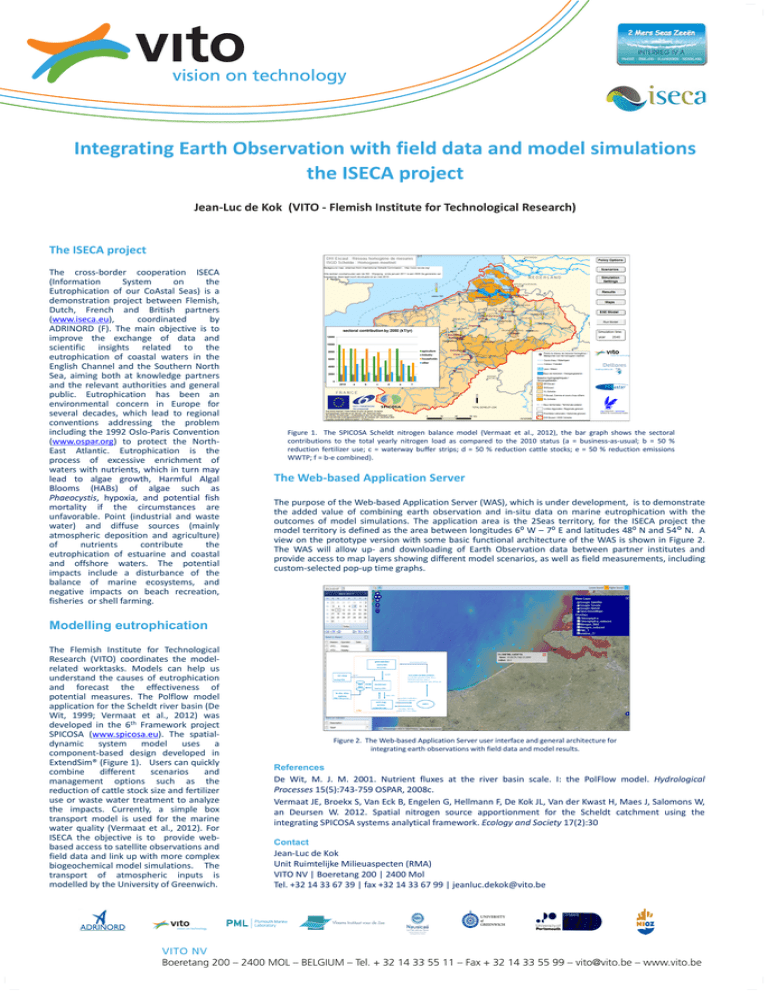
Integrating Earth Observation with field data and model simulations the ISECA project Jean-Luc de Kok (VITO - Flemish Institute for Technological Research) The ISECA project The cross-border cooperation ISECA (Information System on the Eutrophication of our CoAstal Seas) is a demonstration project between Flemish, Dutch, French and British partners (www.iseca.eu), coordinated by ADRINORD (F). The main objective is to improve the exchange of data and scientific insights related to the eutrophication of coastal waters in the English Channel and the Southern North Sea, aiming both at knowledge partners and the relevant authorities and general public. Eutrophication has been an environmental concern in Europe for several decades, which lead to regional conventions addressing the problem including the 1992 Oslo-Paris Convention (www.ospar.org) to protect the NorthEast Atlantic. Eutrophication is the process of excessive enrichment of waters with nutrients, which in turn may lead to algae growth, Harmful Algal Blooms (HABs) of algae such as Phaeocystis, hypoxia, and potential fish mortality if the circumstances are unfavorable. Point (industrial and waste water) and diffuse sources (mainly atmospheric deposition and agriculture) of nutrients contribute the eutrophication of estuarine and coastal and offshore waters. The potential impacts include a disturbance of the balance of marine ecosystems, and negative impacts on beach recreation, fisheries or shell farming. Figure 1. The SPICOSA Scheldt nitrogen balance model (Vermaat et al., 2012), the bar graph shows the sectoral contributions to the total yearly nitrogen load as compared to the 2010 status (a = business-as-usual; b = 50 % reduction fertilizer use; c = waterway buffer strips; d = 50 % reduction cattle stocks; e = 50 % reduction emissions WWTP; f = b-e combined). The Web-based Application Server The purpose of the Web-based Application Server (WAS), which is under development, is to demonstrate the added value of combining earth observation and in-situ data on marine eutrophication with the outcomes of model simulations. The application area is the 2Seas territory, for the ISECA project the model territory is defined as the area between longitudes 6⁰ W – 7⁰ E and latitudes 48⁰ N and 54° N. A view on the prototype version with some basic functional architecture of the WAS is shown in Figure 2. The WAS will allow up- and downloading of Earth Observation data between partner institutes and provide access to map layers showing different model scenarios, as well as field measurements, including custom-selected pop-up time graphs. Modelling eutrophication The Flemish Institute for Technological Research (VITO) coordinates the modelrelated worktasks. Models can help us understand the causes of eutrophication and forecast the effectiveness of potential measures. The Polflow model application for the Scheldt river basin (De Wit, 1999; Vermaat et al., 2012) was developed in the 6th Framework project SPICOSA (www.spicosa.eu). The spatialdynamic system model uses a component-based design developed in ExtendSim® (Figure 1). Users can quickly combine different scenarios and management options such as the reduction of cattle stock size and fertilizer use or waste water treatment to analyze the impacts. Currently, a simple box transport model is used for the marine water quality (Vermaat et al., 2012). For ISECA the objective is to provide webbased access to satellite observations and field data and link up with more complex biogeochemical model simulations. The transport of atmospheric inputs is modelled by the University of Greenwich. Figure 2. The Web-based Application Server user interface and general architecture for integrating earth observations with field data and model results. References De Wit, M. J. M. 2001. Nutrient fluxes at the river basin scale. I: the PolFlow model. Hydrological Processes 15(5):743-759 OSPAR, 2008c. Vermaat JE, Broekx S, Van Eck B, Engelen G, Hellmann F, De Kok JL, Van der Kwast H, Maes J, Salomons W, an Deursen W. 2012. Spatial nitrogen source apportionment for the Scheldt catchment using the integrating SPICOSA systems analytical framework. Ecology and Society 17(2):30 Contact Jean-Luc de Kok Unit Ruimtelijke Milieuaspecten (RMA) VITO NV | Boeretang 200 | 2400 Mol Tel. +32 14 33 67 39 | fax +32 14 33 67 99 | jeanluc.dekok@vito.be


![Legislation and Policy [in the UK] Stephen Malcolm Cefas](http://s2.studylib.net/store/data/011892618_1-c0e7411ac17feb92dbc5612ec0d95ebb-300x300.png)