Middle-Latitude Cyclones - I
advertisement
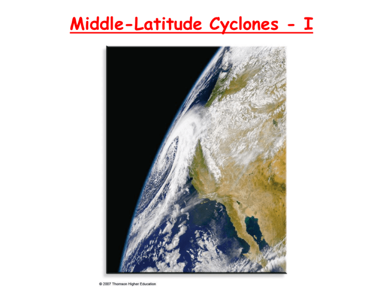
Middle-Latitude Cyclones - I RECAP: Types of Fronts • Cold fronts: cold, dry stable air is replacing warm, moist unstable air. • • • • Moves fast, showers along the leading edge (squall line). Warm fonts: warm, moist unstable air is replacing cold dry stable air. Overrunning: warm air rides up and over the cold air, widespread cloudiness, light-to-moderate precipitation well ahead of the front Stationary fronts: essentially no movement, winds blow parallel to the front, in opposite directions on both sides Occluded fronts: when a cold front catches up with a warm front (more later) The symbols on a map are in the direction of the air mass motion. Stationary Front • Stationary front- a front which does not move or barely moves. • Stationary fronts behave like warm fronts, but are more quiescent. • Many times the winds on both sides of a stationary front are parallel to the front and have opposite direction. • Typically stationary fronts form when polar air masses are modified significantly so as to lose their character (e.g., cold fronts which stall). • Typically there is no strong precipitation associated with stationary fronts (why? – no big contrast in the air mass properties, no air uplifting and condensation). • • • Occluded fronts. Cold fronts move faster than warm fronts. They can catch up and overtake their related warm front. When they do, an occluded front is formed. Cold occlusion: very cold air behind, not so cold air ahead of, the warm front The upper warm front follows the surface occluded front Cold occlusion Warm Occlusion • Very cold air ahead of, not so cold air behind, the warm front • The cooler air from the cold front cannot lift the very cold air ahead, • rides “piggyback” The warm front aloft precedes the surface occluded front Weakening/Strengthening of the Front • Frontolysis: ♦ The front weakens and dissipates ♦ Why?-the air masses start losing their identities. ♦ The temperature (humidity) contrast across the front is decreasing. ♦ Typical for slow moving fronts • Frontogenesis: ♦ The front intensifies. ♦ Why? – The temperature (humidity) contrast across the front is increasing. ♦ Example: cP air mass moves over warm ocean water. • • Weather Map Shown: surface-pressure systems, air masses, fronts, isobars, winds and air flow (large arrows) Green-shaded area: precipitation • Weather Map The example from Chapter 1: Fig. 1.14. Sample weather maps Polar Front Theory • Atheir model of how mid-latitudes storms develop: birth, growth, and decay. • The model connects the storms with the dynamics of the polar front: the transition zone • between the cold air in the polar cell and the warmer air at middle-latitude (Ferrel cell). The polar front is a region of air conversions at the surface, upward motion, and divergence aloft. This results in low surface pressure. Vilhelm Bjerknes Jacob Bjerknes + Halvor Solberg + Tor Bergeron The life of a mid-latitude (wave) cyclone The life of a mid-latitude (wave) cyclone • A:on the polar front is stationary: the winds are in opposite directions the two sides of the front. This creates a cyclonic wind shear. • B:alongA local perturbation: a region of low pressure appears somewhere the front. The front then breaks in two fronts: • • ♦ warm (moving northward - why? Coriolis force) ♦ cold (moving southward - why? Coriolis force) ♦ Central pressure: the junction of the two fronts A frontal wave is formed. ♦ The winds aloft set the general direction of motion (black arrow) ♦ The wave starts moving to the east and gradually becomes C: Open wave. The cold front moves faster than the warm front -> polar front bends. Warm sector between the two fronts. The central pressure keeps dropping: isobars now encircle it. • Weather patterns around a cyclonic wave South of the wave: ♦ First a warm front Warmer air advancing Wide band of precipitation. Starts with snow first. Then rain and drizzle. ♦ Cold front Cold air advancing Sharp drop of pressure Strong precipitation at the front. Then dry, cold, clear weather. North of the wave: some clouds associated with the low pressure center but no strong precipitation because there is no warm moist air around. • • • • • • • • • The life of a mid-latitude (wave) cyclone • D:front. Mature cyclone (initial occlusion). Cold front closes in on the warm Most intense stage of the storm. Clouds cover a large area. • E:together. Advanced occlusion. Triple point: where all three fronts come The center of the storm gradually dissipates: • ♦ Cold air on both sides of the occluded front ♦ Warm sector far removed – the rising warm and moist air provides energy for the storm (kinetic energy, latent heat of condensation) F: Cut-off cyclone plus a stationary front once again. Family of cyclones Dying out E: Advanced occlusion C: Open wave Just forming B: Frontal wave Cyclogenesis • • Some regions have greater Any development or strengthening of a mid-latitude cyclone propensity for cyclogenesis: ♦ Gulf of Mexico ♦ Eastern slopes of Rockies and Sierra Nevada Lee-side lows ♦ Atlantic ocean east of Carolinas Nor’easters • • Lee cyclogenesis Famous nor’easters: the Great Blizzard of 2006 • • Developed an “eye” • Began on Feb 11 2006 All-time record snowfall (27 in) in New York City. • • Where do mid-latitude cyclones form? Typical paths of winter mid-latitude (anti)cyclones: ♦ Lows: towards the east-northeast ♦ Highs: towards the east-southeast Explosive cyclogenesis (bomb): when the central pressure drops very rapidly (more than 24 mb in 24 hours)
