Chapter 8: Major Elements
advertisement

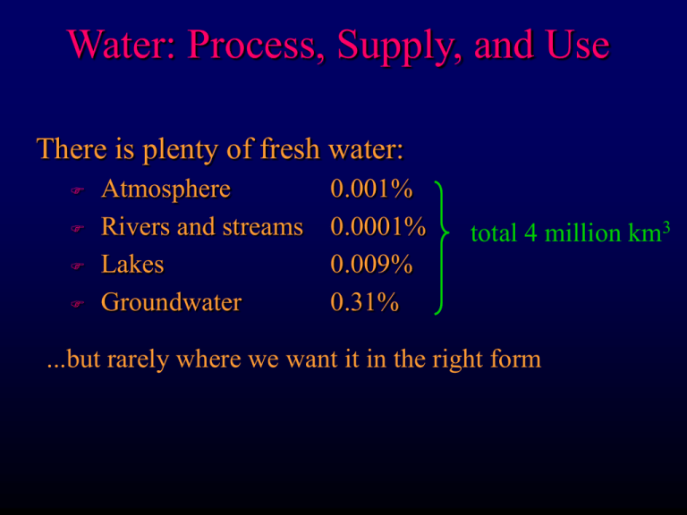
Water: Process, Supply, and Use There is plenty of fresh water: Atmosphere Rivers and streams Lakes Groundwater 0.001% 0.0001% 0.009% 0.31% total 4 million km3 ...but rarely where we want it in the right form Water: Process, Supply, and Use Global per capita water use is 2 m3/day US is 5 m3/day By 2000 will use 6000 km3/yr = 5% of total in lakes and rivers (including a huge amount in uninhabited areas, so locally much higher %) Of course this is renewable, but also pollutable US Water Resources Council est. by 2020 American water use may exceed surface resources by 13% Most of Americans use water that has been used at least once before Water: Process, Supply, and Use Surface water covered in largely in rivers section Surface water supply is controlled largely by precipitation Water: Process, Supply, and Use Areas with < 65 cm/yr have inadequate surface water supplies The West (particularly the Southwest) are headed for trouble How can we make up the difference? Water: Process, Supply, and Use Groundwater Fig. 10-6 Water table = top surface of saturated zone Capillary fringe: water drawn up by capillary action Groundwater usually flows due to slope of water table Water: Process, Supply, and Use Aquifer: high porosity and permeability (+ water) Clastic sediments Fractured igneous or metamorphic Basalts and upper brecciated zone, joints, soil/interbeds Dissolved limestone Impermeable layers are called aquitards (or aquicludes) clay, igneous… Water: Process, Supply, and Use Confined vs. unconfined aquifers “potentiometric surface” Artesian wells: under pressure beneath an aquiclude- water rises up the well pipe Flowing artesian wells actually rise above the ground surface Water table wells are the common type Water: Process, Supply, and Use The same principal works in terms of municipal water supply Water: Process, Supply, and Use Springs occur when the contact between an upper aquifer and a lower aquitard intersects the ground surface Water: Process, Supply, and Use Where to drill and how deep are difficult questions and require good subsurface data Cost of drilling a well averages $15/foot 10 ft. may be fine in a floodplain Generally deeper on slopes of hills A 1000’ well costs $15,000 Water: Process, Supply, and Use Pumping usually faster than recharge due to limited permeability of the aquifer Cone of depression Effect on neighbors Some recovery when cease pumping Compaction when lose water support can cause permanent decrease in porosity and permeability Water: Process, Supply, and Use Perched aquifer: held above the normal water table by an aquiclude Water: Process, Supply, and Use Groundwater flows into an effluent stream in wet climates This is a result of discharge from the aquifer Groundwater flows out from an influent stream in dry climates This results in recharge to the aquifer Recharge areas are often far from the discharge zone or point Water: Process, Supply, and Use Water Supply Water supply depends on climate, geology, stream flow, subsurface flow... Budget = annual runoff + groundwater Cannot contain and use all runoff Cannot extract and distribute all of groundwater Much groundwater is available where surface water is also Water: Process, Supply, and Use Water Supply In much of the American West there is often little surface or groundwater In places where there is groundwater and little surface water, there is a tendency to overdraw, or “mine” the aquifers (non-renewable) Groundwater overdraft for conterminous US in 1975 (Florida in East due to saltwater encroachment) The Ogallala (or High Plains) Aquifer > 170,000 mi2 and holds > 7 x 10¹⁶ gallons of water Charged in glacial times (over 12,000 yrs ago) Current recharge from rainfall (< 16-20”/yr) Main source of water in several arid states The availability of water from the Ogallala led to considerable agricultural development What do we do when the Ogallala aquifer runs dry? One study said that by 2015 the Ogallala will be so reduced and pumping will be so expensive due lowering of the water table that crop yields will be down by 80% and 300,000 people will have to migrate away Water: Process, Supply, and Use Movement of water to people 1. Withdrawal: quantity diverted or taken from surface or groundwater (A) 2. Delivery to point of use (B) 3. Release to pt. of return (C) 4. Conveyance loss: lost in transit (A B) 5. Consumptive use: portion evaporated, leaked, transpired, or absorbed by crops, etc. 6. Return flow: amount returned to surface or groundwater and available for future use Water: Process, Supply, and Use Movement of water to people California: Source of water is runoff in north S. California indigenous water could support ~250,000 people Many cities experiencing shortages, groundwater pollution, salinization (from agriculture and encroaching seawater), etc. Part of Southern California’s answer to its water problem is an alternative to groundwater withdrawal: aqueducts and canals Water: Process, Supply, and Use Water Quality Dissolved material in ppm (or ppb) TDS = total dissolved solids (should be < 300-1000 ppm) “Hard” water: > 80-100 CaCO3 – MgCO3 Causes “scale” in boilers and hot-water pipes Prevents soap from lathering & rinsing Water softeners exchange Na+ for Ca++ and Mg++ Water: Process, Supply, and Use Water conservation is fairly effective since mid 1970’s Drip irrigation Industrial conservation Home conservation Running water or leaks (including mains), toilets, showers/baths, lawn watering, letting water run while washing dishes... Water: Process, Supply, and Use Movement of water to people Water management Geologic and climatic factors as well as political and economic Flood prevention in times of high flow and conservation/distribution when low Conserve groundwater when surface water is available: don’t mine it Desalination may provide fresh water Water: Process, Supply, and Use The Colorado: a managed river Mostly rural water is collected and distributed by dams, reservoirs, aqueducts, canals, and pipes to agriculture and millions of urban residents Water: Process, Supply, and Use The Colorado: a managed river Flow only 3% of the Mississippi, but lifeline of most of the Southwest Elaborate system of distribution, allocation, rights, legal squabbles, etc. between 7 states + Mexico Glen Canyon dam was built at the political boundary between the Upper and Lower Colorado districts Divided water rights between U & L basins Highly variable annual flows Evaporation and infiltration from reservoirs Salinity and pollution Water: Process, Supply, and Use The Colorado: a managed river Allocations made following an unusually wet decade over-allocation when flows returned to normal levels Central Arizona Project just finished (S. California has used 0.6 Maf of Arizona’s allocation) Dams and Reservoirs Dams are multifunctional, but generally designed for Flood control Hydroelectric Ancillary uses: Recreation Irrigation and municipal water supply Navigation Negative effects: Flood large areas: affect human/animal habitat Interrupt fish migration Interrupt sediment flow Water: Process, Supply, and Use Water and Ecosystems Natural ecosystems reflect a balance between climate, nutrients, soils, biota, hydrology... Humans are now degrading most ecosystems on a regional and global basis The most damaging effects are associated with degraded surface water conditions The effects can be far-reaching: even to the oceans (Aswan) and atmosphere (Amazon)


