Maps and Distances Quiz
advertisement
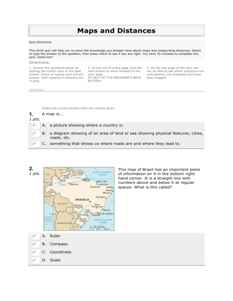
Maps and Distances Quiz Directions This short quiz will help you to show the knowledge you already have about maps and measureing distances. Select or type the answer to the question, then press check to see if you are right. You have 25 minutes to complete this quiz. Good luck! Directions: 1. Answer the questions below by clicking the button next to the best answer choice or typing your correct answer. Each question's answers are in grey. 2. At the end of every page click the next button to move forward to the next page. DO NOT HIT THE BROWSER'S BACK BUTTON! 3. On the last page of the Quiz you will be able to see which questions are unanswered, are answered and have been flagged. questions: Select the correct answer from the choices given. 1. A map is... 1 pts. A. a picture showing where a country is. B. a diagram showing of an area of land or sea showing physical features, cities, roads, etc. C. something that shows us where roads are and where they lead to. 2. This map of Brazil has an important piece of information on it in the bottom right hand corner. It is a straight line with numbers above and below it at regular spaces. What is this called? 1 pts. A. Ruler B. Compass C. Coordinate D. Scale 3. What does the scale on a map tell us? 1 pts. A. It shows the relationship (or ratio) between distance on a map and the corresponding distance on the ground. For example, on a 1:100 000 scale map, 1cm on the map equals 1km on the ground. B. It shows us how much smaller than our ruler the map is. C. It accurately tells us how big a country, place, land feature or distance is. We don’t need to do any maths to use it. D. The distance between places or things. True or false: Using just your eyesight will help you get an accurate measure of a 1 pts. distance? 4. True False 5. Which of the following can be used to accurately measure distances? 1 pts. Hint: There is more than one right answer. Put a tick in the box for all the answers you think are correct. A. Ruler B. Compass C. Tape Measure D. Software like Google Earth E. Protractor When we are measuring distance, which of the following units of measurements 1 pts. might we use? 6. Hint: There is more than one right answer. Put a tick in the box for all the answers you think are correct. A. Litres B. Centimetres C. Milligrams D. Kilometres E. Metres What is the name of the book in which we would find many maps of countries 1 pts. and a big map of the world? 7. A. Directory B. Atlas C. Map D. Novel 8. Using a map to find out a distance might be helpful when? 1 pts. Hint: There is more than one right answer. Put a tick in the box for all the answers you think are correct. A. Playing computer games B. planning a driving holiday C. designing a city D. writing an assignment E. 9. going sailing What does the direction shown on the compass tell us? 1 pts. A. Which way is up B. The location of South C. It shows us North D. Where the top of the page is 10. Which other directions are missing from this compass? 1 pts. Hint: There is more than one right answer. Put a tick in the box for all the answers you think are correct. A. South B. North C. East D. North east E. South west F. South east G. North west H. West Score: /10
