the East Rail Corridor December 15 th – Public
advertisement
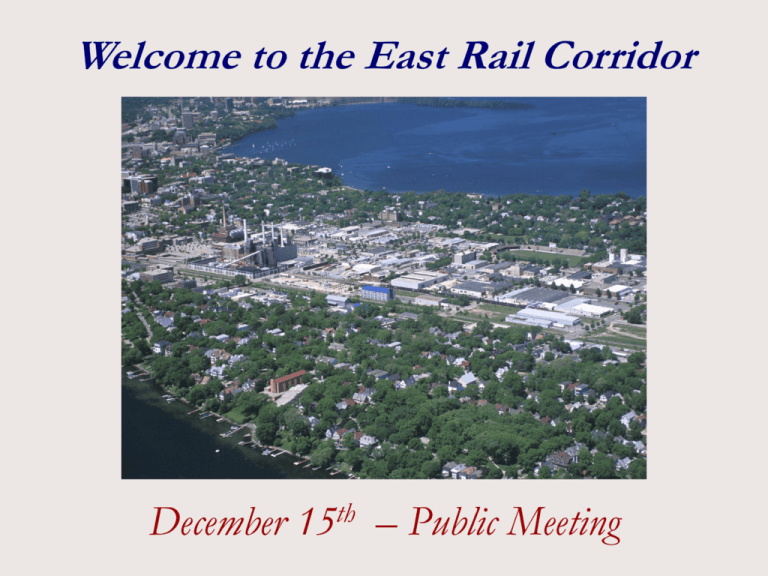
Welcome to the East Rail Corridor December 15th – Public Meeting The East Rail Corridor Planning Area is Bounded By: East Washington Avenue to the North East Wilson Street to the South Blair Street to the West The Yahara River to the East AGENDA EAST RAIL CORRIDOR PLAN ADVISORY COMMITTEE MEETING Saturday, December 15, 2001 Research Products Tech Center Meeting Room 130 South Ingersoll Street 9:00 A.M. to 11:00 A.M. 1. Introductions and update on the planning process. 2. Brief review of the study area’s existing conditions, background information, and planning challenges. 3. Presentation of the draft land use plan recommendations, including maps, sketches, and other information. 4. Beginning at approximately 10 A.M. and lasting until 11:00 A.M., there will be time for questions, comments and group discussion. 5. Adjourn. Planning Process Step One: Data Collection & Review -- December 2000 through May 2001 1. Collect and review various background information. 2. Review existing plans and recommendations for the study area. Step Two: Identify Issues & Planning Concepts -- February 2001 through July 2001 3. Identify planning process issues. 4. Visualize issues and identify alternative concepts. 5. Review and discuss background information, issues and concepts with community. Step Three: Develop & Choose Alternatives -- August 2001 through October 2001 6. Identify land use alternatives. 7. Present & review land use alternatives with community. 8. Evaluate alternatives. 9. Choose recommended alternative. Step Four: Create Plan -- October 2001 through December 2001 10. Identify implementation priorities. 11. Review draft plan, recommended alternative, and implementation with community. 12. Draft & adopt plan. EXISTING CONDITIONS IN THE EAST RAIL CORRIDOR East Rail Corridor Existing Conditions Employment, Housing & Population Around the Total Population Around Planning Area: Tenney - Lapham Neighborhood: 5,785 People M-S-A Neighborhood: 5,906 People Planning Area Tax Information in the Planning Area: 178 acres 74 taxable acres 107 exempt acres Tax Base of $50.3 million Total Housing Around Planning Area: Tenney Lapham Neighborhood: 2,855 Units M-S-A Neighborhood: 2,880 Units There are 3.2 million Square feet of Commercial and Industrial Uses in the Planning Area Total Employment in the Planning Area: 1990 - 3890 1999 - 3660 2020 - 7076 East Rail Corridor Existing Conditions East Rail Corridor Existing Conditions East Rail Corridor Existing Conditions PLANNING GOALS, RECOMMENDATIONS & ISSUES FOR THE EAST RAIL CORRIDOR East Rail Corridor Planning Issues Park & Open Space Goals: New park & open space areas of appropriate urban scale and size should be established in the study area. New park & open space areas must be accessible. Advisory Committee Recommendations: Recommend open space plan and effort to address the existing parkland deficiency and meet the future needs for new parkland. Explore many sources of funding to acquire parkland and establish new partnerships for ongoing maintenance of parkland and open space. Recommend acquisition and development of linked urban squares located on the blocks between Baldwin and Ingersoll streets, and the half blocks fronting both sides of Brearly Street. Link the Brearly Street urban square to the existing Willy Street Park. East Rail Corridor Planning Issues Park & Open Space Advisory Committee Recommendations (cont.): Widen the existing bike path between the downtown and the Yahara River by adding the relocated railroad right-of-way. Design the private open space to link with the public open space into one system. Greenway links between Baldwin Street and the Yahara River should be urban and linear. Questions for Phase II: What should be the features and functions of the park & open space? How should the park & open space interact with the adjoining use and vice-versa? Where should the park & open space funds come from? Should the park be a neighborhood park, an area park or a regional park? East Rail Corridor Planning Issues Residential Goals: Increase the amount of housing in the study area. Provide a mix of housing types, tenures, prices and rents to meet the needs of a variety of households. New housing should fit the character of the neighborhood. Advisory Committee Recommendations: Recommend new housing be of a character to fit in the neighborhoods. New residential development should be of a density range of 25 to 60 units an acre with a target for a 15% affordable housing component. Provide a density bonus for a commitment of 20% affordable housing. East Rail Corridor Planning Issues Residential Advisory Committee Recommendations (cont.): The City should develop a plan to assist developers to make the affordable housing possible using TIF and other tools. Partnerships with existing or future neighborhood affordable housing efforts are encouraged. New housing should be an overall mix of both owner-occupied and rental housing. Questions for Phase II: Where should the various densities of housing be located? What types of new housing would fit the character of the neighborhood? East Rail Corridor Planning Issues Transportation/Rail Alignment Goals: Maintain and enhance the linkages between the various transportation modes. It is very important to maintain cross-isthmus access. Maintain and increase bicycle/pedestrian linkages to jobs and recreation. Maintain access to the rail corridor for future mass transit options. Advisory Committee Recommendations: The City of Madison should explore the feasibility of relocating the railroad tracks to the northern alignment. The alignment should provide for potential multiple rail uses; freight, intercity, and commuter rail. Locate a commuter rail station near Baldwin Street. If northern alignment occurs, close Livingston Street for a consolidated MG&E campus. East Rail Corridor Planning Issues Transportation/Rail Alignment Advisory Committee Recommendations (cont.): Cross-isthmus traffic in the area should be focused on Baldwin, Ingersoll, Patterson, Blount, and Blair Streets. Pedestrian and bike links should be considered as part of the development of traffic patterns in the area. Shift surface parking lots into more intense uses, including parking structures. Establish a parking overlay zoning district. Consider residential parking districts to prevent parking spill over. Questions for Phase II: What are the impacts of the street closings to connectivity? How should the track relocation be implemented? East Rail Corridor Planning Issues Employment Uses Goals: The intensity of use in the employment areas should be increased. A diversity of business uses should be located within the study area, especially startup, high tech and research uses. Generate jobs in the study area and these jobs should employ residents of the neighborhood and encourage “walking to work.” Advisory Committee Recommendations: The predominant use of the East Rail Corridor is as an enhanced major employment center. Support the retention of existing businesses. Develop an MG&E campus. Encourage future uses and structures at higher densities and at multiple-story heights. East Rail Corridor Planning Issues Employment Uses Advisory Committee Recommendations (cont.): Focus on the Main Street corridor for redevelopment opportunities. Consider TIF and other tools to encourage investment in the area, especially transportation-oriented development near the commuter rail station. Questions for Phase II: How should business expansion and retention be accommodated? What are the appropriate types of businesses that should be located within the study area? What is the appropriate scale and character of this development? Where should the various types of businesses be located within the employment area? East Rail Corridor Draft Plan East Rail Corridor Draft Plan East Rail Corridor Draft Plan *Sketch created by VandeWalle & Associates and Modified by the City of Madison East Rail Corridor Phase II East Rail Corridor Plan Phase II – Detailed physical development plan Develop a proposed scope of work and identify outcomes for a more detailed and focused physical development plan to implement the Land Use Plan recommendations East Rail Corridor Phase II East Rail Corridor Plan Phase II – Detailed physical development plan Identify and secure funding commitments to assist in carrying out the physical development plan East Rail Corridor Phase II East Rail Corridor Plan Phase II – Detailed physical development plan Make recommendations to the Plan Commission and Common Council in the following areas: Open space and architectural design, transportation and infrastructure improvements, housing and economic development, environmental remediation and ecology, and funding and financing East Rail Corridor Phase II East Rail Corridor Plan Phase II – Detailed physical development plan Work with staff to identify the role and manner of selection of any outside consultants whose assistance may be requested and for whose work funds have been raised Question and Answer Session
