File
advertisement
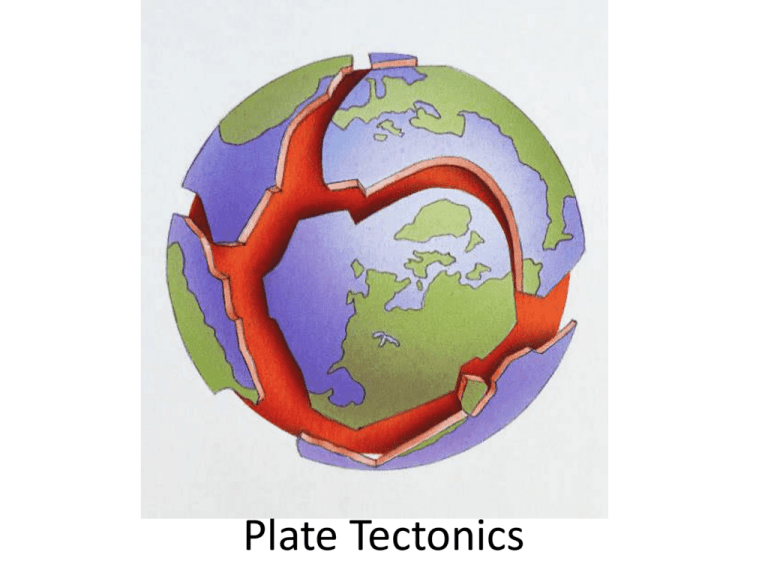
Plate Tectonics Plate Tectonics Continental Drift • Alfred Wegner—1st to propose the theory of continental drift • His theory– Continents were once a single landmass then, over time, they broke up and drifted to where they are today Wegner’s Evidence of Continental Drift 1. Fossil Evidence 2. Rock formations 3. Climatic Evidence 4. Geographic Evidence Fossil Evidence Let’s do a puzzle! • Fossil puzzle…match up the fossils on the continents to view Wegner’s evidence of continental drift Rock Formations • Just like fossils, similar rock formations were found on different continents Climatic Evidence • Shows that land used to have different climates than is natural to have in the current position of the land • Example: Tropical plant fossils were found in Antarctica Geographic Evidence • Shapes of continents look like they fit together and have similar geographical features FYI • *As continents rift or as mountains form, populations of organisms are separated. When • populations of organisms are separated, new species may evolve from existing species. • *Similar rock formations and fossil evidence supported Wegener’s evidence. Mid-Ocean Ridges --a place where crust is spreading an creating new ocean floor --a place where old crust is recycled (this process makes oceanic crust younger than continental crust) ACTIVITY!!!!!!!!! Lets make a mid-ocean ridge! Sea-Floor Spreading • Harry Hess hypothesized that the valley at the center of mid-ocean ridges was a crack in the Earth’s crust • At this crack, magma rises up to form new sea floor which cools and forms new sea flooring This process is known as sea-floor spreading Layers of our Planet Layers of our Planet • Lithosphere – the solid, outer layer of Earth that consists of the crust and the rigid upper part of the mantle • Asthenosphere – The solid, plastic or puttylike layer of the mantle beneath the lithosphere. Made of mantle rock that flows very slowly, which allows tectonic plates to move on top of it Theory of Plate Tectonics • This is the theory that explains how large pieces of lithosphere called plates, move and change shape Tectonic Plates • Scientists have identified about 15 major plates: Plate Tectonics Activity Types of Plate Boundaries Divergent Boundaries • These types of boundaries move AWAY from each other • Examples: Mid-ocean rifts, the Red Sea (between the African and Arabian Plates) Convergent Boundaries Plates collide together at these types of boundaries Examples: • Areas of subduction • Mountain ranges • Ocean trenches trench Transform Boundaries • A boundary at which two plates slide past each other horizontally Example: San Andreas Fault in California The Supercontinent Cycle • The process by which supercontinents form and break apart • This happens because tectonic plates of the Earth are always moving, though very slowly 450 Million Years ago • Near the end of the Precambrian time Earth’s continents were separated…not as much land was above water as today 250 Million Years Ago • By the end of the Permian Period, Pangaea had formed 150 Million Years Ago • Pangaea had split into two continents, Laurasia and Gondwanaland 60 Million Years Ago • Continents were moving toward their current positions on Earth Future? • Scientist propose that in about 250 million years the earth might look like this: Earthquakes What is an Earthquake? • Earthquake--Occur when rocks under stress shift along a fault (energy released) • Fault—break in rock where one block moves relative to another Let’s Build a Fault Model! Damage from Northridge Earthquake in Southern California--1994 Anatomy of an Earthquake • Focus--1st motion of earthquake in Earth, along fault • Epicenter—point on Earth’s surface directly above focus • 90% of continental earthquakes have shallow focus—most damaging Parts of an Earthquake Elastic Rebound Elastic Rebound— sudden return of deformed rock to undeformed shape Elastic rebound causes earthquakes Fence offset due to Elastic Rebound Seismic Waves • When rocks on a fault move, they release energy as seismic waves • Seismic waves travel outward from the focus in all directions Body wave—seismic wave that travels thru a medium –two types: P-wave & S-wave Seismic Waves • P (primary) waves are the fastest & travel thru solids, liquids, & gases Seismic Waves • S (secondary) waves are 2nd fastest & travel thru solids only. Although slower they can cause the most damage Seismic Waves Surface wave— a seismic wave that travels along surface of medium. These are S & P waves that reach the surface & can cause greatest damage Water Wave and Slinky Activities! WAYS TO MEASURE AN EARTHQUAKE • There are two major scales to measure an earthquake: –Mercalli Scale: measures earthquake intensity (by amount of damage caused) –Richter Scale: measures earthquake magnitude (strength) Studying Earthquakes • Seismology—study of earthquakes & seismic waves • Seismograph—records vibrations in ground • Seismogram—tracing of EQ motion, recorded by seismograph Bill Nye on the Richter Scale http://www.youtube.com/watch?v=1qbg7orb1lc Bill Nye on Waves Earthquake recording station/seismograph clip http://www.youtube.com/watch?v=dx4OqT0PYnU&lr=1 SEISMOGRAM Order of recording: P-waves, S- waves, then surface waves •Shows S-P lag time P-Wave S-Wave S-Wave S-Wave •To find S-P lag time, subtract where the P wave starts from where the S wave starts (S-P = Lag Time) What is S-P lag time for El Paso,TX? • 28 sec – 0 sec = 28 sec lag time What is S-P lag time for San Francisco, CA? • 120 sec – 0 sec = 120 sec lag time What is S-P lag time for Seattle, WA? • 165 sec – 0 sec = 165 sec lag time Which city is closest to the epicenter? • The city with the shortest lag time is closest to the epicenter, so it’s El Paso, TX Locating Earthquakes Through Triangulation • S-P lag times are analyzed to find the epicenter of Earthquakes using 3 stations • Why 3 stations? Epicenter • Because all we know is distance, so it takes 3 circles to narrow it down to one point Let’s stop here and practice finding S P lag time Fault Zones • Fault zone—region w/ lots of faults that typically form at plate boundaries • Fault zones and earthquakes can occur away from plate boundaries as well Fault Zones—New Madrid • New Madrid fault line—New Madrid, MO— 120 miles southward on I-55 • 1811/1812—most widely felt series of E.Q. in U.S. history (2000+) • Five were 8.0+ • Ancient fault zone deep in crust of Mississippi River region Tsunamis • Tsunami—giant ocean wave that forms after volcanic eruption, submarine earthquake or landslide • May form when ocean floor rises due to earthquake Tsunami animation http://embc.gov.bc.ca/em/tsunamis/causes _2.htm Japan’s Tsunami Before and After…(Google Earth) Volcanoes Erupting with fun! Magma vs. Lava • Magma is liquid rock produced under the Earth’s surface but Magma becomes Lava as soon as it leaves the Earth and flows outside. Lava Magma Magma Magma can form under three conditions: 1. If rock temperature rises above its melting point then it will melt into magma 2. Rock can melt when too much pressure is removed from rock that is above its melting point 3. The addition of fluids, such as water, may lower the melting point of some rock and cause it to melt Volcanism • Volcanism is any activity that includes the movement of magma onto Earth’s surface • A volcano is a vent or fissure in Earth’s surface through which magma and gases are expelled Location and Formation Of Volcanoes Most volcanoes occur in convergent and divergent boundaries of tectonic plates A major zone of active volcanoes is located in the “Pacific Ring of Fire” which is also a major earthquake zone Locations of Volcanoes Some tectonic boundaries include: • Subduction Zones • Mid-Ocean Ridges • Hot Spots Subduction Zones A subduction zone is where one tectonic plate moves under another Mid-Ocean Ridges • A long, undersea mountain chain that has a steep, narrow valley at its center. • Forms as magma rises from the asthenosphere • Creates new ocean floor as tectonic plates move apart (sea floor spreading) Hot Spots • Areas of volcanism within the interiors of lithospheric plates • The Hawaiian Islands were created by a hot spot • See HOT demo! Types of Volcanic Eruptions • Quiet volcanoes have mafic magma which is rich in magnesium and iron. Mafic magma is dark in color with runny lava • Explosive volcanoes have felsic magma which is rich in light-colored silicate materials and is thick and sticky. Compare water boiling (quiet volcano) to thick spaghetti sauce boiling (explosive volcano) Pyroclastic Materials • “Pyro” means fire • Pyroclastic materials include fragments of rock that form during volcanic eruptions Types of Pyroclastic Materials (from smallest to largest 1. Volcanic dust 2. Volcanic ash 3. Lapilli—means little stones…they normally fall near the vent 4. Volcanic bombs—clots of lava that are thrown out of the volcano & become round or spindle shaped as they go through the air 5. Volcanic blocks—solid rock that is blasted through the vent…some are as big as a house!! Read “What Volcanoes Can Produce” Types of Volcanoes 1. 2. 3. 4. Shield volcanoes Cinder Cones Composite Volcanoes (Stratovolcanoes) Calderas Shield Volcanoes • Wide base • Gently sloping sides • Forms from quiet eruptions Cinder Cone Volcanoes • Steep slopes • Form from explosive eruptions and are made of pyroclastic materials Composite Volcanoes (Stratovolcanoes) • Made with alternating layers of hardened lava flows and pyroclastic materials • This type of volcano alternates quiet and explosive eruptions Calderas • This type of volcano is created when the magma chamber below a volcano empties and the cone collapses • The collapse leaves a large basin-shaped depression (crater) • Some calderas eventually fill with water to become lakes Read “What Are Volcanoes?” and answer questions
