How to Draw Contour Lines
advertisement

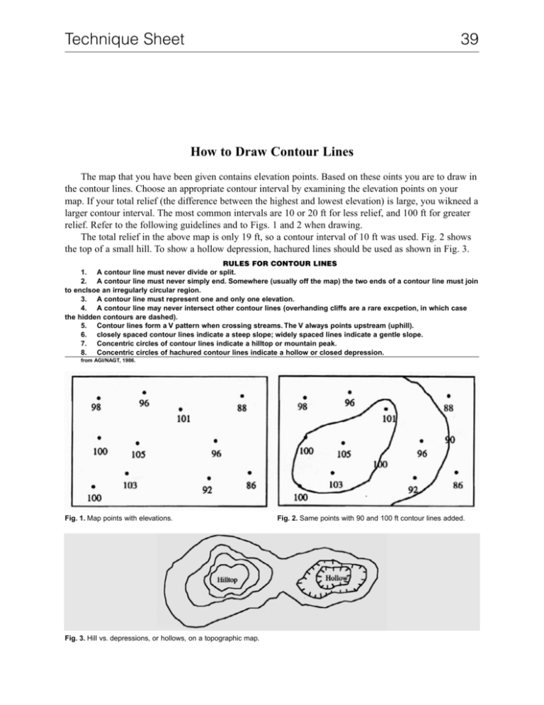
Technique Sheet 39 How to Draw Contour Lines The map that you have been given contains elevation points. Based on these oints you are to draw in the contour lines. Choose an appropriate contour interval by examining the elevation points on your map. If your total relief (the difference between the highest and lowest elevation) is large, you wikneed a larger contour interval. The most common intervals are 10 or 20 ft for less relief, and 100 ft for greater relief. Refer to the following guidelines and to Figs. 1 and 2 when drawing. The total relief in the above map is only 19 ft, so a contour interval of 10 ft was used. Fig. 2 shows the top of a small hill. To show a hollow depression, hachured lines should be used as shown in Fig. 3. RULES FOR CONTOUR LINES 1. A contour line must never divide or split. 2. A contour line must never simply end. Somewhere (usually off the map) the two ends of a contour line must join to enclsoe an irregularly circular region. 3. A contour line must represent one and only one elevation. 4. A contour line may never intersect other contour lines (overhanding cliffs are a rare excpetion, in which case the hidden contours are dashed). 5. Contour lines form a V pattern when crossing streams. The V always points upstream (uphill). 6. closely spaced contour lines indicate a steep slope; widely spaced lines indicate a gentle slope. 7. Concentric circles of contour lines indicate a hilltop or mountain peak. 8. Concentric circles of hachured contour lines indicate a hollow or closed depression. from AGI/NAGT, 1986. Fig. 1. Map points with elevations. Fig. 3. Hill vs. depressions, or hollows, on a topographic map. Fig. 2. Same points with 90 and 100 ft contour lines added.


