Contour Lines
advertisement

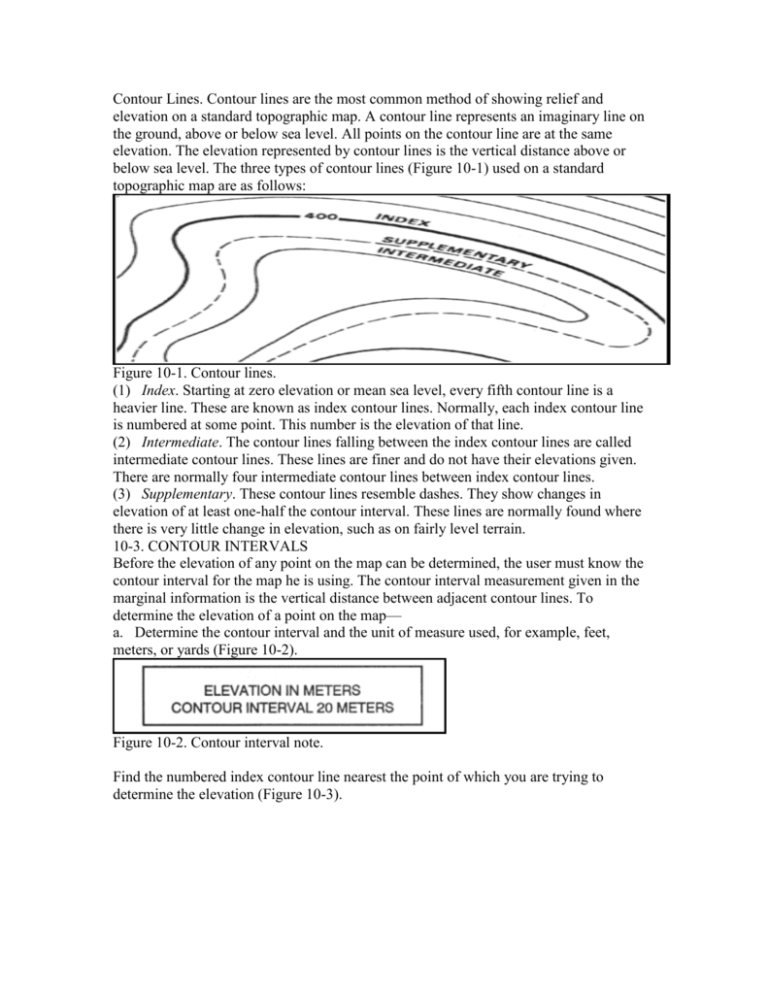
Contour Lines. Contour lines are the most common method of showing relief and elevation on a standard topographic map. A contour line represents an imaginary line on the ground, above or below sea level. All points on the contour line are at the same elevation. The elevation represented by contour lines is the vertical distance above or below sea level. The three types of contour lines (Figure 10-1) used on a standard topographic map are as follows: Figure 10-1. Contour lines. (1) Index. Starting at zero elevation or mean sea level, every fifth contour line is a heavier line. These are known as index contour lines. Normally, each index contour line is numbered at some point. This number is the elevation of that line. (2) Intermediate. The contour lines falling between the index contour lines are called intermediate contour lines. These lines are finer and do not have their elevations given. There are normally four intermediate contour lines between index contour lines. (3) Supplementary. These contour lines resemble dashes. They show changes in elevation of at least one-half the contour interval. These lines are normally found where there is very little change in elevation, such as on fairly level terrain. 10-3. CONTOUR INTERVALS Before the elevation of any point on the map can be determined, the user must know the contour interval for the map he is using. The contour interval measurement given in the marginal information is the vertical distance between adjacent contour lines. To determine the elevation of a point on the map— a. Determine the contour interval and the unit of measure used, for example, feet, meters, or yards (Figure 10-2). Figure 10-2. Contour interval note. Find the numbered index contour line nearest the point of which you are trying to determine the elevation (Figure 10-3). Figure 10-3. Points on contour lines. c. Determine if you are going from lower elevation to higher, or vice versa. In Figure 10-3, point (a) is between the index contour lines. The lower index contour line is numbered 500, which means any point on that line is at an elevation of 500 meters above mean sea level. The upper index contour line is numbered 600, or 600 meters. Going from the lower to the upper index contour line shows an increase in elevation. d. Determine the exact elevation of point (a), start at the index contour line numbered 500 and count the number of intermediate contour lines to point (a). Locate point (a) on the second intermediate contour line above the 500-meter index contour line. The contour interval is 20 meters (Figure 10-2), thus each one of the intermediate contour lines crossed to get to point (a) adds 20 meters to the 500-meter index contour line. The elevation of point (a) is 540 meters; the elevation has increased. e. Determine the elevation of point (b). Go to the nearest index contour line. In this case, it is the upper index contour line numbered 600. Locate point (b) on the intermediate contour line immediately below the 600-meter index contour line. Below means downhill or a lower elevation. Therefore, point (b) is located at an elevation of 580 meters. Remember, if you are increasing elevation, add the contour interval to the nearest index contour line. If you are decreasing elevation, subtract the contour interval from the nearest index contour line. f. Determine the elevation to a hilltop point (c). Add one-half the contour interval to the elevation of the last contour line. In this example, the last contour line before the hilltop is an index contour line numbered 600. Add one-half the contour interval, 10 meters, to the index contour line. The elevation of the hilltop would be 610 meters.


