DHL Express Europe
GIS Determines Better Route Planning and Minimizes Fleet
Driving Distances
CA S E S T U DY
DHL has been an innovative leader in the worldwide shipping business for more than
35 years. The company is now part of Deutsche Post, the modern privatized German
mail service. Deutsche Post acquired Airborne Express in 2003 and integrated it into DHL,
creating a division now known as DHL Express. Today, DHL Express employs 550,000
people and manages the shipment of packages and goods in 220 countries and territories.
The Challenge
CHALLENGE
A leader in international
shipping needed to optimize
the sorting and loading of
packages onto delivery trucks.
R E S U LT S
• Saved 600 man-hours
each day
• Package sorting time
reduced by 50 percent
• Now able to sort packages to
each specific tour or route
DHL is always on the lookout for
improving how it does business.
In 2002, as part of a test
project, the company tackled
the challenge of streamlining
its pickup and delivery (PuD)
system in Sweden, where DHL
operates 1,400 vehicles. PuD
represents 40 percent of the
total cost of the company’s
daily operations. Each morning,
DHL drivers spent, on average,
30 minutes of their shift or
tour sorting goods that needed
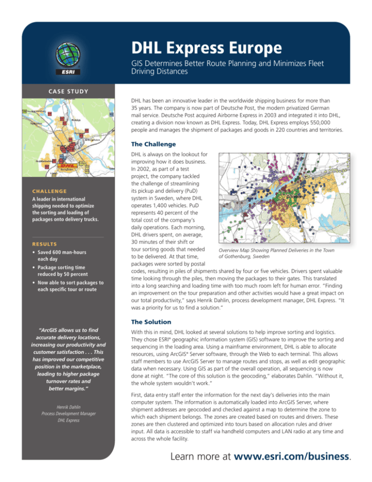
Overview Map Showing Planned Deliveries in the Town
of Gothenburg, Sweden
to be delivered. At that time,
packages were sorted by postal
codes, resulting in piles of shipments shared by four or five vehicles. Drivers spent valuable
time looking through the piles, then moving the packages to their gates. This translated
into a long searching and loading time with too much room left for human error. “Finding
an improvement on the tour preparation and other activities would have a great impact on
our total productivity,” says Henrik Dahlin, process development manager, DHL Express. “It
was a priority for us to find a solution.”
The Solution
“ArcGIS allows us to find
accurate delivery locations,
increasing our productivity and
customer satisfaction . . . This
has improved our competitive
position in the marketplace,
leading to higher package
turnover rates and
better margins.”
Henrik Dahlin
Process Development Manager
DHL Express
With this in mind, DHL looked at several solutions to help improve sorting and logistics.
They chose ESRI® geographic information system (GIS) software to improve the sorting and
sequencing in the loading area. Using a mainframe environment, DHL is able to allocate
resources, using ArcGIS® Server software, through the Web to each terminal. This allows
staff members to use ArcGIS Server to manage routes and stops, as well as edit geographic
data when necessary. Using GIS as part of the overall operation, all sequencing is now
done at night. “The core of this solution is the geocoding,” elaborates Dahlin. “Without it,
the whole system wouldn’t work.”
First, data entry staff enter the information for the next day’s deliveries into the main
computer system. The information is automatically loaded into ArcGIS Server, where
shipment addresses are geocoded and checked against a map to determine the zone to
which each shipment belongs. The zones are created based on routes and drivers. These
zones are then clustered and optimized into tours based on allocation rules and driver
input. All data is accessible to staff via handheld computers and LAN radio at any time and
across the whole facility.
Learn more at www.esri.com/business.
DHL Express Europe
E S R I S O F T WA R E U S E D
ArcGIS Server
O T H E R S O F T WA R E U S E D
Microsoft® SQL Server®
Once the tour plans are created, delivery notes and sort code files are synchronized
with shipments. As a result of the new system, deliveries are now placed at the
correct gates by the time drivers arrive at the terminal. Even after double-checking
and loading, the drivers are out of the terminal in half the time it took before the
system was implemented.
• Tele Atlas® street data
Being able to optimize the number of tours per terminal helps DHL minimize its
fleet and the driving distances of each vehicle. Routes can be optimized daily, which
greatly reduces the effort and resources needed during peak shipment periods such
as the winter holiday season. The system was up and running in a short time, with
parameters set up and fail-safe measures in place. “The system has to work,” Dahlin
stresses. “We rely on it and can’t afford for it to not function.”
• Swedish land information
from Swedish government
The Results
DaTA used
• Postal codes
• Customer addresses
Before using ArcGIS Server,
DHL could only sort to a group
of vehicles, leaving a lot of
room for error and taking too
much time at the terminal.
After implementing ArcGIS
Server, the logistics giant is able
to sort to each particular tour
instead of a larger, less specific
postal code. This reduced the
time spent and manpower
needed to sort, search, and
sequence the loading area by
50 percent. The time savings
are equivalent to 30 minutes
per tour per day. Currently, DHL
Express operates 1,200 tours
per day from the terminals.
Overview Map Showing Planned Deliveries in the Towns
of Falun and Borlänge
Creating an optimum network configuration means a lower total transportation
cost and minimizes the distance driven by each vehicle. “This has improved our
competitive position in the marketplace, leading to higher package turnover rates
and better margins,” says Dahlin.
F O R M O R E I N F O R M AT I O N
ESRI
380 New York Street
Redlands, CA 92373
Phone: 800-447-9778
Fax: 909-793-5953
Web: www.esri.com
Optimized tours result in lowered PuD and fleet costs. Correct prices and delivery
time windows can be given to clients, which increases their satisfaction and fosters
customer loyalty.
DHL Express has found ArcGIS Server improves operations threefold: the bottom line
results are increased; service to customers is improved; and, through accurate drive
times, the company’s impact on the environment is lessened.
Copyright © 2009 ESRI. All rights reserved. ESRI, the ESRI globe logo,
ArcGIS, and www.esri.com are trademarks, registered trademarks, or
service marks of ESRI in the United States, the European Community,
or certain other jurisdictions. Other companies and products
mentioned herein may be trademarks or registered trademarks of
their respective trademark owners.
G35010
7/09kh
Learn more at www.esri.com/business.

