Unit 2-Topographic Maps Note Packet
advertisement

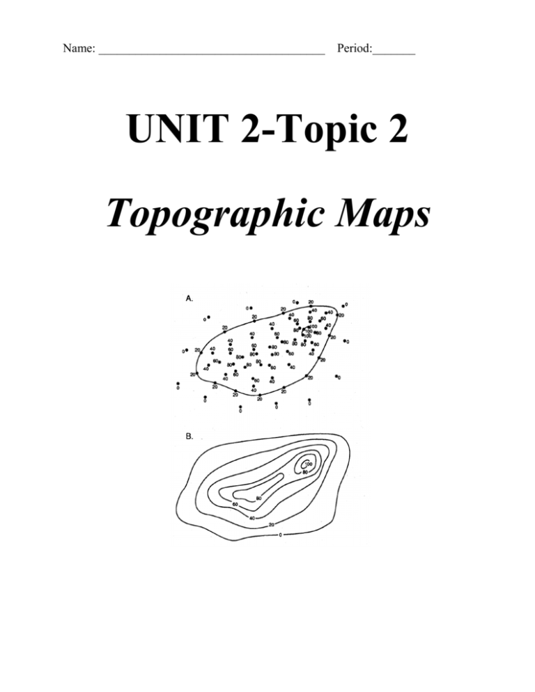
Name: _____________________________________ Period:_______ UNIT 2-Topic 2 Topographic Maps VOCABULARY 1. Field 2. Isolines 3. Gradient 4. Contour Lines 5. Topographic Maps 6. Contour Interval 7. Index Contours 8. Benchmark 9. Depression Contour Lines 10. Map Scale Focus Questions: 1. How do we interpret contour maps? 2. How do we calculate gradient? What does gradient tell us? 3. How do we construct a topographic profile? A. Contour Maps: FOCUS: How do we interpret contour map Field: ____________________________________________________________ Examples: _________________________________________________________ Isolines: ___________________________________________________________ Examples: _________________________________________________________ Lines are drawn between points of the same value. Sometimes lines must be drawn between two points, one of lesser value and one of greater value, but where there is no point equal to the value of the isolines. In those cases, your best judgment must be your guide as to where to position the lines. Contour Lines: _____________________________________________________ Topographic (Contour) Map: __________________________________________ __________________________________________________________________ Contour Interval: ___________________________________________________ Rules Of Drawing Contour Lines: Contour lines never cross!! When contour lines cross a stream, they bend: _______________________ When there is a series of smaller and smaller contour line circles, it means that elevation is: _______________________________________________ ________________________________________________________________ Most maps have Index Contours, which are: _________________________ ________________________________________________________________ Often maps show benchmarks, which are: ___________________________ ________________________________________________________________ Depression contour lines are marked with: ___________________________ When going uphill on a map, the first depression contour line has the same value as the last regular contour line. Each smaller and smaller depression contour line has a value of one contour interval less than the previous line. Map Scale: Most maps will have a distance conversion scale displayed. Using this scale, you can convert distances on the map into actual distances on the ground. NOTE: Don’t confuse this with vertical distance that is shown using contour lines. Distance between two points on a map can be determined by marking the two points on a piece of scrap paper and then laying that scrap paper along the map scale. B. Gradient: FOCUS: How do we calculate gradient? What does gradient tell us? Gradient: __________________________________________________________ Change in field value Formula: gradient = ----------------------------Change of Distance Example: A stream flows between two locations. One location is 100 meters above sea level. The second location is 50 meters above sea level. The length of the stream between the two points is 25 kilometers. What is the stream’s gradient? __________________________________________________________________ -Now lets put everything you have learned all together. On the next page, follow all the directions and answer all the questions. C. Drawing Topographic Profiles: FOCUS: How do we construct a topographic profile? ______________________ __________________________________________________________________ __________________________________________________________________ Topographic Profile: ________________________________________________ Drawing a Topographic Profile: 1. Lay a piece of scrap paper along BOTTOM of the profile line. 3. At the point where the profile line intersects a contour line, put a mark on the scrap paper and mark its elevation. (You may cross the same elevation more than once.) 4. Move your scrap paper to the graph. Line up one point with the left side of the graph and mark each elevation above each mark on the scrap paper. 5. Connect the points with a smooth line. NOTE: At the top of a hill or bottom of a valley, you will have to pass beyond the last elevation mark before reversing direction. Almost no hill top or valley bottom will be completely flat and be exactly on a contour elevation. Practice: Draw a topographic profile of the map below. Making a Topographic Profile I 30 40 A 110 100 100 90 80 70 60 50 40 30 20 10 0 50 60 70 80 90 100 B Making A Topographic Profile II 40 30 50 60 A 110 100 100 90 80 70 60 50 40 30 20 10 0 70 50 60 70 80 B Making A Topographic Profile III 10 20 30 A B 20 60 30 40 110 100 100 90 80 70 60 50 40 30 20 10 0 50


