Eelgrass Conservation for the BC Coast
advertisement
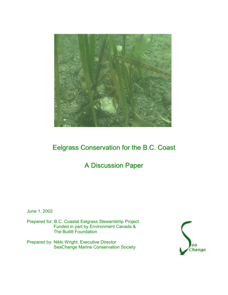
Eelgrass Conservation for the B.C. Coast A Discussion Paper June 1, 2002 Prepared for: B.C. Coastal Eelgrass Stewardship Project Funded in part by Environment Canada & The Bullitt Foundation Prepared by: Nikki Wright, Executive Director SeaChange Marine Conservation Society 1 Table of Contents Introduction……………………………………………………………………….2 1.0 Ecological Dynamics within Eelgrass Meadows……………………...2 1.1 Range of Eelgrass Communities……………………………………….3 2.0 Impacts of Human Activities……………………………………………4 3.0 Effects of Global Change on Eelgrass Communities………………...6 4.0 Strategies for Conservation……………………………………………..7 4.1 Mapping and Monitoring…………………………………………………7 4.2 Methods of Monitoring………………………………………………… 8 5.0 Restoration……………………………………………………………… 9 6.0 Protection………………………………………………………………… 9 7.0 Conservation Models………………………………………………… 10 7.1 Nuu-Chah-Nulth/West Coast Vancouver Island Regional Aquatic Management Board……………………………… 11 7.2 People for Puget Sound’s Habitat Project…………………………….11 8.0 Common Problems of Conservation Efforts……………………………12 8.1 The Four “C’s” of Conservation……………………………………… 12 Notes………………………………………………………………………………13 “Let us be quite clear on one thing, sustainable use of our resources is a social, not a scientific issue…We must get out of the analysis mode, and think in terms of synthesis, building, creating understanding. We must communicate not only the results of our work but facilitate more symposia and workshops to integrate and draw the implications….” Patricia Roberts-Pichette, “Killing the Canary”, from the concluding remarks of the Fourth National Science Meeting, January 21-24, 1998 of the Ecological Monitoring and Assessment Network (EMAN), Pointe-au-Pic/La Malbaie, Quebec 1 2 Introduction In 1994, six scientists from Washington state and British Columbia came together to determine the most pressing environmental stress on the shared waters of BC and Washington. Their conclusion: nearshore habitats in the Georgia Basin are most vulnerable to loss and degradation because they are the closest to human activities. They are also the most critical for the survival of threatened fish and wildlife populations. Ironically, we have very poor inventories of these valuable habitats in British Columbia and Washington; further research and monitoring are needed. (1) This paper is a discussion on the ecology of eelgrass beds and the need to conserve these critical habitats in British Columbia. It is an abridged version of a larger discussion paper written in October 2001 for the Canadian Wildlife Service. It presented the need for further research and monitoring of eelgrass (Zostera marina) growing along the nearshore coast of the Strait of Georgia, British Columbia. Three objectives constitute this discussion paper. The first is to briefly outline the significance of eelgrass meadows to the biological and physical characteristics of the nearshore community. The second is to address how human activities are affecting eelgrass beds, and how global climate change may alter their distribution and composition. The third is to describe several conservation models and propose strategies that may assist our goals. I.0 Ecological dynamics within Eelgrass Meadows The complex and intricate food webs of an eelgrass meadow rival the world’s richest farmlands and tropical rainforests. From an unstructured muddy/sandy bottom grows a myriad pattern of leaves that supply nutrients to fish, shellfish, waterfowl and about 124 species of faunal invertebrates. The plants offer surface area for over 350 species of macroalgae and 91 species of epiphytic microalgae (2). A study in Padilla Bay, Washington showed that the biomass of macroalgae attached to leaves or shells or loosely floating beneath the leaves in seagrass habitats was greater than the native eelgrass shoot biomass. (3) The high biological diversity available in eelgrass systems provide food in several ways. In the Trent River delta on Vancouver Island, for example, 124 species of birds have been identified, over 38,000 individuals. Forty eight per cent were observed using the intertidal eelgrass (Z. japonica) of the delta for feeding, foraging or preening at some time during the year. (4) 2 3 Native eelgrass (Z. marina) plants retain their leaves year-round. Because the plants are rarely exposed to air, the leafy habitat is available to marine animals almost continuously. Living in the web of blades, animals, including juvenile salmon, young herring, plume hydroids, nudibranchs, anemones, jellyfish, clams, scallops, cockles, shrimp, spider, red rock and dungeness crabs, sea stars, moon snails and sand dollars find protection and food. The mat of underground rhizomes prevents the easy movement of predators into and through the sediment, and the thick canopy of blades makes quick movements by larger predators (fish and birds) more difficult. (5) Only about 5% of eelgrass is consumed by direct grazing. Only a few species eat the leaves. Among the consumers are snails and amphipods, important prey for fish and birds. Great Blue herons, dabbling ducks, widgeon, pintail and mallard ducks and Black Brant geese are among the millions of shorebirds that use eelgrass beds for foraging. Over 2.3 million birds, representing 150 species, use the intertidal flats of the Fraser River annually. (6) Recently, in the Strait of Georgia, green urchins and Canada Geese have been observed consuming significant amounts of eelgrass and seriously impacting the local eelgrass populations. (C. Durance, pers. com.) Central to the marine food web is the Pacific herring, contributing 30% to 70% to the summer diets of Chinook salmon, Pacific cod, lingcod, and harbour seals in southern B.C. marine waters. Herring roe constitutes an important component of the diets of migrating seabirds, grey whales, and invertebrates. About 500 linear km of B. C. coastline turn milky-white every March and April as a result of the herring’s release of sperm around the eggs (roe) spawned directly on eelgrass and also on algae which is often epiphytic on eelgrass. (7). Eelgrass detritus provides the basis for a chain of consumers in the open ocean living as far as 10,000 meters in depth. (8) The extensive root system of the plants helps stabilize sediments and prevent erosion along the BC coastline. Damage to eelgrass can affect an entire ecosystem as well as the stability of our shorelines. 1.1 Range of Eelgrass Communities Eelgrass meadows are found in most of the world’s coastal temperate regions except at extremely high latitudes. Physical and chemical factors affecting Zostera marina include temperature, light attenuation, elevation, substratum, wave action, salinity and pH. Worldwide, the plants survive under a wide range of water temperatures, from 0 to greater than 30C. The optimum temperature for growth lies between 10 - 20 C in most areas. (9) Eelgrass grows best in the Strait of Georgia in salinity ranges of 20 ppt - 32 ppt. (10). Eelgrass can tolerate periods of freshwater inundation on a seasonal or daily basis. (C. Durance, pers. com.) 3 4 Of all the above factors, light availability and elevation may be the most crucial. Light availability seems to be the primary factor limiting depth distribution, density, and productivity of eelgrass meadows within their salinity and temperature ranges. When the Coal Port was expanded in 1982-3 in Roberts Bank, both species of eelgrass (Z. japonica and Z. marina) expanded. The construction of causeways across a broad intertidal zone directed the turbid Fraser River water offshore, improving the light regime and initiating higher productivity in the eelgrass beds. (11) 2.0 Impacts of Human Activities The majority of the earth’s population now lives within 10% of land defined as “coastal”. One of the results of this increased pressure on coastal shorelines has been the destruction of approximately 215,000,000 acres of estuarine habitat worldwide. . The recent loss of coastal habitat in Puget Sound totals 58% while in the Georgia Strait, it is estimated at 18% (12). Dredging and filling associated with the construction of harbors and ports have been the major cause of this decline (13). The plants themselves are removed and then the physical, chemical and biological composition of the systems is altered. Sediments raised by dredging can bury plants growing nearby. Sediments alter eelgrass density by affecting water clarity. The reduction in plant density can increase silt load because of the reduced capacity to trap sediments, and increase the erosion of bottom sediments. The ultimate result is the reversal of the entire nutrient-flow mechanics of the ecosystem. (14) Dredging activities include hydraulic clam harvesting, bay scallop raking, oyster harvesting and maintenance dredging of harbors. Filling activities, such as landfills, wood processing, agricultural runoff and logging severely impact eelgrass habitats as well. Since estuaries are extremely vulnerable to changes in salinity and temperature, human activities affecting water flows from freshwater streams heavily affect eelgrass meadows. Pristine watersheds surrounding estuaries provide steady supplies of fresh water and clean sediments to seagrass communities in the estuary. The opposite holds true as well: unhealthy watersheds increase the problems for seagrass distribution and productivity. Nutrient loads in streams and rivers can cause overgrowth of algae that then die and deplete the oxygen from the bottom of poorly flushed bays. Quiescent waters are more susceptible to chronic contamination than areas with high energy water flows. 4 5 Logging may cause scouring of stream channels and thereby increase sedimentation in estuaries, limiting the light available for photosynthesis. Bark chips from log booms smother eelgrass beds and form a blanket on the substrate, which leads to anaerobic sediment devoid of life. Similarly, land development for farms and housing can increase erosion and sedimentation. Chemical contaminants, such as fertilizers, pesticides and household hazardous wastes, runoff from streets and roads and industrial activities also add to the toxic composition of muddy bottoms of eelgrass meadows. (16) Most toxic chemicals that accumulate in sediments in an inland sea such as the Strait of Georgia reside there for long periods of time unless they are physically removed. There is evidence that the roots of eelgrass take up a significant amount of heavy metals (e.g. lead, cadmium, zinc and chromium) for long periods of time, thereby making up a large pool of heavy metals in coastal systems. (17) The consequences may have long term effects on eelgrass consumers, especially waterfowl and marine invertebrates. In the Strait, more than 540 sq. kilometers of intertidal gravel, sand and mud habitat are closed for shellfish harvesting because of bacterial contamination. More than 730 sq. kilometers of shallow water habitat are unusable for crab and shrimp because of dioxin contamination from pulp mills. More than 32% of classified commercial shellfish growing areas in Puget Sound and Juan de Fuca Strait are either restricted or prohibited for harvesting due to water quality issues. (18) Oil spills pose serious threats to eelgrass communities growing in sheltered bays that are poorly flushed. These areas will tend to retain oil for long periods of time, becoming chronically contaminated. If spills happen in late summer or winter when leaf sloughing is at its peak, mats of drift blades will tend to catch and retain oil for later decomposition in the intertidal zone. If a spill occurs in the spring, seed production and viability could be affected. (19) Research has shown that the surfactants applied to mitigate oil spills has a permanent and more significant detrimental effect on eelgrass than the actual oil. Docks create shading problems for eelgrass beds. Anchoring of recreational boats along the nearshore disturbs rhizomes. Boat propeller cuts disturb eelgrass beds in shallow waters. Weekend boaters may be affecting waterfowl such as black brant, which have been steadily decreasing in the Pacific Northwest since the 1940’s. Protected zones and mooring buoys for recreational boats around large eelgrass beds may help the entire seagrass ecosystem. (20) 5 6 Community monitoring programs designed to track changes in eelgrass habitats are necessary to create a means of legislating policy necessary in ecological sensitive areas. Conflicting use of eelgrass habitat, such as oyster and clam harvesting, boating and anchoring over meadows and near-shore development that requires dredging and later sewage deposition needs suitable management strategies. (21) Both sides of the boundary could work together to develop and implement a research program identifying the source of contaminates that are bioconcentrated in birds at the top of the marine food chain. 3.0 Effects of global climate change on eelgrass communities If greenhouse gases continue to increase in the Earth’s atmosphere, global warming is likely to have profound effects on nearshore habitats. Scientists suggest the Pacific Northwest will experience: More flooding in winter and spring, but more water shortages in late summer and fall The inundation of low-lying sections of coastal highways and property under a rising sea Degradation of forests by more severe fires and pest infestations Increased risk of extinction for endangered salmon runs and impacts on a variety of valuable fisheries habitats.(22) Average regional temperatures are projected to increase 5 degrees Fahrenheit by 2050 9% increase in winter precipitation and a 5% decrease in the summer by 2050. Global climate models are increasingly predicting that global warming is likely to lock the Pacific into El Nino conditions by mid-century. (23) Tidal mudflats could be permanently inundated with rising sea levels over the next century. Wave energy during high tides would threaten shore banks. Solid breakwaters could be constructed to prevent property damage, which would then squeeze out tidal habitats that otherwise might be able to advance inland. The volume of freshwater flowing through streams and rivers at different times of the year could affect salinity levels in eelgrass meadows. Light availability could change in response to the increase of sediments entering from flooding streams and runoff from adjacent lands. Elevation levels could also change from the increased sediments, possibly altering the composition of substrate from fine to coarser material, unsuitable for eelgrass. As well, temperature ranges could be higher in the summer months, which could affect productivity, and possibly eliminate eelgrass from some habitats. 6 7 4.0 Strategies for Conservation 4.1 Mapping & Monitoring of Eelgrass Communities As of 1995, there was a lack of current and georeferenced foreshore fish habitat data for the Strait of Georgia. (24) Between 1995 and 1997 a database of approximately 500 coastal fish habitat references for the Strait was compiled by the Department of Fisheries & Oceans. This information is posted on the World Wide Web through the DFO web site. The west coast of Vancouver Island and the rest of BC is presently being mapped but the coverage is not presently centralized. The Strait of Georgia was the earliest mapped. For the most part, the data available does not include aerial biology mapping. Presently, there are about ten to fifteen Seabed Imaging and Mapping System ( SIMS) projects in the Strait of Georgia ecoregion. All of these contain classification of eelgrass habitat as well as nearshore algae. (per. comm. with John Harper, Coastal & Ocean Resources Inc.). Monitoring of eelgrass sites to identify causes of change is intrinsically linked with issues of scale. Mapping of eelgrass over landscape scales provides information on the aerial coverage of eelgrass in a region, changes to depth related distributions and longterm changes in eelgrass abundance and distribution. At smaller geographic scales the monitoring of eelgrass communities can detect disturbance at an early stage and distinguish changes due to human activities or natural causes from environmental variation. Methods for delineating B.C.’s marine ecosystems at the national and regional scale (e.g. >1:500 K) were researched in the late 1980’s. Since then there have been several methods used to classify the Georgia Basin at larger scales (e.g. 1:300 K) for macro-scale planning. The Province of British Columbia’s Land Use Coordination Office (LUCO) outlined the Georgia Basin ecoregion as the majority of the Strait of Georgia, the Canadian section of Juan de Fuca Strait, the watersheds on the east coast of Vancouver Island, and the lower Fraser River. (25) An ecosection is defined as the above geographical area excluding the watersheds on the east coast of Vancouver Island. In order to be useful, ecosystem mapping must include classification of the productive capacity, which requires interpretation at a micro to meso scale. LUCO had developed the ecounit scale, which describes biophysical units of ~ 15 km square. Ideally, an ecosystem mapping should entail the combined biophysical capacity of all landscape and habitat properties. (26) 7 8 4.2 Methods of Monitoring Although schemes for mapping of ecosystems at functional scales have been reviewed nationally, the micro and mesoscale concepts proposed for areas such as the Georgia Basin have received little attention. Differences in goals, approaches and principles between agencies in the government and the scientific community have hampered successful completion of a definition and delineation of intertidal and nearshore marine ecosystems thus far. (27) Management of eelgrass habitats involves common methods for mapping and monitoring abundance and distribution. Policy decisions on protection issues could use site specific information from mapping and monitoring protocols agreed upon by scientists, communities and policy makers. Monitoring over time allows for detection of seasonal variation in eelgrass abundance that can be described at various spatial scales. Repeated monitoring of fixed or randomly placed transects within eelgrass beds could detect short term fluctuations in eelgrass and algal coverage, canopy height, patchiness and composition. The use of multiple transects and replicated sampling units within beds allows for comparisons to be made between eelgrass communities. (28) Monitoring and research must be maintained to provide the earliest possible warning if new threats to the eelgrass ecosystem arise. The effects of multiple environmental stresses on an eelgrass bed are cumulative and may cause effects that are more than additive. The ability of the ecosystem to recover from a single source of harm is diminished if the system is suffering additional stress from other sources, such as higher water temperatures or shading by Sargassum. The complexity of the ecological linkages is poorly understood and assessment of cumulative effects is very difficult. All the more reason for more communication between communities and scientists within and beyond international borders. Provided with adequate support and training, local communities could be well equipped to monitor the changes in eelgrass meadows in response to natural and anthropogenic impacts. Programs in Australia, Puget Sound and California point to the feasibility of community “seagrass watch” programs. Scientists, policy makers and academics are now widely recognizing the role of community based management programs in the sustainable management of natural resources. This process entails a change from top down decision making to a more integrated cooperative approach based on shared decision making, clear communication, and easy access to information. 8 9 5.0 Restoration Most sites available for the mitigation of estuarine wetlands are within highly urbanized areas. High density land activities adjacent to the sites present serious constraints to the development of wildlife habitat. Pollution from run-off from agricultural lands, urban areas, landfills and within the bay itself may affect the suitability of certain sites. (29) In a recent review (1999-2000) of eelgrass restoration projects in the Pacific Northwest, more than half of the projects failed to meet their performance standards. (30) Poor performance has led to a high degree of uncertainty about the potential usefulness of any restoration effort. Part of this high failure rate may be due to insufficient information on the potential of the site to support eelgrass. Adaptive management, which may include careful site assessments, field studies and laboratory growth experiments, have been used in Washington state. (31) Knowledge gained through monitoring of the project is combined with existing social policies to help determine restoration policy and to redesign or modify the projects. Planners and project managers can then effectively use the information from the monitoring program to assure that restoration project goals are achieved. Integration of good science with community based restoration initiatives can ensure greater success rates while expanding the quality and quantity of habitat restoration in coastal areas. 6.0 Protection Under the federal Fisheries Act, “fish habitats” are defined as those parts of the environment on which fish depend, directly or indirectly, in order to carry out their life processes”. The Act also defines “fish” to include all the life stages of “fish, shellfish, crustaceans, marine animals and marine plants”. The Department of Fisheries and Ocean’s long-term policy objective is the achievement of an overall net gain of the productive capacity of fish habitats. The no net loss principle guides the Department to balance unavoidable habitat losses with habitat replacement on a project-by-project basis. (32) In terms of “eelgrass-ese”, protection is a watery proposition. In 1994, only 12.8% of the wetlands of the whole Fraser Lowland, including Roberts’ Bank and Boundary Bay had a high level of protection. The majority of the Fraser Lowland had only a medium level of protection. Wetlands have been reduced to about one-quarter of their original area, thus reducing their capacity to sustain fish and wildlife populations. (33) 9 10 Estuarine protection entails much more than the plants themselves. Migratory birds, in response to the loss of wetland feeding grounds, depend upon adjacent farmland for food in winter months when seagrasses are submerged during the daytime high tides. Marine protected areas are on the agenda for both the Canadian Parks and Wildlife Fund (CPAWS) and the Sierra Club of B.C. These organizations are calling for a moratorium of several major fisheries underway in the Strait’s waters, a major investment in scientific research programs, and the establishment of a network of “notake” marine reserves throughout the Strait of Georgia. These necessary measures including the marine reserves would help protect a diversity of habitats that would maintain the natural structure of coastal marine systems. (34) Whether marine protected areas will actually protect and conserve marine ecosystems over the long term in the Strait is unknown. When 250,000 tonnes of fish are routinely caught every year, roughly the amount of biomass equal to the weight of the British Columbia’s human population, and 10% of the “primary production” at the very bottom of the food chain is removed from the waters of the Canadian Pacific (35), marine protected areas might be another type of “zoo” of exotic creatures once remembered as plentiful. Bill C-10 has passed. This legislation is the tenth law authorizing Ottawa and Victoria to establish various kinds of marine protected areas. Others include foreshore reserves, wildlife-management areas, national parks, bird sanctuaries, ecological reserves and others. There seems to be little agreement, however, on what should be protected .(36). Parks Canada considers five marine ecosystems on Canada’s Pacific coastline that should be represented in Marine Protected Areas. The former B.C. Ministry of the Environment applies a different set of standards that identifies 12 marine ‘ecoregions” containing 65 “ecounits.” Once again, the need arises for agreement on a common habitat classification system. Increasing habitat loss along the coastline of B.C. makes it mandatory to continue studies in marine areas where impacts are kept to a minimum. Such studies would give baseline data for use as control information on the inherent genetic, morphological and physiological capabilities of eelgrass systems. (37) As well, because herring, herring spawning areas, including eelgrass beds, and salmon are interconnected, accurate, complete and reliable mapping and monitoring of spawning areas along the entire coastline is imperative. 10 11 7.0 Conservation Models 7.1 The Nuu-Chah-Nulth/West Coast Vancouver Island Regional Aquatic Management Board First Nations and non-First Nations communities on the West Coast of Vancouver Island have worked towards a community-based aquatic ecosystem management for over twelve years. The initiative and development have risen almost exclusively from within the region. A Steering Committee of over sixty representatives from within the community was formed in 1997 with a common vision of an ecosystembased approach to aquatic management. (38) A three pronged strategy was used. First, relationships and partnerships in and outside the region were established. Second, an organizational design appropriate to managing aquatic ecosystems in the region involving how to make decisions, who should make what decisions, what kinds of information systems are needed and what kinds of communication systems would be most effective was decided upon. Third, the Committee worked on management capacity in the region through coordination and development of projects, people and resources. (39) The Board considered itself to be the only regionally based process for aquatic ecosystem management in Canada (1998). 7.2 People for Puget Sound’s Habitat Project People for Puget Sound has undertaken a project to protect natural estuarine habitats by engaging citizens, government and the private sector. In a three step process, they have launched a long-term habitat restoration strategy to reverse loss and degradation trends of critical habitats in the Puget Sound area and increase public awareness and support for Puget Sound habitats. The three steps they have designed are the following: data collection by consultants, interns and volunteers on habitats around the Puget Sound estuary. composition of a written report on the status and trends of critical habitats around the Sound. Based on the report’s assessment, and the formation of a “broad range of constituencies”, there is a blueprint for action in place.. The Action Plan will outline priority projects and areas, set quantified goals for habitat protection, and identify the means to meet these goals. Through restoration projects, presentations and events, the organization will raise public awareness and build support to execute the action plan. (40) 11 12 8.0 Common Problems of Conservation Efforts: 8.1 The Four “C’s” of Conservation 1. Coordination In all aspects of conservation work within nearshore habitats: mapping, monitoring, restoration and outreach, there is a lack of organization and agreement about priorities and techniques. Non-profit organizations are unable to carry out long term projects with fluctuating trends in funding resources. Working together on goals, objectives and funding possibilities could alleviate some of the “hit and miss” quality of short term environmental programs and projects. 2. Communication There is a clear need to manage and preserve the nearshore habitats and resources remaining in B.C. This necessitates a strong collaboration between the Canadian federal and provincial agencies and consultants and community organizations. As well, a continued dialogue and working relationship needs to be maintained between scientists and managers on both sides of the border. Joint planning, monitoring activities, research studies and the development of compatible environmental regulations for both the U.S. and Canada could be further developed. 3. Consistency There is a clear need for a common habitat classification system and a common regional habitat monitoring program for transboundary species. (41) Agreement between and among scientists in Canada and the U.S. on a compatible system for assessing estuarine habitats could accelerate monitoring programs “do-able” by communities. The monitoring must be user friendly if the goal is to collect data surrounding the entire coast. 4. Constancy Regardless of political changes, the trend towards habitat degradation continues as the population surges upward in coastal regions. Partnerships between the scientific community, private consultants, academics and community stewardship groups could only benefit the long term goal of habitat protection. Sharing of ideas, new discoveries, funding resources, information in the forms of mapping and monitoring systems, training in restoration techniques and many more benefits could be realized. 12 13 Notes 1. British Columbia/Washington Marine Science Panel. 1994. The shared marine waters of British Columbia and Washington: A scientific assessment of current status and future trends in resource abundance and environmental quality in the Strait of Juan de Fuca, Strait of Georgia and Puget Sound. Province of BC, State of Washington. p. 71. 2. Harlin,M.M. Seagrass epiphytes. p. 117-151, In: Handbook of Seagrass Estuary Biology: An Ecosystem Perspective. Phillips, R.C. & McRoy, C.P., (eds), Garland STPM Press, New York. 3. Belthuis, D.A.. 1991. Distribution of habitats and summer standing crop of seagrass and macroalgae in Padilla Bay, Washinton. In: Padilla Bay National Estuarine Reseach Reserve Technical Report 2. Washington State Dept. of Ecology. 35p. 4. Harrison, P.G. and Dunn, M. Chapter 15: The Fraser Delta seagrass ecosystems: importance to migratory birds and changes in distribution. In: Unpublished manuscript. p. 3-4. 5. Ibid. p. 5. 6. Ibid. p. 7. 7. Fisheries & Ocean Canada Pacific Biological Station and Environment Canada Environmental Reporting Program. Web site: http://www.pbs.dfo.ca/pbs/herring/pages.htm 8. Port Townsend Marine Science Center: What’s so important about eelgrass? Web site: http://www.olympus.net/ptmsc/eelgrass.html 9. Phillips. R.C. 1984. The ecology of eelgrass meadows in the Pacific northwest: A community profile. Sch. Nat. & Mathematical Sciences, Seattle Pacific University. Fish & Wildlife Service, U.S. Dept. of the Interior. 10. Ibid. 11. Harrison and Dunn. 199?. op.cit. p. 19. 12 British Columbia/Washington Marine Science Panel. 1984. op. cit. p. 63. 13 Levings and Thom. 1994. op.cit. p..330. 14. Phillips, R.C. 1984, op.cit. p. 61-2 13 14 15. 16. Thompson, R.E. 1994. Physical oceanography of the Strait of Georgia - Puget Sound - Juan de Fuca system. Symposium on the Marine Environment, Institute of Ocean Sciences, Sidney, B.C.. p. 36. B.C./Washington Marine Science Panel. 1994. op. cit. p.62. 17. Lyngby,J.E. & Brix, H. 1989. Heavy metals in eelgrass (Zostera marina) during growth and decomposition. In: Hydrobiologist 176/177:189-196. Belgium. 18. Levings and Thom. 1994. op. cit. p. 330. 19. Beak Consultants. 1975. Biology oil impact literature review Final report 1975. Baseline Study Program, North Puget Sound, Dept. of Ecology, Olympia, Washington. 20. Phillips, R.c. 1984. op.cit. p. 64. 21. Ibid. p.66. 22. Doherty, S., Roth, R., Snover, A. Global warming and the Pacific northwest: Region risks increased floods and droughts, forest fires, salmon extinction and electrical shortages. Cascadia Planet web site. 23. Mazza, P., Global warming could put northwest in hot water. Bioregional webzine for Cascadia. 24. North, S. and Levings, C. 1993-7. Marine foreshore fish habitat assessment project. Coastal & Marine Habitat Science Section: Estuaries in the Strait of Georgia. 25. Levings, C. and Pringle, J. 1998. Marine ecosystem delineation in the Georgia Basin: Conclusions of a regional workshop, Coastal Zone Management Conference, 1998. Victoria, B.C. p. 129. 26. Ibid. p. 130. 27. Ibid. 28. Community based monitoring of intertidal seagrass meadows in Hervey Bay and Whitsundays, Australia. Unpublished manuscript. 29. Josselyn,M., Zedler, T., Griswold, T. 1990. Wetland mitigation along the Pacific coast of the U.S. In: Wetland Creation & Restoration: the Status of the Science, Kusher & Kentula (eds). Island Press. P. 16. 14 15 30. Thom, R.M., Borde, A., Antrim, L.D., Shreffler, D.K., Gardiner, W.W. 1999. Enhancing success of eelgrass meadow restoration projects through site assessment and adaptive management. Battelle Marine Laboratory, Sequim, Washington. 31. Ibid. 32. Fisheries and Oceans Canada.1986. Policy for the management of fish habitat. Communications Directorate, Ottawa, Ontario. P. 10-12. 33. Harrison and Dunn. op. cit. p. 37-8. 34. Sierra Club B.C. and Canadian Parks and Wilderness Society. 2001. Media Release for Oceans Day, 2001, Victoria, B.C. 35. Glavin, T. 2001. Protective Custody. Georgia Straight, Jan. 25 – Feb. 1, 2001. P. 17. 36. Ibid. p. 21. 37. Phillips. 1984. op. cit. p. 66. 38. Day, A., Edwards, D., Tamm, E., Atleo, C., Hall, D., West Coast Sustainability Association, 1998. Ucluelet, B.C.. Community based coastal zone management: A case study of the Nuu-chah-nulth/West Coast Vancouver Island Regional Aquatic Management Board, abstract presented at the 1998 Coastal Zone Canada Conference, Sidney, B.C.. p. 230. 39. Ibid. 40. People for Puget Sound’s Habitat Project: Protecting and restoring Puget Sound’s habitats. Web site: http:/www.pugetsound.org/habitat/default.html 41. Levings, C., 1994. op. cit. p. 331 15
