Itinerary - The University of Waikato
advertisement
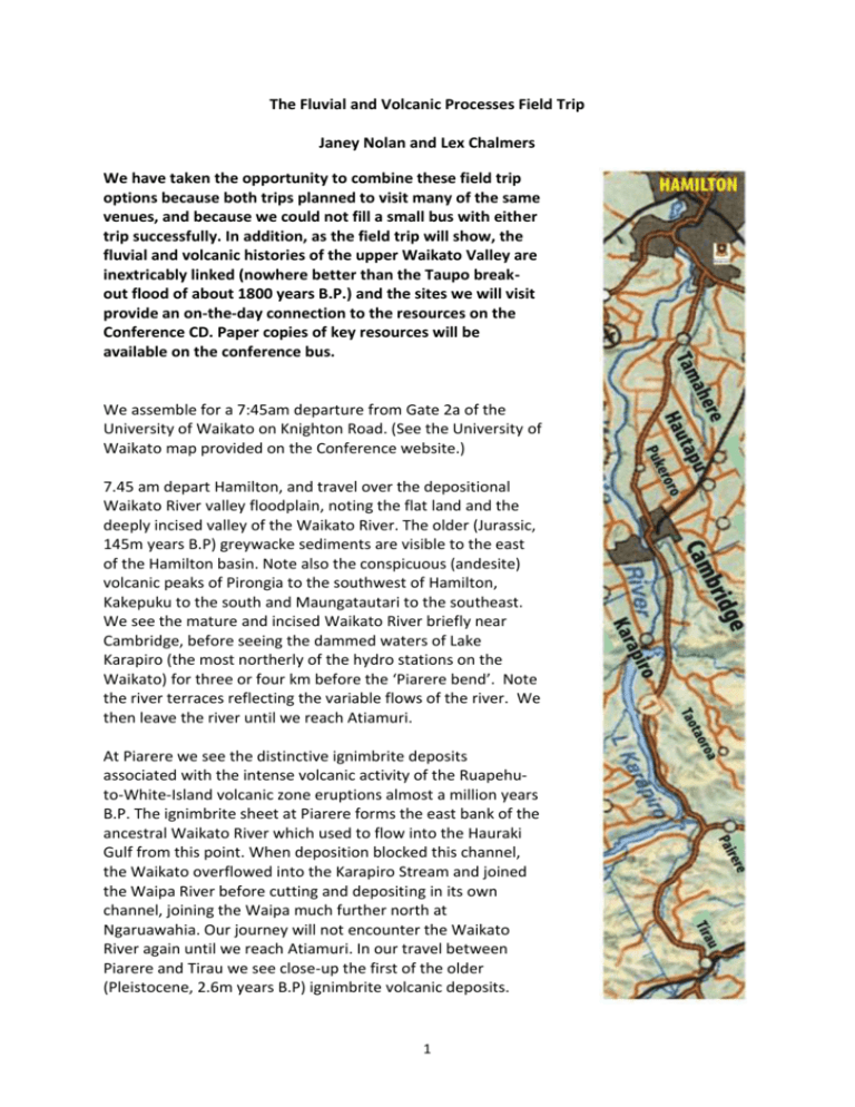
The Fluvial and Volcanic Processes Field Trip Janey Nolan and Lex Chalmers We have taken the opportunity to combine these field trip options because both trips planned to visit many of the same venues, and because we could not fill a small bus with either trip successfully. In addition, as the field trip will show, the fluvial and volcanic histories of the upper Waikato Valley are inextricably linked (nowhere better than the Taupo breakout flood of about 1800 years B.P.) and the sites we will visit provide an on-the-day connection to the resources on the Conference CD. Paper copies of key resources will be available on the conference bus. We assemble for a 7:45am departure from Gate 2a of the University of Waikato on Knighton Road. (See the University of Waikato map provided on the Conference website.) 7.45 am depart Hamilton, and travel over the depositional Waikato River valley floodplain, noting the flat land and the deeply incised valley of the Waikato River. The older (Jurassic, 145m years B.P) greywacke sediments are visible to the east of the Hamilton basin. Note also the conspicuous (andesite) volcanic peaks of Pirongia to the southwest of Hamilton, Kakepuku to the south and Maungatautari to the southeast. We see the mature and incised Waikato River briefly near Cambridge, before seeing the dammed waters of Lake Karapiro (the most northerly of the hydro stations on the Waikato) for three or four km before the ‘Piarere bend’. Note the river terraces reflecting the variable flows of the river. We then leave the river until we reach Atiamuri. At Piarere we see the distinctive ignimbrite deposits associated with the intense volcanic activity of the Ruapehuto-White-Island volcanic zone eruptions almost a million years B.P. The ignimbrite sheet at Piarere forms the east bank of the ancestral Waikato River which used to flow into the Hauraki Gulf from this point. When deposition blocked this channel, the Waikato overflowed into the Karapiro Stream and joined the Waipa River before cutting and depositing in its own channel, joining the Waipa much further north at Ngaruawahia. Our journey will not encounter the Waikato River again until we reach Atiamuri. In our travel between Piarere and Tirau we see close-up the first of the older (Pleistocene, 2.6m years B.P) ignimbrite volcanic deposits. 1 The Waikato River catchment was affected by the Oruanui eruption (26,500 BP). An aggradation period followed with transport of the volcanic material that fell during the eruption. One of the main sedimentary responses was the diversion of the Waikato River from the Firth of Thames into the Hamilton Basin. Fluvial terrace sets formed (the “Hinuera Formation”). These deposits occur in both the Hauraki Plains and the Hamilton Basin. The Hinuera Formation was generated by a series of fluvial deposits composed of pyroclastic minerals. Fluvial terraces in Waikato River. TERRACE AGE Hinuera D 17.6 – 14 ka Hinuera C 22.5 – 17.6 ka Hinuera B 26.5 – 22.5 ka Hinuera A 220 – 26.5 ka Climate change around 17,600 BP reduced sediment yields from the hinterland, causing incision of the channel and trapping of the Waikato River into the Hamilton Basin. Aggradational processes along this river were a result of volcanic activity, whereas incision was initiated by climate conditions. From Tirau to Tokoroa we see initially some riverine depositional geology, and clear evidence of airborne volcanic deposition before we climb onto the Whakamaru ignimbrites of the Volcanic Plateau near Putaruru. If you Google Earth the Ignimbrite outpourings that constitute this part of the field trip, you will see that they are generally flatter that the rhyolites and andesites that we see elsewhere on our field trip. 8:45 am Arrive at Tokoroa, allowing five minutes to collect preorder coffee at McDonalds. Quick comfort stop available if required. The Whakamaru ignimbrites extend over 35km of our route, from north of Putaruru until we descend across the younger extrusions of the Haparangi rhyolites of Tar Hill to Atiamuri. Atiamuri marks a transition from the extensive ignimbrites (Tirau to Tar Hill) to the complexities of the viscous rhyolites of the heavily faulted volcanic zone. The stops from here on are characterised by late Pleistocene rhyolites. Note the sentinel Pohaturoa, a natural defensive site for Maori, perched high (714 m) above the Waikato River near Atiamuri. If it was undammed, the river at this point would be actively eroding as the fall in metres per km is still significant compared to that of the Waikato to the north of Hamilton. 2 15 minutes before we arrive at Aratiatia, we pass through Oruanui which gives its name to the caldera eruption over 2 weeks, 26,500 year B.P. 9.55 am First stop, the Aratiatia Rapids, where the Mighty River Power scheme has transformed the flow regime of the river, affecting both erosional and depositional processes. 10.30 am depart Aratiatia Rapids and drive to the viewing point on top of the hill overlooking Lake Taupo and the Control Gates Talk briefly about the headwaters of the Waikato River system, and the Taupo reservoir that determines the downstream fluvial processes. Comment on the intersection of volcanic and fluvial processes with reference to the Taupo break-out flood caused by eruption-induced failure of a natural dam; see resources available on the bus and Conference CD. 10.45-11:15 am At Huka Falls to discuss fluvial processes. 11.25 am. Arrive at Craters of the Moon (Karapiti). The site is an extensive area of geothermal activity where groundwater is superheated and forced to the surface. The reduction in pressure causes the hot water to emerge as steam. Karapiti is a tourism venue within the 25 sq km of the Wairakei geothermal area. View fumaroles and mudpools. Craters up to 20m deep have been formed by hydrothermal eruptions. 12.25 pm. Depart Craters of the Moon for the Fairways restaurant at the Wairakei Hotel. Here you may select and pay for the light lunch of your choice. The Moroccan wrap filled with lamb strips, grilled vegetables, tzatziki and harissa is $14, a burger is $15, and the vegetarian quesadilla is $13. Gluten free meals are available. 1.30 pm. Arrive at Wairakei Research Centre of GNS (the Geologic and Nuclear Sciences CRI) to hear presentation by Dr Gill Jolly. Part of the presentation will focus on the use of the GNS website (see http://www.gns.cri.nz/) for teaching. 2.30 pm. Depart Wairakei Research Centre for geothermal visit to the viewing platform in the Wairakei Valley. Explore the management of geothermal steam generation – how humans have affected processes associated with volcanism – through the re-injection of water into the geothermal system. 2.50-4-10 pm. Travel for Lake Karapiro. A five minute comfort stop before viewing the dam and discussing the impact of the dam on the natural processes. 4.30 pm. Depart for Hamilton arriving 5:00 pm. 3
