Application for RESURS-DK1 and METEOR-M1 Data
advertisement
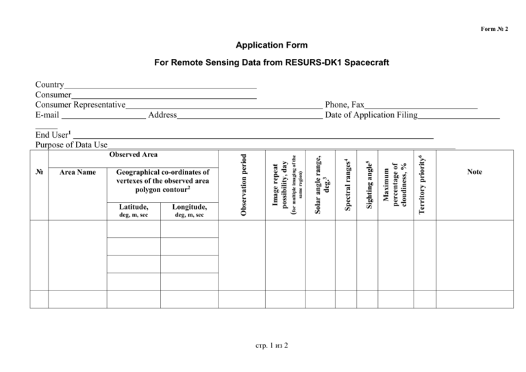
Form № 2 Application Form For Remote Sensing Data from RESURS-DK1 Spacecraft Country Consumer Consumer Representative E-mail Phone, Fax Date of Application Filing Address стр. 1 из 2 Territory priority6 Maximum percentage of cloudiness, % deg, m, sec Sighting angle5 Longitude, deg, m, sec Spectral ranges4 Latitude, Solar angle range, deg.3 Geographical co-ordinates of vertexes of the observed area polygon contour2 same region) Area Name (for multiple imaging of the № Image repeat possibility, day Observed Area Observation period End User1 Purpose of Data Use Note Notes 1. It is filled in if an end user is other than the organization that filed an application. 2. Clockwise enumeration of polygon vertexes, latitude and longitude of a point are entered in one row. The number of polygon (test site) vertex points is no more than 30. The size of test site: - 0.5 deg. in longitude and 1.0 deg. in latitude in case of an operational imaging with territorial priorities; - Without restriction in case of a plan of possible future imaging to be coordinated with the Russian Federal Ministry of Defense. The co-ordinates of an area to be imaged may be sent in shape-file (ArcView, ArcMap); in that case there is no need in entering the columns. 3. The solar angle is measured in reference to horizon between 0 and 90 degrees. In case of imaging with law solar angles, the image structure is distorted with shadow. 4. Available spectral ranges: 0.5-0.6, 0.6-0.7, 0.7-0.8, and 0.58-0.8µm; Image Type Panchromatic Color Spectral Ranges Modes 0.58-0.8 1 0.5-0.6, 0.6-0.7, 0.7-0.8 2 0.5-0.6, 0.58-0.8, 0.7-0.8 3 False color 0.5-0.6, 0.6-0.7, 0.58-0.8 4 Imaging in modes 1 and 2 requires twice as much time then that in modes 3 and 4 (without regard for cloudiness). 5. Sighting angle of the spacecraft is from 0 to 30 degrees; angle assignment is dictated by relief type. 6. Priority of territories to be imaged is given by an integer: 1 is of highest priority, then 2, 3 and etc. Processing level, format of media recording, media type, and technique for data transfer to Consumer are coordinated apart or indicated in Application Note стр. 2 из 2

