Peirce bio attached
advertisement
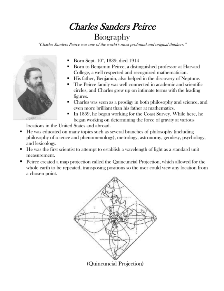
Charles Sanders Peirce Biography “Charles Sanders Peirce was one of the world’s most profound and original thinkers.” Born Sept. 10th, 1839; died 1914 Born to Benjamin Peirce, a distinguished professor at Harvard College, a well respected and recognized mathematician. His father, Benjamin, also helped in the discovery of Neptune. The Peirce family was well connected in academic and scientific circles, and Charles grew up on intimate terms with the leading figures. Charles was seen as a prodigy in both philosophy and science, and even more brilliant than his father at mathematics. In 1859, he began working for the Coast Survey. While here, he began working on determining the force of gravity at various locations in the United States and abroad. He was educated on many topics such as several branches of philosophy (including philosophy of science and phenomenology), metrology, astronomy, geodesy, psychology, and lexicology. He was the first scientist to attempt to establish a wavelength of light as a standard unit measurement. Peirce created a map projection called the Quincuncial Projection, which allowed for the whole earth to be repeated, transposing positions so the user could view any location from a chosen point. (Quincuncial Projection) He was an appointed lecturer of Logic (a field of philosophy) at John Hopkins University from 1879 to 1884. While at Hopkins University, he conducted some early experiments in Psychology that has now led some to believe that he was the America’s first experimental psychologist. After his resignation from the Coast and Geodetic Survey (formally called the Coast Survey), he patented a process of bleaching and another process for extracting acetylene (a compound of carbon and hydrogen that is very flammable) that he was developing to create a light source. THE CONNECTION TO NOAA NOAA's charting piece, which evolved into the National Ocean Service (NOS), began at the turn of the 19th century when President Thomas Jefferson, a true NOAA pioneer, established the first science agency of the United States: the Survey of the Coast. The Survey of the Coast changed its name to the Coast and Geodetic Survey in 1878 to reflect the role of geodesy. Today NOS still helps people find their position on the planet by managing the National Geodetic Survey (NGS), which specifies latitude, longitude, height, scale, gravity, and orientation throughout the nation. Aviation safety, in particular the orientation of runways, depends on this system. When the Washington Monument was covered in scaffolding for renovations in 1999, NGS surveyors confirmed the height and stability of the structure. NOS has been a leader in the introduction of electronic nautical charts which, together with GPS, has enhanced the safety and efficiency of navigation on the nation's waterways. More than a century later NOS has evolved into the nation's principal advocate for coastal and ocean stewardship. As the trustee for 12 marine protected areas, NOAA protects National Marine Sanctuaries, which are akin to national underwater parks. Each sanctuary has a unique goal. While one may protect the breeding ground of humpback whales, for example, another preserves the remains of historical shipwrecks, and still another protects thriving coral reef colonies. Through the sanctuary program, a growing number of partners and volunteers embrace NOAA's ocean ethic--to preserve, protect and respect our nation's marine environment. (Reprinted from http://www.history.noaa.gov/noaahistory.html) For more information, visit: http://www.iupui.edu/~peirce or http://www.history.noaa.gov/noaahistory.html.

