PATREC-URBANET Seminar
advertisement
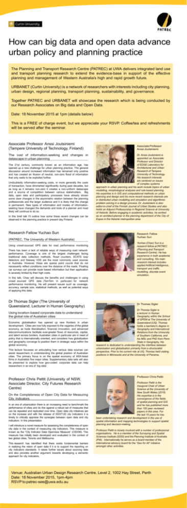
How can big data and open data advance urban policy and planning practice The Planning and Transport Research Centre (PATREC) at UWA delivers integrated land use and transport planning research to extend the evidence-base in support of the effective planning and management of Western Australia’s high and rapid growth future. URBANET (Curtin University) is a network of researchers with interests including city planning, urban design, regional planning, transport planning, sustainability, and governance. Together PATREC and URBANET will showcase the research which is being conducted by our Research Associates on Big data and Open Data. Date: 18 November 2015 at 1pm (details below) This is a FREE of charge event, but we appreciate your RSVP. Coffee/tea and refreshments will be served after the seminar. Associate Professor Anssi Joutsiniemi (Tampere University of Technology, Finland) The cost of information-seeking and changes in datascape in urban planning The 21st century, commonly known as an information age, has opened up a new challenge for urban planning practice. The general discussion around increased information has remained only positive and has created an illusion of neutral, non-zero flood of information that only waits to be exploited further. Undoubtedly information-seeking costs, or more generally the costs of transaction, have diminished significantly during past decades, but as long as it remains non-zero it creates a non-uniform datascape and a source of competition between various stakeholders. Big data, open data and participatory processes have already shown some clear changes in the asymmetric relation between the planning professionals and the larger audience and it is likely that the change is permanent. New types of information and modes of informationseeking have changed the demands and tools of a planner and most likely will continue to do so. In this brief talk I’ll outline how some these recent changes can be observed in the planning practice in present day Finland. Research Fellow Yuchao Sun (PATREC, The University of Western Australia) Using crowd-sourced GPS data for road performance monitoring There has been a lack of reliable ways of measuring road network performance. Coverage is one of the largest challenges facing traditional data collection methods. Road counters, SCATS loop detectors and freeway VDS are the most commonly used sources in Australia. However, these are sparse point counts that do not necessarily reflect conditions over the distance of the roads. Floating car surveys can provide route based information but their application is severely limited by their high costs. Associate Professor Anssi Joutsiniemi Dr. Anssi Joutsiniemi is appointed as Associate Professor and Director of EDGE Laboratory for Architectural and Urban Research of Tampere University of Technology. His research interests are centered on issues of complex systems approach in urban planning and his work include topics of urban modelling, morphological analyses and rule-based planning. His expertise is in GIS and computational methods on urban planning and design and his more recent research interests are in distributed urban modelling and simulation and algorithmic problem solving in a design process. Dr. Joutsiniemi is also editor-in-chief of the Finnish Journal of Urban Studies and also holds an Adjunct Professorship in Regional Science at University of Helsinki. Before engaging in academic activities, he worked as an architect-planner in the planning department of the City of Espoo in the Helsinki metropolitan area. Research Fellow Yuchao Sun Yuchao (Chao) Sun is a research fellow at PATREC (Planning and Transport Research Centre). He has experience in both academia and consulting. His main research interest includes applied Artificial Intelligence, transport and traffic modelling, discrete event simulation. In this talk, Chao will discuss the benefits and challenges in using crowd sourced GPS data (TomTom in particular) for network performance monitoring. He will present issues such as coverage, accuracy, sample size, statistical methods, as well as potential ways of applying this data. Dr Thomas Sigler (The University of Queensland, Lecturer in Human Geography) Using location-based corporate data to understand the global role of Austalian cities Economic globalisation has opened up new frontiers in urban development. Cities are now fully exposed to the vagaries of the global economy, as trade liberalisation, financial innovation, and advanced telecommunications facilitate ever-greater flows of resources, capital, and talent across borders. Australian cities in particular are in need of policy that is internationally oriented, and considers how globalization and geography converge to position them in strategic ways within the global economy. This lecture focusses on articulating how various data sources can assist researchers in understanding the global position of Australian cities. The primary focus is on the spatial economy of ASX-listed firms in Australia’s five major cities. Supplementary data sets will also be presented to explore how geo-coded corporate data can help researchers in an era of ‘big data’. Professor Chris Pettit (University of NSW, Associate Director, City Futures Research Centre) On the Completeness of Open City Data for Measuring City Indicators In an era of urbanization there is an increasing need to benchmark the performance of cities and do this against a robust set of measures that can be repeated and replicated over time. Open data city initiatives are on the increase and with the release of IS037120 city indicators it is timely to critically appraise the synergies between open data and city indicators. In this presentation I will introduce a novel measure for assessing the completeness of open city data in the context of measuring city indicators. This measure is known as the “City Indicator Data Openness Measure” (CIDOM). This measure has initially been developed and evaluated in the context of two global cities, Toronto and Melbourne. This research has identified that there exists fundamental barriers in realizing the vision of open data if it is to support the reporting on city indicators standards. It raises further issues about sourcing data and also provides another argument towards developing a semantic approach for city indicators. Dr Thomas Sigler Dr Thomas Sigler is a lecturer in Human Geography within the School of GPEM at The University of Queensland (UQ). Thomas holds a bachelor’s degree in Geography and International Relations from the University of Southern California, and his MSc and PhD from Penn State in Geography. His research is dedicated to understanding the interface between urbanisation and globalisation primarily from a structuralist perspective. Prior to his current role at UQ, Thomas held visiting positions in Minnesota and at the University of Panama. Professor Chris Pettit Professor Pettit is the inaugural Chair of Urban Science at the University of New South Wales (2015). His expertise is in the convergence of the fields of spatial planning and GIS and he has published more than 100 peer reviewed papers in this area. For the last 15 years he has been undertaking research and development in the use of spatial information and mapping technologies to support spatial planning and decision-making. Professor Pettit is closely involved with a number of professional organisations. He is a member of the Surveying and Spatial Sciences Institute (SSSI) and the Planning Institute of Australia (PIA). Internationally he serves as a board member of the International advisory board for the “Geo for All” initiative amongst other activities. Venue: Australian Urban Design Research Centre, Level 2, 1002 Hay Street, Perth Date: 18 November 2015, 1pm-4pm RSVP to patrec-see@uwa.edu.au


