CHAPTER 4 -- PLATE TECTONICS
advertisement
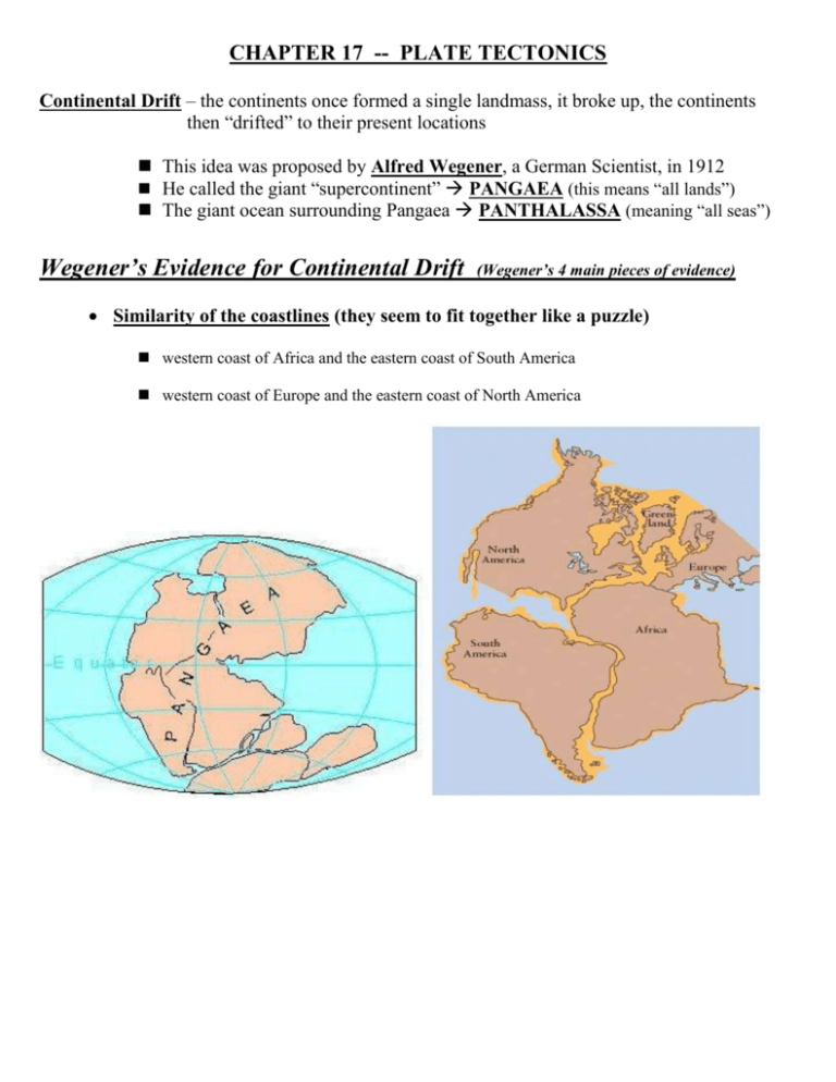
CHAPTER 17 -- PLATE TECTONICS Continental Drift – the continents once formed a single landmass, it broke up, the continents then “drifted” to their present locations This idea was proposed by Alfred Wegener, a German Scientist, in 1912 He called the giant “supercontinent” PANGAEA (this means “all lands”) The giant ocean surrounding Pangaea PANTHALASSA (meaning “all seas”) Wegener’s Evidence for Continental Drift (Wegener’s 4 main pieces of evidence) Similarity of the coastlines (they seem to fit together like a puzzle) western coast of Africa and the eastern coast of South America western coast of Europe and the eastern coast of North America Fossil records are similar on separate landmasses ex. Mesosaurus – It was a small reptile that lived 270 million yrs. ago that lived in shallow, fresh water, inland seas. Its fossilized remains were found in eastern South America and also in Western Africa Geologic Evidence Similarities The age and type of rocks are similar in the coastal regions: Rock samples taken from along the coastline of Africa are similar in age and type to the samples taken from South America Old mountain chains (more than 200 myo) are similar in age and structure: The age and structure of the Appalachians (in the Eastern U.S.) is similar to mountains in Greenland and Northern Europe Rocks in the Appalachians of North America and the Caledonians of Britain and Norway are very similar (folded mtns.) and are also similar in age. When we fit Europe and North America together, we find that The Appalachians and Caledonides form a single mountain chain. Climatic Change Similarities Evidence of glaciers found on separate landmasses o Debris from glaciers (rocks that have been carried great distances) are found o Scarring is found in the rock layers Evidence of tropical swamps on separate landmasses o Seams of coal are found in the United States and in Europe appear to connect o Seams of coal found in Antarctica (coal is made from ancient swamp material) __________________________________________________________________________________________ Although Wegener had an enormous amount of evidence to support his idea, many scientists still doubted him. Why? * He could not explain what force could be strong enough to rip the landmasses apart and move them so far * How could the landmasses move through the solid ocean floor SECTION 17.2 Additional Evidence for Continental Drift During World War II (the 1940’s) SONAR technology was improved because submarine pilots needed detailed maps and a way to navigate under water. These maps that were created helped to identify previously unknown ocean floor formations (Mid-Ocean Ridges and trenches). (SONAR -- sound navigation and ranging) During World War II (the 1940’s) Magnetometers were originally developed to be towed behind ships on the surface to help them detect the magnetic fields generated by the steel hulls of submarines. These were later modified to measure the magnetic field strength of ocean-floor rocks. It was discovered that there were magnetic patterns on the ocean floor. Mid-Ocean Ridge Systems -- Ocean Rock Samples: Glomar Challenger – (1968) Large research ship with a drilling rig attached. It took a series of core samples along the Mid-Atlantic Ridge from the center of the rift valley going outward. By examining the fossils embedded in the samples they discovered that the cores drilled closest to the rift valley had the youngest fossils and they got progressively older as the samples were drilled farther from the rift valley. The Glomar Challenger was the first research vessel specifically designed in the late 1960s for the purpose of drilling into and taking core samples from the deep ocean floor. Ocean Floor Sediments: Deep Sea Sediments – Deep-sea sediments are fine-grained and accumulate slowly over time. Measurements showed that the sediment deposits were thinnest next to the Mid-Ocean Ridges and they get thicker as you move further from the ridges.


