04 the Globe
advertisement

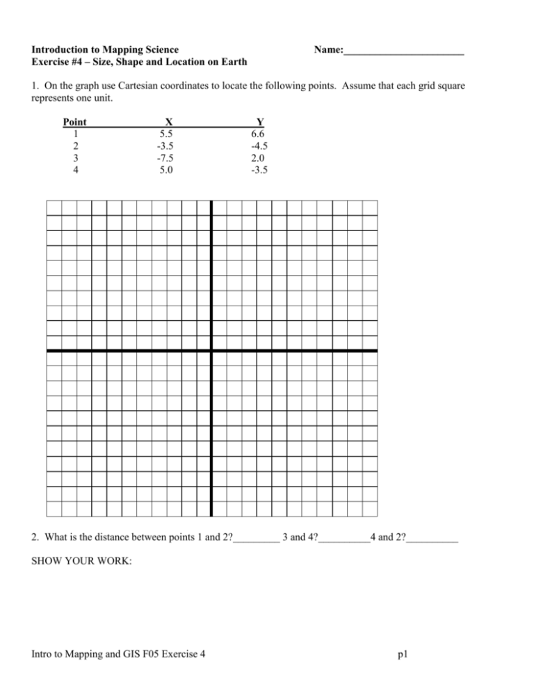
Introduction to Mapping Science Exercise #4 – Size, Shape and Location on Earth Name:_______________________ 1. On the graph use Cartesian coordinates to locate the following points. Assume that each grid square represents one unit. Point 1 2 3 4 X 5.5 -3.5 -7.5 5.0 Y 6.6 -4.5 2.0 -3.5 2. What is the distance between points 1 and 2?_________ 3 and 4?__________4 and 2?__________ SHOW YOUR WORK: Intro to Mapping and GIS F05 Exercise 4 p1 3. For each location on the map [1-5] write its latitude and longitude in the following table. Point Latitude Longitude 1 2 3 4 5 Intro to Mapping and GIS F05 Exercise 4 p2 4. Convert each of the following locations to decimal degrees: . 1. 2. 3. 40̊ 30’ 15” N 45̊ 25’ 05” S 10̊ 35’ 15” N Point 75̊ 45’ 21” W 35̊ 55’ 01” E 55̊ 25’ 18” E Latitude Longitude 1 2 3 Show your work: Intro to Mapping and GIS F05 Exercise 4 p3 5 - Great Distance Measurements When measuring long distances we need to account for the curvature of the earth. In this case the procedure is to calculate the number of degrees of great circle arc between the two places and then convert the arc measure, which is in degrees, to distance measure by multiplying by 69 [for converting to miles]. Given the latitude and longitude of two places, use the following formula to determine the number of degrees in the arc of the great circle connecting the two places: Arccos ((Sine(Lat1)*Sine(Lat2)) + (Cosine(Lat1)*Cosine(Lat2) * Cosine(|Long1 - Long2|))) You can find the required trigonometric functions on any scientific calculator. On many calculators you access the arccosine function by pressing the Inverse or second function key and then pressing the cosine key. Inverse Specify Degrees In Windows you can access a calculator, pictured here, by clicking on Start–> Programs –> Accessories –> Calculator. The illustration highlights the trigonometric function keys and the Inverse check box. Note that for the formula giver here you need to specify angular measurements in degrees, so you should click in the Degrees option box. The map depicts Philadelphia and San Francisco. The following table displays the latitude and longitude of each place. Use the data in the table to calculate the numbers of degrees of great circle arc between the two places and then convert the degrees into miles. Here are the steps you need to follow: 1. 2. 3. Trigonometric functions Windows calculator. Access by: Start Programs Accessories Calculator Convert the degrees, minutes, and seconds to decimal degrees. Use the formula to determine the number of degrees of great circle arc separating the two places. Multiply the number of degrees by the length of a degree in linear measure [69 in the case of miles]. Intro to Mapping and GIS F05 Exercise 4 p4 Global Coordinates Place Longitude Philadelphia San Francisco Latitude 75̊ 18' 13" W 40̊ 3' 4" N 121̊ 42' 53" W 36̊ 26' 7" N Decimal Degrees Place Longitude Latitude Philadelphia San Francisco Sine Lat1 = Sine Lat2 = Cos Lat1 = Cos Lat2 = Cos (| Long1 - Long2|) = ((Sine Lat1) * (Sine Lat2)) + (Cos Lat1 * Cos Lat2 * Cos (| Long1 - Long2 |) ) = Arccos of result in previous line. Degrees = degrees. Distance = Miles Show your work: Intro to Mapping and GIS F05 Exercise 4 p5 6 - World Time Zones Worksheet (use page 27 Dates and Times to help you answer) * Where is all time measured from? ________________________________________ * How many world time zones are there? Why? ________________________________________ * Approximately how wide is each time zone? ________________________________________ * Explain why time zone boundaries are not completely straight. ________________________________________ * Name the four major United States time zones. ________________________________________ If the time in London is 12:00 P.M. GMT, Wednesday what time is it in: Chicago _____________________________ Paris _____________________________ Moscow _____________________________ Tokyo ___________________________ Buenos Aires ________________________ If the time in Philadelphia is 12:15 P.M., Wednesday what time is it in: Chicago ____________________________ Paris ______________________________ Moscow ___________________________ Tokyo _____________________________ Sydney ____________________________ Buenos Aires ________________________ Show your work: Intro to Mapping and GIS F05 Exercise 4 p6


