Adventure Activities in Region III
advertisement
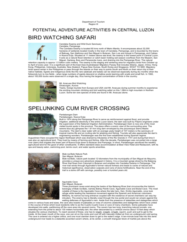
Department of Tourism Region III POTENTIAL ADVENTURE ACTIVITIES IN CENTRAL LUZON BIRD WATCHING SAFARI Candaba Swamp and Wild Duck Sanctuary Candaba, Pampanga The Candaba Swamp is located 60 kms north of Metro Manila. It encompasses about 32,000 hectares of wetlands located mostly in the town of Candaba, Pampanga, and is bounded by the towns of Baliuag, San Ildefonso and San Miguel in Bulacan, San Luis and Arayat in Pampanga, and Cabiao in Nueva Ecija. Situated at 11 meters above sea level, the swamp is the lowest point in Central Luzon. It acts as a natural flood retention or catch basin holding wet season overflows from the Maasim, San Miguel, Garlang, Bulu and Penaranda rivers, and draining into the Pampanga River. The natural retention capacity is approx 1.5 billion cubic meters. The swamp is the staging and wintering area for migratory birds from October up to April of every year. It is a significant part of the East Asia-Australiasian Migratory Flyway that includes Siberia, Japan, China, Hong Kong, Philippines, Indonesia, Australia, New Zealand, Papua New Guinea, South Korea and Singapore. WHAT TO SEE: Migratory birds spend winter in the Philippines or pass through the islands on their way to points South and North on their return trip to their native habitats. Egrets and indigenous birds like the rare salaksak and batala can be observed especially during dry months when the fishponds turn to rice fields - when large numbers of egrets descend on shallow pools teeming with snails and small fish. In 1982, about 100,000 ducks were observed in a single day, thus having the largest concentration of birds in the country. Mt. Anacuao Bird Watching Dinalungan, Aurora Yearly, foreign tourists from Europe and USA visit Mt. Anacuao during summer months to experience the exciting mountain climbing and bird watching safari on this 1,984-m high mountain in Northen Luzon. Some ten rare species of birds are found in Mt. Anacuao alone. SPELUNKING CUM RIVER CROSSING Pantabangan Dam Pantabangan, Nueva Ecija Built in 1974 along the Pampanga River to serve as reinforcement against flood, and provide irrigation, additional electricity in the entire Luzon island, the dam was built by Filipino engineers under the supervision of the National Irrigation Administration. Pantabangan Dam is now one of the most visited tourist spots in the province. The place offers a scenic view of the surrounding area. The serene blue sky glimpses the 1.61-km long dam enveloped by the picturesque Sierra Madre mountains. The dam's clear water with an average yealy height of 107 meters is the sanctuary of tropical marine life and an inviting site for jetskiing and fishing. Tourists will also appreciate the dam's engineering wonders. Pantabangan was the first town established during Spanish regime. Augustinian friars occupied the region Northeast which was drained by tributaries of the Rio Grande in 1701 and during that time it was also an agricultural land. They lived by means of farming and fishing. After the decade, Pantabangan was converted into a large river (dam) that irrigates the lower part of Nueva Ecija down to Bulacan and Pampaga. In short, Pantabangan sacrificed the wealthy agricultural land for the good of other constituents. It offers standard-class accommodation at Best View Hotel and Restaurant, with its spa and beauty salon, swimming pool, tennis court, and water sports amenities. Biak-na-Bato Nature Park San Miguel, Bulacan Biak-na-Bato, nature park located 12 kilometers from the municipality of San Miguel de Mayumo, provides a unique eco-adventure steeped in history. It is a mountain gorge sliced by the Balaong River that flows from Calumpit in Bulacan and empties into Candaba Swamp in Pampanga. The river trail winds through Aguinaldo's former natural fortress and leads to caves of natural and historical significance, observation outposts and ruins of stone fortifications. Near the end of the trail is a stone cliff with carvings, possibly over a hundred years old. Aguinaldo Cave San Miguel, Bulacan Three prominent caves exist along the banks of the Balaong River that circumscribe the historic barangay of Biak-na-Bato, namely Bahay Paniki Cave, Aguinaldo Cave and Bukal Cave. The most notable of these is the Aguinaldo Cave where the late hero, Gen. Emilio Aguinaldo, once took refuge while leading the resistance movement against the Spanish and American colonizers. Militarily, its narrow but long entrance coupled with the existence of secret chambers can way-lay intruders. The enemy has to literally crawl through the low portal and would ran smack against the waiting defenses of Aguinaldo's men. Aside from the presence of stalactites and stalagmites which come in various hues and sizes, the cave also boasts of palisades or rows of columns (stalactites and stalagmites which have united in the course of time) which local residents refer to as the Cuarto-Cuarto Cave or cave of many chambers. Some palisades have developed into walls, partitioning off the cave area into several rooms. The cavern has two long, branching natural tunnels: one extending from the portal to about 130 meters horizontally lain; the other descended by a vertical crevice about 10 feet deep which situates the various chambers. To reach several of these, one has to wiggle, waggle, wriggle, squirm, push and pull to get to the inside. At the lower mouth of the cave, one can sit on the rocks and cool off with naturally chilled air from an underground cold spring. The cave is entered via a higher orifice, and one must clamber down to get to the water's edge. A ten-minute boat ride into this eerie underground river leads to a stalactite-accented cavern where, at its center, a smooth triangular block of marble juts above the surface of the clear emerald water. Local lore claims it to be "la mesa de Aguinaldo", the table on which Aguinaldo signed the historic peace treaty. Madlum Cave San Miguel, Bulacan Madlum Cave is a prominent feature in the Angat Limestone Formation which occupy most of the whole reservation of Biak-na-Bato National Park and is considered a shrine by the people of San Miguel, Bulacan. There are three giant portals to the approximately 50-meter long cavern. An entrance to the right, which is about 30 meters from the water level of the Madlum River, is a statue of the Virgin Mary. It is the place where the town's patron saint, St. Michael, was found. It is located in Sitio Madlum, Brgy. Sibul Spring. It is only 5 minutes ride on a private vehicle from the Poblacion or in an hour or so from the North Luzon Expressway by bus plying the Manila - Tuguegarao route. This place which offers a scenic view of the natural environment delights excursionists and nature lovers. Pinagrealan Cave Norzagaray, Bulacan This major cave in Norzagaray is a natural refuge used by Filipinos during the struggle against Spain and the Americans and during the last world war. Floral species observed on the hills encompassing the cave are limited to shrubs, vines, cogon and some types of plants that thrive on limestone with very thin soil substrate. A few unidentified birds are noted flying over the loose canopies of the thicket. Inside the cave, which averages about 4 meters by 2.5 meters in height and width, is a quite and crystal-clear stream which extends to some 200 meters to a point where the ill-equipped team can no longer penetrate due to deep water. Fauna observed include shrimps, biya, and bivalves. Sounds of nocturnal bats, which are few as characterized by unnoticeable guano excretes, are also heard. Stalactites and stalagmites abound after passing through two passages 10 meters from the portal, which converges some 20 meters to the underground stream. Numerous sinkholes, columns, uneven vertical fractures, domes, flowstones and fossilized flora and fauna are embedded in the limy sand-stones that form some parts of the cave wall. This subterranean network of caverns was the site of secret meetings of the Filipino revolutionary forces during the war against Spain in 1896. Minalungao National Park and Cave Gen. Tinio, Nueva Ecija The site features the breathtaking view of narrow deep river that looks up to 16-meter high limestone walls. At the end of the white rock formation is an enchanting cave that is perfect for trekking activities. The cave - Located at the foot of Minalungao Hill, Minalungao Cave's rock formation is composed mainly of calcites (limestones and marbles) which are dotted with tiny and shallow holes, evidence of dissolving reaction from the continuous dripping of rain water (during wet season) from the apex of the vertical soil-filled cragged species of grass. The vegetative cover in the area is limited to species like shrubs, vines, cogon and other unidentified species of grass. Fauna species observed outside the caves include monkey, wild pig, squirrel and birds like oriole, swift, martinez and ground thrust. The nocturnal troglophiles - fruit- and insect-eating - are characteristic of almost every cave visited. The portals to the cave (one large and another small) situated about 10 meters up to the river's water level, is blocked by a big, brown rock, simulating Jesus' Tomb at first glance. An ascending vertical crevice welcomes visitors some 50 meters into the portals. A lone bamboo pole serves as the only way up the ante-room which is adorned with flowstones, stalactites and stalagmites. A narrow sinkhole directly above the dome faintly provides natural light to the place. Its naturally ridged formation is cut through the center by the Penaranda River where various fish species abound. The water-lined corrosion on the cragged vertical rocks suggest a 10-meter swelling of the otherwise peaceful river, during rainy days. Dona Remedios Trinidad Natural Wonders Dona Remedios Trinidad, Bulacan Because of its altitude, the town of Dona Remedios Trinidad has a cooler and moister climate than the rest of the towns of Bulacan. Its natural features include rivers, waterfalls, forests, springs, limestone formations mountains and hills. Magnificent and well-preserved caves can be found in Barangay Bayabas one of which is called Puning Cave with a spring running down a mountain. Another beautiful cave is the Baras-Bakal spring cave located at Barangay Pulong Sampaloc and Madlum Cave in Biak-na-Bato National Park. It has several breathtaking waterfalls like the Tumutulo Falls in Brgy. Bayabas which drops from a height of fifteen meters into an attractive setting of white stone formation and marble and cascades further into an old stone formation called Simbahan ni Lapud (Brgy. Kabayunan), Mount Bato Falls (Brgy. Sapang Bulak), Verdivia Falls (Brgy. Talbak), Talon ni Eva (Brgy. Kalawakan) are ideal places for group picnics and outings. Preferred ecotourism activities include: mountain climbing, bushwalking, rock climbing, camping, mountain biking, bird watching or simply enjoying the majestic view and landscape of the Sierra Madre Mountain Ranges. Sto. Nino Cave Candelaria, Zambales Sto. Nino Cave is a fissure on the earth's crust in one of the hills of Barangay Babangcal, northeast of of the town of Candelaria in Zambales. It is accessible by any type of transportation and can be reached from the town proper in about 20 minutes. The cave measures about 50 by 75 meters and at the central wall sits an altar with the images of the Holy Family. The weired cross in the background is a makeshift human femur bones. The place is actually a shrine built in honor of an unsung hero, who during the last world war provided a company of Japanese soldiers with a meal of wild, boiled but poisonous cassava roots that "wiped them out without a single shot being fired." Another unique charm of the cave is the presence of a petrified giant clam (taklobo), measuring almost two feet in diameter, imbedded in the rocky stratum of the cave's ceiling. SURFING AND SCUBA DIVING (seaplane, parasailing, snorkelling, yachting) Cemento Beach and Reef Baler, Aurora White sand, seashells, and crushed corals are found along the stretch of Cemento Beach. The waters are ideal for expert/professional surfers as the waves are of the right-hand break type. It is also suitable for body boarding, snorkeling and diving. Charlie's Point Baler, Aurora Ideal for surfing, with medium quality right-hand-and-left-break waves on a sand-and-gravel bottom. The waves are best in December and January. The surf scenes from the movie Apocalypse Now were filmed here. Cobra Reef in Cemento Baler, Aurora The area produces excellent right-break waves over sharp reefs. It is one of the spots most frequented by Australians, Europeans, and Japanese surfers in Aurora. Sabang Beach Baler, Aurora Located on this long stretch of gray sand beach are several resorts namely: Angara's Beach House, Bay's Inn Resort, MIA Surf and Sports Resort and Baler Guesthouse and Restaurant, which offer accommodation near the beachfront and provide food, relaxation, and respite for swimmers and surfers. From March through June, the waves are relatively calm providing a good beachfront for swimmers and an excellent challenge for expert windsurfers. The months from October to February bring in the large waves for beginner surfers to learn the basics with relative safety, since most of the beach is sandy- bottomed. Undertows, which are helpful to surfers and dangerous for non-swimmers, do occur in certain areas. The most popular surfing point is found right in front of Bay's Inn, where beginners brave the moderate waves and regular surfers practice. Lindy's point, found further north along Sabang beach, is a highly-prized secret spot among local surfers. San Narciso Beach San Narciso, Zambales The town prides itself in having the having the best place for surfing for beginners. It is now offered by the management of Crystal Beach Resort owned by Mr. Dodo Ramos, also the President of the local beach resort association. Subic Bay Subic Bay Freeport Zone, Zambales Subic Bay has the country's only remaining three-layered virgin canopy rainforest teeming with wildlife and foliage. The bay offers ocean-going vessels a natural, deep-water port facilities and sheltered harbor. It contains a wealth of historical wrecks many of which lie in quite shallow waters below 130 feet. Of the dozen known vessels that were sunk during the last world war, seven are now dive sites. Of the seven vessels, three are from the American Navy, one is from the Japanese, one is from the Spanish, and the rest are barges and landing crafts. The significant vessels fom the American Naval Forces are the El Capitana, the Catalina Patrol Aircraft, and the USS new York, the flagship of the North Atlantic Squadron. The Japanese Oryoku Maru, christened as "Hell Ship," was even a luxury liner. It was actually carrying more than a thousand Americans and Allied Prisoners when the Americans made the deadly mistake of attacking it, thus sending their own people and allies to a watery grave. The USS New York, which was scuttled by the US Navy in 1941 at the approach of the Japanese, is now the home of multitudes of marine life species. To swim past the barrels of those massive cannons while schools of talakitok dart overhead in this eerie environment is never to be forgotten. La Gallega, a scaled-down faithful reconstruction of an authentic Spanish galleon used to be commissioned for one's cruising trip along the bay. It is host to the sprawling Subic Bay Freeport Zone - now an industrial and tourism estate. Needless to say, opportunities for excellent underwater photography including scuba diving and snorkeling are endless. (Credit: Blue Rock Resort) Grande Island Subic Bay Freeport, Zambales The former R & R center for most of the American Navy personnel stationed in Subic, now an island paradise of international standards under management by Grande Island Resort. Enjoy the fine beaches of the island amidst aquatic resources. Take a trek along the wilderness trail system. In April 1975 at the end of the Vietnam War, Grande Island was made into a haven for 43,000 Vietnamese and Cambodian men, women and children refugees. Grande Island served as a temporary housing area until the refugees could be transferred to a more permanent location. This was called “Operation New Life”. One year later, the Grande Island Recreation Center was opened to military personnel and their dependents and was established as a Family Recreational Center. (Source:www.grandeislandresort.com) Masinloc Oyon Bay Masinloc, Zambales The combination of the sunset and cool breeze from the sea provides an excellent environment for nature lovers of all ages. You never get tired going there early in the morning to inhale the fresh sea breeze and in the afternoon to view the envigorating sight of the sunset. The Taclobo (Clam) Farm & Coral Reef Transplantation Project contributes to the improvement of the condition of Philippine coral reefs thru coral transplantation and resseding of giant clams. The continued production of giant clams has resulted in numerous cohorts at the grow-out phase, now ready for restocking. Masinloc Oyon Bay, with its crystal clear water, white sand and biological life forms, is perfect for snorkeling and diving, particularly Bacala diving site. San Salvador Island/Marine Sanctuary Masinloc, Zambales San Salvador Island, located in the western side of Masinloc, Zambales, is about 2.5 kilometers away from the mainland, or a 30minute pump boat ride from the coast. Its abundance in marine resources has made it famous as scuba divers' paradise in Central Luzon. Divers would certainly love feasting their eyes on seeing the largest Manta Rays in the country each measuring about 10 feet in diameter. The island is rich in fruit-bearing trees like mangoes. Clean water, smooth beach coupled with powdery white sand and cool sea breeze. The island is host to the only fish sanctuary in Luzon whose reef is made up of used tires to substantially increase fish production. MT. CLIMBING AND VOLCANO TREKKING Mt. Arayat Arayat, Pampanga Rising above sea level by 3,300 ft., this legendary wonder of Mother Nature boasts of lush green vegetation and wildlife sanctuary. Visitors to the area are welcomed by its envigorating mountain air coupled with nature's serenity. At the foot of the mountain, visitors are prone to take a dip and experience the rejuvenating effect of cool mountain spring at the Arayat National Park. An extinct volcano, Mt. Arayat is a sight one will not miss, since it stands alone in the open plains. Not to be missed is the so-called White Rock which is said to have formed about 600,000 years ago during a prehistoric eruption and that it was used as a sentinel by Filipino patriots in the early revolts against Spanish rule. Take the two-hour climb from Magalang side (via Pampanga Agricultural College), then go down to the Arayat side where one can take a dip in the cool spring water at Bano Resort. Mt. Natib Orani, Bataan Mt. Natib is the highest peak in the Bataan Natural Park with an elevation of 1,253 meters above sea level. The slope is characterized by very steep forest cover. Its mossy forest features a collection of small stunted trees as one approaches the top. The peak is covered with small patches of grassland. Also found are boulders with inscribed names of American expeditionary forces that climbed the peak way back in the 1930s. The Bataan Natural Park where Mt. Natib is located is located approximately 124 kms from Manila. To reach the mountain from the North Luzon Expressway, exit at the San Fernando tollway and take the Gapan-Olongapo road. Upon reaching the Layac junction in Dinalupihan, Bataan, take the Roman Superhighway. From there it's about 10 minutes travel to Tala-Orani intersection, then take a turn right to Brgy. Tala where the PASU-DENR monitoring station is located. Mt. Olivette Bongabon, Nueva Ecija Climbing a hundred steps of curved stone, one reaches the church built by the Adarnista Spiritual Community on a hilltop. An outdoor overnight stay a firefly-lit night, enchanting its visitors and in the morning, one wakes to cascading waterfalls whose view adds to its lush sceneries . Olivete is most famous for its medicinal springs where pilgrims bathing and drinking are an everyday sight and every visitor either to discover its awesome wonders inside or to purify their inner selves crawling through its endless veins. Mt. Pinatubo Botolan, Zambales Mt. Pinatubo is an active volcano located on the island of Luzon at the intersection of the borders of the provinces of Zambales, Tarlac, and Pampanga. The volcano’s eruption in June 1991 came after 500 years of dormancy, and produced one of the largest and most violent eruptions of the 20th century. Before 1991, the mountain was inconspicuous and heavily eroded. It was covered in dense forest which supported a population of several thousand indigenous people called Aetas, who fled to the mountains from the lowlands when the Spain conquered the Philippines in 1565. Mt. Pinatubo "Puning" Hot Springs Via Sapang Bato, Angeles City Geothermal exploration following the 1991 Mt. Pinatubo eruption indicated that the volcano hosted a hydrothermal system which today manifests varying degrees of temperature (some even reach close to boiling point!). Some of these are the thermal springs along the Sacobia River in Sitio Puning, Brgy. Inararo, Porac, Pampanga where temperatures range from 40 to 70 degrees. Surging waters on these mountain springs were tested and were found to have zero couliform and 7.5 pH level which indicate their curative and healthful qualities and effect on bathers and frolickers. Incredibly, cold springs and waterfalls are also found in close proximity to these thermal manifestations. WHAT TO SEE: Spectacular views, towering lahar canyons, hot and cool mountain springs and cascading waterfalls make this trip a rewarding experience. HOW TO GET THERE: Drive up north towards North Luzon Expressway and onto Clark Freeport Zone in Pampanga (exit Magalang or Dau). From Clark, proceed to Sapangbato Gate along Quirino Ave. and continue driving past the Brgy. Sapangbato to Sitio Bliss and finally towards Sitio Target - the jump-off point to the thermal springs. Experience a sweltering though exciting off-road adventure (onboard 4x4 workhorse)for an hour along Sacobia River up to Sitio Puning where the intrepid explorer is bound to soak up or bathe for a rejuvenating bath minus the tub. Total travel time is 2 1/2 hours from Manila to the hot spings. Mt. Tapulao Palauig, Zambales Mt. Tapulao, standing at a height of 6,683 feet (2,037m) above sea level with temperature cooler than Baguio at 12 - 16 Celsius (53.6 - 60.8 Farenheit), is veritably a garden of nature abundant with century-old pines, locally known as Tapulao, hence, the name of the mountain. It plays host to species of orchids, ferns, mossy forest and a secret garden of Bonsai trees, wild strawberry farm, home to monkeys, wild deers, birds, wild boars, upland horses, cattles, wild cats and lizards. Truly, a perfect paradise for nature lovers. It is located at the rolling terrain of Mt. Salaza, Palauig, Zambales. Ideal for biking, driving, trekking, camping and kayaking at the Wild Water River. HOW TO GET THERE: Take a bus (Victory Liner) bound for Sta. Cruz. At the Banlog Triangle Palauig Arc, leave the road at a clearly marked crossing that leads inland to Dampay Resettlement Area (about 8 kms). From there, it is an 18 km or 7-8 hours of trekking up to Mt. Tapulao. The journey may be shortened to about 4 hours on board 4x4 vehicle. For further details, contact Palauig Tourism Office (Danny Timbol), Mobile: 0917-952-1533 Sierra Madre Trail Luzon Island The Sierra Madre Mountains, the country's longest mountain range and one of the most biologically diverse areas in the world, is a 600-km trail that features over 200 destinations in the nine provinces of Cagayan, Isabela, Nueva Vizcaya, Quirino, Aurora, Nueva Ecija, Bulacan, Rizal, Laguna and Quezon. The trail involves unique trekking adventure through the 1.4-million ha. mountain range that is home to 3,500 species of plants and the widest variety of birds in Luzon. The trail is punctuated by the best bird-watching points; the areas with the most diverse flower species and other flora and fauna; and sites for religious rites and other cultural experiences. The Sierra Madre trail is threepronged. A lowland road trail, a mountain foot trail and a coastal trail. The lowland trail follows the national highways from Metro Manila; the Maharlika Highway in the north and the Marilaque Highway in the south. Interesting points on the lowland trail are the Penablanca Protected Landscape, Biak-na-Bato National Park, Northern Sierra Madre Natural Park, and the Capisaan Caves in Nueva Vizcaya. To the south are the Pamintinan Caves and Avelon Zoo in Rizal. The coastal trail features beaches, surfing and dive sites, and towns of Luzon's Pacific coast that can be reached primarily by boat. One such place is the Baler-Palanan trail whose coastline is noted for waves ideal for surfing. The mountain foot trail, on the other hand, is arguably the most challenging of the three options and is expected to be the most popular among foreign trekkers and mountaineers. The trail from Palaui Island in Cagayan, the northernmost tip of the Sierra Madre, to the UP Land Grant in Quezon, south of Metro Manila is mapped out to become an ecotourism zone. The Aguinaldo trail, on the other hand, follows the route of Gen. Emilio Aguinaldo when he crossed the Sierra Madre from San Mariano to Palanan to escape pursuing American forces during the the Philippine-American War. Ethnic communities identified along the trail are the Dumagats, Kalingas, Ibanags, and Bungkalots. This ecohistorical tourism program is a project of Miriam PEACE led by Ms. Donna Paz Reyes, project coordinator, Miriam College. (Credits: Phil. Daily Inquirer, Blanche Rivera, Dec. 6, 2005) Tarlac Ecotourism Park Sitio Padlana, Brgy. Lubigan, San Jose, Tarlac In the early months of 2001 under the leadership of Governor Jose "Aping" Yap, a project was launched to find a place in the province where people and nature can co-exist in harmony with each other. Soon after, a 278-ha forested land that would eventually serve as a sanctuary for environment and nature lovers was established. Located at an altitude of 308 meters above sea level, 30 kilometers from Tarlac City, the said place boasts of perfect climatic condition with natural ecosystem for plants, disterocarp trees, convenient habitat for native and migratory birds and wild animals. The place is a perfect place for camping holidays. On April 12, 2004, President Gloria Macapagal Arroyo issued Proclamation No. 602 officially declaring the Tarlac Ecotourism Park as "ecotourism park and campsite." Vic Yap, in-charge of Special Projects Office, facilitated the construction of concrete roads, electricity, water system, eco-park buildings and other amenities for the campsite. Today, the Monasterio de Tarlac Chapel , a hermitage house, dormitories donated by friends of the "Servants of the Risen Christ" are now in place and soon a bigger church will rise to serve as a repository of a host of religious relics and artifacts that originates from the Vatican. The blessing of the monasterio dedicated to the Relic of the Holy Cross was presided by His Excellency Most Rev. Fernando Filoni, D.D., Apostolic Nuncio to the Philippines, together with Tarlac Bishop Florentino F. Cinense, and other clergy on January 30, 2007. Verdivia Falls Dona Remedios Trinidad, Bulacan Located in Barangay Talbak, this splendid waterfall is an ideal venue for group picnics and outings. Roosevelt National Parks Dinalupihan, Bataan An unspoiled forest area ideal for picnics and camping activities with facilities for irrigation and game hunting. The surrounding area is great for day hikes and trekking. An unspoiled area that used to be a US military jungle survival training camp. A standard-class restroom was built by the Department of Tourism in 1998 in time for the Asia Pacific Economic Conference. The park teems with roadside mini restaurants and fruit stands - all catering to commuters bound for Olongapo City. The park is operated and managed by the Municipality of Dinalupihan. SPECIAL INTEREST (safari, jungle survival, rafting, slide for life, canopy walk, animal encounter, trekking) Forest Adventure Park Location Group I, Ilanin Forest, Subic Bay Freeport Zone, Zambales Located in a dense jungle and protected area of Subic Bay Freeport, the park consists of a wildlife sanctuary called "Zoobic Safari" where 12 adult tigers roam freely, a museum called Ancient World and Heroes Trail depicting Philippine history through life-sized figures, Butterfly Garden, Jungle Survival Camp for team-building seminars, petting zoo and a "Serpentarium." For further details and rates, pls see this page under Zoobic Safari. JEST Camp/Jungle Survival Camp Upper Cubi, Subic Bay Freeport, Zambales Jungle survival demonstration, visit to insectarium, butterfly garden, aviary, spider world, viewing deck and mini-zoo Rates: P150/pax - Demonstration and tour; P300 - Jungle tour; P600 Overnight stay; P75 - Mini-jungle tour (30 mins) Pamulaklakin Forest Trails Subic Bay Freeport, Zambales Sightseeing, ocular of the area with natives - P20/pax Mini-jungle tour, trekking, jungle survival P30/pax Ecology tour, trekking and jungle survival (2 - 3 hrs) - P250/adult P150/children Overnight jungle tour - P500/pax Ocean Adventure (Subic Bay Marine Exploratorium) Camayan Wharf, West Ilanin Forest Area, Subic Bay Freeport Zone A chance to watch the whales and sea lions do spectacular stunts Visit to the Ocean Discovery Aquarium and Learning Center, Wild Life In Need Rescue Center, Photo encounter, dining, gift shop Admission fees: P450/adult P370/children/ senior citizens Whale Encounter (swim with the whales) - P3,500/pax Dive with the Whales - P4,200 Shipwreck dive - P1,750 Whale plus shipwreck - P5,040 (inclusive of dive gears) Hotel accommodation next door at Camayan Beach Resort Park Hours: Daily, 9 a.m. - 6 p.m. Accreditation CLASS "AA" RESORT Phone (63 47) 252-9000/8982/(63 2) 637-6579/638-2281 Contact John Corcoran/May Yao Email info@oceanadventure.com.ph Website www.oceanadventure.com.ph Paradise Ranch (Leisure Park and Wildlife Sanctuary) Sitio Monicayo, Brgy. Calumpang, Sacobia Valley, Clark, Pampanga Perfect for field trips, get-away vacation, camping, retreats, rock climbing, trekking, rest and recreation, outdoor adventure and other occasions. Amenities include: villas, lake house, cafe/restaurant, man-made lake, aviary, playfield, butterfly garden, botanical garden, fishing lagoon, picnic huts, cottages, prayer hill, and more. For reservation, contact: Paradise Ranch Admin Office, Tel. No. (63 45) 889-8245/8286 / 6256698/6696/321-0444/0445 email: give@pinoykids.org Contact Person: Eric Gomez (Executive Director) and Gerry Guiriba (Fund Development Manager) Developer: Philippine Children's Fund (PCF) Website: www.paradiseranchclark.com Pastolan Extreme Adventure Park Zone Pastolan Aeta Village, Subic Bay Freeport, Zambales Activities: P250/pax/day - Canopy slide, slide for life, get yourself clipped in, sit on the harness and ride the wind; P150/pax P50/tour climb - Wall climbing; P750/pax - Airsoft gun including gun and mask (additional P800 for 200 pellets); P500/pax - Rope courses; Subic ATV Tours (Contact: (+63) 921-4225737 eMail subic_atv@yahoo.com) Zoobic Safari (The only Tiger Safari in the Philippines) Forest Adventure Park, Group I, Ilanin Forest, Subic Bay Freeport Zone Tiger safari, a ride in the Savana with a safari jeep witnessing live tigers - all of 1,000 lbs!; Close Encounter, an exciting close encounter (2 ft away) with Siberian and Bengal tigers; Serpentarium with live Iguanas, crocodiles, snakes, lizards and turtles; Rodent World (Mice Surprise), an amazing collection of rodents, watch guinea pigs being groomed in the Rodent Salon; Forbidden Tree, conquer your fear with snakes as you walk thru a cage with snakes dangling from the tree; Zoobic Park (petting zoo) with live deers, ostrich, albino carabao, bear, monkey, eagle, potbelly, cassowary, miniature horse, turtles, etc. Rates: Entrance fee - P395 inclusive of visit to animal care center, close encounter with Tigers, forbidden tree, savannah, serpentarium, rodent world, tiger safari, zoobic park, zoobic shows, croco loco, hip hop bay-wak, zoonamic trail (optional); zooper train (1 hr) - P50 horseback riding - P200 pitney jeep - P89 zooper cab - P139 room accommodation at Zoobic Lodge (Tiara) Contact Information: Subic Office Tel. No. (63 47) 252-2272 Manila Office (3/F Yupangco Bldg., Puyat Ave., Makati City, Tel. No. (63 2) 8957142/898-3695/899-9319/899-9829 www.zoobic.com.ph email nedge_abrasia@yahoo.com AIR SPORTING ACTIVITIES Hot-air Ballooning 2nd Thurs-Sun of February Clark, Pampanga Held every 2nd weekend of February in Clark, the annual festival features air-sporting events like hot-air balloon competition, aircraft maneuvers and precision flying, ultralights, RC Demonstration Flying, sky diving, aircarft rally, rocketeering, flag jump, balloon bursting competition, kite flying, trade fair, carnival rides and nightly concerts. Sky Diving in Clark Ultralight Flying Magalang, Pampanga Angeles City Flying Club Angeles City Flying Club is dedicated to Sport (Ultralights) Aviation. We offer flight instruction and aircraft rental to qualified club members. We have full Sport Aviation Maintenance facilities and a 450 meter grass runway. Our club also has a swimming pool, clubhouse with canteen and view deck. For further details, contact: Department of Tourism – Region III Hilaga Village, City of San Fernando, Pampanga Tel. No. (045) 961-2612/625-8525 Email celtour@yahoo.com Website www.visitmyphilippines.com
