Bones report from the state Department of Geography and
advertisement
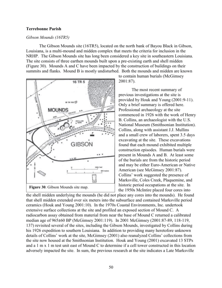
Terrebonne Parish Gibson Mounds (16TR5) The Gibson Mounds site (16TR5), located on the north bank of Bayou Black in Gibson, Louisiana, is a multi-mound and midden complex that meets the criteria for inclusion in the NRHP. The Gibson Mounds site has long been considered a key site in southeastern Louisiana. The site consists of three earthen mounds built upon a pre-existing earth and shell midden (Figure 30). Mounds A and C have been impacted by the construction of buildings on their summits and flanks. Mound B is mostly undisturbed. Both the mounds and midden are known to contain human burials (McGimsey 2001:87). The most recent summary of previous investigations at the site is provided by Houk and Young (2001:9-11). Only a brief summary is offered here. Professional archaeology at the site commenced in 1926 with the work of Henry B. Collins, an archaeologist with the U.S. National Museum (Smithsonian Institution). Collins, along with assistant J.J. Mullins and a small crew of laborers, spent 3.5 days excavating at the site. These excavations found that each mound exhibited multiple construction episodes. Human burials were present in Mounds A and B. At least some of the burials are from the historic period and may be either Euro-American or Native American (see McGimsey 2001:87). Collins’ work suggested the presence of Marksville, Coles Creek, Plaquemine, and historic period occupations at the site. In Figure 30. Gibson Mounds site map. the 1950s McIntire placed four cores into the shell midden underlying the mounds (he did not place any cores into the mounds). He found that shell midden extended over six meters into the subsurface and contained Marksville period ceramics (Houk and Young 2001:10). In the 1970s Coastal Environments, Inc. undertook extensive surface collections at the site and profiled an exposed section of Mound C. A radiocarbon assay obtained from material from near the base of Mound C returned a calibrated median age of 965±60 BP (McGimsey 2001:119). In 2001 McGimsey (2001:87-89, 118-119, 137) revisited several of the sites, including the Gibson Mounds, investigated by Collins during his 1926 expedition to southern Louisiana. In addition to providing many heretofore unknown details of Collins’ work at the site, McGimsey (2001) also reanalyzed Collins’ collections from the site now housed at the Smithsonian Institution. Houk and Young (2001) excavated 13 STPs and a 1 m x 1 m test unit east of Mound C to determine if a cell tower constructed in this location adversely impacted the site. In sum, the previous research at the site indicates a Late Marksville 50 through Plaquemine pre-colonial occupation of the site. Intrusive historic period burials on Mound B may be related to a later Euro-American or Native American reuse of the site. In November 2009 reports began to surface about human bones being found in the now abandoned house located atop Mound A at the site. In December 2009 I drove to Houma, Louisiana to pick up human remains that had been collected from the house on Mound A by local law enforcement. I picked up what turned out to be two large grocery-sized paper bags containing a mixture of human remains, faunal material, and aboriginal ceramics. I screened the contents of both bags and separated the bone from the cultural material. Any bone that was clearly non-human was further sorted from the bone pile. All remaining bone was then turned over to Ms. Mary Manhein and Dr. Ginny Listi of the LSU FACES Laboratory. On December 29, 2009 Dr. Chip McGimsey and Ms. Jessica Crawford, with the Archaeological Conservancy, visited the site. They met there with Mr. Mark Morgan, the owner of the portion of the site that contains Mound A. The property is for sale and the Archaeological Conservancy is interested in purchasing the site. During their visit to the site additional bone and artifacts were recovered from the basement of the house. These were then turned over to me and added to the overall assemblage. In general, the human remains from the site consist of heavily fragmented cranial and postcranial elements. A minimum of four individuals (three adults and one juvenile) are represented in the assemblage. A detailed analysis of the human remains recovered from the site (and thought to have originated from within Mound A), undertaken by Ms. Michelle Whipp under the direct supervision of Ms. Manhein and Dr. Listi, is provided in Appendix D. This analysis has been done in consultation with the Chitimacha Tribe of Louisiana and the human remains will be repatriated to the Chitimacha for reburial at the site. A total of 186 ceramic sherds and two pieces of burned clay/daub (15.6g) were present in the artifact assemblage (Table 4). The most prevalent decorated ceramic type in the assemblage is Pontchartrain Check Stamped, var. unspecified (n=32, w=417.2g), suggesting a strong Coles Creek component present on Mound A. Table 4. Artifacts from Gibson Mounds (16TR5). Cat. No. 16TR5-18-1 16TR5-18-2 16TR5-18-3 16TR5-18-4 16TR5-18-5 16TR5-18-6 16TR5-18-7 16TR5-18-8 16TR5-18-9 16TR5-18-10 16TR5-18-11 16TR5-18-12 Description Baytown Plain, var. unspecified Baytown Plain, var. unspecified Pontchartrain Check Stamped, var. unspecified Pontchartrain Check Stamped, var. unspecified Unidentified red filmed pottery Coles Creek Incised, var. unspecified French Fork Incised, var. unspecified Unidentified stamped pottery Unidentified punctated pottery Unidentified punctated pottery Larto Red, var. unspecified Daub/fired clay Ct. 133 14 29 3 1 1 1 1 1 1 1 2 51 Wt. Comments 1088.2g body sherds 205.1g rim sherds 338.3g body sherds 78.9g rim sherds 16.0g rim sherd 1.7g body sherd 2.3g 11.2g 6.9g 1.6g 1.2g 15.6g body sherd body sherd rim sherd body sherd body sherd In April 2010 Marc Massom, LSU graduate student, and I visited the Gibson Mound site and met with the property owner, Mr. Mark Morgan. Our goal was to make a detailed topographical map of Mound A, where the human remains and artifacts analyzed were recovered (Figure 31). At the time of our visit Mr. Morgan was in negotiations with the Archaeological Conservancy to purchase the site. One stipulation of the sale is that the house atop Mound A will be removed (as of the writing of this report, the sale of the property containing Mound A to the Archaeological Conservancy has been finalized and efforts are underway to acquire the rest of the site). It is important to map the mound as it currently exists so that we will have baseline data for monitoring the impacts to the site related to the removal and stabilization of the mound. We further discovered that a large, cinder block lined subterranean cistern is located on the summit of the mound (see Figure 31). Although covered over, the cistern remains unfilled and will also need to be addressed during any efforts to stabilize and preserve the mound. The Gibson Mounds site (16TR5) is considered eligible for the NRHP under Criterion D and is clearly an important archaeological site. The site is likely to yield significant data concerning the pre-colonial history of southeast Louisiana. The site contains intact stratified deposits, well preserved faunal remains, intact features and burials that may provide information about chronology, subsistence, settlement, and trade during the Marksville through Plaquemine periods. In addition, The Louisiana Comprehensive Archaeological Plan (Smith et al. 1983) lists several themes for Management Unit V, including Mound Building, Prehistoric Adaptation to the Alluvial Valley, and European-Indian Contact, that the Gibson Mounds site might address. The present project has provided preliminary data on the archaeology and bioarchaeology of Mound A. More detailed studies of the site are certainly warranted in order to proceed with a nomination to the NRHP. At a minimum, such studies should include coring all three mounds, as well as the underlying shell and earth midden. In addition, controlled test excavations of the mounds and midden should serve to gather data on the nature, extent (vertical and horizontal), and culture affiliation(s) of the site. 52 N580 N560 ch Por N540 Ga rag e House Dri vew ay N520 lkw Wa ay N500 N480 Contour Interval = 25cm a nd Fa Subterranean Cistern t re lS Utility Pole Datum E450 et yo Ba E460 E470 E480 E490 k lac B u E500 Figure 31. Topographic map of Mound A at the Gibson Mounds (16TR5). 53 E510
