Texas Regions Project
advertisement
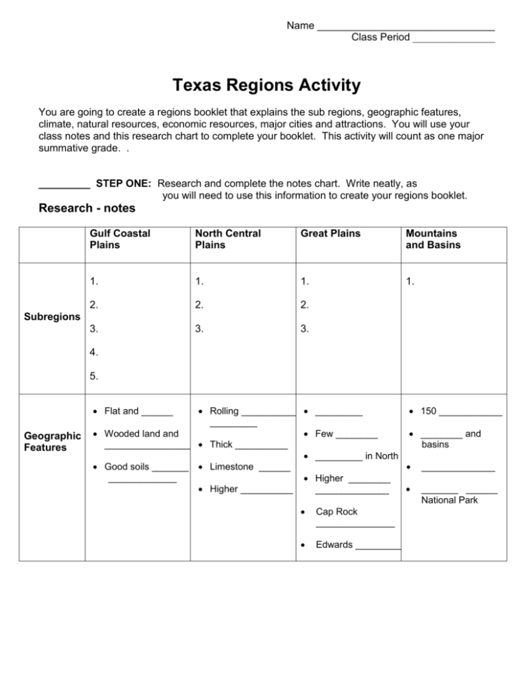
Name _______________________________ Class Period ________________ Texas Regions Activity You are going to create a regions booklet that explains the sub regions, geographic features, climate, natural resources, economic resources, major cities and attractions. You will use your class notes and this research chart to complete your booklet. This activity will count as one major summative grade. . _________ STEP ONE: Research and complete the notes chart. Write neatly, as you will need to use this information to create your regions booklet. Research - notes Gulf Coastal Plains North Central Plains Great Plains Mountains and Basins 1. 1. 1. 1. 2. 2. 2. 3. 3. 3. Subregions 4. 5. Flat and ______ Geographic Features Rolling ___________ _________ Wooded land and _________________ Thick __________ Good soils _______ Limestone ______ _____________ Higher __________ _________ 150 ____________ Few ________ ________ and basins _________ in North Higher ________ ______________ Cap Rock _______________ Edwards _________ ______________ _______ ______ National Park Gulf Coastal Plains Climate Hot and _______, ________ __________ and _____________ ________ inches of rain per year Natural Resources Economic Resources North Central Plains Great Plains Mountains and Basins Dry _______ Driest ___________ _______________ _______ inches of rain per year Cold _________ ______ air Hot __________ ________ storms ______ nights ________ inches of rain per year ________ inches of rain per year ________ inches in mountains Major Cities _____ days _________ STEP TWO: Draw and label the following rivers on your map from class: Rio Grande Trinity Sabine Brazos Red River Colorado Pecos _________ STEP THREE: Using your Research Notes, Create your booklet! For each region include: Geographic Features – 2 features Climate – 1 thing and the inches of rain per year Natural Resources – 2 – 4 resources Economic Resources – 2 - 4 resources Major Cities – 2-5 cities Map from Class 2 pictures per region (can be drawn) Name __________________ Class Period ________ Date____________________ Texas Regions Project Grade Sheet Each region shows required research 50 points _________ Each region is included in the booklet with required information 40 points _________ Booklet is put together neatly and includes color and pictures 10 points _________ FINAL GRADE ___________
