Study W&AR-13 Fish Assemblage and Population D

Don Pedro Project
Comment
No.
1
Fish Assemblage and Population
Between Don Pedro Dam and La Grange Dam Study Plan
STUDY PLAN W&AR-13
TURLOCK IRRIGATION DISTRICT
AND
MODESTO IRRIGATION DISTRICT
DON PEDRO PROJECT
FERC NO. 2299
Fish Assemblage and Population
Between Don Pedro Dam and La Grange Dam Study Plan
RELICENSING PARTICIPANTS’ COMMENTS
RWG
Meeting
Date
09/15/11
Comment Response
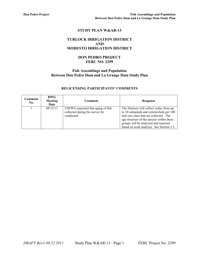
USFWS requested that aging of fish collected during the survey be conducted.
The Districts will collect scales from up to 10 salmonids and centrarchids per 100 mm size class that are collected. The age structure of the species within these groups will be analyzed and reported based on scale analysis. See Section 5.3.
DRAFT-Rev1-09.22.2011
Study Plan W&AR-13 - Page 1 FERC Project No. 2299
Don Pedro Project Fish Assemblage and Population
Between Don Pedro Dam and La Grange Dam Study Plan
STUDY PLAN W&AR-13
TURLOCK IRRIGATION DISTRICT
AND
MODESTO IRRIGATION DISTRICT
DON PEDRO PROJECT
FERC NO. 2299
Fish Assemblage and Population
Between Don Pedro Dam and La Grange Dam Study Plan
Related Study Requests: SWRCB-01
1.0 Project Nexus
The continued operation and maintenance (O&M) of the existing Don Pedro Project (Project) has the potential to affect the fish assemblage and fish populations between Don Pedro Dam and
La Grange Diversion Dam.
2.0 Resource Agency Management Goals
The Districts believe that two agencies have resource management goals related to resident fish populations and their habitat within the study area: (1) California Department of Fish and Game
(CDFG); and (2) State Water Resources Control Board, Division of Water Rights (SWRCB).
Each of these agencies and their management direction, as understood by the Districts at this time, is described below.
CDFG’s mission is to manage California's diverse fish, wildlife, and plant resources, and the habitats upon which they depend, for their ecological values and for their use and enjoyment by the public. CDFG’s resource management goals, as summarized in restoration planning documents such as “Restoring Central Valley Streams: A Plan for Action” (Reynolds et al.
1993), are to restore and protect California's aquatic ecosystems that support fish and wildlife, and to protect threatened and endangered species under California Fish and Game Code
(Sections 6920–6924).
SWRCB is the state agency that administers the federal Clean Water Act (CWA) (33 U.S.C.
§11251-1357) as applies to California waters with the responsibility to maintain the chemical, physical, and biological integrity of the state’s waters and to preserve the water quality necessary to protect the beneficial uses of stream reaches consistent with Section 401 of the federal CWA, the Regional Water Quality Control Board Basin Plans, State Water Board regulations,
California Environmental Quality Act, and any other applicable state law.
DRAFT-Rev1-09.22.2011
Study Plan W&AR-13 - Page 2 FERC Project No. 2299
Don Pedro Project Fish Assemblage and Population
Between Don Pedro Dam and La Grange Dam Study Plan
3.0 Study Goals
The goal of the study is to characterize the fish assemblage and populations between Don Pedro
Dam and La Grange Diversion Dam.
The objectives of the study are to: (1) characterize fish species composition, relative abundance
(e.g.
, catch per unit effort [CPUE]), and size length and weight) between Don Pedro Dam and La
Grange Diversion Dam; (2) characterize the functional habitat in the reach as either riverine or lacustrine; and (3) characterize fish size and condition factor.
4.0 Existing Information and Need for Additional Information
La Grange Diversion Dam diverts water into the Districts’ irrigation infrastructure. The reach between La Grange Dam and Don Pedro Dam is privately owned by the Districts, with no public access. No records of any stocking activities were found during a search of CDFG archives.
Additionally, no fishing reports or anecdotal information was discovered by internet searches.
In 2008, Stillwater Sciences conducted a minimal hook and line sampling effort in this reach focused on rainbow trout for the purpose of monitoring mercury levels in fish tissue (Stillwater
Sciences 2009). Six rainbow trout ranging from 356 millimeters (mm) to 489 mm (fork length) and an average of 427 mm fork length were captured for tissue mercury sampling. These data represent the only recorded information and the only known fishing activity in this reach of the
Tuolumne River (Stillwater Sciences 2009).
Built in 1893, La Grange Dam was the tallest dam of its kind in California. The dam was constructed for the purpose of raising the river to the level required to channel river water to the
Districts’ off-channel impoundments at Turlock Lake and the Modesto Reservoir (TID/MID
2011). A high flow event in 1997, after the completion of New Don Pedro Dam, brought a large amount of sediment down the Project’s spillway and greatly reduced the storage available within the La Grange impoundment. Preliminary information indicates depths range from 5 to 10 feet throughout the reach; the current condition of the area between the two dams is more accurately described as a deep, wide river channel, rather than an impoundment. On average, 900,000 acrefeet of water passes through the reach annually.
Additional safety concerns have been taken into account in the preparation of the following methodology. The headworks of the two canals are open tunnels and pose a safety risk for anyone attempting to work on the impoundment during normal operations. Surplus water is generally spilled over La Grange Dam creating additional safety concerns. However, such spills only occur when excess water over and above the amount that can be diverted into the MID and
TID canals is being released from Don Pedro Reservoir.
5.0 Study Methods
5.1 Study Area
The study area is the reach between Don Pedro Dam and La Grange Diversion Dam which is owned by the Districts.
DRAFT-Rev1-09.22.2011
Study Plan W&AR-13 - Page 3 FERC Project No. 2299
Don Pedro Project Fish Assemblage and Population
Between Don Pedro Dam and La Grange Dam Study Plan
5.2 General Concepts
The following general concepts apply to the study:
■
Personal safety is an important consideration of each fieldwork team. The Districts and their consultants will perform the study in a safe manner and will modify the study as appropriate to ensure safety.
■ Field crews may make minor modifications in the field to adjust to and to accommodate actual field conditions and unforeseeable events. Any modifications made will be documented and reported in the draft study report.
5.3 Study Methods
Sampling will use boat electrofishing and gill nets to collect fish following the study methods outlined below. However, the Districts may adapt the existing methodologies to follow any additional criteria identified in the CDFG Scientific Collection Permit or to adapt to prevailing safety concerns. The study reach is best characterized as a swift, wide, shallow water body during most of the year when irrigation water is being delivered to downstream users and when flood management conditions are being maintained by flood releases. Sampling during these typically high flow release periods result in conditions that are unsafe for boating or other activities associated with the proposed fish study. Safe study conditions will only occur during periods of low flow, or outages. Hence, a single sampling effort will be conducted during an annual outage, after the regular irrigation season in order to minimize safety concerns. This is also likely to aid in sampling efficiencies during the sampling effort.
The Districts will obtain all necessary permits prior to performing fieldwork.
The study methods will consist of four steps, each of which is described below.
Step 1 – Field Reconnaissance. A field survey will be conducted prior to sampling to view the existing habitat and identify those areas in which each sampling technique will be most effective.
Boat electrofishing and gillnet sampling require specific characteristics in order to accurately sample fishes. Upon documenting habitat with photos and GPS, the Districts will notify relicensing participants of the area and extent to which each method will be utilized.
Electrofishing stations, or sampling units, will be a minimum of 100 meters (m) long. They will be located throughout the study area to represent the diversity of identified near-shore habitats that can be sampled by boat electrofishing. The Districts will make a good faith effort to sample approximately 50 percent of the accessible shoreline of the study reach. The exact number of sampling stations will depend on the diversity of near-shore habitat conditions that will be assessed during field reconnaissance. Diversity conditions will likely include depth, cover, substrate, and proximity to sources of inflow. Sampling stations will be designated on orthophotographs of the study reach and documented using GPS.
The shallow nature of reach between Don Pedro and La Grange dams does not lend itself to successful gillnetting as a sampling method alone. After outage conditions have been assessed, gill nets will be utilized in any areas conducive to required depth and flow criteria. Gill net
DRAFT-Rev1-09.22.2011
Study Plan W&AR-13 - Page 4 FERC Project No. 2299
Don Pedro Project Fish Assemblage and Population
Between Don Pedro Dam and La Grange Dam Study Plan sampling will occur concurrently with electrofishing activities during daylight hours, with a maximum soak time of six hours. Boat electrofishing and gill net sites will be spatially separated to prevent any potential influences on catch. Sampling stations will be designated on orthophotographs of the study reach and documented using GPS.
Step 2a – Boat Electrofishing . Boat electrofishing will be used to sample near-shore habitat in the study reach. Field activity will be conducted during daylight hours due to safety concerns.
Boat electrofishing will take place using standard methods (Reynolds 1996). One or two electrode booms will be employed, and the booms and boat will be outfitted with standard nonconductive material in appropriate places for safety. Electrofisher “time on” will be recorded for each sampling site and a consistent effort and pace will be employed at all sites. Fish will be identified, where possible, as to origin; hatchery or wild stock (i.e.
, basic visual identification, such as a clipped adipose fin). Data recorded for each fish will include species identification, fork length (standard length of all fish species without forked caudal fins), weight, and, if applicable, notes on general condition. Scales will be collected from up to 10 fish for each 100 mm size group of salmonids and Centrarchids.
General information recorded will include impoundment name, GPS sample site location, crew member names, weather conditions, air temperature, and water chemistry at approximate fish sampling location (i.e., water temperature, dissolved oxygen, and conductivity). Minimum, maximum, and mean water depths will be recorded.
Step 2b – Gill Netting . Habitat and water velocity will be assessed for suitability of sampling. If appropriate conditions are found, gill nets will be deployed in up to five locations across the study area. Samples will be taken using variable mesh gill nets (e.g., adult net: 1-inch to 3-inch mesh, and juvenile net: 0.5-inch to 0.75-inch mesh). At each location one adult net and one juvenile net will be set at the surface, perpendicular to the shoreline. The shallow condition of the reach will preclude the need for nets at multiple depths for each site. The times of deployment and locations of each gillnet set will be recorded, and photographs will be taken of each gillnet after deployment to document both location and placement relative to the shoreline.
The gillnets will be set for up to six hours to assure good coverage. Nets will be checked at the end of each day.
Fish will be identified, where possible, as to origin; hatchery, or wild stock (i.e., basic visual identification, such as a clipped adipose fin). After fish are captured, each fish will be processed, and information will be collected regarding species identification, fork length (standard length of all fish species without forked caudal fins), weight, and, if applicable, notes on general condition.
Scales will be collected from up to 10 fish for each 100 mm size group of salmonids and
Centrarchids.
General information recorded will include impoundment name, GPS sample site location, crew member names, weather conditions, air temperature, secchi depth, and water chemistry (i.e., water temperature and dissolved oxygen). Minimum, maximum, and mean water depths will be recorded along with the depth placement of each gillnet. Dissolved oxygen will be measured at the surface and near the bottom at four (25 percent intervals of length along the thalweg of the reach) locations within the reach.
DRAFT-Rev1-09.22.2011
Study Plan W&AR-13 - Page 5 FERC Project No. 2299
Don Pedro Project Fish Assemblage and Population
Between Don Pedro Dam and La Grange Dam Study Plan
Step 3 – Data Entry and Data Analysis . Data will be entered into a database. The database will be organized, compiled, and subjected to quality assurance/quality control procedures. Data will be analyzed graphically and summarize species composition, relative abundance, length frequency, and location.
Gill net and boat electrofishing results will be reported both as total catch and in terms of CPUE.
CPUE for fishes captured by boat electrofishing and gill net will be calculated by dividing the number of fish of each species captured by the length of time fished (e.g., fish/hour). CPUE will be summarized for the reach and for each species.
The relative abundance of fish at each site will be calculated to identify fish species composition and distribution patterns throughout the study area.
Fish size and weight will be summarized by fish species and site. Length-weight regressions will be generated to calculate a relative condition factor (K n
) for fish species.
Age composition and growth information on Centrarchids and salmonids within the study area will be determined using collected scales and implementing methods described by Lux (1971),
Ricker (1975), Bagenal et al. (1978), DeVries and Fries (1996), Isley, and Grabowsky (2007).
Step 4 – Prepare Report . The Districts will prepare a report that includes the following sections:
(1) Study Goals and Objectives; (2) Methods and Analysis; (3) Results; (4) Discussion; and (5)
Description of Variances from the FERC-approved study, if any. The report will also contain
GIS maps of sampled areas and relevant summary tables and graphs. Further, the report will describe daily water surface elevation patterns and approximate pool volumes. The report will include a summary of water quality information collected during sampling and during any other sampling efforts that take place in the sampling year. The report will also include:
■
Fish species composition, relative abundance (i.e.
, CPUE), location, and condition factor by species in the reach.
■ Water quality information and dissolved oxygen concentrations will be summarized from the current study.
■
Photo documentation of survey efforts and areas assessed or sampled.
If the Districts observe any special-status fish species, the Districts will complete the appropriate
California Natural Diversity Database (CNDDB) form and transmit the form to the CNDDB.
6.0 Schedule
The Districts anticipate the schedule to complete the study proposal as follows, assuming
FERC’s Study Plan Determination is deemed final on December 31, 2011:
Planning .................................................................................................... January – February 2012
Field Work ........................................................................................... February – September 2012
Office Work ....................................................................................... September – December 2012
Report Preparation ......................................................................................... January – March 2013
Report Issuance ............................................................................................................ January 2014
DRAFT-Rev1-09.22.2011
Study Plan W&AR-13 - Page 6 FERC Project No. 2299
Don Pedro Project Fish Assemblage and Population
Between Don Pedro Dam and La Grange Dam Study Plan
7.0 Consistency of Methodology with Generally Accepted Scientific Practices
The study methods discussed above are consistent with the study methods followed in several other relicensings. The methods presented in this study plan also are consistent with those used in recent relicensings in California.
8.0 Deliverables
In addition to GIS-based maps of survey locations documented as part of this study, the Districts will prepare a report, which will document the methodology and results of the study. Interim communications, such as technical memos produced during the course of the study, will be summarized in the final report
9.0 Level of Effort and Cost
Study Plan implementation cost will be provided in the Revised Study Plan.
10.0 References
Bagenal T.B., Tesch F.W. 1978. Age and growth. Pp. 101.136. In: Bagenal, T.B. (ed.) Methods for the assessment of fish production in fresh waters. Blackwell Scientific Publications,
Oxford.
DeVries, D.R. and R.V.Frie. 1996. Determination of Age and Growth. in B. R. Murphy and D.
W. Willis, editors. Fisheries techniques , 2nd edition. American Fisheries Society,
Bethesda, Maryland.
Isley, J.J. and T.B. Grabowsky. 2007. Age and Growth in Christopher S. Guy and Michael L.
Brown, editors. Analysis and Interpretation of Freshwater Fisheries Data.
American
Fisheries Society, Bethesda, Maryland.
Lux, F. E. 1971. Age determination of fishes (revised). National Marine Fisheries Service.
Fishery Leaflet. 637. Seattle, Washington
Reynolds, J.B. 1996. Electrofishing. Pages 221-253 in B. R. Murphy and D. W. Willis, editors.
Fisheries techniques , 2nd edition. American Fisheries Society, Bethesda, Maryland
Reynolds, F.L., T.J. Mills, R. Benthin, and A. Low. 1993. Restoring Central Valley Streams: A
Plan for Action. Inland Fisheries Div., Calif. Dept. of Fish and Game. Sacramento CA.
184 p.
Ricker, W.E. 1975. Computation and interpretation of biological statistics of fish populations.
Bulletin of the Fisheries Research Board of Canada 191: 1.382.
Stillwater Sciences. 2009. Don Pedro Reservoir Fish Mercury Study. Final Report for Turlock
Irrigation District and Modesto Irrigation District.
DRAFT-Rev1-09.22.2011
Study Plan W&AR-13 - Page 7 FERC Project No. 2299
Don Pedro Project Fish Assemblage and Population
Between Don Pedro Dam and La Grange Dam Study Plan
Turlock Irrigation District and Modesto Irrigation District (TID/MID). 2011. Don Pedro
Project, FERC No. 2299, Pre-Application Document. February 2011.
DRAFT-Rev1-09.22.2011
Study Plan W&AR-13 - Page 8 FERC Project No. 2299


