Checklist 1: - Macedon Ranges Shire Council
advertisement
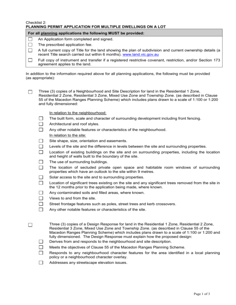
Checklist 2: PLANNING PERMIT APPLICATION FOR MULTIPLE DWELLINGS ON A LOT For all planning applications the following MUST be provided: An Application form completed and signed. The prescribed application fee. A full current copy of Title for the land showing the plan of subdivision and current ownership details (a recent Title search carried out within 6 months). www.land.vic.gov.au Full copy of instrument and transfer if a registered restrictive covenant, restriction, and/or Section 173 agreement applies to the land. In addition to the information required above for all planning applications, the following must be provided (as appropriate): Three (3) copies of a Neighbourhood and Site Description for land in the Residential 1 Zone, Residential 2 Zone, Residential 3 Zone, Mixed Use Zone and Township Zone. (as described in Clause 55 of the Macedon Ranges Planning Scheme) which includes plans drawn to a scale of 1:100 or 1:200 and fully dimensioned: In relation to the neighbourhood: The built form, scale and character of surrounding development including front fencing. Architectural and roof styles. Any other notable features or characteristics of the neighbourhood. In relation to the site: Site shape, size, orientation and easements. Levels of the site and the difference in levels between the site and surrounding properties. Location of existing buildings on the site and on surrounding properties, including the location and height of walls built to the boundary of the site. The use of surrounding buildings. The location of secluded private open space and habitable room windows of surrounding properties which have an outlook to the site within 9 metres. Solar access to the site and to surrounding properties. Location of significant trees existing on the site and any significant trees removed from the site in the 12 months prior to the application being made, where known. Any contaminated soils and filled areas, where known. Views to and from the site. Street frontage features such as poles, street trees and kerb crossovers. Any other notable features or characteristics of the site. Three (3) copies of a Design Response for land in the Residential 1 Zone, Residential 2 Zone, Residential 3 Zone, Mixed Use Zone and Township Zone. (as described in Clause 55 of the Macedon Ranges Planning Scheme) which includes plans drawn to a scale of 1:100 or 1:200 and fully dimensioned. The Design Response must explain how the proposed design: Derives from and responds to the neighbourhood and site description. Meets the objectives of Clause 55 of the Macedon Ranges Planning Scheme. Responds to any neighbourhood character features for the area identified in a local planning policy or a neighbourhood character overlay. Addresses any streetscape elevation issues. Page 1 of 3 Three (3) copies of a proposed site plan drawn to a scale of 1:100 or 1:200 and fully dimensioned. The plan must show: The location of existing buildings on adjacent properties (including nominated setbacks from the common boundaries to the subject site). The location of existing and proposed buildings. Any existing or proposed earthworks, including contours. Location of existing individual trees within 10 metres of all proposed buildings, structures and excavations. All trees and vegetation to be removed and those to be retained. The setback of the buildings and works from title boundaries. Details and location of any car parking structures, areas and access ways. Details and location of proposed landscaping. Details and location of any external lighting proposed. Three (3) copies of Floor and Elevation Plans drawn to a scale of 1:100 or 1:200 and fully dimensioned. The plans must show: Floor plans of the proposed buildings and structures and any existing buildings to be retained. Natural ground levels and finished floor levels (to Australian Height Datum). Wall heights and overall building heights for each elevation (including internal floor, ceiling heights, fencing heights and details whether proposed or existing and a streetscape elevation). External colours, finishes and materials. Three (3) copies of Shadow Diagrams drawn to a scale of 1:100 or 1:200 of the proposed buildings and adjacent structures at 9am, 12 noon and 3pm at the September equinox. 1 copy of all submitted plans in A3 size suitable for photocopying. Where there are existing trees on the subject site or trees on adjoining properties within 10 metres of future buildings and works, a report from aborist must be obtained and submitted. This report must provide the following details: The species, height, girth, canopy width and approximate age of the tree/s to be removed and retained. A statement regarding the health, structure and vigour of the tree/s. Comments in relation to the future health of trees (how will trees to be retained be protected) A recommendation based on all of the above. For applications requiring the removal of 10 or more trees (and/or the removal of under storey vegetation which is considered as significant remnant vegetation) a Flora and Fauna and Net Gain Assessment prepared by a suitably qualified professional (in accordance with the State Government’s Native Vegetation Management Framework) will be required to calculate appropriate offset planting requirements. A written submission detailing how the proposal responds to the provisions of the relevant zone, overlays (i.e. Heritage), particular provisions and local planning policies of the Macedon Ranges Planning Scheme (as appropriate). It must explain how the proposal achieves the objectives and standards of Clause 55 (ResCode) for land in the Residential 1 Zone, Residential 2 Zone, Residential 3 Zone, Mixed Use Zone and Township Zone. Page 2 of 3 For non-sewered land a Land Capability Assessment prepared by an appropriately qualified professional must be provided which demonstrates that the land is capable of treating and retaining all wastewater in accordance with the State Environment Protection Policy (Waters of Victoria) under the Environment Protection Act 1970. Please discuss such proposals with a Statutory Planning Officer and Environmental Health Officer for further guidance. For new dwelling applications on non-sewered land within an Environmental Significance Overlay – Schedule 4 or 5 and a detail written response on how the proposal satisfies State Policy – Planning permit applications in open, potable water supply catchment areas. Please discuss such proposals with a Statutory Planning Officer and Environmental Health Officer for further guidance. For a buildings and works application affected by a Bushfire Management Overlay associated with Accommodation (including a Dependant Persons Unit) or other use in the overlay, such an application must address the requirements of the overlay, unless exempt. For building and works application affected by the Erosion Management Overlay must provide a Soil and Water Report, which shall address how soil and water impacts are going to be managed, so that the water quality of the Malmsbury Reservoir is not affected. The report shall demonstrate: The capacity of all drainage infrastructure to service the development. The methods for the treatment and retardation of all stormwater. The methods for sediment control. Pre-application meetings are recommended as a part of the application process. Council officers can provide advice to applicants on whether the proposal is generally consistent with the Macedon Ranges Planning Scheme. Council officers will also aim to assist applicants to become fully aware of the expected standard and extent of documentation they are required to provide with their application to reduce the need for Council to request further information. To arrange an appointment for a pre-application meeting with a Statutory Planning Officer contact the Statutory Planning Unit Directly on (03) 5421 9699. Please note that: If the application is not up to an acceptable standard it will be returned. A Cultural Heritage Management Plan may be required under the provisions of the Aborignal Heritage Act 2006. If so, Council is unable to process your application further until the required documentation has been submitted to Council to show that the Act has been satisfied. Refer to the relevant section on Council’s website (www.mrsc.vic.gov.au) for further information. Office Use Only Counter Enquiry Date Officer Pre Application Lodgement Disclaimer: Note these requirements are intended as a guide for applicants only and may vary depending on the extent of the proposed development. This list of information to be provided is not exhaustive and is compiled without the benefit of a site inspection or referrals which might reveal other material constraints and / or considerations. Additional items may be required to enable a proper consideration of an application. Council reserves the right to request additional information pursuant to Section 54(1) of the Planning and Environment Act (1987) Please include this completed checklist with your application. Page 3 of 3
