Watershed modelling at Nam Songkhram
advertisement
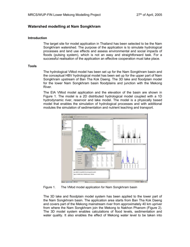
MRCS/WUP-FIN Lower Mekong Modelling Project 27th of April, 2005 Watershed modelling at Nam Songkhram Introduction The target site for model application in Thailand has been selected to be the Nam Songkhram watershed. The purpose of the application is to simulate hydrological processes and land use effects and assess environmental and social impacts of floods (pulsing system), which is not an easy and straightforward task. For a successful realisation of the application an effective cooperation must take place. Tools The hydrological VMod model has been set up for the Nam Songkhram basin and the conceptual HBV hydrological model has been set up for the upper part of Nam Songkhram upstream of Ban Tha Kok Daeng. The 3D lake and floodplain model for the lower Nam Songkhram basin floodplains and junction with the Mekong River. The EIA VMod model application and the elevation of the basin are shown in Figure 1. The model is a 2D distributed hydrological model coupled with a 1D hydrodynamic river, reservoir and lake model. The model is a physically based model that enables the simulation of hydrological processes and with additional modules the simulation of sedimentation and nutrient leaching and transport. Figure 1. The VMod model application for Nam Songkhram basin The 3D lake and floodplain model system has been applied to the lower part of the Nam Songkhram basin. The application area starts from Ban Tha Kok Daeng and covers part of the Mekong mainstream river from approximately 40 km upriver from where the Nam Songkhram join the Mekong to Nakhon Phanom (Figure 2). The 3D model system enables calculations of flood levels, sedimentation and water quality. It also enables the effect of Mekong water level to be taken into MRCS/WUP-FIN Lower Mekong Modelling Project 27th of April, 2005 consideration properly when looking at the flooding in the floodplain. The pilot 3D model application area for lower Nam Songkhram basin is shown in Figure 2. Figure 2. The elevation grid for 3D model application for the Lower Nam Songkhram. Collection of existing data Collection and processing of existing data has been mainly done during 2004 and early 2005. There remains still some additional data collection to be done in March- April 2005. The time period with the best data is at the moment 1987-1993. The preliminary data analysis including calculating the mean monthly precipitations, minimum and maximum temperatures and discharges from the most important observation sites has been done in February-March 2005. Available data: Digital elevation map for the land area with 50 m resolution from old topographical maps and new SRTM elevation model with 90 m resolution (MRC) Hydrographic atlas for Mekong mainstream, bathymetry of the river (MRC) The older (1997) and new (year 2002) land use data (MRC). Soil types (MRC) Location of river networks (MRC) Precipitation from 16 stations at or near the watershed (MRC) Temperature (daily minimum and maximum temperatures) from one station at the watershed and a few further away (MRC) Evaporation from three stations at or near the watershed and a few further away (MRC) Discharge and water level observations form two points on the watershed: Ban Tha Kok Daeng and Nam Oon dam Discharge and water levels from the Mekong mainstream river o Nakhon Phanom measured water levels and discharges o Discharge from DSF to 3D model upper boundary condition in Mekong mainstream MRCS/WUP-FIN Lower Mekong Modelling Project 27th of April, 2005 Below there is a list of additional data requested from the TNMC: Socio-Economic data Statistical or spatial district/commune level data (preferably from many years to see trends) on primary &secondary occupations, particularly on fish-related livelihoods population, including rural/urban population &migration poverty. +info on other reports related to above mentioned issues. Hydrological, hydrodynamic and water quality model data: Cross section data for Nam Songkhram and other tributaries including areas from both banks and floodplain: survey by DEDP in 1993 or 1994 Water level and discharge data and rating curves from the Nam Songkhram basin: o Nam Songkhram at Ban Chai Buri and Ban Tha Huai Lua o Nam Oon at Ban Phok Yai, Pannanikom and Bang Nong Bua o Nam Yam at Akat Amnuai and Ban Khon Sai o Huai Khong at Ban Tha Sri Chomchun o Huai Hi at Ban Nong Yang o Nam Mao at Ban Kham Hai Water level at stations measured by NEDECO in 1981-1982 with temporary gauges. Irrigation data: irrigation practices, location of pumping stations, discharge of pumping in each station, project area and location, etc. Ground water levels from as many wells as available Detailed data (height, storage capacity, bridge dimensions etc.) from existing control structures (dams, weirs, dikes, bridges, road embankments, gates) in the basin. Currently the best available hydrological data is between 1986 and 1993, so the water level and discharge data should be obtained from that period. If the evaporation data 1994 – 2002 is available, also that period will be included in the calculation years. The Ban Tha Kok Dang station water quality data 1985 – 2000 is available through the MRCS. Nam Oon and other tributaries’ data should be collected for that period also. If there are any monitoring points in the Nam Songkhram (lower) floodplain these would be especially needed for the 3D water quality model calibration. At least nutrients, suspended solids and dissolved oxygen measurements would be needed but also other parameters such as chlorophyll a would be useful. MRCS/WUP-FIN Lower Mekong Modelling Project 27th of April, 2005 Field measurements Collection of additional field data will be limited to current measurements in the lowest part of Nam Songkhram River for detection of the possible reverse flow event from Mekong main stream into the Nam Songkhram flood plain during the rising flood. According to the preliminary model calculations the back water effect extends almost 50 km inside the Nam Songkhram basin. However, no record exists of a possible inflow from the Mekong main stream. The measurement is planned for July-September 2005.

