MSWord format
advertisement
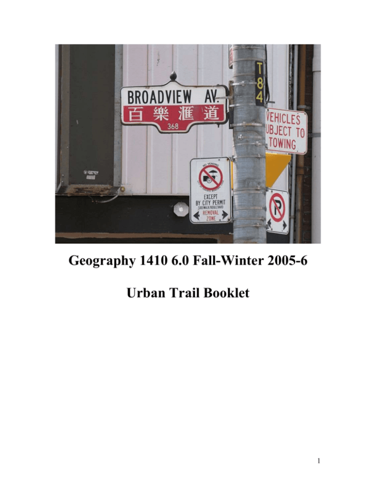
Geography 1410 6.0 Fall-Winter 2005-6 Urban Trail Booklet 1 The Urban Trail The urban trail aims to acquaint you with a Toronto neighbourhood and uses it to explore a number of themes relevant to human geography. These include: The connections between ethnicity and place. Gentrified urban landscapes and areas without much obvious gentrification. Conflicts over the use of space. The impact of transportation facilities on landscape. The nature of boundaries, edges and transitions between different kinds of spaces. The impact of economic activity on landscape. The legacy of historic air pollution. Please think about these themes as you walk the trail. They should be important in class discussions in Workshop 3A and will influence the essay questions set in Workshop 3B. The 2005 urban trail begins and ends at Broadview subway station. It takes you along Danforth Avenue (“The Danforth”) and in into “Greektown”. This is an ethnic business area. There are Greek communities in the surrounding area, but it is not a heavy concentration. The trail explores some of the human geography of the Danforth, and then takes in residential gentrification, the issue of conflicts of land use, including conflicts over the use of parks. We pass south and east towards Pape Avenue where less gentrification is apparent. We have entered an area where middle-class gentrifiers are still few in number. It still tends to be inner-city working class. Passing south down Pape, we cross the railway tracks on the footbridge, and then turn west along Gerrard St E, towards Chinatown East and the Don Jail. We turn north, passing up Broadview Avenue, visiting Riverdale Park, back into gentrified residential areas again and back to Broadview-Danforth. In this booklet italics are used to issue instructions about your route, or to provide you with information. Questions are written in ordinary type, with space for responses. You need to bring this copy of the urban trail with you when you attend Workshop 3A and 3B. You will be required to hand it in at Workshop 3B. It will be examined by the TA, but the purpose is only to verify that you made a reasonable job of doing the trail. It is OK if the trail booklet looks like it was filled in on the trail. We recommend that you walk the trail with a friend (partly for safety, but mainly because a second pair of eyes will help you notice things). We recommend that you walk the trail. It is not possible to drive, although it may be possible to cycle. Two backgrounders are provided, one on Gentrification and one on the Riverdale Plume. We recommend you read both before starting the trail. The trail proper begins on page 6. A map of the urban trail is given on page 3. 2 3 Backgrounder: The Riverdale Plume From about 1900 to 1960 this part of Toronto experienced severe air pollution. It was a consequence of the burning of coal by industries, homes and the railways. The most polluted conditions occurred, as they do today, when the wind was in the south west. Smoke from industrial development in the lower Don area, south of Queen Street frequently penetrated as far north as Danforth Avenue. Smoke (and smell) came from the gas works on Booth Ave, the Dunlop Factory at Queen & McGee and various other plants. In the days of steam trains the CN line was very active, and the steep climb eastwards to Scarborough resulted in considerable locomotive smoke. The smoke soiled laundry, spoiled paint, upholstery, furnishings and people’s health. The urban trail takes us through an area which was downwind, and within the smoke plume coming from the industry and railways. When the wind came from the south or south west, visibility would be reduced below 500 metres over much of the district where the urban trail is located. The smoke made parts of the area unattractive for residential use. The wealthy tended to avoid the smoky districts and they were left to the poorer people. During the 1950s the widespread use of coal ceased in Toronto, and the district’s air quality dramatically improved. 4 Backgrounder: Gentrification Gentrification refers to the process whereby wealthy people decide to start establishing homes in inner-city neighbourhoods, areas which they might previously have avoided. In Toronto the middle class generally preferred to live in the suburbs until some time in the later 1960s. The inner city was left to poorer people, and was generally avoided by those with a little money. From the 1970s you can see middle class people beginning to invest in inner city residential properties. The process has intensified and spread. In many parts of the urban trail well-established gentrified areas can be seen. Some places are less gentrified. Areas with better access to transit, and with better-built older homes tend to attract gentrifiers before less favoured areas. In the case of the Riverdale area, the geography of gentrification is probably connected to the changing patterns of air pollution. The Riverdale Plume brought intense pollution to some parts of the district, leading to the construction of the cheapest homes in the worst affected areas. The clearing of the smoke in the 1960s meant that the middle-class could now re-consider the area as a residential district, but the gentrifiers tended to favour the better built homes in Riverdale. The parts of Riverdale which had been least smoky were therefore the first to attract the gentrifiers in the 1960s and 1970s. The gentrifiers are mostly “white-collar” service sector workers, working in offices rather than working in blue-collar factory jobs. The gentrifiers bring with them middle-class taste in restaurants, furnishing, landscaping, and vehicles. They also frequently operate home businesses and require business service outlets such as office supply stores. Businesses of these kinds have been attracted to the commercial streets adjoining the gentrified areas. 5 THE URBAN TRAIL Broadview & Danforth Exit Broadview subway station to Broadview Avenue, turn left and begin walking south to Danforth Avenue. A little before you reach the NE corner of Broadview and Danforth there is a Discovery Walks display panel which describes hiking routes in the Don Valley. Read about the Prince Edward Viaduct. When was the viaduct constructed? What does it carry over the Don valley (besides water and sewer lines)? At the NE corner of Broadview & Danforth is a CIBC bank branch. What messages does its architecture convey? Why would this intersection be a suitable location for a bank branch? Cross Danforth Ave to the SE corner of Broadview & Danforth. Check the properties listed in the windows of Sutton Realty. Is there a geographical focus to the properties listed in the window? 6 What sort of price range are local residential properties? The Danforth Streetscape Continue along the south side of Danforth Ave, and walk east from Broadview. As you walk along compile notes on the following: The ethnic groups associated with the businesses (where visible). The point at which the first recognizably Greek businesses/institutions begin to appear (how can you tell) The point at which you feel you are properly in “Greektown” (how can you tell) The uses made of different storeys (commercial on ground floor/residential above?) 7 Any evidence of the idea of globalization and the image of “the global” being used to sell goods and services on Danforth? Comment on the use of sidewalks and on any issues related to parking. The litter bin outside 253 Danforth is one of a new type proposed for the city of Toronto. Give your opinion on the suitability of its design. The buildings at 261-275 Danforth sell a variety of things, probably to the occupants of “gentrified” housing. What sorts of goods and services are sold in this block? The 261-275 Danforth block preserves ornamental leaded window glass in the storefronts. What role does this preserved glass play in the storefront? At 285 Danforth Ave there is “Mail Boxes Etc.” branch. Why would this district require this kind of business? 8 At St Barnabas Anglican Church (361 Danforth at Hampton) read the tablet placed in memory of church members who died in the 1914-1918 war. What was their ethnic background? Gentrification At Danforth & Fenwick, turn south onto Fenwick Avenue. Comment on the status of parking issues. How does the commercial activity of the Danforth affect the parking on Fenwick Ave? Fenwick Avenue seems to be a residential street occupied by gentrifiers. Describe the nature of the street. Are there any signs of recent major investments having been made by local homeowners in their buildings or landscaping? What sorts of things? 9 A Dog’s Life in Withrow Park Proceed to the southern end of Fenwick, which ends at McConnell Avenue, facing Withrow Park. Cross McConnell proceed east towards Carlaw Ave. Turn and proceed south on Carlaw, keeping the park to your right. Withrow Park is laid out in a former river valley, parts of were filled with ashes and rubbish by the city in the early 20th century. It is a heavily-used park and this tends to produce conflicts. One of the conflicts which received attention in recent months was over dogs. Owners bring their dogs to the park for exercise, and this irritates some people. In one incident recently someone left poisoned hotdogs in the park, several dogs became sick after eating them and one died. Examine the group of trees in Withrow Park (on Carlaw Ave between Cavell and Strathcona). What evidence is there of large numbers of dogs using the park? If you look at the tree trunks, each is a lighter colour at the bottom than it is farther up. Why? More Gentrification Cross Carlaw Avenue and proceed east on Strathcona Ave. The street is the one with the #14 cycle route clearly marked. What evidence is there of Strathcona Ave being a “gentrified” street? 10 More Gentrification? At Pape Avenue, turn right and proceed south. As you walk down Pape Avenue comment on the following: Evidence for gentrification (or otherwise) Would Pape Avenue be attractive to gentrifiers? What special things are recycled at 572 Pape Ave? 11 There are various clusters of stores, in use or buildings which were once stores and which have been converted. At each cluster of stores/old stores record: Intersection Number of Stores/former stores Cross to the SE corner of Pape and Riverdale Ave. Observe that Pape runs on a ridge between two ravines: one to the west, and one to the east., Both now filled, drained and built on. You should be able to see Pape Ave public school. A rehab centre for drug addicts and alcoholics has been proposed for a property next door to the school. Industrial Rail Corridor Continue south on Pape Avenue and onto the pedestrian footbridge over the CNR tracks. In the middle of the footbridge pause to observe. The CNR main line between Toronto and Montreal is below you. This carries VIA GO and freight trains. On this section of the route the railway has to climb from its crossing of the Don river. In the days of steam it was known as the Scarborough Climb and was notoriously smoky with 300 trains a day passing below. We are in the heart of an industrial corridor which once followed the CNR line, and whose smoke once darkened the neighbourhood. There were also smoky trackside industries. The No Frills store is located on the site of the former SherwinWilliams paint factory and the Gerrard Square Mall is built on an old dump and former coal & lumber yard. Why would coal yards, lumber yards and factories have been constructed next to the CNR line in the early 20th century? 12 From the south end of the bridge you should be able to see three major chimneys on the skyline (like the photo below). The oldest of these, the Hearn Generating Station was built in the later 1940s to supply electricity to the city, by burning coal. It used to have three chimneys, but was converted to natural gas, and given one chimney in the 1970s. The station is now closed. The Commissioners St Incinerator was built in 1955, to burn city garbage. It had no pollution controls until 1980, when the present smokestack was built. It closed in 1988. The main sewage treatment plant on Ashbridges Bay was begun around 1912. The chimney, however, dates from the 1980s, when the city began to incinerate sewage sludge. In the recent past, when they were operational, what effects might these chimneys have had on the neighbourhood you are now standing in? Why does Pape Ave cross the CNR tracks on a footbridge? Is there any evidence that it was once a grade (level) crossing? 13 Gerrard & Pape Proceed south on Pape to Gerrard St E. On SE corner of Pape and Gerrard, note a large green tube in the sidewalk. What is it? Walk south on Pape a short distance. You come to the ivy-covered gates of Holy Blossom Cemetery. The gates were reconstructed in the 1930s, but this burial ground was the first cemetery to serve Toronto’s Jewish population. It is no longer used for burials, but people still come to visit. Most of the folks in the cemetery still have family in Toronto. At the time this cemetery was laid out, Holy Blossom congregation was worshipping in Downtown Toronto, yet the burials were done here, at a site which was then miles outside the built up area of the city and was, indeed, well outside the city limits. It was only a small burial ground. Give us your suggestion as to why the congregation had to come so far to bury their dead. Coexisting peacefully on the opposite side of the street at 336 Pape Ave is a building catering to a different faith community. Identify it. 14 Gerrard St E Return northwards along Pape to Gerrard St E. The green tube is actually a vent pipe for the main trunk sewer which was constructed under Gerrard St E in the early 20th Century. Stand on the SW corner of Pape and Gerrard. What is the former purpose of the building on the NW corner of Pape & Gerrard? Begin to walk west on Gerrard from Pape. As you go along, make notes on the following: Which ethnic groups are present? Is this a place to attract gentrifiers? Gerrard passes under a major railway bridge, constructed in the early 1930s. Afterwards give your comments on: The point at which Gerrard St E begins to become “Chinese” Is there any sign of any other ethnic groups from SE Asia? What are the visible characteristics, in the landscape, of Chinese settlement? 15 811 Gerrard St E: The person who owns this property appears to be eccentric. What is the evidence? There is a cornerstone in the building at 793 Gerrard St E, laid in 1912: by whom? Chinatown East Proceed westwards on Gerrard St E to Broadview Avenue Describe the characteristics of this area, known as Chinatown East. Colours Text in the landscape Congestion The nature of the place 16 Cross Broadview to the NW corner of Broadview & Gerrard, proceed west to a point opposite the parking lot at Hamilton & Gerrard. What structure is being proposed for the parking lot? Proceed a little further westwards on Gerrard. To the north of Gerrard, and set back a little from the road there is a large institutional building. Parts of this are a heritage structure. What is the purpose of the building? What evidence is there on the heritage structure of past air pollution? Walking east again on Gerrard, towards Broadview. What is proposed for 562 Gerrard St E? 17 Riverdale Park Return to Gerrard & Broadview, and walk north on the west side of Broadview. Continue north past the campus of Bridgepoint Hospital. You should eventually see a statue in the park. Walk towards the statue. Who is commemorated by the statue and what connection does he have with Chinatown East? Continue north on Broadview. Head to a park bench on Broadview between Bain and Withrow Avenues. Sit on it and look at the scene in front of you. You can see downtown Toronto quite clearly (or you should be able to, if the weather is clear). Why does downtown Toronto have a mass of tall buildings? A short distance north of the downtown skyscraper cluster is another cluster of high rise residential buildings in St Jamestown, south of Bloor. In front of you is an area of soccer fields, a running track and baseball diamonds. Either side of you is a row of metal pipes sticking out of the ground, with warnings about smoking. The area of the soccer fields was constructed out of landfill placed here by Metro Toronto in the early 1960s. What is the function of the thin green pipes? Proceed northwards up Broadview. What ethnic group is associated with the Holy Eucharist Catholic Church? 18 On Broadview, opposite Millbrook Crescent look north and observe the two tall residential high-rise buildings. Why would they be here? On the NW corner of Broadview and Montcrest luxury homes are advertised. How much are they asking? Why would luxury homes be offered for sale here? Walk north on Broadview, comment on the houses on the west side of Broadview north of Riverdale Park. For whom might they have been built? 19 Prince Edward Viaduct Walk up to Danforth on Broadview, and proceed westwards on the south side of Danforth. Be careful of the fast moving traffic on the DVP ramp. A short distance to the west of Broadview, on the south side, is a low-rise brick building which used to be a public washroom. It was located at the junction of the Broadview and Danforth streetcar lines. What is its purpose today? Continue westwards onto the viaduct. Admire the view. The bridge has an interesting architectural feature throughout its length, consisting of decorative metal bars. What is the purpose of this? Walk east again back to Broadview & Danforth, where the trail ends and you can return to the Broadview subway station. 20

