Regional Controls on Mineralisation in the Eyre Peninsula, South
advertisement
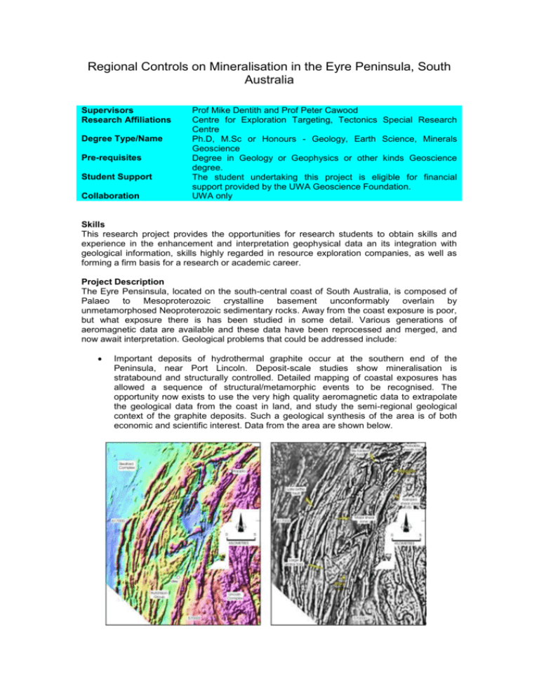
Regional Controls on Mineralisation in the Eyre Peninsula, South Australia Supervisors Research Affiliations Degree Type/Name Pre-requisites Student Support Collaboration Prof Mike Dentith and Prof Peter Cawood Centre for Exploration Targeting, Tectonics Special Research Centre Ph.D, M.Sc or Honours - Geology, Earth Science, Minerals Geoscience Degree in Geology or Geophysics or other kinds Geoscience degree. The student undertaking this project is eligible for financial support provided by the UWA Geoscience Foundation. UWA only Skills This research project provides the opportunities for research students to obtain skills and experience in the enhancement and interpretation geophysical data an its integration with geological information, skills highly regarded in resource exploration companies, as well as forming a firm basis for a research or academic career. Project Description The Eyre Pensinsula, located on the south-central coast of South Australia, is composed of Palaeo to Mesoproterozoic crystalline basement unconformably overlain by unmetamorphosed Neoproterozoic sedimentary rocks. Away from the coast exposure is poor, but what exposure there is has been studied in some detail. Various generations of aeromagnetic data are available and these data have been reprocessed and merged, and now await interpretation. Geological problems that could be addressed include: Important deposits of hydrothermal graphite occur at the southern end of the Peninsula, near Port Lincoln. Deposit-scale studies show mineralisation is stratabound and structurally controlled. Detailed mapping of coastal exposures has allowed a sequence of structural/metamorphic events to be recognised. The opportunity now exists to use the very high quality aeromagnetic data to extrapolate the geological data from the coast in land, and study the semi-regional geological context of the graphite deposits. Such a geological synthesis of the area is of both economic and scientific interest. Data from the area are shown below. The Middleback Ranges, located in to the northeast of the Pensinsula are an important source of iron ore, feeding the smelters in near by Whyalla. Mineralisation is structurally controlled within one or two (depending on stratigraphic model) units of banded iron formation. A recent reinterpretation of the area, based primarily on a structural analysis of the rocks exposed further south, suggests the Middleback Ranges comprise a large-scale sheath fold. This model requires only one iron formation unit. Alterative models involve thrust repetition of a single iron formation horizon. In contrast, yet another interpretation is based on two original iron formation units, and hence no need for a structural explanation of the two units seen in the field. Using high-resolution gravity and magnetic data from the region, it is proposed to model the observed responses to ascertain whether they can resolve the debate. In the extreme northeast of the Eyre Peninsula Neoproterozoic sedimentary rocks hosting copper mineralisation occur, comprising the Myall Creek prospect. Extensive drilling in the 1960s to 1980s has allowed variations in grade, thickness and metal content to be mapped in the area. However, the poor quality aeromagnetic and gravity data available at the time meant the cause of these variations remained unexplained. High quality data from the area now allow these questions to be addressed. These data allow the structure of the crystalline basement and also volcanic units within the Neoproterozoic succession to be mapped with confidence (see figure below). Basement structure and topographic relief related to differential erosion of volcanic units are likely to be the principal controls on the type and distribution of the copper mineralisation, because they in turn control facies in the sedimentary succession. Thus, the opportunity exists to understand the economic geology of the area through the integration of geological exploration data and geophysics. Also located in the northeastern part of the peninsula is a large complex of fault scarps created by pre-historic earthquakes. The area is currently not especially seismically active, so the presence of so many scarps is enigmatic. Bedrock is very poorly exposed in this area, but high quality aeromagnetic data are available. Since most intra-plate earthquakes, such as formed the fault scarps, involve reactivation of existing basement structures, the key to understanding the scarps probably lies the bedrock geology. Careful interpretation of the aeromagnetic data is needed to establish which of the many structures present is the youngest/related to the scarps and why these structures were reactivated. The ultimate aim of any such study is to ascertain whether the seismic hazard in the area has been underestimated. This multifaceted research project provides opportunities for research students to integrate geological and geophysical data to address problems and acquire skills relevant to the mining sector, as well as forming a firm basis for a research or academic career. A Ph.D study could combine all the components above, whilst M.Sc and Honours projects can be constructed from selected components. Recommended Reading Dentith, M. and Cowan, D., 2003. Unconformity-related copper mineralisation on the Stuart Shelf, South Australia: Geophysical responses of mineralisation and the mineralised environment. In: Dentith, M.C., (editor). Geophysical Signatures of South Australian Mineral Deposits. Centre for Global Metallogeny Publication No.31, Australian Society of Exploration Geophysicists Special Publication No.12, pp 197-212. Vassallo, J.J. and Wilson, C.J.L., 2001. Structural repetition of the hutchison Group metasediments, Eyre Peninsula, South Australia. Australian journal of Earth Sciences, 48, 331-345. Vassallo J J. Wilson C J L, 2002. Palaeoproterozoic regional-scale non-coaxial deformation; an example from eastern Eyre Peninsula, South Australia. Journal of Structural Geology, 24, 1-24.

