Map Scale and Measuring Distance
advertisement
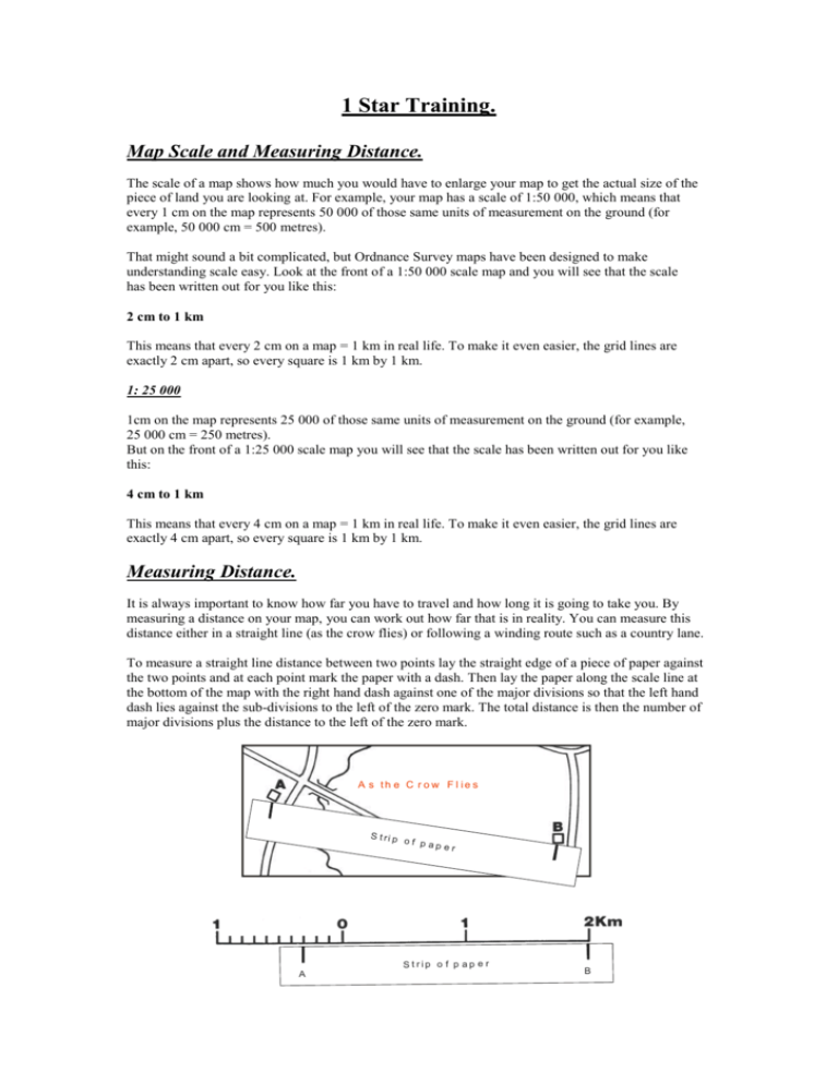
1 Star Training. Map Scale and Measuring Distance. The scale of a map shows how much you would have to enlarge your map to get the actual size of the piece of land you are looking at. For example, your map has a scale of 1:50 000, which means that every 1 cm on the map represents 50 000 of those same units of measurement on the ground (for example, 50 000 cm = 500 metres). That might sound a bit complicated, but Ordnance Survey maps have been designed to make understanding scale easy. Look at the front of a 1:50 000 scale map and you will see that the scale has been written out for you like this: 2 cm to 1 km This means that every 2 cm on a map = 1 km in real life. To make it even easier, the grid lines are exactly 2 cm apart, so every square is 1 km by 1 km. 1: 25 000 1cm on the map represents 25 000 of those same units of measurement on the ground (for example, 25 000 cm = 250 metres). But on the front of a 1:25 000 scale map you will see that the scale has been written out for you like this: 4 cm to 1 km This means that every 4 cm on a map = 1 km in real life. To make it even easier, the grid lines are exactly 4 cm apart, so every square is 1 km by 1 km. Measuring Distance. It is always important to know how far you have to travel and how long it is going to take you. By measuring a distance on your map, you can work out how far that is in reality. You can measure this distance either in a straight line (as the crow flies) or following a winding route such as a country lane. To measure a straight line distance between two points lay the straight edge of a piece of paper against the two points and at each point mark the paper with a dash. Then lay the paper along the scale line at the bottom of the map with the right hand dash against one of the major divisions so that the left hand dash lies against the sub-divisions to the left of the zero mark. The total distance is then the number of major divisions plus the distance to the left of the zero mark. A s th e C r o w F l ie s S t ri p of pa per S t rip o f p ap e r A B To measure the distance along a road or a river which is not straight, lay a piece of paper along the first section and mark it with a dash at the start and end of that section. Then pivot the paper about the second dash until it lies along the second section and repeat the process, and so on, until the last point is marked. The total distance along the road is then recorded as a straight line on the piece of paper lay the paper along the scale line at the bottom of the map with the right hand dash against one of the major divisions so that the left hand dash lies against the sub-divisions to the left of the zero mark. The total distance is then the number of major divisions plus the distance to the left of the zero mark.
