Landsat 5 History
advertisement
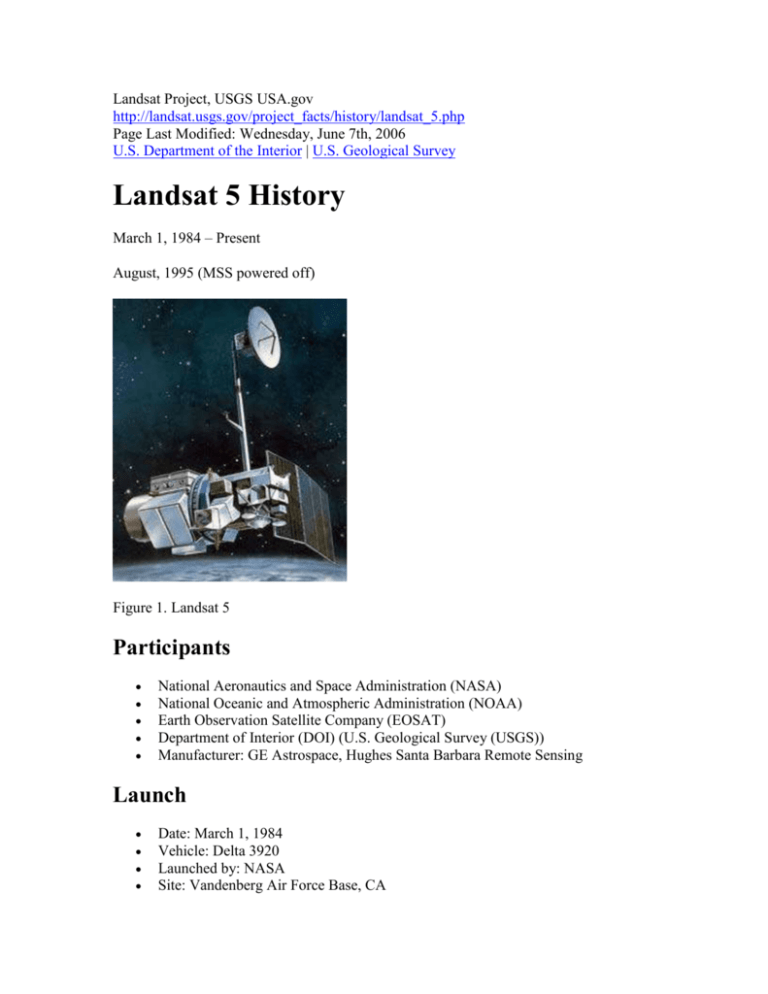
Landsat Project, USGS USA.gov http://landsat.usgs.gov/project_facts/history/landsat_5.php Page Last Modified: Wednesday, June 7th, 2006 U.S. Department of the Interior | U.S. Geological Survey Landsat 5 History March 1, 1984 – Present August, 1995 (MSS powered off) Figure 1. Landsat 5 Participants National Aeronautics and Space Administration (NASA) National Oceanic and Atmospheric Administration (NOAA) Earth Observation Satellite Company (EOSAT) Department of Interior (DOI) (U.S. Geological Survey (USGS)) Manufacturer: GE Astrospace, Hughes Santa Barbara Remote Sensing Launch Date: March 1, 1984 Vehicle: Delta 3920 Launched by: NASA Site: Vandenberg Air Force Base, CA Spacecraft 3-axis stabilized, zero momentum with control of 0.01 deg using reaction wheels Aluminum with graphite struts Hydrazine propulsion system Single solar array with 1-axis articulation produces 1430 W (BOL) Two NiCd batteries provide 100 AHr total Retractable boom (4 m long) with 2 powered joints supports the articulated HGA which downlinks data via Tracking and Data Relay Satellite System (TDRSS) Communications system uses S,X,L, and Ku-Bands Weight: approximately 4,800 lbs (2200 kg) Communications Direct downlink with TDRSS Data rate: 85 Mbps Quantisation: 8 bit (256 levels) Orbit WRS-2 path/row system Circular, sun-synchronous, near-polar orbit at an altitude of 705 km (438 mi) Inclined at 98.2° Repeat cycle: 16 days Swath width: 185 km (115 mi) Equatorial crossing time: 9:45 a.m. +/- 15 minutes Sensors Multispectral Scanner (MSS) Four spectral bands (identical to L1 and L2) o Band 4 Visible green (0.5 to 0.6 µm) o Band 5 Visible red (0.6 to 0.7 µm) o Band 6 Near Infrared (NIR) (0.7 to 0.8 µm) o Band 7 NIR (0.8 to 1.1 µm) Six detectors for each spectral band provided six scan lines on each active scan Ground Sampling Interval (pixel size): 57 x 79 m Thematic Mapper Added the mid-range infrared to the data Seven spectral bands, including a thermal band : o Band 1 Visible (0.45 – 0.52µm) 30m Band 2 Visible (0.52 – 0.60µm) 30m Band 3 Visible (0.63 – 0.69µm) 30m Band 4 NIR (0.76 – 0.90µm) 30m Band 5 NIR (1.55 – 1.75µm) 30m Band 6 Thermal (10.40 – 12.50µm) 120m Band 7 Mid IR (2.08 – 2.35µm) 30m Ground Sampling Interval (pixel size): 30m reflective 120m thermal o o o o o o Other Characteristics Scene Size: 184 x 185.2 km | prev page | next page | AccessibilityFOIAPrivacyPolicies and Notices U.S. Department of the Interior | U.S. Geological Survey URL: http://landsat.usgs.gov/project_facts/history/landsat_5.php Page Contact Information: Contact Us Page Last Modified: Wednesday, June 7th, 2006


