Avoid - Nillumbik Shire Council
advertisement
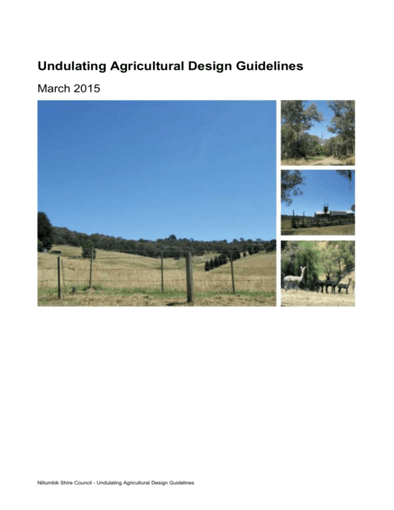
Undulating Agricultural Design Guidelines March 2015 Nillumbik Shire Council - Undulating Agricultural Design Guidelines The Shire of Nillumbik includes a diverse range of landscapes, ranging from the open rolling agricultural pastures in the west, to the dense bushland surrounding the Kinglake National Park to the east. The municipality is valued for its high environmental and landscape qualities associated with the Kinglake National Park, Yarra and Plenty Rivers, Diamond Creek and Metropolitan water storages, such as Sugarloaf Reservoir. The Shire's high scenic quality and natural beauty, combined with its proximity to Melbourne, makes Nillumbik a popular place to live and visit (Planisphere, 2009). The significance of Green Wedge landscapes (or non-urban areas) within the Nillumbik Shire has been assessed in the Nillumbik Landscape Character Assessment, December 2009 (Planisphere). This report found that ‘all parts of the Green Wedge area have a high degree of landscape significance within the context of the municipality and the broader region’. The Shire’s non-urban areas have been divided into seven ‘Landscape Character Areas’ based on common physical, environmental and cultural conditions; such as the density of settlement, pattern of viewing, land use, vegetation, topography, or special landscape features. SLO8: Open Pastures SLO9: Rolling Valleys SLO10: Undulating Agricultural SLO11: Bushy Slopes SLO12: Agricultural Uplands SLO13: River Interface SLO14: Suburban Rural Each Character Area has an established landscape character and significance, and future character directions have been developed to provide a basis from which to manage the rate and scale of landscape change across the area. Based on the level of significance identified for each Character Area and the degree of threat to this significance posed by landscape changes that have already occurred, or may occur in the future, 7 schedules to the Significant Landscape Overlay (SLO) have been applied to the Shire’s Green Wedge landscapes. The SLOs seek to achieve a level of landscape protection and management that is warranted for the particular landscape character significance and sensitivity to development that has been identified for each Character Area. Nillumbik Shire Council - Undulating Agricultural Design Guidelines Nillumbik Shire Council - Undulating Agricultural Design Guidelines Introduction The integrity of Nillumbik's Green Wedge landscapes is often threatened by developments that do not respond to the local characteristics of the area. It is therefore important to ensure that new development within the Shire contributes positively to the surrounding environment. Good site planning and building design are essential if new developments are to respect and reinforce the existing character of the Green Wedge landscapes. Purpose The purpose of the Landscape Management Design Guidelines is to provide guidance in relation to the design, siting, style and landscaping of new development so that the existing landscape character and visual amenity of Nillumbik's Green Wedge landscapes is not compromised by new development, but is protected and strengthened for future generations. It is the intention of these Guidelines that new development in the Shire’s non-urban areas should fit into its existing setting and complement the established landscape character of the area. The Guidelines should be used by anyone involved in the planning and development process (i.e. landowners, designers, builders, Council etc) to better understand how to suitably respond to the planning policies and design controls associated with the Green Wedge landscapes of the Nillumbik Shire. Where the guidelines apply The Guidelines generally apply to all land within the non-urban areas of the Nillumbik Shire, covered by Schedules 6 to 12 of the Significant Landscape Overlay (SLO) of the Nillumbik Planning Scheme. How to use the guidelines The SLO schedule which applies to each of the Character Areas sets out objectives and development requirements to protect an enhance the landscape character of the area. These Guidelines should be used to better understand how to appropriately respond to the design and development requirements of the SLO. How a proposed development responds to the objectives and design responses of these Guidelines is also a matter Council must consider in order to make a decision on any planning permit application affected by the SLO. The non-urban areas of the Shire are also subject to a range of other planning scheme provisions. The majority of non-urban areas are either zoned Rural Conservation Zone or Green Wedge Zone, which both have an emphasis on environmental and landscape conservation values. Other zones which apply to non-urban areas include Public Conservation and Resource Zone, Low Density Residential Zone, Public and Special Use Zones and Public Park and Recreation Zone. In addition, there are a number of other planning scheme overlays covering parts of the Shire’s Green Wedge landscapes that include the Environmental Significance Overlay, Design and Development Overlay, Development Plan Overlay, Bushfire Management Overlay, Restructure Overlay and Heritage Overlay. Each of overlay has specific objectives and requirements relating to Nillumbik Shire Council - Undulating Agricultural Design Guidelines development. Together, these Guidelines, the Nillumbik Planning Scheme provisions and the CFA ‘Landscaping for Bushfire’ guidelines should be used to assist in the design phases for all new development within the Shire’s Green Wedge landscapes. There will likely be a need to strike a balance between vegetation and landscaping objectives of the Design Guidelines and the Bushfire Management Overlay requirements. As a result; it may not always be possible to achieve all of the vegetation and landscaping objectives of these Guidelines. Guidelines structure The Nillumbik Landscape Management Design Guidelines have been separated into two parts that include the following: Part A: Character Area Description: This section includes a map and brief description of the Character Area, its significance, attributes and pattern of viewing, as well as threats to significance. Each Character Area description also includes a future character direction statement and a series of landscape character objectives which describe how to achieve the future direction. Part B: Design Guidelines: This section includes both general and specific objectives and design guidance that responds to the landscape character assets and significance of each of the Character Areas. The purpose of the Design Guidelines is to assist landowners in siting and designing buildings, structures and other site works for new development within the Shire’s Green Wedge landscapes that requires a planning permit under the provisions of the SLO of the Nillumbik Planning Scheme. Application requirements An application must be accompanied by the following information to the satisfaction of the Nillumbik Shire Council: Site Analysis Plan Provides detailed analysis of the natural and manmade features of the site including landform (contours at 1m intervals), drainage lines and waterways, existing exotic and native vegetation, existing buildings, adjoining land uses, key views to and from the site and climatic factors. The Site Analysis Plan also identifies opportunities and constraints that affect future development of the land. Overall Site Plan Details the boundaries and dimensions of the site, adjoining roads, relevant ground levels, the location and layout of existing and proposed buildings and works, driveways, services and proposed landscape areas. The Overall Site Plan should respond to the site features, and the constraints and opportunities identified in the Site Analysis. Nillumbik Shire Council - Undulating Agricultural Design Guidelines Landscape Plan Includes a description of native vegetation to be planted, the surfaces to be constructed, screening of buildings and structures from main road/ key viewing corridors and within open areas by native vegetation. The Landscape Plan should include a response to the CFA ‘Landscaping for Bushfire’ guidelines and other relevant bushfire risk management policies. Significant Landscape Overlay 10: Undulating Agricultural The Undulating Agricultural Character Area provides a scenic transition between the open rural pastures to the north, the heavily vegetated areas to the east and the built up urban residential areas to the south of the Shire. Comparatively open and predominantly agricultural, the Area is characterised by farms and residences set on gently undulating topography with occasional shelterbelts and patches of remnant indigenous vegetation. Large areas of dense native vegetation occur throughout, particularly along roadsides and creek corridors towards the north east. Two creek lines run through the north of the Character Area, where small rural settlements are nestled amongst the vegetated creek corridors. A dominant rural character is evident across the mosaic of agricultural, natural and settled landscapes that occupy this Character Area. Two creek lines run through the north of the Character Area, where the small rural settlements of Arthurs Creek, Nutfield and Cottles Bridge are nestled amongst the vegetated creek corridors. Nillumbik Shire Council - Undulating Agricultural Design Guidelines Nillumbik Shire Council - Undulating Agricultural Design Guidelines Key Attributes Large areas of cleared agricultural landscape with pockets of remnant vegetation and occasional shelter belts. Some large areas of dense native vegetation, particularly along narrow roads and creek corridors. Gently undulating topography. Agricultural land use. Strong rural character. Pattern of Viewing Views within this Character Area are typically confined to the immediate topography and bands of dense vegetation that occur at the roadsides. Large patches of cleared agricultural land can be viewed from roads that traverse the Character Area but often terminate at dense patches of vegetation or a high horizon. On the upper slopes, long range views capture the distant slopes of the Kinglake National Park. Key viewing corridors are highlighted in orange on the map opposite. Threats to Character Gradual conversion to a ‘suburban’ built form through the conversion to hobby farms and construction of new residential dwellings, particularly surrounding the low density residential zoned land to the south west. Large, non-site responsive dwellings with large areas of hard surfaces, long driveways and formal exotic garden design and fencing. Nillumbik Shire Council - Undulating Agricultural Design Guidelines Excessive lighting on private property (e.g. lighting of driveways, pathways and vegetation etc). Development of houses and sheds in prominent locations and along ridgelines. Dominance of horticultural/agricultural structures in the landscape. Development of utility installations (e.g. telecommunications towers, electricity supply lines). Loss of shelterbelts and native vegetation. Degraded vegetation particularly on roadsides and creek corridors. Weeds/pest plants and animals e.g. rabbits. Land degradation-drought, overgrazing. Indicators of Significance/Key Sites A number of significant Aboriginal cultural heritage sites occur in the Character Area, particularly near waterways. The Character Area is an important scenic transition between agricultural and natural bushland areas of the Shire. The Arthurs and Diamond Creeks are important landscape, environmental and recreational resources within the Shire. Many parts of the Character Area are subject to an Environmental Significance. Overlay in recognition of sites of Faunal and Habitat significance. Future Character Direction The Undulating Agricultural Character Area will continue to provide a comparatively open and predominantly rural aspect of medium scale cultivation interspersed with occasional shelterbelts and patches of dense vegetation. The rural landscape character will be maintained by controlling and managing the establishment of built form and nonagricultural land uses that detract from this character. Gradual evolution of the agricultural character will be encouraged including new farming practices and crops (e.g. orchards and vineyards), and revegetation of less productive agricultural land and areas of environmental degradation. The mosaic of agricultural, natural and settled landscapes will be maintained by protecting remnant native vegetation and the relative openness of hillsides and carefully integrating buildings, settlements and infrastructure. Vegetation patterns will be maintained with a mix of established exotic vegetation and native remnants Landscape Character Objectives To maintain the rural, agricultural character of the Area. Nillumbik Shire Council - Undulating Agricultural Design Guidelines To protect clusters of remnant vegetation. To minimise the visual impact of buildings and structures within this open landscape. To maintain a balance between natural and settled landscapes. Nillumbik Shire Council - Undulating Agricultural Design Guidelines 1 Vegetation & Landscaping 1.1 Objectives To protect and enhance indigenous vegetation as a key character element of the Green Wedge areas, particularly at roadsides, along river and creek corridors. To ensure vegetation continues to positively contribute to the landscapes of the Green Wedge. 1.2 Design Response a. Protect and, where necessary, rehabilitate significant stands of vegetation, particularly on prominent hill faces/ridgelines, at roadsides, along river and creek corridors, subject to considerations such as fire protection, safety and bushfire recovery. b. Minimise vegetation removal in new development. Development which requires removal of any vegetation should aim to replace or rehabilitate an equivalent vegetation cover using locally appropriate species. Nillumbik Shire Council - Undulating Agricultural Design Guidelines c. Screen buildings, structures and large areas of hard surfaces with appropriately scaled informal landscaping, suitable to the landscape character of the area. d. Remove environmental weeds and replace with local native and indigenous species, particularly those that are drought- resistant and have fire retardant properties. e. Consider the existing landscape character of the area as a guide to the selection of vegetation and the layout of private gardens and public spaces, extending the existing character into private and public domain landscaping. f. Landscaping and vegetation retention should maintain an area of defendable space around habitable buildings. Refer to the CFA 'Landscaping for Bushfire' guidelines for specific measurements and vegetation types. g. Reinforce vegetative linkages to natural features such as creek environs and other public recreation locations. Nillumbik Shire Council - Undulating Agricultural Design Guidelines Refer also to the Native Vegetation Clauses of the Nillumbik Planning Scheme (Clauses 12.01 and 52.17), and the State Government’s Native Vegetation Management: A Framework for Action. Avoid Loss of significant stands of vegetation, particularly on prominent hill faces/ridgelines, at roadsides, along river and creek corridors. Ad-hoc clearing and removal of vegetation. Development which requires clearing of vegetation. Lack of landscaping and substantial vegetation in new development. Reduction in the overall vegetation coverage of the area. Landscaping that provides little connection to the surrounding natural environment and existing landscape character. Formal landscape design (e.g. geometrically aligned tree avenues/large areas of lawn/formal garden beds). Hard surfaces and hard edges in landscaping. Continuous spreading/planting of environmental weeds. Nillumbik Shire Council - Undulating Agricultural Design Guidelines 2 Views & Vistas 2.1 Objectives To preserve and enhance scenic views of the Kinglake National Park, the Yarra and Plenty River corridors and their surrounding environs, as viewed from main roads and other publicly accessible locations. To maintain the visual prominence of highly vegetated hill slopes and riverbanks, which form an important part of the amenity and character of the Green Wedge. 2.2 Design Response a. Site buildings, structures and other infrastructure away from prominent views available from main road/ key viewing corridors and other publicly accessible locations. b. Design and site buildings, structures and other infrastructure which occurs in the foreground (up to 1 kilometre) of views of the Kinglake National Park, to not adversely affect the character and quality of these views, unless it can be shown that equivalent publicly accessible vistas are available nearby. c. Design and site buildings, structures and other infrastructure which occurs in the immediate foreground (up to 1 kilometre) of views of the Yarra and Plenty River corridors, to not adversely affect the character and quality of views of the vegetated hill slopes and riverbanks. Nillumbik Shire Council - Undulating Agricultural Design Guidelines d. Consider the cumulative impact of developments visible from main road/ key viewing corridors on the character of the roadside environment and surrounding landscapes. e. Consider the impact of developments on immediate views within the area, as well as back into the Shire as viewed from the Kinglake National Park and the adjoining Whittlesea municipality. f. Design vegetation planting and regeneration works to retain views towards the Kinglake National Park where possible. Avoid Unsympathetic/intrusive buildings and structures that obscure prominent views. Conspicuous or incongruous (out of place) buildings, structures or infrastructure visible in the foreground of views of the Kinglake National Park. Loss of publicly accessible views of the highly vegetated hill slopes and riverbanks along river corridors. Loss of the current balance between natural and cultivated/settled landscapes. Conspicuous or incongruous (out of place) buildings, structures or infrastructure which are highly visible from surrounding municipalities. Vegetation that disrupts prominent views towards the Kinglake National Park. Nillumbik Shire Council - Undulating Agricultural Design Guidelines 3 Buildings & Structures: Siting 3.1 Objectives To site buildings and structures to reflect the natural topography and complement the landscape character of the area. To ensure that buildings and structures are sited so that they do not visually dominate the landscape. 3.2 Design Response a. Site buildings and structures: away from visually prominent locations such as ridgelines, hill faces and elevated areas; below the alignment of ridgelines to ensure silhouetting against the skyline does not accur. to minimise the area of exposed batter/embankment and avoid excessive disturbance to existing topography; to be set back from property boundaries, river and creek corridors and roads; amongst existing vegetation and/or in areas where substantial landscaping of locally appropriate species is proposed; and in groups/clusters to consolidate building footprints. b. If the site is in an area that is cleared of vegetation ensure substantial landscaping is proposed. Nillumbik Shire Council - Undulating Agricultural Design Guidelines Avoid Loss of the existing landscape character where the spacious nature and absence of buildings are key characteristics of the area. Buildings and structures which are highly visible or located in prominent locations. Buildings and structures which break the ridgeline silhouette. Buildings that do not follow the natural contours of the site, and require excessive cut and fill. Buildings and structures set close to property boundaries and roads. Buildings and structures which impact on the character and environmental quality of watercourses. Buildings and structures that do not have sufficient vegetative screening. Nillumbik Shire Council - Undulating Agricultural Design Guidelines 4 Buildings & Structures: Design 4.1 Objectives To design buildings and structures to reflect the natural topography and complement the landscape character of the area. To ensure that buildings and structures are designed so that they do not visually dominate the landscape. To ensure buildings and structures demonstrate a high standard of contemporary design and respond to the principles of environmental sustainability. 4.2 Design Response a. Design new development to respond to the character of its surrounds, and not derive from urban building forms and styles. b. Building height and massing should: be of a scale and design, which does not dominate the surrounding environment; achieve a minimal building footprint, ensuring that adequate space is available on the site for the retention of existing vegetation and /or new landscaping; Nillumbik Shire Council - Undulating Agricultural Design Guidelines disaggregate the massing of larger buildings and avoid excessive symmetry in plan or elevation; recess and articulate upper level(s) to reduce the dominance of the upper level and impacts in terms of overlooking and visual bulk; flow with and emphasise the topography by adapting building footprints and including level changes to follow the natural form of the landscape; and use building forms and heights which sit beneath the dominant tree height. c. Building materials and design detail should: use simple detailing; have visible roofs, eaves and verandahs; use external materials that are appropriate to their natural setting (e.g. timber, stone, corrugated iron, mud brick render). Bricks and other rendered surfaces should be used only as minor elements of a building’s exterior; and Nillumbik Shire Council - Undulating Agricultural Design Guidelines be constructed of non-reflective materials and finishes in muted tones which reduce distant visibility (e.g. darker colours on hill slopes, within vegetated areas and lighter colours on skylines). d. Design buildings to incorporate principles of environmental sustainability: maximise energy efficiency with regard to solar access, heat loss, cross ventilation, and the thermal capacity of materials; and orient buildings to optimise thermal performance, utilise natural light and protect solar access for future development. Avoid Buildings or structures that do not harmonise with the character of the surrounding environment. Large, bulky building masses/footprints that are conspicuous elements within the spacious setting of the site. Buildings or structures which require substantial vegetation removal. Nillumbik Shire Council - Undulating Agricultural Design Guidelines Bland, boxy, unarticulated building forms. Sheer, visually dominant elevations. Buildings that do not follow the natural contours of the site, and require excessive cut and fill. Buildings and structures that protrude above the dominant tree height of the vegetated (or proposed vegetated) backdrop. Mock historical style housing, poorly proportioned,with excessive use of ‘reproduction’ or decorative detailing. Overuse of heavy looking materials such as masonry or brick detailing. Use of reflective building materials, such as zincalume, in visually exposed areas. The following palette provides a summary illustration of the external materials, colours and finishes that are considered to complement the natural setting of Nillumbik's Green Wedge Areas and those materials, colours and finishes that should be avoided. Nillumbik Shire Council - Undulating Agricultural Design Guidelines 5 Rural Buildings & Structures 5.1 Objectives To accommodate agricultural/horticultural land uses without detracting from the natural landscape character and environmental qualities of the area. 5.2 Design Response a. Design new buildings and structures for agricultural/rural activities to harmonise with the existing landscape setting of the area; b. Shade materials, hail netting, glasshouses and large machinery or equipment sheds should be sited and designed to minimise visual impacts on the surrounding landscape. Where possible, locate agricultural buildings and structures within existing clusters of buildings, and screen with vegetation of locally appropriate species. Nillumbik Shire Council - Undulating Agricultural Design Guidelines c. Encourage the use of temporary netting/sheeting, in preference to permanent structures, where possible. Where netting/sheeting must be erected as a permanent structure, encourage open sides. d. Encourage the use of dark, muted colours and materials (e.g. green, black or grey) for structures, ground surfaces and netting/sheeting of orchards, which blend in visually with the surrounding landscape, unless it can be demonstrated that particular colours are necessary to enhance function. e. Limit site coverage of structures that cover cultivated land (e.g. greenhouses, igloos, hail, shade and pest netting). f. Minimise storage areas/outbuildings. Avoid Conspicuous agricultural/rural buildings and structures that dominate the landscape.. Agricultural/rural buildings and structures (e.g. horse ménages, agricultural machinery sheds) located in areas where they do not complement the existing landscape character. Permanent netting/sheeting structures, where possible. Lightly coloured or reflective materials and colours being used for all structures, ground surfaces and netting/orchard sheeting. Loss of the current balance between the natural landscape character of the area and agricultural land use/activities and structures. Scattering of structures across a site and visual clutter. Numerous storage areas/outbuildings on a site. Nillumbik Shire Council - Undulating Agricultural Design Guidelines 6 Infrastructure & Signage 6.1 Objectives To minimise the visual impact of infrastructure and signage on the landscape, particularly when visible from main road/ key viewing corridors and other publicly accessible locations. 6.2 Design Response a. Locate infrastructure, such as powerlines and other utility services, underground wherever possible. b. Design tall or dominant structures to minimise the need for vegetation removal on prominent hill faces and along skylines, particularly in areas which are highly visible to the public. Where vegetation removal cannot be avoided, dominant structures should be appropriately screened. c. Minimise the intensity, size and extent of both public and private signage and advertising: d. consolidate signage and advertising into a single location or locate on a building in a manner that complements the architecture, where possible; Nillumbik Shire Council - Undulating Agricultural Design Guidelines e. visually coordinate signage in both the public and private realm through use of colours that harmonise with the surrounding landscape; f. signage illumination, if any, should be appropriate to its function and the need for its visibility after dark. Illumination should be by external means, such as baffled floodlights, rather than internal illumination; g. limit public realm roadside signage to safety and directional signage, as far as reasonably possible; and h. limit private signage to business identification signs only, as far as reasonably possible. Refer also to Clause 52.05 Advertising Signs of the Nillumbik Planning Scheme. Avoid Large scale or linear landscape changes which disrupt the scenic character of the area. Landscape ‘scarring’ resulting from the removal of vegetation for infrastructure. Signage that lacks visual coordination and/ or has a negative impact on the surrounding landscape/ built form. Large, visually dominant or brightly coloured infrastructure and signage, particularly internally illuminated signs. Continuous strips of roadside signage and advertising. Signage clutter / non-essential signage. Nillumbik Shire Council - Undulating Agricultural Design Guidelines 7 Property Entrances, Front Boundary Fencing & Gates 7.1 Objectives To minimise the visual impact of property entrances, front boundary fencing and gates on the landscape, particularly when visible from main road/ key viewing corridors and other publicly accessible locations. 7.2 Design Response Construct front boundary fencing and entry gateways to a low height and/or use traditional materials (e.g. timber, post and wire) or materials that harmonise with the surrounding landscape character and allow a view to the property frontage. Use landscaping with locally appropriate species to screen unsightly materials or equipment along property frontages. Formal avenues of trees should not detract from the landscape character of the area. Minimise the use of lighting at property frontages, as per guidelines in Section 9. Nillumbik Shire Council - Undulating Agricultural Design Guidelines Avoid Property entrances, front boundary fencing and gates that dominate the landscape. Front boundary treatments that include urban or suburban-style fences and landscaping. Large entry features, particularly in heavy materials such as brick, wrought iron, cast iron or concrete. High front boundary fences that enclose and conceal the property frontage, where the property frontage adds to the landscape character of the area. Tree avenues that are not consistent with the landscape character of the area. Excessive use of lighting at property frontages. Nillumbik Shire Council - Undulating Agricultural Design Guidelines 8 Car Parking, Formed Driveways & Roads 8.1 Objectives To minimise the visual impact of car parking, formed driveways, access tracks and roads on the landscape, particularly when visible from main road/ key viewing corridors and other publicly accessible locations. 8.2 Design Response a. Site and design roads, access tracks, driveways and car parking areas to reduce visual intrusion by following the topography and maintaining vegetation as a screen. b. In highly visible locations, use dark, locally sourced material for gravel roads and driveways where possible. c. Site buildings and structures to utilise existing access roads and car parks where possible. d. Retain unsealed roads, access tracks and driveways as an important character element, as far as reasonably possible. e. Limit the extent of large hard/paved surfaces, including driveways, yards, car parks, footpaths, and roads, in both the private and public domain. Nillumbik Shire Council - Undulating Agricultural Design Guidelines f. Locate on site parking for vehicles at the rear of buildings. Avoid Prominent roads, access tracks, driveways and car parking areas which cause visual ‘scarring’ of the landscape. Straight roads that do not reflect the natural contour of the slope. Roads, access tracks and driveways, which require the removal of substantial vegetation or are constructed of bright and/or highly contrasting materials. Construction of additional roads and car parking areas, where existing infrastructure is adequate. Sealing or ‘urbanising’ of roads, access tracks and driveways where it may not be absolutely essential (e.g. use of concrete kerb, channel, footpath and roundabouts). Car parking areas located between the road frontage and buildings on the site. Nillumbik Shire Council - Undulating Agricultural Design Guidelines 9 Lighting 9.1 Objectives To reduce the intrusive effects of lighting on the natural environment. 9.2 Design Response a. Consider the cumulative visual impact of interior and exterior lighting visible from all publicly accessible locations, on the landscape character of the area. b. Restrict permanently installed exterior lighting (including advertising signs, driveways, ménages and tennis courts) to areas necessary for safety and security purposes. c. Lighting should be functional, not purely decorative, and a modest element within the overall landscape. d. Contain light spillage from exterior lighting on private property to within property boundaries. Use landscaping to prevent spillage into adjoining properties. Nillumbik Shire Council - Undulating Agricultural Design Guidelines e. Prioritise interior lighting systems that emit minimal light on the outdoor environment. f. Consider the environmental effects of interior and exterior artificial night lighting on local ecological communities. g. Restrict lighting for advertising to business operating hours, as far as reasonably possible. Avoid Interior and exterior lighting that has a negative impact on the landscape character of the area. Large areas of non-essential lighting. Obtrusive lighting that contributes to distraction, discomfort, or reduces the ability of a person to see essential information such as road signs and signal lights. Lighting for purely decorative purposes (e.g. highlighting of vegetation and property entrances). Excessive spill of exterior lighting (including advertising signs, driveways, ménages and tennis courts). Interior and exterior lighting systems which have a negative effect on the surrounding outdoor environment, including local wildlife. Advertising lighting that extends beyond business operating hours. Nillumbik Shire Council - Undulating Agricultural Design Guidelines 10 Tennis Courts and Ménages 10.1 Objectives To minimise the visual impact of private tennis courts and ménages on the landscape, particularly when visible from main road/ key viewing corridors and other publicly accessible locations. 10.2 Design Response a. Tennis courts and ménages should be appropriately sited to maintain the sense of spaciousness in the landscape and minimise visibility, particularly when visible from main road corridors and other publicly accessible locations. Tennis courts and ménages should:be sited with existing clusters of buildings/structures; be set back from watercourses and roads; be sited as to minimise the area of exposed batter/embankment and avoid excessive disturbance to existing topography; utilise surface colours that harmonise with the surrounding landscape; be set amongst existing vegetation, and/or landscaping of locally appropriate species; be sited in a location that requires minimal vegetation removal; and Nillumbik Shire Council - Undulating Agricultural Design Guidelines be sited and constructed to minimise the effects of the tennis courts and ménages on nearby properties. Refer to Clause 52.21 Private Tennis Courts of the Nillumbik Planning Scheme. Avoid Tennis Courts and ménages which are highly visible and/or located in prominent locations. Tennis Courts and ménages that are set close to watercourses or roads. Excessive disturbance to existing topography. Tennis Courts and ménages which have a negative impact on the spacious landscape character of the area. Tennis Courts and ménages located in rural/agricultural areas where they detract from the prominent land use characteristics of the area. Visually dominant elevations as a result of excessive cut and fill. Lack of sufficient vegetative screening/landscaping. Tennis Courts and ménages sited in locations which require substantial vegetation removal. Negative impacts on nearby properties. Nillumbik Shire Council - Undulating Agricultural Design Guidelines
