Winds and Weather Systems Study Guide
advertisement
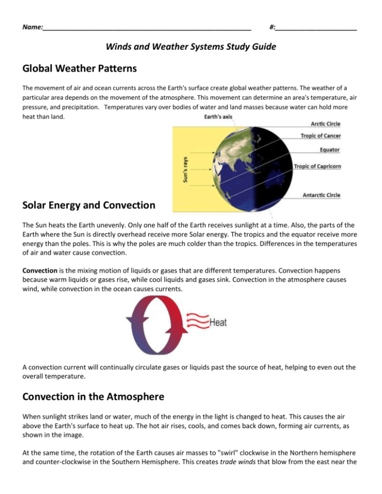
Name:________________________________________________________ #:______________________ Winds and Weather Systems Study Guide Global Weather Patterns The movement of air and ocean currents across the Earth's surface create global weather patterns. The weather of a particular area depends on the movement of the atmosphere. This movement can determine an area's temperature, air pressure, and precipitation. Temperatures vary over bodies of water and land masses because water can hold more heat than land. Solar Energy and Convection The Sun heats the Earth unevenly. Only one half of the Earth receives sunlight at a time. Also, the parts of the Earth where the Sun is directly overhead receive more Solar energy. The tropics and the equator receive more energy than the poles. This is why the poles are much colder than the tropics. Differences in the temperatures of air and water cause convection. Convection is the mixing motion of liquids or gases that are different temperatures. Convection happens because warm liquids or gases rise, while cool liquids and gases sink. Convection in the atmosphere causes wind, while convection in the ocean causes currents. A convection current will continually circulate gases or liquids past the source of heat, helping to even out the overall temperature. Convection in the Atmosphere When sunlight strikes land or water, much of the energy in the light is changed to heat. This causes the air above the Earth's surface to heat up. The hot air rises, cools, and comes back down, forming air currents, as shown in the image. At the same time, the rotation of the Earth causes air masses to "swirl" clockwise in the Northern hemisphere and counter-clockwise in the Southern Hemisphere. This creates trade winds that blow from the east near the equator. It also causes prevailing westerlies that blow across the United States. The prevailing westerlies cause weather patterns in the United States to generally move from west to east. Prevailing westerlies affect weather in North Carolina. Between the easterlies and westerlies, high in the atmosphere, air currents called jet streams are located. A jet stream is a quick-moving ribbon of air. Jet streams constantly change position. Air masses and weather systems in the path of the jet streams are moved by the quick-moving air. High pressure systems, for example, will send winds from the North, as it moves closer to an area. The Northern and Southern Hemispheres each have two main jet streams—a polar jet stream and a subtropical jet stream. In the Northern Hemisphere, the polar jet stream brings cold weather from the north, and the subtropical jet stream brings warm weather from the south. In the winter, jet streams are closer to the equator. In the summer, they are farther from the equator. The seasonal north and south movements of the jet streams' positions are said to follow the Sun, because the Sun's highest position in the sky moves north and south at the same times. The jet stream affects the amount of rain expected in an area. Winds in the jet stream flow between boundaries of cold and hot air. Sea Breezes Land warms more quickly than cooler ocean waters. Sea breezes cause decreases in land temperature near the ocean. When warm waters in the Gulf Stream affect coastal areas, sea breezes will cause an increase in temperatures. Oceans can have a major effect on climate in another way also. Water absorbs solar energy without changing temperature much. This means that ocean temperature remains within a small range throughout the year, even when the amount of solar energy received is changing. This explains why the climate in coastal areas changes less with the seasons than areas that are far away from the coast. Warm water from the Gulf Stream warms the surrounding land, affecting coastal NC’s climate for example. The Gulf Stream also increases the speed and intensity of hurricanes. The Gulf Stream is an ocean current which originates in the Gulf of Mexico and causes warm water to travel. Summer storms in North Carolina, for example, are caused by air masses moving from the Gulf of Mexico, via the Gulf Stream. El Niño & La Niña El Niño and La Niña refer to short-term changes from normal wind and ocean current patterns in the tropical Pacific Ocean. These changes interrupt normal global weather patterns. In normal conditions, the trade winds blow from east to west across the tropical Pacific Ocean. This builds up warmer water in the western Pacific and allows colder water to rise in the eastern Pacific. In certain periods of time, two distinct, short-term changes in this pattern occur. These changes are called El Niño and La Niña. In El Niño conditions, such as the conditions shown at the bottom of the image above, trade winds do not blow as heavily as normal in the western and central Pacific Ocean. This prevents colder water from rising as it normally does in the eastern Pacific, and results in warmer ocean currents than normal. These effects disrupt the flow of the jet stream. El Niño usually occurs every 3 to 7 years. El Niño interrupts normal global patterns. For example, El Niño usually causes droughts in the western Pacific and heavier rains in the eastern Pacific. The southern Rocky Mountains and the southeastern United States will both have increased precipitation in the winter of an El Niño year. The upper Midwest and Northeast U.S. will usually have a warmer than average winter, but the Gulf Coast will tend to be cooler than normal during the winter months. El Niño leads to an increase in temperature and an increase in precipitation, because the warmer ocean water allows for warmer wet air travels east. When the jet stream is pushed south, it results in increased precipitation, such as an increase in winter precipitation in North Carolina. In La Niña conditions, the trade winds blow more heavily than normal, causing more cold water to rise and spread westward across the Pacific. Air and surface water temperatures in the Pacific Ocean near the equator are colder than normal, and global climate patterns are opposite those of El Niño conditions. For example, in North Carolina, La Niña will cause decreased rainfall in the summer and in August, NC would have an active hurricane season. For another example, in the winter, La Niña would cause a slight dip in the jet stream, which would bring colder weather to North Carolina. Global Warming and Hurricanes Local weather temperature will increase as a result of global warming. Tropical storms and hurricanes develop from the west coast of Africa and move westward toward the United States. Water temperatures increase. As the storm moves westward it increases in strength. High winds associated with hurricanes are caused by air pressure. The Gulf Stream impacts hurricane development off the southeastern coast of the United States, as the warmer water from the Gulf Stream helps to increase the speed and intensity of the hurricane.

