Final draft 03/12/15 Guilsborough Parish Today The Parish of
advertisement

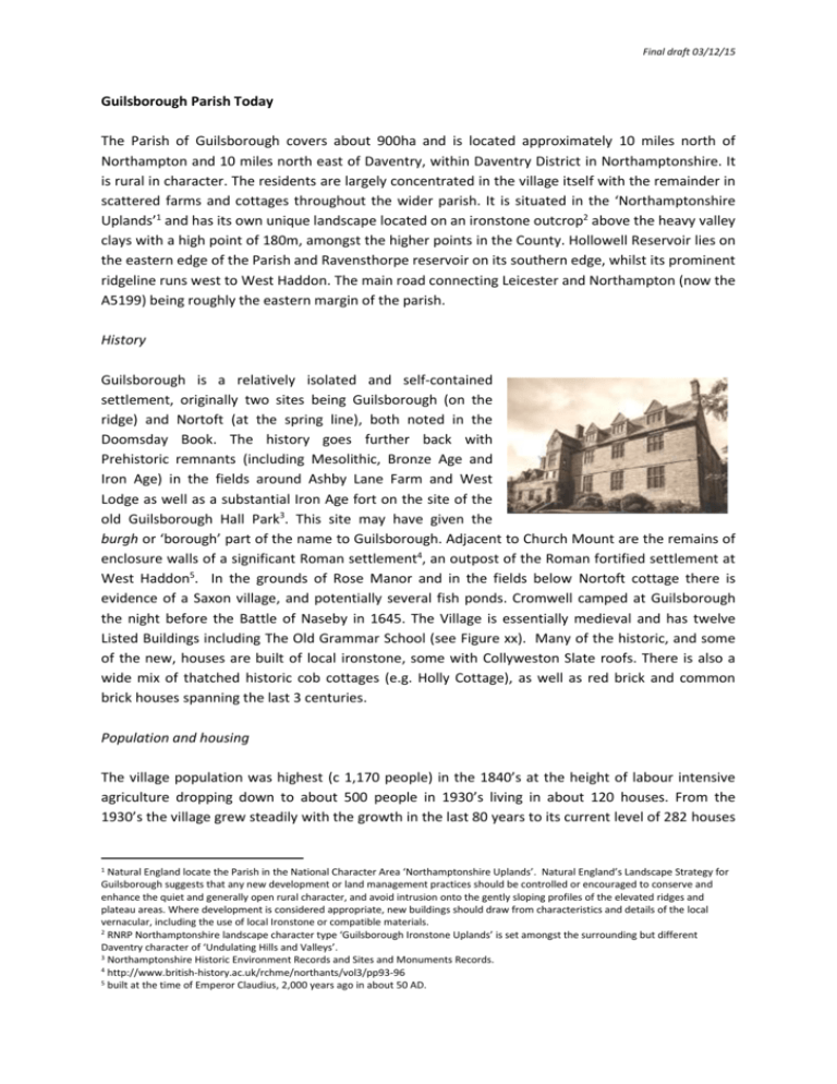
Final draft 03/12/15 Guilsborough Parish Today The Parish of Guilsborough covers about 900ha and is located approximately 10 miles north of Northampton and 10 miles north east of Daventry, within Daventry District in Northamptonshire. It is rural in character. The residents are largely concentrated in the village itself with the remainder in scattered farms and cottages throughout the wider parish. It is situated in the ‘Northamptonshire Uplands’1 and has its own unique landscape located on an ironstone outcrop2 above the heavy valley clays with a high point of 180m, amongst the higher points in the County. Hollowell Reservoir lies on the eastern edge of the Parish and Ravensthorpe reservoir on its southern edge, whilst its prominent ridgeline runs west to West Haddon. The main road connecting Leicester and Northampton (now the A5199) being roughly the eastern margin of the parish. History Guilsborough is a relatively isolated and self-contained settlement, originally two sites being Guilsborough (on the ridge) and Nortoft (at the spring line), both noted in the Doomsday Book. The history goes further back with Prehistoric remnants (including Mesolithic, Bronze Age and Iron Age) in the fields around Ashby Lane Farm and West Lodge as well as a substantial Iron Age fort on the site of the old Guilsborough Hall Park3. This site may have given the burgh or ‘borough’ part of the name to Guilsborough. Adjacent to Church Mount are the remains of enclosure walls of a significant Roman settlement4, an outpost of the Roman fortified settlement at West Haddon5. In the grounds of Rose Manor and in the fields below Nortoft cottage there is evidence of a Saxon village, and potentially several fish ponds. Cromwell camped at Guilsborough the night before the Battle of Naseby in 1645. The Village is essentially medieval and has twelve Listed Buildings including The Old Grammar School (see Figure xx). Many of the historic, and some of the new, houses are built of local ironstone, some with Collyweston Slate roofs. There is also a wide mix of thatched historic cob cottages (e.g. Holly Cottage), as well as red brick and common brick houses spanning the last 3 centuries. Population and housing The village population was highest (c 1,170 people) in the 1840’s at the height of labour intensive agriculture dropping down to about 500 people in 1930’s living in about 120 houses. From the 1930’s the village grew steadily with the growth in the last 80 years to its current level of 282 houses 1 Natural England locate the Parish in the National Character Area ‘Northamptonshire Uplands’. Natural England’s Landscape Strategy for Guilsborough suggests that any new development or land management practices should be controlled or encouraged to conserve and enhance the quiet and generally open rural character, and avoid intrusion onto the gently sloping profiles of the elevated ridges and plateau areas. Where development is considered appropriate, new buildings should draw from characteristics and details of the local vernacular, including the use of local Ironstone or compatible materials. 2 RNRP Northamptonshire landscape character type ‘Guilsborough Ironstone Uplands’ is set amongst the surrounding but different Daventry character of ‘Undulating Hills and Valleys’. 3 Northamptonshire Historic Environment Records and Sites and Monuments Records. 4 http://www.british-history.ac.uk/rchme/northants/vol3/pp93-96 5 built at the time of Emperor Claudius, 2,000 years ago in about 50 AD. Final draft 03/12/15 and 692 population6. In the 1930’s the linear housing construction commenced along the West Haddon Road with about 30 detached and semi-detached properties, followed in the 1960’s by a further 5 houses on that road running up to the then new ‘County School’(now Guilsborough Academy). A further 22 houses were built at Church Mount and 22 at Pells Close, followed in the 1990’s by housing on the village green garage site (9 houses), Guilsborough Hall/Church Way (8 houses) and on the builder’s yard on Cold Ashby Road (6 houses). Then in the last 20 years or so a total of about 26 houses were built being 9 additional properties (including 4 flats) on Wills Close, 14 houses on a brownfield site now called Neaton Lane in Nortoft and 5 other single properties. Guilsborough’s housing stock with 3 bedrooms or more is relatively high at 82% compared to a district value of 72% and national value of 60%. Correspondingly, 2 bedroom housing stock is at 12% in Guilsborough relatively low compared to the 22% for the district and a national average of 38%. Demographics Between 2001 and 2011 persons under the age of 18 years in Guilsborough remained steady at 24%; a slightly high percentage relative to the decreasing district level which is now at 22% in line with a similar and steady national average. During the same period over 65 year olds increased from 19% to 21% in Guilsborough, compared to 13% rising to 17% for the district and a near steady national average of 16%. A slightly ageing population trend might be inferred, however, over a third (36%) of houses in the village have children (compared to a district and national average of 30%). This may be in part due to the attraction for young families of the good quality primary and secondary schools. Some 2.4% of villagers were born outside of Britain compared to 5.4% for Daventry District and a national average of 13%. The result is a relatively well balanced, stable community. Life and work The Village has a relatively prosperous and well educated local community and there is a good quality of life enjoyed by many7. Guilsborough in its rural position plays host to prosperous schools and a doctors’ surgery. A higher proportion work in agriculture, education and health8 and there is a relatively high level of managers, directors and senior officials9. Overall health is relatively good10. Community The Village has an active community offering a range of clubs and groups meeting regularly in the Village Hall and in the Church. There is limited but highly valued open space including the sports 6 2011 census The 2011 Census indicates that 36% of 16-74yr old are employed full time compared to 41.2% in Daventry District and 38.6% in England. However, 75% of Guilsborough residents are economically active compared to 72% in the district and 70% nationally (reflecting high percentage of self employed and part time employees as well as full time students). A relatively low proportion of Guilsborough residents have no qualifications (14% compared to 19% in Daventry and 22% in England), and 42% have taken up education beyond ‘A’ level compared to a 28% average for the district and England. 8Agriculture (3.8% compared to 1.7% in Daventry and 0.8% in England). Slightly higher proportion work in education (11.8% compared to 9.7% in Daventry and 9.9% in England). A creditable 8.5% of Guilsborough work in Human Health & Social Work (relative to a district 9.7% and a national value of 12.4%). 9 21.2% of Guilsborough residents are managers, directors and senior officials compared to 14.4% in Daventry District and 10.9% in England, and 20.6% are in professional occupations (compared to 16.7% in Daventry and 17.5% in England) 10 Overall health is relatively good, with 77% reporting “very good health” compared to 73% in Daventry and 69% in England. 7 Final draft 03/12/15 fields (Guilsborough Playing Field Association), neighbourhood play area (grass junior playing field, open space and equipped play run by the Parish, but currently under a short term lease from the landowner) and ‘The Green’ (Parish owned with historic ‘cob’ barn). There is a nursery school and primary school (Church of England Voluntary Aided). The large Guilsborough Academy takes children from the surrounding villages and further afield (1,303 pupils aged 11-18 years; is rated as ‘good’ school11). In addition, services include a fire station, the Witch & Sow pub, Tracey’s hairdressers, Seaton’s village shop (with post office) and the large GPs’ surgery (with independent pharmacy) built just outside the village boundary in 2003. Employment also includes agriculture, equine and other rural enterprises, a small commercial incinerator (Timeright), barn conversations (including Yorks Studio and Ashby Farm), small offices above Seaton’s shop and many small businesses working from home offices. Whilst there is broadband, it is very patchy and often there is a poor service, but this is soon to be improved by a fibre-optic service (Gigaclear), which will enhance the practicalities of working from home, as well as improve communications generally. Environment The measured development of the small rural village over time has been fortunate in avoiding any significant contaminated land, landfill or other blighted areas. The rolling high ground of the parish has a productive arable landscape. It lies in a valued12 ‘Special Landscape Area’ and above two water reservoirs that serve Northampton and the wider area. Despite much commercial agriculture, it retains many copses, hedgerows and small ponds, with two brooks running down the valleys, and areas set aside by farmers for conservation. It is a quiet area, apart from the two arterial roads. Almost all the houses have gardens, a few with large parklands. Some small scale industrialisation of the countryside has occurred within the parish, including a solar farm and a small incinerator. These are largely hidden from view. However, some damage has been done to the distant skyline views by a relatively large number of wind turbines. As a rural community, the countryside is a key resource for local recreation. There is a limited but well used range of footpaths. The Countryside Access fields, by the Fish Pond and along the Teeton Road, are well-loved and are an important part of the limited accessible open space. The quiet country lanes of the parish and district are much used by local people for walking, jogging, cycling (including the Tour of Britain women’s race and many other cycling events) as well as horse riding. The annual Point to Point event, the adjacent Hollowell Steam Rally attract residents and visitors in their thousands, temporarily adds to the existing traffic issues, but supports the local economy. The whole village comes together every two years for its very successful Guilsborough Village Festival. Summary Guilsborough is a confident community proud of, and benefiting from, a wide range of services. Whilst it suffers from high levels of traffic, our community welcomes the opportunity offered in the development of our own neighbourhood plan to further clarify and strengthen our community’s well-being, retaining the unique and historic village character and look forwards to appropriate future development. 11 12 Ofsted, Parent View. Village questionnaire


