Report template-SingleSided
advertisement
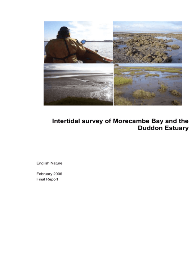
Intertidal survey of Morecambe Bay and the Duddon Estuary English Nature February 2006 Final Report A COMPANY OF HASKONING UK LTD. ENVIRONMENT Elizabeth House Emperor Way Exeter, Devon EX1 3QS United Kingdom +44 (0)1392 447999 01392 446 148 info@exeter.royalhaskoning.com www.royalhaskoning.com Document title Status Intertidal survey of Morecambe Bay and the Duddon Estuary Final Report Date February 2006 Client English Nature Telephone Fax E-mail Internet CONTENTS Page 1 INTRODUCTION 1.1 Background 1.2 Aims and objectives 1 1 1 2 METHODOLOGY FOR THE STUDY 2.1 Introduction 2.2 Survey coverage and scope 2.3 Overview of sampling technique 2.4 Reporting and GIS 2.5 Health and safety 2 2 2 2 4 4 3 RESULTS OF BIOLOGICAL SURVEY 3.1 Introduction 3.2 Duddon Estuary 3.2.1 Transect A: Haverigg Point 3.2.2 Transect B: Angerton Marsh, upper Duddon estuary 3.2.3 Transect C: Millom Marsh to Kirkby in Furness 3.2.4 Transect D: Duddon Sands 3.2.5 Transect F: North End Marsh, Walney Channel 3.2.6 Transect G: Walney Channel 3.3 Morecambe Bay 3.3.1 Transect H: Westfield Point to Snab Sands 3.3.2 Transect I: Haws Bed 3.3.3 Transect J: South End Haws 3.3.4 Transect K: Rampside 3.3.5 Transect L: Roosebeck Sands 3.3.6 Transect N: Mortbank 3.3.7 Transect O: Baycliff to Ulverston Channel 3.3.8 Transect P: Hammerside Point 3.3.9 Transect R: Cartmel Sands 3.3.10 Transect S: Cartmel Wharf 3.3.11 Transect T: Grange over Sands 3.3.12 Transect U: Milnthorpe Sands / Kent Channel 3.3.13 Transect V: Warton Sands 3.3.14 Transect W: Morecambe (North) 3.3.15 Transect X: Morecambe 3.3.16 Transect Y: Aldrens Hedge Baulks 3.3.17 Transect Z: Mussel Knott End Skear to Sandylands 3.3.18 Transect AA: Knott End to Heysham 3.3.19 Transect BB: River Lune 3.3.20 Transect CC: Cockerham Sands 3.3.21 Transect DD: River Wyre 3.3.22 Transect EE: North Wharf, Fleetwood 3.3.23 Transect FF: Sandylands (2) 5 5 9 9 10 10 11 11 12 13 13 13 14 15 15 16 16 17 17 18 19 19 20 21 21 22 23 24 24 25 26 26 27 4 DISCUSSION 28 Intertidal survey of Morecambe Bay and the Duddon Estuary -i- English Nature February 2006 1 INTRODUCTION 1.1 Background As the statutory nature conservation agency for England, English Nature has the responsibility for the identification and protection of sites intended to conserve important wildlife and Earth science features. Such sites may be designated as Sites of Special Scientific Interest (SSSI) under national legislation or Special Areas of Conservation (SAC) and Special Protection Areas (SPA) under European legislation. In order to assess the effectiveness of legislative and policy measures in contributing to biodiversity conservation, regular monitoring of sites is undertaken. The intertidal habitats of Morecambe Bay and the Duddon Estuary are an important interest feature in the designations of these areas. A broad objective of the current study, therefore, is to provide data on the status of the intertidal habitats of these areas to support the overall monitoring programme of the sites. The ultimate aim is that the data will form part of the condition assessment for these sites. Morecambe Bay and Duddon Estuary are designated as a single SAC; the Morecambe Bay SAC. Both Morecambe Bay and the Duddon Estuary are also designated as SSSI, SPA and Ramsar sites. This report describes the aims and objectives of the study, the methodology employed in the survey work and analysis if data, presents the results of the surveys and concludes by describing the findings of the study and making recommendations. 1.2 Aims and objectives As noted in Section 1.1, a broad objective of the study is to provide data on the status of the intertidal habitats of Morecambe Bay and the Duddon Estuary in order to support the overall monitoring programme of the designated sites. The specific objectives of the study were discussed in detail at a project start-up meeting held between English Nature and Royal Haskoning on 19 August 2004 and can be summarised as follows: Definition of the extent of intertidal sediment and the interface with saltmarsh; The composition of intertidal soft sediment biotopes; Sediment character (based on quantitative and qualitative sampling); and, Biotope distribution. The methodology for the survey work is described in Section 2 and is designed to fulfil the above objectives of the study and to reflect the discussions held at the start-up meeting. Intertidal survey of Morecambe Bay and the Duddon Estuary -1- English Nature February 2006 2 METHODOLOGY FOR THE STUDY 2.1 Introduction The survey work was undertaken over three separate periods. This was necessary given that the timing of the award of contract coincided with the autumn/winter period which meant that the survey work had to be coordinated with both spring tide conditions and periods of good weather. The extended overall survey period is largely a consequence of short day length which restricts working time combined with the large study area. The survey periods are as follows: 2.2 29th August 2004 to 1st September 2004; 27th September 2004 to 1st October 2004; 8th March 2005 to 10th March 2005. Survey coverage and scope Prior to commencing the survey, a plan for the work was agreed with English Nature. A series of pre-determined transects were established and these transects were specifically selected to provide the appropriate spatial coverage to meet the objectives for the survey as set out in Section 1. Specifically, transects were established and aligned so as to maximise data collection at locations characterised by biotopes of high conservation value or biotopes subject to change due to anthropogenic or natural processes. In total, 29 transects were established, the locations of which are presented in Figure 2.1 which resulted in a total surveyed transect length of almost 99km. As a consequence of the transect-based approach to the survey work it was agreed that the mapping of biotope boundaries was not an appropriate output of the study and that the study would provide an assessment of biotope diversity and composition. It was further agreed that the survey work would not comprise quantitative sampling for infaunal species and that it would be preferable to obtain more quantitative detail on sediment characteristics throughout the survey area. 2.3 Overview of sampling technique Given the large scale of the survey area and the very dangerous conditions that characterise the site, an Osprey 5 hovercraft was used to transport surveyors and equipment between sampling stations. Sampling was undertaken at a number of sampling stations along each of the 29 pre-defined transects. Individual sampling stations were not pre-defined and were chosen where there was a noticeable visual change in sedimentary conditions or species along the transect, or, in instances where the sediment appeared uniform, sampling was undertaken at regular intervals that were appropriate for the length of the transect. At each sampling station, the following records were taken: Location (as a 10 figure British National Grid reference (WGS 84) using GPS); Noticeable species present and notes on abundance; Sediment characteristics (e.g. sediment type, presence of anoxic layer, etc) Photographs; Supplementary target notes of any other features of interest. Intertidal survey of Morecambe Bay and the Duddon Estuary -2- English Nature February 2006 Fig 2.1 Intertidal survey of Morecambe Bay and the Duddon Estuary -3- English Nature February 2006 A number of samples were taken for subsequent analysis of particle size distribution from each transect. The rationale for taking these samples was to aim to achieve as complete a spatial coverage of the survey as possible. The analysis of sediment samples for particle size distribution was carried out by the Institute of Estuarine and Coastal Studies (IECS) at the University of Hull on behalf of Royal Haskoning. At the end of each survey data, all of the field records were input to master spreadsheet of data for subsequent incorporation into the GIS. 2.4 Reporting and GIS The main output of the study is a GIS which contains all of the findings of the survey work, including all of the photographs, and the quantitative results of the sediment quality analysis. This report is intended to complement the GIS in that it gives an overview of the biotopes encountered on each transect and discusses in further detail the findings of the survey. The report also contains hard copies of some of the maps presented within the GIS showing, for examples, sample locations. In accordance with English Nature’s project specification, biotopes have been assigned according to the 1997 Marine Nature Conservation Review (MNCR) marine biotope classification system. Where an assemblage of species did not match MNCR descriptions exactly, a ‘best-fit’ biotope was assigned which most closely matched the biotope description. Where it was judged that there was a high level of uncertainty in the biotope classification, a higher level biotope code was assigned. 2.5 Health and safety The large intertidal area within the study area presented a variety of important health and safety considerations, and there are inherent severe risks associated with working in this area. Given this, the survey team were accompanied by a member of the local RNLI crew with an intimate knowledge of the area and who was able to indicate where it was safe to survey and provide advice on the location of launch sites and impassable channels. This proved invaluable to the survey and is considered to be a crucial consideration for any future survey work that may be undertaken. Intertidal survey of Morecambe Bay and the Duddon Estuary -4- English Nature February 2006 3 RESULTS OF BIOLOGICAL SURVEY 3.1 Introduction This section summarises the characteristics of each of the transects that were surveyed, including the location and orientation of the transect and a general description of the biotopes encountered with reference to the substrata and communities present. Transect reference codes are as presented in the accompanying GIS and names have been assigned to each transect to identify approximate location. Figure 2.1 shows the location of each transect. Table 3.1 below provides a summary of length of each transect and the sampling that was undertaken on each transect. Table 3.1 Summary of each surveyed transect with details of sampling that was undertaken Transect Approximate transect location Transect length (km) Number of sample stations A B Haverigg Point Hodbarrow-Point – Askam in Furness Millom Marsh Askam Walney Island (North) Walney Meetings Westfield Point/Gas terminal Haws Bed South End Haws Seaward Rampside Roosebeck Sands Mortbank Baycliff to Ulverston Channel Hammerside Point Cartmel Sands Cartmel Wharf Grange Over Sands Milnthorpe Sands / Kent Channel Warton Sands Morecambe (North) Morecambe Aldrens Hedge Baulks Knott End Skear to Sandylands Knott End to Heysham River Lune Cockerham Sands River Wyre North Wharf, Fleetwood Sandylands (2) 2 1.5 6 6 3.8 3.2 1.3 0.3 3.3 3.1 0.3 2.4 3.8 3.6 1.4 2.7 12.3 10 3.5 1.8 5.5 3.6 1.3 1.2 1.5 12.5 4.3 1.5 2.0 3.3 1.7 7 5 8 5 11 9 5 10 3 5 8 9 3 9 5 7 9 14 6 7 8 12 12 10 5 9 4 C D F G H I J K L N O P R S T U V W X Y Z AA BB CC DD EE FF Intertidal survey of Morecambe Bay and the Duddon Estuary -5- English Nature February 2006 A summary of the biotopes encountered along each transect is provided in Table 3.2 below. Table 3.2 Transect A B Summary of the biotopes encountered on each transect Biotope LGS.BarSnd LMS.MacAre LMU.Sm LMS.BatCor LMU.SMu C LMU.HedMac LMU.Sm LMS.MacAre LGs.BarSnd D LMS.BatCor LMU.Sm LGS.BarSnd LMS.MacAre F G H LMS.PCer LMU.Sm LGS.BarSnd LMS.Pcer LMS LMX LMU.Sm LMU.Mu SLR.FvesX SLR.MytX SLR.FvesX LMS.Zos LMU.Sm LMS.MacAre LMU.Smu Intertidal survey of Morecambe Bay and the Duddon Estuary Biotope description Barren course sand shores Macoma balthica and Arenicola marina in muddy sand shores Saltmarsh Bathyporeia spp. and Corophium spp. in upper shore slightly muddy fine sands Sandy mud shores Hediste diversicolor and Macoma balthica in sandy mud shores Saltmarsh Macoma balthica and Arenicola marina in muddy sand shores Barren course sand shores Bathyporeia spp. and Corophium spp. in upper shore slightly muddy fine sands Saltmarsh Barren course sand shores Macoma balthica and Arenicola marina in muddy sand shores Polychaetes and Cerastoderma edule in fine sand and muddy sand shores Saltmarsh Barren course sandy shores Polychaetes and Cerastoderma edule in fine sand and muddy sand shores Littoral muddy sands Littoral mixed sediments Saltmarsh Soft mud shores Fucus vesiculosus on mid eulittoral mixed substrata Mytilus edulis beds on eulittoral mixed substrata Fucus vesiculosus on mid eulittoral mixed substrata Littoral Zostera (seagrass) beds Saltmarsh Macoma balthica and Arenicola marina in muddy sand shores Saltmarsh -6- English Nature February 2006 Table 3.2 I (continued) SLR.MytX LMS.MacAre LMU.HedMac LMU.Sm LGS.BarSh J LGS.AP.P K MLR.EntPor LMU LMX LGS LMU.Sm LMU.Smu LMU.HedMac L LMS.Pcer SLR.MytX LGS LMS.MacAre LMS.Pcer N1 SLR.Bllit LMS O1 LMS.MacAre LGS.BarSh LMS.MacAre LGS.S LMS.MS P LMU.Sm LGS.S LGS.AP.P LMS.Bat Cor R LMS.BatCor Intertidal survey of Morecambe Bay and the Duddon Estuary Mytilus edulis beds on eulittoral mixed substrata Macoma balthica and Arenicola marina in muddy sand shores Hediste diversicolor and Macoma balthica in sandy mud shores Saltmarsh Barren coarse sandy shores Burrowing amphipods and polychaetes (often with Arenicola marina) in clean sand shores Porphyra purpurea or Enteromorpha spp. On sandscoured mid or lower eulittoral rock Littoral muddy shores Littoral mixed sediments Littoral gravels and sands Saltmarsh Sandy mud shores Hediste diversicolor and Macoma balthica in sandy mud shores Polychaetes and Cerastoderma edule in fine sand and muddy sand shores Mytilus edulis beds on eulittoral mixed substrata Littoral gravels and sands Macoma balthica and Arenicola marina in muddy sand shores Polychaetes and Cerastoderma edule in fine sand and muddy sand shores Barnacles and Littorina littorea on unstable eulittoral mixed substrata Littoral muddy sands Macoma balthica and Arenicola marina in muddy sand shores Barren shingle or gravel shores Macoma balthica and Arenicola marina in muddy sand shores Sand shores Muddy sand shores Saltmarsh Sand shores Burrowing amphipods and polychaetes (often with Arenicola marina) in clean sand shores Bathyporeia spp. And Corophium spp. In upper shore slightly muddy fine sands Bathyporeia spp. And Corophium spp. In upper shore slightly muddy fine sands -7- English Nature February 2006 Table 3.2 (continued) S LMS.PCer LMS.MacAre T U V LMU.HedMac.Are LMU.Sm LMU.Sm LMU.Mu LMS.MS LMU.Mu LMU LMS LMU.Sm LMS LMS.PCer LMS.BatCor LGS W LMS.PCer LMS.BatCor LMU.HedMac.Are LMS.PCer LMU.HedOl X SLR.BLlit LMS LMS Y LMS.PCer SLR.MytX SLR.MytX SLR.BLlit LGS.AP.P LGS LMS Intertidal survey of Morecambe Bay and the Duddon Estuary Polychaetes and Cerastoderma edule in fine sand and muddy sand shores Macoma balthica and Arenicola marina in muddy sand shores Hediste diversicolor, Macoma balthica and Arenicola marina in muddy sand or sandy mud shores Saltmarsh Saltmarsh Soft mud shores Muddy sand shores Soft mud shores Littoral muds Littoral muddy sands Saltmarsh Littoral muddy sands Polychaetes and Cerastoderma edule in fine sand and muddy sand shores Bathyporeia spp. and Corophium spp. in upper shore slightly muddy fine sands Littoral gravels and sands Polychaetes and Cerastoderma edule in fine sand and muddy sand shores Bathyporeia spp. and Corophium spp. in upper shore slightly muddy fine sands Hediste diversicolor, Macoma balthica and Arenicola marina in muddy sand or sandy mud shores Polychaetes and Cerastoderma edule in fine sand and muddy sand shores Hediste diversicolor and oligochaetes in low salinity shores Barnacles and Littorina littorea on unstable eulittoral mixed substrata Littoral muddy sands Littoral muddy sands Polychaetes and Cerastoderma edule in fine sand and muddy sand shores Mytilus edulis beds on eulittoral mixed substrata Mytilus edulis beds on eulittoral mixed substrata Barnacles and Littorina littorea on unstable eulittoral mixed substrata Burrowing amphipods and polychaetes (often with Arenicola marina) in clean sand shores Littoral gravels and sands Littoral muddy sands -8- English Nature February 2006 Table 3.2 (continued) Z LGS.AP SLR.MytX AA BB CC SLR.Blit MLR.Salv LMS LMS.PCer LMS LMU.Smu LMS LMS.MS LMU.Sm LMU LMS SLR.Fspi LMU.Sm LMS LMS.BatCor DD LMS.BatCor LMU.Mu LMU.Smu EE FF SLR.BLlit LGS LMU LGS.BarSh LMS.MacAre LMS.MS LMS.MacAre 3.2 Duddon Estuary 3.2.1 Transect A: Haverigg Point Burrowing amphipods and polychaetes in clean sand shores Mytilus edulis beds on eulittoral mixed substrata Barnacles and Littorina littorea on unstable eulittoral mixed substrata Sabellaria alveolata reefs on sand-abraded eulittoral rock Littoral muddy sands Polychaetes and Cerastoderma edule in fine sand and muddy sand shores Littoral muddy sands Sandy mud shores Littoral muddy sands Muddy sand shores Saltmarsh Littoral muds Littoral muddy sands Fucus spiralis on moderately exposed to very sheltered upper eulittoral rock Saltmarsh Littoral muddy sands Bathyporeia spp. and Corophium spp. in upper shore slightly muddy fine sands Bathyporeia spp. and Corophium spp. in upper shore slightly muddy fine sands Soft mud shores Sandy mud shores Barnacles and Littorina littorea on unstable eulittoral mixed substrata Littoral gravels and sands Littoral muds Barren shingle or gravel shores Macoma balthica and Arenicola marina in muddy sand shores Muddy sand shores Macoma balthica and Arenicola marina in muddy sand shores Extending in a south-west direction from the sand dunes of Haverigg Point, transect A runs for approximately 2 km across a large expanse of rippled medium to coarse intertidal sand punctuated by standing pools of water. The six sampling stations along this transect exhibited a general paucity of infauna which may be expected in coarser sediments of this nature. The upper foreshore of rounded cobbles and pebbles is backed by an established sand dune system. Intertidal survey of Morecambe Bay and the Duddon Estuary -9- English Nature February 2006 Plate 3.1 3.2.2 View of transect A off Haverigg Point Transect B: Angerton Marsh, upper Duddon estuary Located in the upper Duddon Estuary, Transect B runs from the grazed Angerton saltmarsh south of Foxfield to Millom Marsh on the western shore of the estuary. The sediment type along the transect is predominantly sandy mud/muddy sand with higher mud content towards the banks. The sediment at stations at higher level on the shore closer to the saltmarsh edge is intensively burrowed by the mud shrimp Corophium volutator. The Baltic tellin Macoma balthica is also present. Plate 3.2 3.2.3 View of transect B off Angerton Marsh Transect C: Millom Marsh to Kirkby in Furness From Kirkby in Furness, transect C crosses the Duddon Sands and the Duddon Channel to Millom Marsh. Elevated banks are present in the mid-channel while the muddier Intertidal survey of Morecambe Bay and the Duddon Estuary - 10 - English Nature February 2006 sediments adjacent to the saltmarsh either side of the channel contain Macoma balthica, Corophium volutator and the laver spire shell Hydrobia ulvae. Plate 3.3 3.2.4 View of grazed saltmarsh at Millom Marsh on transect C Transect D: Duddon Sands Medium sand dominates the sediment of this transect which runs from just south of Askam in Furness to the Haverigg Nature Reserve. The western shore adjacent to the rock revetment of nature reserve is heavily rippled with large standing pools of water. The mobile and coarse nature of the sediments at this site is likely to be the primary reason for the lack of conspicuous species present. The mid channel is characterised by multiple channels with megaripples of medium sand and here infauna is limited to Arenicola marina which is occasional to abundant. On the eastern shore a muddier substrate, anoxic at approximately 10cm, supports Cerastoderma edule and Hediste diversicolor. 3.2.5 Transect F: North End Marsh, Walney Channel From North End Marsh to north of Sowerby Lodge, Transect F crosses the Scarth Channel and a 1km stretch of relatively barren medium to fine sand. Isolated muddier areas support Cerastoderma edule and Hediste diversicolor. The western shore is backed by saltmarsh, the eastern upper shore comprises mixed sediment matrix over clay. Intertidal survey of Morecambe Bay and the Duddon Estuary - 11 - English Nature February 2006 Plate 3.4 3.2.6 View of transect F looking across the Scarth Channel Transect G: Walney Channel The sample stations of this transect predominantly comprise a matrix of coarse sand, pebbles, boulders with occasional shell fragments interspersed with small standing pools of water. The brown algae Fucus vesiculosus and Ascophyllum nodosum are attached to larger rocks and provide habitat for Patella vulgata, Semibalanus balanoides, Elminius modestus, Carcinus maenas, amphipod spp. and Littorina littorea. The western shore is backed by a narrow (less than 5m wide) strip of saltmarsh. This transect also has patchy mussel beds. Plate 3.5 View of transect G with patchy mussel beds in the background Intertidal survey of Morecambe Bay and the Duddon Estuary - 12 - English Nature February 2006 3.3 Morecambe Bay 3.3.1 Transect H: Westfield Point to Snab Sands On the eastern shore of the Walney Channel adjacent to the Gas Terminal, a rock revetment backs the mixed sediment of the upper shore. Patches of Fucus vesiculosus are attached to stones which also support species such as Patella vulgata, Cerastoderma edule, Hediste diversicolor and Littorina littorea. An area of patchy saltmarsh is punctuated with shallow channels and Enteromorpha covered mud banks. Zostera is found in standing pools of water and shallow channels. After approximately 300m from the upper shore the sediment graduates to a muddy sand which is anoxic at about 5cm; this substratum continues to the opposite side of the channel at Snab Sands. In the muddy rippled sand of Snab Sands, C. edule and Corophium volutator are found until, at the saltmarsh boundary, fine mud prevails and high numbers of Hydrobia ulvae are found on the sediment surface. Plate 3.6 3.3.2 Zostera beds in the Walney Channel Transect I: Haws Bed Transect I extends from the Barrow RNLI lifeboat station westwards across the Piel Channel and Haws bed at the southern end of Walney Island. Adjacent to the lifeboat station, Mytilus edulis beds also support Semibalanus. balanoides, Littorina. littorea and Hediste diversicolor. To the west of the channel the sand is cleaner with Macoma balthica and Cerastoderma edule present. Towards the saltmarsh of Haws bed, Corophium volutator, Cerastoderma edule and Hediste diversicolor are found in muddier sediment. The upper shore consists of well rounded cobbles and pebbles on sand/gravel matrix. Intertidal survey of Morecambe Bay and the Duddon Estuary - 13 - English Nature February 2006 Plate 3.7 3.3.3 View of the lifeboat station at Barrow with mussel beds in the foreground Transect J: South End Haws From the southern tip of Walney Island, transect J extend westwards from an upper shore of predominantly coarse sand and cobbles on mixed sediment matrix. A band of cobbles and pebbles interspersed with large areas of standing water support Porphyra purpurea, Enteromorpha sp. and Fucus vesiculosus. Semibalanus balanoides and Carcinus maenas are found in and around larger boulders. From the mid to lower shore stable medium coarse sand dominates with the occasional presence of Arenicola marina. Plate 3.8 View along transect J with stable cobble skear at South End Haws Intertidal survey of Morecambe Bay and the Duddon Estuary - 14 - English Nature February 2006 3.3.4 Transect K: Rampside From an upper shore of coarse sand with shell fragments adjacent to Rampside, transect K passes through a fragmented saltmarsh belt of Spartina and Salicornia. The substratum in this area comprises anoxic sandy mud with Cerastoderma edule and Hydrobia ulvae. Further seawards, approximately 1km from the shore, fine mud supports Hediste diversicolor, C. edule, Nephtys and Macoma balthica. Immediately adjacent to Foulney Island an area of extensive mussel bed on a substrate of muddy sand is present. The algae Porphyra purpurea, Fucus vesiculosus and Chondrus crispus are scattered. In addition to the banks of Mytilus edulis other faunal species include C. edule, H. diversicolor and H. ulvae. Plate 3.9 3.3.5 View of transect K showing fragmented saltmarsh in the foreground Transect L: Roosebeck Sands From an upper shore of clean medium sand with abundant cockle shells, transect L crosses an area of muddy sand which is anoxic at between 1cm and 5cm depth. The species assemblage is dominated by Cerastoderma edule and Macoma balthica. Intertidal survey of Morecambe Bay and the Duddon Estuary - 15 - English Nature February 2006 Plate 3.10 3.3.6 Typical view of the substratum (muddy sand) on transect L Transect N: Mortbank The foreshore is largely medium sand with scattered boulders. Associated with these boulders are Semibalanus balanoides, Littorina littorea, Carcinus maenas and Mytilus edulis. Extending toward the south-east the remainder of the transect comprises muddy sand and supports C. edule, Hediste diversicolor and Macoma balthica. Plate 3.11 3.3.7 View of transect N showing large boulders on medium sand Transect O: Baycliff to Ulverston Channel Transect O begins with an upper shore zone of Enteromorpha covered pebbles and cobbles and covers an expanse of muddy sand for the remainder of its length. The muddy sands are dominated by Macoma balthica and Arenicola marina. Intertidal survey of Morecambe Bay and the Duddon Estuary - 16 - English Nature February 2006 Plate 3.12 3.3.8 Typical view of the substratum at transect O Transect P: Hammerside Point Transect P runs from Hammerside Point, Ulverston westwards across to Cartmel Sands across the point where the River Leven meets Morecambe Bay, south of the Leven viaduct. Sediments are predominantly muddy sand with Hediste diversicolor. The eastern end of the transect is muddy sand and is interspersed with fragmented saltmarsh where high numbers of the mud snail Hydrobia ulvae are found. Sediments become heavily gullied toward the marsh. 3.3.9 Transect R: Cartmel Sands From the seaward extent of the saltmarsh belt, transect R runs southwards and comprises rippled muddy sand at all stations sampled and is heavily burrowed by Corophium volutator with Cerastoderma edule present in low numbers. Intertidal survey of Morecambe Bay and the Duddon Estuary - 17 - English Nature February 2006 Plate 3.13 3.3.10 Rippled muddy sand at transect R which is heavily burrowed by Corophium volutator Transect S: Cartmel Wharf Transect S is approximately 10 km long and extends over the length of Cartmel Wharf sandflats to the central area of Morecambe Bay. The transect is predominantly muddy sand over the entire length. Cerastoderma edule is present at stations on the mid to lower shore, but at relatively low density. Plate 3.14 View of transect S (Cartmel Wharf sandflats) Intertidal survey of Morecambe Bay and the Duddon Estuary - 18 - English Nature February 2006 3.3.11 Transect T: Grange over Sands At the point where the River Kent meets Morecambe Point, transect T starts at Holme Island, Grange over Sands and crosses the Kent channel in a south-east direction towards Arndale Park. Adjacent to Holme Island, and backed by the railway embankment, a dense saltmarsh predominantly comprising the cord grass Spartina anglica is present. The open expanse of muddy sand between Holme Island and Arndale Park is largely devoid of conspicuous infauna but polychaete casts are present, albeit in very low numbers. Plate 3.15 3.3.12 Pioneer saltmarsh (left) and mudflats (right) adjacent to Holme Island, Grange over Sands Transect U: Milnthorpe Sands / Kent Channel Transect U covers an area of sandy mud interspersed with variable narrow channels. The muddy sand is anoxic at about 0.5cm depth with no conspicuous infauna and a small amount of organic detritus covers some areas of mudflat. Intertidal survey of Morecambe Bay and the Duddon Estuary - 19 - English Nature February 2006 Plate 3.16 3.3.13 Muddy sand largely devoid of conspicuous infauna (Milnthorpe Sands) Transect V: Warton Sands The upper shore is predominantly muddy sand which is anoxic at about 15cm with Macoma balthica, Corophium volutator and occasionally Cerastoderma edule. From the mid to lower shore the sediment is largely fine sand and Cerastoderma edule is common to abundant. Plate 3.17 View of transect V showing commercial cockle (C. edule) harvesting in the background Intertidal survey of Morecambe Bay and the Duddon Estuary - 20 - English Nature February 2006 3.3.14 Transect W: Morecambe (North) The mid to upper shore comprises mixed sediment to include boulders, cobbles, pebbles, gravel and coarse sand. Semibalanus balanoides, Littorina littorea and Littorina saxatilis are present on the larger boulders while Mytilus edulis and Carcinus maenas are found amongst the finer substrates and standing pools of water. A band of clayey mud with bivalve shell fragments supports C. edule (abundant), Corophium volutator, Hydrobia ulvae (abundant), Hediste diversicolor and L. littorea. On the mid shore there are deep meandering gullies (1m to 1.5m deep) formed in muddy sand with shell fragments. On the mid to low shore the sediment is predominantly muddy sand with C. volutator, C. edule and H. diversicolor. Plate 3.18 3.3.15 Transect W with meandering gullies in muddy sand, North Morecambe Transect X: Morecambe Orientated in a north-westerly direction from Morecambe, Transect X incorporates biotopes of muddy sand and mussel beds. The sediment is generally anoxic between 2 and 5cm deep. In addition to the abundant Mytilus edulis, the mussel beds also support Hydrobia ulvae, Carcinus maenas and Littorina littorea. Cerastoderma edule is occasionally present within mussel beds and stations situated in open muddy areas. Intertidal survey of Morecambe Bay and the Duddon Estuary - 21 - English Nature February 2006 Plate 3.19 3.3.16 Transect X showing mussel beds off Morecambe Transect Y: Aldrens Hedge Baulks Between the seafront and the skear the sediment is muddy sand displaying a general paucity of conspicuous infauna with the exception of Arenicola marina. Further seaward the skear by the Aldrens Hedge Baulks provides the substrate for a bed of Mytilus edulis which is present in superabundant quantities. Adjacent to the remains of the wooden fishing baulks is a band of cobbles and boulders on mixed sediment matrix. Enteromorpha sp., the ephemeral green alga, covers boulders which are also colonised by Porphyra purpurea as well as M. edulis, Semibalanus balanoides, Littorina littorea, Carcinus maenas and Gammaridae under boulders. At the end of the transect by the starboard marker, a superficial layer of muddy fine sand over a mixed sediment matrix is interspersed with cobbles and fragments of Sabellaria reef. The area represents a patchy M. edulis bed with Lanice conchilega abundant in the mud. Rocks are colonised by S. balananoides and an evenly distributed surface layer of Ulva lactuca. Intertidal survey of Morecambe Bay and the Duddon Estuary - 22 - English Nature February 2006 Plate 3.20 3.3.17 Mussel beds by Aldrens Hedge Baulks on transect Y Transect Z: Mussel Knott End Skear to Sandylands Transect Z has a variety of biotopes along its 1.5km length. Muddy sand with occasional Arenicola marina casts with small pools of standing water. On reaching the Heysham Flat the sandy mud gives way to large pools of standing water on a sand/mud/shell matrix with large scattered boulders colonised by Mytilus edulis and Semibalanus balanoides. Adjacent to this, extensive mussel beds of M. edulis are present in which S. balanoides, Littorina littorea are also found. Towards Knott End Skear large formations of Sabellaria reef sit within patchy mussel bed and interstitial muds populated by Lanice conchilega. Plate 3.21 Sabellaria reefs near Mussel Knott End Skear Intertidal survey of Morecambe Bay and the Duddon Estuary - 23 - English Nature February 2006 3.3.18 Transect AA: Knott End to Heysham Transect AA runs for 12.5 km from the slipway at Knott End to the power station at Heysham. The transect crosses the Lune Channel and includes sample stations from Preesall Sands on the North Wharf and Middleton Sands and Sunderland Bank on the Shoulder of Lune. The sample stations predominantly comprise muddy sand with Arenicola marina and Cerastoderma edule varying in abundance between stations. Plate 3.22 3.3.19 Littoral muddy sand with C. edule north of the Lune Channel Transect BB: River Lune Transect BB follows the edge of Calloway Marsh, an extensive area of saltmarsh on the westward edge of the Lune Channel opposite the sewage works. Man-made river training walls constructed with placed boulders have a covering of Enteromorpha sp., Fucus spiralis, Elminius modestus and Littorina litoralis. At the sample stations where fine muds prevail, the sediment is largely devoid of conspicuous macrofauna. Intertidal survey of Morecambe Bay and the Duddon Estuary - 24 - English Nature February 2006 Plate 3.23 3.3.20 Sheltered littoral rock biotope formed from the artificial training walls of the River Lune Transect CC: Cockerham Sands Transect CC passes through Cockerham Marsh, a large area of predominantly Atlantic salt meadow. Pioneer saltmarsh supports high numbers of Hydrobia ulvae and seaward of this dense Enteromorpha covers an expanse of muddy sand. Within the muddy sand of the final four stations on this transect, Corophium volutator is present in high numbers. Plate 3.24 Dense Enteromorpha covers an expanse of muddy sand at Cockerham Sands Intertidal survey of Morecambe Bay and the Duddon Estuary - 25 - English Nature February 2006 3.3.21 Transect DD: River Wyre Comprising stations of fine mud, transect DD crosses the River Wyre from Little Thornton to Hambleton. Stations are largely impoverished muddy sand backed by grazed saltmarsh with occasional deep gullies. A cobble skear situated by Hambleton is colonised by the barnacle Elminius modestus with interstitial fine mud anoxic at approximately 2cm depth. Plate 3.25 3.3.22 A cobble skear colonised by barnacles with interstitial fine mud Transect EE: North Wharf, Fleetwood The upper shore is a coarse sand/pebble matrix containing no conspicuous infauna. The exposed North Wharf is largely rippled sand which varies in mud content. Plate 3.26 Intertidal survey of Morecambe Bay and the Duddon Estuary Barren mobile sand, North Wharf - 26 - English Nature February 2006 3.3.23 Transect FF: Sandylands (2) Joining the ends of transects Y and Z, Transect FF comprises sample stations in the lower shore. The sediment at all stations is rippled muddy fine sand with Arenicola marina. Plate 3.27 A. marina casts on muddy sand, Sandylands, Morecambe Intertidal survey of Morecambe Bay and the Duddon Estuary - 27 - English Nature February 2006 4 DISCUSSION The methodology adopted for the survey (i.e. a transect-based approach) has resulted in a good overall spatial coverage of the extensive intertidal areas of Morecambe Bay and the Duddon Estuary, with sampling undertaken at from the upper shore to the lowest level of the shore possible at the time of survey. A number of notable biotopes were recorded during the survey which could be considered to be of particular conservation value, such as areas of Sabellaria reef, eelgrass beds and mussel beds. In addition, extensive areas of Morecambe Bay were characterised by cockles although the abundance of cockles was generally considered to be low, possibly due to the very high intensity of cockle harvesting that is undertaken in the Bay. The vast majority of the intertidal area comprises fine sediments ranging from clean sands through to sandy mud, with particularly sheltered areas being almost entirely muddy sediment. Intertidal survey of Morecambe Bay and the Duddon Estuary - 28 - English Nature February 2006
