Request for Floodplain Advice and Information
advertisement
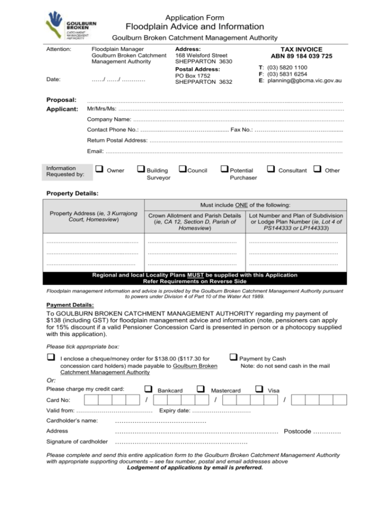
Application Form Floodplain Advice and Information Goulburn Broken Catchment Management Authority Attention: Date: Floodplain Manager Goulburn Broken Catchment Management Authority ……/ ……/ ………… Address: 168 Welsford Street SHEPPARTON 3630 Postal Address: PO Box 1752 SHEPPARTON 3632 TAX INVOICE ABN 89 184 039 725 T: (03) 5820 1100 F: (03) 5831 6254 E: planning@gbcma.vic.gov.au Proposal: ……………………………………………………………………………………………………...………………………… Applicant: Mr/Mrs/Ms: ………………………………...…………………………………………………………………………….… Company Name: ………………………………………………………………………….……………………………… Contact Phone No.: ………..…………………….…........ Fax No.: ………..…………………….…........ Return Postal Address: ………………………………………………………………………………………………... Email: ……………………………………………………………………………………………….……………………… Owner Information Requested by: Building Council Potential Surveyor Consultant Other Purchaser Property Details: Must include ONE of the following: Property Address (ie, 3 Kurrajong Court, Homesview) Crown Allotment and Parish Details (ie, CA 12, Section D, Parish of Homesview) Lot Number and Plan of Subdivision or Lodge Plan Number (ie, Lot 4 of PS144333 or LP144333) ………………………………………..…… …………………………………………… …………………………………………… ……………………………………..……… …………………………………………… …………………………………………… …………………………………………… …………………………………………… …………………………………………… Regional and local Locality Plans MUST be supplied with this Application Refer Requirements on Reverse Side Floodplain management information and advice is provided by the Goulburn Broken Catchment Management Authority pursuant to powers under Division 4 of Part 10 of the Water Act 1989. Payment Details: To GOULBURN BROKEN CATCHMENT MANAGEMENT AUTHORITY regarding my payment of $138 (including GST) for floodplain management advice and information (note, pensioners can apply for 15% discount if a valid Pensioner Concession Card is presented in person or a photocopy supplied with this application). Please tick appropriate box: I enclose a cheque/money order for $138.00 ($117.30 for concession card holders) made payable to Goulburn Broken Catchment Management Authority Payment by Cash Note: do not send cash in the mail Or: Please charge my credit card: Card No: / Valid from: ………………………………… Bankcard Mastercard / Visa / Expiry date: ………………………… Cardholder’s name: …………………………………… Address ………………………………………………………………… Postcode …………. Signature of cardholder ……………………………………………………. Please complete and send this entire application form to the Goulburn Broken Catchment Management Authority with appropriate supporting documents – see fax number, postal and email addresses above Lodgement of applications by email is preferred. Information to be Provided by Applicants for Floodplain Advice and Flood Information The following information should be provided by the applicant, as applicable. This is a fairly thorough checklist and not all items will be necessary for every application: The minimum information to be provided is as follows: Name and address of landowner; Permit or reference number (if applicable); Property description; including street address, parish name, CA No, Section No, Lot No, LP or PS details; Purpose of application, eg dwelling, subdivision, earthworks; An accurate sketch showing location of proposal on property, eg dwelling, earthworks; An accurate locality plan of the property, showing existing property boundaries (and proposed subdivision boundaries if proposed); and A regional locality plan to determine the property’s whereabouts within the catchment. The following additional information may be required where applicable: Existing and proposed use of the site; The number of people expected on site during normal operations; An accurate locality plan of the property - existing natural surface levels, including levels at the proposed building site and along the access-way to the property boundary; - existing and proposed buildings, including floor levels; - existing and proposed earthworks, including finished surface levels, embankment alignments and crest levels; - existing and proposed fencing; - existing and proposed road or access-way alignments and crest levels; - existing and proposed drainage systems, including waterways, pipelines, drains, culverts and bridges; - other important physical features upstream and downstream of the property that may affect flows, such as levee banks, fences and retaining walls. Regional Locality Plan Property Location Can be acopy N of Vicroads Directory or CFA map. N Locality Plan Subject Property This should show the property boundaries as well as adjacent properties and several identifiable roads. N Sketch of Proposed Works This should show a reasonably accurate location of the proposed works within the subject property. N
