Science@Sea 19th November 2010
advertisement
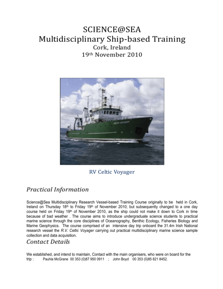
SCIENCE@SEA Multidisciplinary Ship-based Training Cork, Ireland 19th November 2010 RV Celtic Voyager Practical Information Science@Sea Multidisciplinary Research Vessel-based Training Course originally to be held in Cork, Ireland on Thursday 18th to Friday 19th of November 2010; but subsequently changed to a one day course held on Friday 19th of November 2010, as the ship could not make it down to Cork in time because of bad weather . The course aims to introduce undergraduate science students to practical marine science through the core disciplines of Oceanography, Benthic Ecology, Fisheries Biology and Marine Geophysics. The course comprised of an intensive day trip onboard the 31.4m Irish National research vessel the R.V. Celtic Voyager carrying out practical multidisciplinary marine science sample collection and data acquisition. Contact Details We established, and intend to maintain, Contact with the main organisers, who were on board for the trip : Pauhla McGrane 00 353 (0)87 950 0911 ; John Boyd 00 353 (0)85 821 8452. Meeting Times Participants joined the R.V. Celtic Voyager at Albert Quay between 08:45 and 09:00hrs after which the vessel wi departed Cork city returning at 16:30hrs. R.V. Celtic Voyager The R.V. Celtic Voyager is a 31.4m multi-purpose research vessel owned by the Irish Marine Institute. The vessel has wet, dry and chemical laboratories, which are permanently fitted with standard scientific equipment. Additional equipment to address specific sampling and data acquisition requirements is mobilized prior to each survey. The vessel is maintained to a high standard and manned by a very experienced crew who are highly skilled in handling and deploying scientific equipment. Further details in appendix. CTD deployment on the RV Celtic Voyager Page 2/20 Training Schedule & Survey Plan Cork Harbour is a natural harbour and river estuary at the mouth of the River Lee in County Cork, Ireland. The cruise track and sampling areas are shown in Figure 2. Sampling consisted of CTD casts and grab samples taken on 5 stations as the research vessel was in transit down river. This was followed by shooting the beam trawl off Whitegate and passage out to the multibeam box (in red) for preliminary surveying. Access to the multibeam box is dependant on weather conditons. In the event of rough seas operations will take place in the sheltered expanse between Cobh and Roche’s point. . The rest of the day will focus on using multibeam, CTD, grabs, cores and VPH to survey the designated multibeam box. Figure 2: Survey track and approximate locations for training activities Page 3/20 Training: participants were divided into 2 groups with 6 students in each. The curriculum consists of the following modules: Welcome and Vessel orientation (15 mins) & Safety Tour (15 mins) Presentation: Research Vessel Operations and Capabilities (15 mins) 15 minute theoretical sessions (oceanography, geophysics, benthic ecology and fisheries) 1hr practical sessions in oceanography, geophysics, benthic ecology and fisheries biology. Survey Design and Planning (30 mins) & Bridge tour with the Captain Presentation of practical Environmental Impact Assessment (EIA) excercise. Page 4/20 Station Positions Action Area CTD CTD/Grab CTD/Grab CTD/Grab CTD/Grab CTD/Grab Trawl Start Point Trawl End Point Multibeam Start line Tivoli Passage West Monkstown Cobh Dogsnose deep Roches Point SW Whitegate Dognose North South North South Multibeam End line Decimal Degrees -8.41573 -8.33538 -8.32556 -8.29671 -8.27113 -8.27222 -8.27004 -8.27238 -8.24479 -8.24464 -8.23349 -8.23349 51.8997 51.87628 51.84104 51.84696 51.81468 51.78536 51.82232 51.81484 51.7645 51.75103 51.76434 51.75103 Degrees Minutes -8 -8 -8 -8 -8 -8 -8 -8 -8 -8 -8 -8 24.944 20.123 19.533 17.802 16.268 16.333 16.202 16.343 14.688 14.678 14.009 14.009 51 51 51 51 51 51 51 51 51 51 51 51 53.982 52.577 50.462 50.818 48.881 47.122 49.34 48.89 45.87 45.062 45.861 45.062 Page 5/20 Appendix I: Celtic Voyager Page 6/20 Page 7/20 Page 8/20 Page 9/20 Integrated Marine Exploration Programme Increasing capacity through Support, Training and Infrastructure The Marine Institute’s Integrated Marine Exploration (IME) programme is an innovative, strategic approach to develop and augment national capacity for executing world class multidisciplinary marine scientific research. The programme is funded under the Strategy for Science, Technology and Innovation (SSTI) and aligned with the Sea Change plan. The IMEP aims to further build capacity in multidisciplinary marine science research and technology by providing: 1. 2. 3. 4. Annual Competitive Grant-aided Ship-time Marine Institute-led Ship-based Training Support for Integrated Research and Dedicated Training Deep-sea Research and Innovation. The investment in the four areas of Infrastructure, Training, Research and Innovation will facilitate an integrated approach to marine research and provide Irish scientists with increased access to the National research vessels, thereby maximising research opportunities within Irish waters. Our Students and especially Environmental Science students and Fishery students should should tap into this resource to further their knowledge in the marine section of the Environment, which will be an immensely important source of energy, geological and biological resources (eg. fish and invertebrate stocks). While on board we were introduced to the INFOMAR programme. This is a joint venture between the Geological Survey of Ireland and the Marine Institute and is the successor to the Irish National Seabed Survey. The Irish National Seabed Survey (INSS), a multimillion European initiative supported by the Irish government. The survey aimed to map Ireland's 220 million acres of territorial seafloor, a natural resource that is approximately ten times the size of Ireland's land area. Phase 1 of the Irish National Seabed Survey (INSS) is now complete, and we are currently in Phase 2: Integrated Mapping for the Sustainable Development of Ireland's Marine Resources (INFOMAR). While Phase 1 concentrated on outer deep-sea territorial waters, Phase 2 has moved inshore to coastal waters. INFOMAR aims to map the remaining 13% of the Irish territorial seafloor, concentrating on specific areas of interest such as priority bays and areas of biological interest. . Covering some 125,000 km² of Irelands most productive and commercially valuable inshore waters, INFOMAR will produce integrated mapping products covering the physical, chemical and biological features of the seabed. Initially, INFOMAR will focus on 26 bays (including Donegal Bay) and 3 priority areas (shown in map). This information is readily available via the web and could be accessed by our students as a source of supplementary data for their projects. We at IT, Sligo should aim to be a centre for marine research in the North West Region (e.g. Donegal Bay). Page 10/20 Day Grab (with weights) Sorting table with sieve and hopper Environmental Monitoring of the Sea Bed The seafloor is a very suitable indicator of stresses on the marine environment and can act as an early warning system. These stresses can originate from natural and/or anthropogenic sources. The condition of the seafloor (physical, chemical and biological) has been shown to modify in response to external influences. For example, organic matter falling to the seafloor may increase oxygen demand in the vicinity and stress and/or kill organisms located therein. Surveys using a variety of tools have been used to assess natural conditions prior to development or to assess the conservation status of an area. The Marine Environment and Food Safety Services Benthic Monitoring Unit is responsible for the review and assessment of existing and proposed activities that may have an influence on the marine environment. Activities Requiring Benthic Monitoring Dumping at Sea Activities such as maintenance dredging of shipping ports and navigation channels that remove large amounts of sedimentary material from one marine area generally are discarded in other marine areas, if an alternative use cannot be found. The spoil area will require an extensive benthic survey to determine a baseline set of data that can be referred to in subsequent monitoring programs. The disposal of fish waste and other organic material is another issue that typically requires a survey of the benthic environment in order to assess the impact of the activity. Point Source Discharge Marine areas influenced by point source effluent (i.e., sewage outfalls) require pre/post benthic surveys to assess the impact of the organic and nutrient input on the environment. Page 11/20 Finfish Aquaculture Finfish farming (salmon and trout) are carried out along the Western seaboard of Ireland. These activities result in inputs to the marine environment in the form of wasted feed and faecal material. This organic rain falls to the seafloor and can result in stress on benthic environment. As a result, aquaculturists monitor the benthic environment with a view to minimising the impact. Benthic Monitoring Protocols In May 2000, the Department of Marine and Natural Resources implemented a series of Protocols to monitor fish farming activities in Ireland. An annual benthic monitoring survey forms a part of these protocols. In the event of a breach of the allowable impact levels, suitable management modifications are implemented to reduce the impact and allow a suitable degree of recovery of the benthic environment. Benthic Monitoring Tools There are a number of tools utilised to monitor the benthic environment. These range from observational (qualitative) surveys carried out by divers or Remotely Operated Vehicles (ROVs) or (semi-quantitative) surveys using dredges or beam trawls (only semi-quantitative because of large mesh sizes used on the nets, and because they bounce along the bottom), to more quantitative surveys carried out using a variety of grabs and cores. We used the Day Grab on this trip (see photograph above). In some cases in-situ sediment profiling equipment (Sediment Profiling Imagery - SPI) whose images can be interrogated using a variety of investigative software are used. On this trip the beam trawl (see photo below) was used primarily to obtain samples of fish stocks. However, invertebrates found in it were used, in addition to those obtained in the Day grab samples (which, because of time constraints, were only partially sorted out of the sediments, without using microscopes or stains), along with (superficially only visually examined on this occasion) sediment samples, taken from the grab and other environmental parameters, to show the range of fauna and the habitat present. We were shown how the Marine Nature Conservation Review (MNCR) SACFOR abundance scales (Superabundant, Abundant, Common, Frequent, Occasional, Rare) could be used to interpret species numbers and along with the physical data, tentatively suggest what biotope was being sampled on each occasion. Normally objective interpretation using classificatory separation techniques of computer analysis of a large number of stations and biological and physical/chemical parameters (e.g. using similarity indices between stations) would be need to separate regions into different Biotopes; or cluster analysis involving the study of principal component analysis of physical/chemical and biological parameters; both of which are very time consuming methods. ‘Real ship-time’, quick and less accurate methods such as SPI can be used to make real time interpretations and judgements on board , which could be used to modify sampling regimes immediately. These can later be verified by the more conventional (tested over time ) methods. Page 12/20 Species found in Beam Trawl Fri 19 November 2010 Fish : Commercial Species Common Name Species Name Plaice Pleuronectes platessa L Dab Limanda limanda (L) Flounder Pleuronectes flesus (L) Cod Gadus morhua L Whiting Merangius merlangus (L) Gadus merlangus Bib (Pouting) Trisopterus luscus (L) Pollach Pollachius pollachius (L) Common eel Anguilla anguilla (L) Black Sole Solea solea (L) Lesser spotted Dogfish Scyliorhinus caniculus (L) Murmaid’s Purse (no tendrils = rays or skate) Non-Commercial Species Common Name Species Name Dragonet Callionymus lyra L 2 Spot Goby Gobiusculus flavescens (Fabricius) Great Pipefish Syngnathus acus L Garfish Belone belone Long spined sea scorpion Taurulus bubalis (Euphrasen) (Cottus bubalis) Species found in Beam Trawl Fri 19 November 2010 Phylum Echinodermata: The Starfish and sea urchins Common Name Common starfish Spiny starfish 7 armed starfish Sea potato Brittle starfish Species Name Asterias rubens L Marthasterias glacialis (L) Luidia ciliaris (Philippi) Echinocardium chordatum (Pennant) Amphiura sp. Phylum Crustacea Common green shore crab Carcinus maenas (L) Edible crab Cancer pagurus L Harbor Swimming crab Liocarcinus depurator (L) Velvet Swimming crab Liocarcinus puber Necora puber (L) Hermit crab Eupagurus bernhardus (L) Pagurus bernhardus (L) Small Spider crab Macropodia sp. Phylum Mollusca Class Gastropoda Common whelk Class Bivalvia Razor fish Clam Smoth Artenis Clam Buccinum undatum (L) Ensis sp. Venerupis / Tapes sp. Dosinia lupines (L) Abra alba Page 13/20 Holland I Deepwater ROV - Remotely Operated Vehicle The Marine Institute operates a Deepwater Remotely Operated Vehicle (ROV) which was funded by the European Regional Development fund (ERDF). While on Board we were shown video clips of the operation of this machine. The vehicle is named the Holland I after John Phillip Holland from Liscannor, Co. Clare, Ireland who was an early inventor and builder of submarines. This 3000 metre rated system allows an expansion in the level of deepwater research undertaken by Irish researchers as well as being available as a national resource to state agencies in emergency situations such as casualty investigation, wreck surveys or salvage. The ROV system was designed and built by SMD Ltd (Newcastle, UK) and is designed to be capable of accommodating a wide range of user equipment without modification from the outset. Ample space is available within the vehicle frame for accommodation of scientific payload, numerous survey ports for a wide variety of equipment including multi-beam, CTD, nutrient sensors as well as numerous spare serial and I/O ports which have been incorporated into the system to allow a wide range of scientific sensors to be deployed. The vehicle is equipped with a high level of auto control features including auto hold which is invaluable in the completion of delicate scientific tasks. The vehicle is also equipped with the latest underwater camera equipment including a HDTV camera and recording system to allow the capture of high definition footage for a variety of uses. Download more detailed ROV Specifications if you require more information. The system is a fully contained system including launch and recovery systems and whilst primarily designed to operate from the RV Celtic Explorer, is readily capable of mobilization from a range of suitable vessels as required. Further information may be obtained from RV operations at rv@marine.ie. Page 14/20 Fisheries Surveys Beam Trawl Sorting Tray The Marine Institute has a large number of fisheries surveys on R.V. Celtic Explorer, RV. Celtic Voyager, and commercial vessels throughout the year. These fisheries surveys provide critical information on the status of fish and shellfish stocks. This information is used to assist with sustainable management of our marine resources. Fisheries surveys are specifically designed to satisfy multiple objectives and are often cross disciplinary in nature. In addition to collecting fisheries data the surveys provide important information on the wider marine environment. Fisheries surveys are also used as a training platform for many students who participate in the scientific programmes. Our students should tap into these. Irish Groundfish Survey Fisheries Science Services (FSS) carries out the Irish Groundfish Survey (IGFS) as part of an internationally co-ordinated survey effort that takes place in the 4th quarter annually around the Atlantic shelf waters of Ireland. Purpose of Survey A broad spectrum of data is collected during the survey, but the overriding objective is to provide information on commercially exploited fish stocks. In particular the survey provides an index of the proportion of juveniles in the stock, which in turn gives an indication of its spawning success. This is an important source of information not available from commercial landings due to the necessary minimum fish length restrictions on commercial catches. In addition, the survey provides data on species and environmental parameters in areas of both high and low commercial activity. This gives a better context to data for the entire survey area as opposed to focusing entirely on traditional fishing “hot-spots” that can remain stable while significant changes in surrounding background abundance and distribution go un-noticed. Page 15/20 In total 170 stations are carried out annually over 6 weeks in the ICES fisheries management areas VIa, VIIb,g&j indicated by red solid lines on the map. Circles indicate completed valid tows and hauls where damage or other problems occurred are indicated by an X. How the Groundfish Survey works The International Bottom Trawl Survey Working Group (IBTS) co-ordinates demersal trawl surveys under ICES for the North Sea and Northeast Atlantic. In order to make data as comparable as possible each survey, including the IGFS, operates under a set of agreed standard protocols. Each tow is 30min long and takes place during daylight hours at 3.5-4 knots. Net geometry and ground contact is monitored and logged. Once the catch is aboard it is sorted into species and samples taken for calculation of number at length for all fish, elasmobranch and commercial squid species. Other species such as the benthos are weighed and/or counted. As management of commercial stocks is largely based on data for each age class of fish, samples are also taken for most commercial fish species to determine their age, sex and maturity. It is important to recognise that trawls are quite selective in what they catch and their efficiency can change under different conditions. As it is difficult to ascertain what is not sampled by a trawl, a lot of the work of the survey staff involves keeping sample procedures as standard as possible to ensure all catches are as comparable as possible. Length frequency mearurement categories are now standard among all EU Countries, and we observed and used these methods. Biological Survey histological sample of fish gonads showing developing eggs Purpose of the Survey The survey is intended to collect information on maturity, sex ratio, growth, etc. for a number of species that are of commercial importance. The survey takes place in early spring, the time when most fish spawn. It is important to sample during the spawning season as immature fish can be easily distinguished from mature fish during this time. Page 16/20 Why is it important? In order to assess the state of a fish stock, fisheries scientists need to know more than just the size of the stock. It is important to know how many fish are reproducing and how fast they grow and reach maturity in order to know how resilient a stock is to fishing exploitation. Which species are targeted? The main species that are targeted by the survey are: cod; haddock; whiting; hake; pollack; anglerfish; plaice; megrim; black sole; blue whiting; mackerel; herring and various rays. We sampled some of these species on our trip (see Table). The species we caught were very representative of what is normally caught in this region off Whitegate. When is a fish considered mature? During the spawning season, the gonads (ovaries and testes) of mature fish expand to many times their original size; it is assumed that fish with undeveloped gonads will not spawn during that particular spawning season and that all other fish will contribute to spawning. The development of the gonads is classified according to a maturity scale. Download maturity scales (PDF, 1.1 MB) for the main commerical fish species of importance to Ireland. How the survey works The survey consists of a number of short fishing tows, scattered throughout the survey area. The fish in each haul are sorted by species and then weighed and measured. We were introduced to these standard measurement practices.A number of fish from each haul are selected for age determination and to establish their sex, maturity stage and weight. We were shown how to obtain otoliths from Cod and Plaice. After the data have been analysed, the results are presented to ICES working groups that assess the stock size and give advice on the management of fish stocks. Nephrops Under Water TV Surveys Nephrophs survey sledge Page 17/20 The prawn (Nephrops norvegicus) are common around the Irish coast occurring in geographically distinct sandy/muddy areas were the sediment is suitable for them to construct their burrows. Nephrops spend a great deal of time in their burrows and their emergence from these is related to time of year, light intensity and tidal strength. The Irish Nephrops fishery is extremely valuable with landings in recent years worth around €30 m at first sale supporting an important indigenous processing industry. Since demersal fish like Cod eat Nephrops the fate of both of these fisheries are ecologically intertwined The Marine Institute has been using underwater television surveys to independently estimate abundance, distribution and stock sizes of Nephrops on the Aran Grounds and Western Irish Sea. Data are also collected on Nephrops behaviour and the impact of fishing activity on the seabed. While we were on board the RV Celtic Voyager we were shown video footage displaying survey techniques How Under Water TV Surveys Work During these surveys an under water video camera is towed over the sea bed for around 200m and 0.8 knots on a purpose built sledge. The number of Nephrops in the seabed are counted by experienced scientists. These burrow density estimates are then interpolated for the entire area of the Nephrops grounds using geostatistical methods. Recent Survey Results Each year the Marine Institute carries out three underwater TV surveys on the Aran Grounds, Galway Bay and Slyne Head grounds in the west of Ireland, in the Celtic Sea, and in the Western Irish Sea. Results of these surveys are submitted to annual ICES working groups. These recent reports can be downloaded for each of the survey Page 18/20 Certification When our students have completed the Marine Institute-led Ship-based Training course, they will receive a certificate similar to those obtained by Guy Marsden and Bill Crowe Science@Sea courses are recognised by the Institute of Marine Engineering, Science and Technology (IMarEST: http://www.imarest.org) as contributing towards the Continuous Professional Development (CPD) of marine scientists. As such, all those who successfully completed the course were awarded a certificate. Page 19/20 Foreign Vessel Surveys In any year, up to approximately 50 foreign marine scientific research programmes (FMSR) are undertaken in Irish waters. If scientists or postgraduate students are interested in partaking in any of these surveys as an observer details of future trips and application forms to join may be found on the Marine Institute Foreign Vessel Observer Scheme . Our students should gain Marine experience here, if they are interested in pursuing a marine direction to their studies. or having the option to do so. There may be opportunities to undertake research projects and collect samples for undergraduate or postgraduate research projects. However there are some prior Requirements: Some prior seagoing research experience is essential (Hence the importance of the Science at Sea National Research Ship time Training programme. All observers must present valid up to date ENG 11 medical and Sea Survival certificates. Observers should have a background and active involvement in marine research. Both Guy Marsden and Bill Crowe have Sea Survival certificates. Bill Crowe in addition has a PhD in the Benthic Biology / Ecology field, has completed a Course in Marine GIS from University College Cork, while Guy Marsden has his Captain’s Ticket and is very experienced with GIS and Computer technology. SmartBay Galway is a national research infrastructure project. It comprises of a network of buoys, seafloor cables and other infrastructure, supporting a range of sensors, information systems, telemetry and other communication technologies. Together they provide the basis for in-situ, real time oceanographic monitoring. Page 20/20


