Factors Contributing to the Flood
advertisement
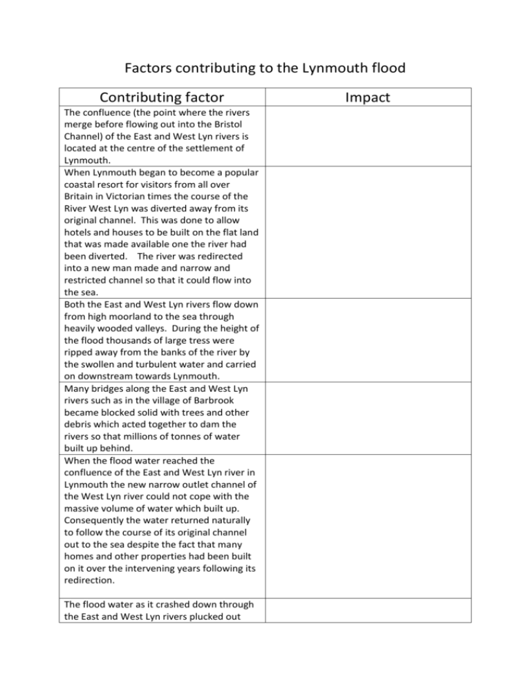
Factors contributing to the Lynmouth flood Contributing factor The confluence (the point where the rivers merge before flowing out into the Bristol Channel) of the East and West Lyn rivers is located at the centre of the settlement of Lynmouth. When Lynmouth began to become a popular coastal resort for visitors from all over Britain in Victorian times the course of the River West Lyn was diverted away from its original channel. This was done to allow hotels and houses to be built on the flat land that was made available one the river had been diverted. The river was redirected into a new man made and narrow and restricted channel so that it could flow into the sea. Both the East and West Lyn rivers flow down from high moorland to the sea through heavily wooded valleys. During the height of the flood thousands of large tress were ripped away from the banks of the river by the swollen and turbulent water and carried on downstream towards Lynmouth. Many bridges along the East and West Lyn rivers such as in the village of Barbrook became blocked solid with trees and other debris which acted together to dam the rivers so that millions of tonnes of water built up behind. When the flood water reached the confluence of the East and West Lyn river in Lynmouth the new narrow outlet channel of the West Lyn river could not cope with the massive volume of water which built up. Consequently the water returned naturally to follow the course of its original channel out to the sea despite the fact that many homes and other properties had been built on it over the intervening years following its redirection. The flood water as it crashed down through the East and West Lyn rivers plucked out Impact hundreds of huge boulders weighing up to 46 tonnes from the river bed and adjacent banks and carried them away down to the village of Lynmouth. Many of the blocked bridges, such as at Hillsford on Farley water a tributary of the East Lyn, eventually gave way under the massive pressure of flood water that had built up behind the dam of debris. On August 15th a massive thunderstorm resulted in 230mm of rain falling across the high moorland catchment area of the East and West Lyn rivers in just 14 hours. This is equivalent to 22.5 billion litres of water. During the first 14 days of August 152 mm of rain had already fallen on the East and West Lyn catchment and consequently both the shallow top soils and the thicker underlying peat were already saturated before the massive thunderstorm which was to come on August 15th. Much of the underlying rock which forms the catchment area of the East and West Lyn on Exmoor is impermeable which means it does not allow water to percolate through it. Both the East and West Lyn rivers flow down to the Bristol Channel through very steep sided gorges with narrow channel widths which consequently have little capacity to cope with sudden heavy periods of rainfall such as that which occurred on the night of August 14th – 15th. Because of the very narrow valleys of the East and West Lyn the only available flat land for building in Lynmouth has always been very close to the rivers. Consequently most homes, hotels and services such as shops in the village have been established over the years only a few meters from the water.

