General Regulations - Kitsap County`s Shoreline Master Program
advertisement
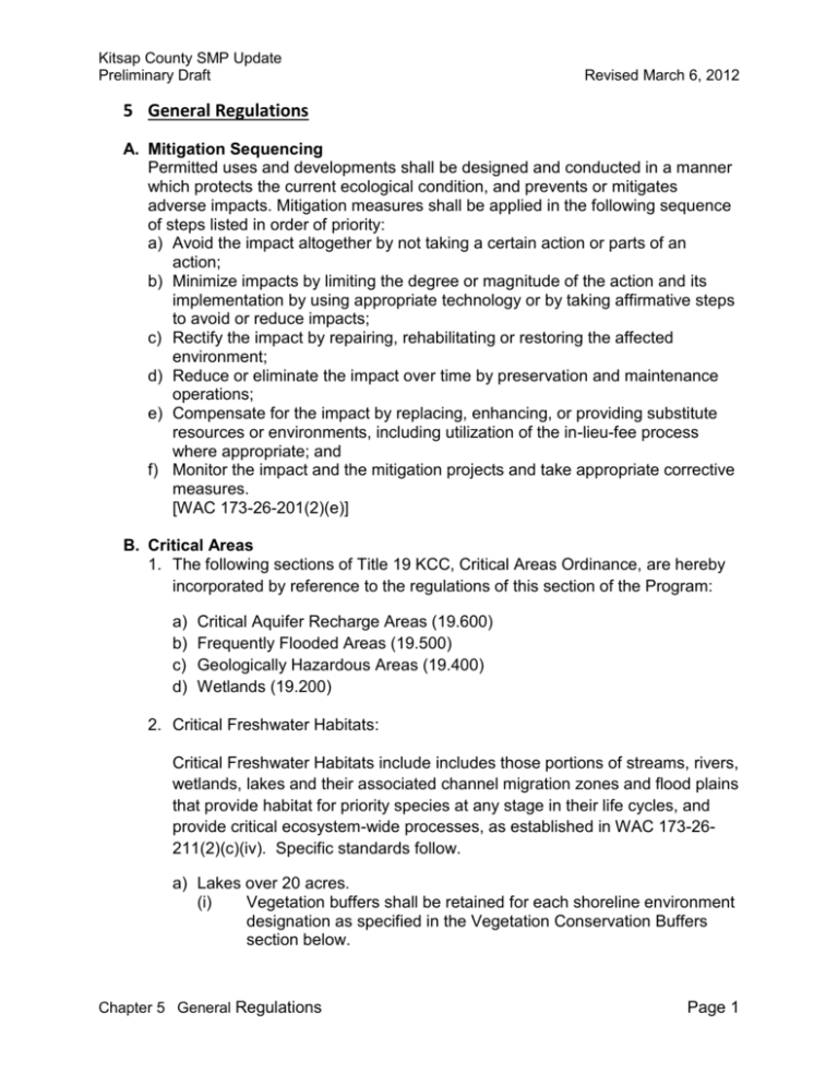
Kitsap County SMP Update Preliminary Draft Revised March 6, 2012 5 General Regulations A. Mitigation Sequencing Permitted uses and developments shall be designed and conducted in a manner which protects the current ecological condition, and prevents or mitigates adverse impacts. Mitigation measures shall be applied in the following sequence of steps listed in order of priority: a) Avoid the impact altogether by not taking a certain action or parts of an action; b) Minimize impacts by limiting the degree or magnitude of the action and its implementation by using appropriate technology or by taking affirmative steps to avoid or reduce impacts; c) Rectify the impact by repairing, rehabilitating or restoring the affected environment; d) Reduce or eliminate the impact over time by preservation and maintenance operations; e) Compensate for the impact by replacing, enhancing, or providing substitute resources or environments, including utilization of the in-lieu-fee process where appropriate; and f) Monitor the impact and the mitigation projects and take appropriate corrective measures. [WAC 173-26-201(2)(e)] B. Critical Areas 1. The following sections of Title 19 KCC, Critical Areas Ordinance, are hereby incorporated by reference to the regulations of this section of the Program: a) b) c) d) Critical Aquifer Recharge Areas (19.600) Frequently Flooded Areas (19.500) Geologically Hazardous Areas (19.400) Wetlands (19.200) 2. Critical Freshwater Habitats: Critical Freshwater Habitats include includes those portions of streams, rivers, wetlands, lakes and their associated channel migration zones and flood plains that provide habitat for priority species at any stage in their life cycles, and provide critical ecosystem-wide processes, as established in WAC 173-26211(2)(c)(iv). Specific standards follow. a) Lakes over 20 acres. (i) Vegetation buffers shall be retained for each shoreline environment designation as specified in the Vegetation Conservation Buffers section below. Chapter 5 General Regulations Page 1 Kitsap County SMP Update Preliminary Draft Revised March 6, 2012 (ii) Where a lot cannot accommodate required buffers due to size, shape or topography, the Alternatives for New and Existing Development (Vegetation Conservation Buffers, items 5-7), shall apply. (iii) The specific Shoreline Use and Modification development standards of the program shall apply (Chapter 7). b) Streams and Rivers over 20 cubic feet per second (cfs) mean annual flow. (i) A 200 foot vegetation buffer and an additional 15 foot building setback shall be maintained from the ordinary high water mark. Additional critical area setbacks may apply where flood hazard areas, geologically hazardous areas or wetlands are present. (ii) Where a lot cannot accommodate required buffers due to size, shape or topography, the Alternatives for New and Existing Development (Vegetation Conservation Buffers, items 5-7), shall apply. (iii) The specific Shoreline Use and Modification development standards of this program shall apply (Chapter 7). 3. Critical Saltwater Habitats. Critical saltwater habitats require a higher level of protection due to the important ecological functions they provide. a) When a habitat survey is required pursuant to the applicable use or modification section, the SMP Inventory and Characterization shall be utilized as a basis for existing conditions. See the applicable sections for specific measures necessary for minimization and mitigation of impacts to critical saltwater habitats. b) Critical Saltwater Habitats include (see Definitions Chapter for more detail): (i) (ii) (iii) (iv) (v) (vi) (vii) Kelp beds Eelgrass beds Spawning and holding areas for forage fish, such as herring, smelt and sandlance Shellfish beds (subsistence, commercial and recreational) Mudflats Intertidal habitats with vascular plants Areas with which priority species have a primary association C. Vegetation Conservation Buffers Chapter 5 General Regulations Page 2 Kitsap County SMP Update Preliminary Draft Revised March 6, 2012 1. Vegetation conservation buffers provide a means to conserve, protect and restore shoreline vegetation in order to provide for ecological and habitat functions as well as human health and safety. The standards below provide a flexible approach to maximize both ecological functions and water-dependent uses. 2. Vegetation Conservation standards shall not be applied retroactively in a way which require lawfully existing uses and developments (as of the effective date of this program), including residential landscaping and gardens, to be removed, except when required as mitigation for new or expanded development. [Place Holder for Diagrams] 3. Standard buffer. Each Shoreline Environment Designation shall have a starting, or Standard Buffer, as measured landward from the Ordinary High Water Mark of the shoreline. This buffer shall be adhered to unless otherwise allowed as described in the Reduced Standard Buffer provisions below. The Standard Buffer for each Environment Designation are as follows: (i) (ii) (iii) (iv) (v) (vi) High Intensity: 50’ Shoreline Residential: 85’ Urban Conservancy: 100’ Rural Conservancy: 130’ Natural: 200’ The Standard Buffer for Shoreline Jurisdictional freshwater streams and rivers is 200’. 4. Reduced Standard buffer. Utilizing the Mitigation Standards Table (Appendix E) to achieve no net loss of shoreline ecological functions, the Standard Buffer may be reduced down to the Reduced Standard buffer as specified below. Mitigation options shall be reviewed and approved by the County for applicability to the project site commensurate with project impacts. The SMP Restoration Plan shall serve an initial review source. The Reduced Standard buffer for each Environment Designation are as follows: (i) High Intensity: 50’ (no reduction without variance) (ii) Shoreline Residential: 50’ (iii) Urban Conservancy: 85’ (iv) Rural Conservancy: 100’ (v) Natural: 150’ (vi) Shoreline Jurisdictional Freshwater streams and rivers: buffers may be reduced pursuant to the standards in 5, 6 and 7 below. Chapter 5 General Regulations Page 3 Kitsap County SMP Update Preliminary Draft Revised March 6, 2012 5. Additional Standards for Applying the Reduced Standard Buffer within the Rural Conservancy Designation, Natural Designation and Shorelines of Statewide Significance. Buffers may be reduced for single-family residences and water-oriented uses in the Rural Conservancy Designation, Natural Designation and Shorelines of Statewide Significance (Hood Canal), only under the following circumstances: (i) The lot is physically constrained by slopes, wetlands or other natural features such that the Standard Buffer cannot be met; (ii) The lot is legally constrained by its size or shape, such that it would not support a home and garage with a footprint of at least 1,200 sq. feet if placed at or above the Standard Buffer; (iii) The lot is currently vacant and development below the Standard buffer would be compliant with the view-blockage standards of this Program; (iv) The existing condition is such that the lot was previously cleared below the Standard Buffer, and intact, mature native vegetation is located at or above the Standard Buffer which would otherwise be removed in order to comply with the Standard Buffer. 6. Alternatives for New Development. New single family and water-dependent development may qualify for an alternative buffer if the following apply: (i) Constrained Lot Provisions. (A) The legally platted lot has a depth that would not allow for compliance with the Standard or Reduced Standard Buffer. In such cases, a Shoreline Mitigation Plan, starting with review of existing conditions as presented in the Inventory and Characterization, shall be required, and will be reviewed pursuant to the variance criteria of this Program. (B) If the development requires less than a 50% reduction of the Standard Reduced Buffer, a Type II administrative variance shall be required. If the development requires greater than a 50% reduction of the Standard Reduced Buffer, a Type III Variance (with hearing) shall be required. (ii) Infill Provision. For new construction on a vacant parcel adjoined by existing homes on both sides, the Reduced Standard Buffer may be administratively reduced by up to 10% in compliance with section 5F (View Blockage). The Mitigation Standards Table (Appendix E) shall apply to such reductions. Chapter 5 General Regulations Page 4 Kitsap County SMP Update Preliminary Draft Revised March 6, 2012 7. Alternatives for Existing Development. (i) Expansion of development outside of the Standard Buffer. Expansion of existing development outside the Standard Buffer shall be permitted, provided all other provisions are met. (ii) Expansion of development within the Standard Buffer. Structures in existence on the effective date of this title that do not meet the setback or buffer requirements of this title may be remodeled or reconstructed provided that the new construction or related activity does not further intrude into the Standard buffer, except where mitigation is applied pursuant to the Mitigation Standards Table (Appendix E). Mitigation may be waived where the expansion occurs directly upland of the existing structure and where such expansion does not require removal of intact native vegetation or expansion of impervious surfaces. (iii) Expansion of development below the Reduced Standard Buffer. Expansion of existing development below the Reduced Standard Buffer shall not occur further waterward of the existing structure, unless no other feasible option exists due to physical constraints of the property. Any expansion below the Reduced Standard Buffer shall require a Shoreline Mitigation Plan. Expansion within the upper 50% of the Reduced Standard Buffer shall require a Type II Administrative Buffer Reduction. Expansion within the lower 50% of the Reduced Standard Buffer shall require a Type III Variance. 8. Standards for Water-Oriented Appurtenances. In order to accommodate water-oriented uses and modifications within the buffer, the following standards shall apply: (i) Trails. Trails shall be limited to five feet in width, except where demonstrated necessary for a water-dependent use. Disturbance to soil, hydrological character, trees, shrubs, snags and important wildlife habitat shall be minimized. (ii) Decks and Viewing Platforms. Decks and viewing platforms may be permitted, but shall be limited to ten feet by ten feet (10’x10’) in size, unless demonstrated that a larger structure will not result in a net loss of shoreline ecological function through submittal of a Shoreline Mitigation Plan. (iii) Beach Stairs. Beach stairs are permitted, subject to the exemption provisions. Beach stairs placed below the ordinary high water mark will normally require a shoreline exemption from Kitsap County, and Chapter 5 General Regulations Page 5 Kitsap County SMP Update Preliminary Draft Revised March 6, 2012 Hydraulic Project Approval from Washington Department of Fish and Wildlife. Beach stairs with stair towers shall require an SDP where exemption provisions are not met. (iv) Boat Launches. Boat launches installed above ordinary high water may be permitted with an exemption or SDP, provided all applicable provisions are met to avoid net loss of shoreline functions. (v) Water-Dependent Storage. Water-dependent storage, including boat houses and sheds above ordinary high water shall be allowed provided: (A) The width shall be no greater than 25’ or 25% of the lot width, whichever is less; (B) The height shall not be greater than 14’ above grade, and shall also comply with the View Blockage provisions of this program; (C) The overall size shall not exceed 200 square feet. Exceptions may be considered upon demonstration of need. In such cases, applicable Mitigation Standards (Appendix E), View Blockage (Section 5F) and Residential Building Code provisions shall apply. (vi) In no case shall non-water-dependent uses and activities be allowed below the Standard Reduced Buffer. This includes swimming pools and sports courts or fields. 9. Standards for View Thinning (i) View thinning activities shall be limited to 25% of the total buffer length in the High Intensity and Shoreline Residential designations; (ii) View thinning activities shall be limited to 15% of the total buffer length in the Urban Conservancy and Rural Conservancy designations; (iii) No tree removal is allowed in the Natural designation for view enhancement, however limited tree limbing may be allowed upon review and approval by the Department. (iv) View thinning within the limited areas specified above shall generally be limited to tree limbing. Where tree removal is demonstrated to be necessary, replanting of native trees shall occur at a 3:1 ratio within the buffer area. (v) Topping of trees is prohibited, except where demonstrated necessary for safety. (vi) See the Forest Practices standards (Section 7.J) for danger tree removal requirements. 10. Mitigation Compliance Chapter 5 General Regulations Page 6 Kitsap County SMP Update Preliminary Draft (i) (ii) (iii) (iv) Revised March 6, 2012 Unless otherwise specified, mitigation shall take place prior to the final project inspection to provide assurance that it will be completed and to mitigate for temporal loss of shoreline functions; Kitsap County shall require monitoring reports on an annual basis for a minimum of five years and up to ten years, or until the department determines that the mitigation project has achieved success. The mitigation plan shall provide specific criteria for monitoring the mitigation project. Results and additional conditions shall be electronically tagged to the parcel for future reference. Mitigation conditions or requirements shall run with the parcel. In the event that a subsequent landowner applies for additional permits, the electronic permit database will be queried for past mitigation requirements. If such mitigation is no longer in place or functioning, it shall be reinstalled prior to permit issuance. Mitigation enforcement shall occur under the authority of the Permit Provisions, Review and Enforcement section of this Program. 11. Mitigation Options (i) Mitigation selection shall begin with the Mitigation Standards Table (Appendix E). (ii) Mitigation shall be the most applicable to the impacting activity and location. (iii) Where documented restoration activities have occurred on the site within the previous five years, such restoration activity may be utilized as mitigation to offset new development impacts. D. Water Quality and Quantity 1. All shoreline use and development shall be conducted in accordance with Title 12 KCC (Storm Water Drainage) and Chapter 173-201A WAC (Water Quality Standards). [WAC 173-26-221(6)(b)(ii)] 2. All shoreline use and development shall be conducted in accordance with Title 15 KCC (Flood Hazard Areas). In accordance with Federal Emergency Management Agency (FEMA) National Flood Insurance Program (NFIP) standards, appropriate protection measures for critical habitats shall be established through a Habitat Assessment before new development activities are permitted within the floodplain. 3. The subdivision of land shall not be established when it would be reasonably foreseeable that the development or use would require structural flood hazard Chapter 5 General Regulations Page 7 Kitsap County SMP Update Preliminary Draft Revised March 6, 2012 reduction measures within the channel migration zone or floodway. When evaluating alternate flood control measures or floodplain restoration opportunities, the removal or relocation of structures in flood-prone areas shall be given consideration. [WAC 173-26-221(3)(b)] E. Historic, Archaeological, Scientific, Cultural, and Educations Resources If archaeological resources are identified in advance or uncovered during excavation, developers and property owners must immediately stop work and notify Kitsap County, the Office of Archaeology and Historic Preservation and affected Indian tribes. Permits may be conditioned after review by a professional archaeologist, pursuant to KC-422-07. [WAC 173-26-221(1)(c)] F. View Blockage 1) Definitions. The following definitions shall apply in the administration and enforcement of this chapter: (i) “Accessory structure” means buildings encompassing less than one hundred fifty square feet and less than eight feet in height from grade level, structures less than eight feet in height from grade level and fences which are less than six feet in height from grade level (Note: revise to 200 s.f.?). (ii) “Adjacent principal building” means a principal building located on a lot abutting the applicant’s lot. (iii) “Building” means any structure used or intended for supporting or sheltering any use or occupancy. “Building line” means the perimeter of that portion of a principal building including decks and balconies closest to the ordinary high water mark but excluding open steps, architectural features (such as cornices), decks less than eighteen inches above grade and roof overhangs less than two feet. (Note: recommend revision to exclude decks and balconies) (iv) (v) “Ordinary high water mark” means that mark on all lakes, streams and tidal water that will be found by examining the bed and banks and ascertaining where the presence and action of waters are so common and usual, and so long continued in all ordinary years, as to mark upon the soil a character distinct from that of the abutting land, in respect to vegetation as Chapter 5 General Regulations Page 8 Kitsap County SMP Update Preliminary Draft Revised March 6, 2012 that condition existed on June 1, 1971 or as it may naturally change after; provided, that in any area where the ordinary high water mark cannot be found, the ordinary high water mark adjoining salt water shall be the line of mean higher high tide and the ordinary high water mark adjoining fresh water shall be the line of mean high water. (See RCW Chapter 90.58). (vi) “Principal building” means that building on a lot closest to the ordinary high water mark excluding accessory structures. (vii) “Structure” means that which is built or constructed. (viii) “Shoreline structure setback line” means the closest distance measured on a horizontal plane between the ordinary high water mark and the building line. (Res. 240-1984 § 1, 1984) 2) Shoreline structure setback line. All principal buildings shall be so located as to maintain the minimum shoreline structure setback line. The shoreline structure setback line shall be determined as follows: (i) No Adjacent Principal Buildings. Where there are no adjacent principal buildings, the shoreline structure setback line shall be that setback specified elsewhere in this Zoning Ordinance. (ii) Adjacent Principal Building on One Side. Where there is an adjacent principal building on one side, the shoreline structure setback line shall be a distance no less than that of the adjacent principal building to the shoreline or that setback specified elsewhere in this Zoning Ordinance, whichever is greater. (iii) Adjacent Principal Buildings on Both Sides on a Regular Shoreline. Where there are adjacent principal buildings on both sides of the proposed structure on a regular shoreline, the shoreline structure setback line shall be determined by a line drawn between the building line of the adjacent principal buildings or that setback specified elsewhere in this Zoning Ordinance, whichever is greater. (iv) Adjacent Principal Buildings on Both Sides on an Irregular Shoreline. Where there are two adjacent principal structures on a shoreline which Chapter 5 General Regulations Page 9 Kitsap County SMP Update Preliminary Draft Revised March 6, 2012 forms a cove or peninsula, the shoreline structure setback line shall be determined by averaging the setback lines of the two adjacent principal buildings or the setback specified elsewhere in this Zoning Ordinance, whichever is greater. (Res. 240-1984 § 2, 1984) 3) Accessory structures. Accessory structures may be sited within the shoreline setback area provided that they do not substantially obstruct the view of adjacent principal buildings. (Res. 240-1984 § 3, 1984) 4) Appeal procedure. Determinations of shoreline structure setback lines are classified as Type I decisions under Title 21 of this code, the Land Use and Development Procedures Ordinance. (See Section 21.04.060, “Type I – Ministerial Decision”). (Ord. 346 (2005) § 7, 2005: Res. 240-1984 § 4(b), 1984)* * Editor’s Note: Prior to amendment by Ordinance 346 (2005), this section was numbered as § 17.450.050. 5) Conditional waiver procedure. (i) An applicant aggrieved by the strict application of this chapter may seek a conditional waiver from the director. Such a waiver shall be a Type II administrative decision. A conditional waiver may be granted after the applicant demonstrates the following: A) The hardship which serves as the basis for granting the conditional waiver is specifically related to the property of the applicant and does not apply generally to other property in the vicinity; 2. The hardship which results from the application of the requirements of this chapter is not a result of the applicant’s own actions; 3. The conditional waiver, if granted, will be in harmony with the general purpose and intent of the Shoreline Management Act and the Kitsap County Shoreline Management Master Program in preserving the views of the adjacent shoreline residences; Chapter 5 General Regulations Page 10 Kitsap County SMP Update Preliminary Draft Revised March 6, 2012 4. In balancing the interest of the applicant with adjacent neighbors, if more harm will be done by granting the conditional waiver than would be done by denying it, the conditional waiver shall be denied. B) The applicant seeking a conditional waiver of the strict application of this chapter may file an application with the department accompanied by an application fee per the Kitsap County Development Permit Fee Schedule (Section 21.06.100). (Ord. 346 (2005) § 8, 2005: Ord. 291 (2002) § 13, 2002: Res. 240-1984 § 4(a), 1984)* * Editor’s Note: Prior to amendment by Ordinance 346 (2005), this section was numbered as § 17.450.040. Editor’s Note: Former Section 17.450.060, Hearings, was repealed by Section 9 of Ord. 346 (2005). The section was originally derived from Res. 240-1984 § 4(c), 1984. * [Note: update illustrations – remove old setbacks] VIEW BLOCKAGE REQUIREMENTS – ILLUSTRATIONS ILLUSTRATION A Chapter 5 General Regulations Page 11 Kitsap County SMP Update Preliminary Draft Revised March 6, 2012 ILLUSTRATION B ILLUSTRATION C Chapter 5 General Regulations Page 12 Kitsap County SMP Update Preliminary Draft Revised March 6, 2012 ILLUSTRATION D Chapter 5 General Regulations Page 13 Kitsap County SMP Update Preliminary Draft Revised March 6, 2012 ILLUSTRATION E G. Bulk and Dimension Standards 1. All bulk and dimension standards shall comply with KCC 17.382, Zoning. 2. All new subdivided shoreline lots shall be, at a minimum, a 1:2 width to depth ratio. H. Public Access 1. All recreational and public access facilities shall be designed, located and operated in a manner consistent with the purpose of the environment designation in which they are located. (WAC) 2. The removal of on-site native vegetation shall be limited to the minimum necessary for the recreational development area, such as picnic areas, campsites, selected views, or other permitted structures or facilities. Chapter 5 General Regulations Page 14 Kitsap County SMP Update Preliminary Draft Revised March 6, 2012 3. Preference shall be given to activities which are consistent with approved state and local park plans for water-oriented recreational development, including but not limited to the Kitsap County Comprehensive Plan, Mosquito Fleet Trail Master Plan, Washington State Parks CAMP plans, Kitsap County Non-Motorized Plan, and other agency plans. (WAC) 4. Non-water-oriented recreational facilities, such as golf courses, playing fields, and facilities with extensive impervious surfaces, shall observe Critical Area Buffers and Vegetation Conservation Standards. 5. Vehicular traffic is prohibited on beaches, bars, spits and streambeds, except for permitted construction and boat launching, or in areas where it can be demonstrated that a historical use has been established. (Current 22) 6. Public road-ends, tax-title lands and right-of-ways adjacent to shorelines of the state shall be preserved for public access. Pursuant to RCW 36.87.130, vacation of such shall only occur if the purpose is to: a) enable any public authority to acquire the vacated property for port purposes, boat moorage or launching sites, or b) for park, viewpoint, recreational, educational or other public purpose, or c) unless the property is zoned for industrial uses. (Current 22+WAC+RCW 36.87.130) 7. Trail access shall be provided to link upland facilities to the beach area. (Current 22) 8. When applicable, recreational and public access development shall make adequate provisions for: a) Vehicular parking and pedestrian access; b) Proper wastewater and solid waste disposal methods; c) Security and fire protection; d) The prevention of overflow and trespass onto adjacent properties, including, but not limited to, landscaping, fencing, and posting of property; and e) Screening of such development from adjacent private property to prevent noise and light impacts. 9. Shoreline trails and pathways shall be located, designed, and constructed to avoid and minimize bank instability. 10. Off-site public access may be allowed where it results in an equal or greater public benefit than on-site public access, or when on-site limitations relating to Chapter 5 General Regulations Page 15 Kitsap County SMP Update Preliminary Draft Revised March 6, 2012 security, environment, use conflict, intervening improvements or feasibility are present. Sites on the same waterbody, or secondarily within the same watershed, are preferred. Off-site public access may be visual or physical in nature and should include both visual and physical elements. Off-site public access may include, but is not limited to, enhancing an adjacent public property (existing public or recreation access site, road, street, or alley abutting a body of water, or similar) in accordance with County standards; providing, improving or enhancing public access on another property under the control of the applicant/proponent; or another equivalent measure. 11. Public entities are required to incorporate public access measures as part of each public development project. Additionally, shoreline public access shall be installed where specifically required of public or private uses or modifications of Chapter 7. Public access shall not be required if an applicant/proponent demonstrates to the satisfaction of the County at least one of the criteria below is met: a) Unavoidable health or safety hazards to the public exist and cannot be prevented by any practical means; b) Inherent security requirements of the use cannot be satisfied through the application of alternative design features or other solutions; c) Significant adverse environmental impacts will result from the public access that cannot be mitigated; d) Significant undue and unavoidable conflict between any access provisions and the proposed use and/or adjacent uses would occur and cannot be mitigated; or e) Adequate public access already exists along the subject shoreline and there are no gaps or enhancements required to be addressed by the individual shoreline development. 12. Project-specific public access standards are contained in the following Use and Modification sections (Chapter 7): a) Commercial b) Industrial c) Residential d) Barrier Structures e) Shoreline Stabilization f) Fill g) Boating Facilities Chapter 5 General Regulations Page 16

