S2 File - Figshare
advertisement
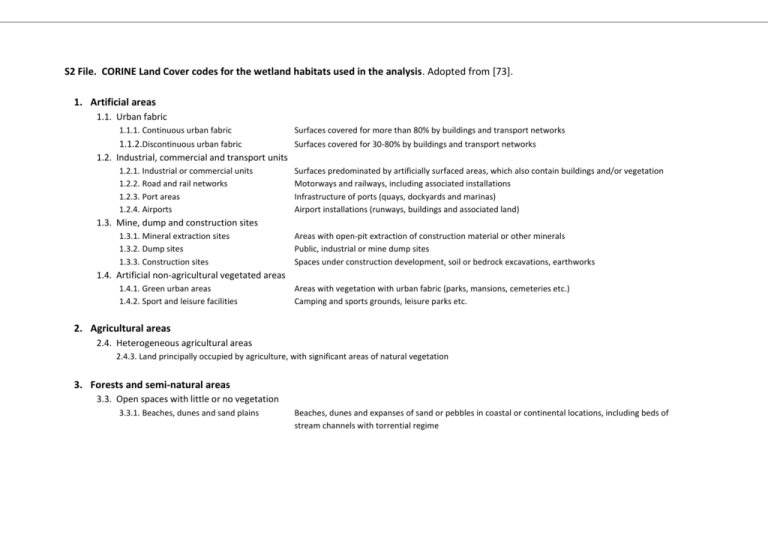
S2 File. CORINE Land Cover codes for the wetland habitats used in the analysis. Adopted from [73]. 1. Artificial areas 1.1. Urban fabric 1.1.1. Continuous urban fabric Surfaces covered for more than 80% by buildings and transport networks 1.1.2.Discontinuous urban fabric Surfaces covered for 30-80% by buildings and transport networks 1.2. Industrial, commercial and transport units 1.2.1. Industrial or commercial units 1.2.2. Road and rail networks 1.2.3. Port areas 1.2.4. Airports Surfaces predominated by artificially surfaced areas, which also contain buildings and/or vegetation Motorways and railways, including associated installations Infrastructure of ports (quays, dockyards and marinas) Airport installations (runways, buildings and associated land) 1.3. Mine, dump and construction sites 1.3.1. Mineral extraction sites 1.3.2. Dump sites 1.3.3. Construction sites Areas with open-pit extraction of construction material or other minerals Public, industrial or mine dump sites Spaces under construction development, soil or bedrock excavations, earthworks 1.4. Artificial non-agricultural vegetated areas 1.4.1. Green urban areas 1.4.2. Sport and leisure facilities Areas with vegetation with urban fabric (parks, mansions, cemeteries etc.) Camping and sports grounds, leisure parks etc. 2. Agricultural areas 2.4. Heterogeneous agricultural areas 2.4.3. Land principally occupied by agriculture, with significant areas of natural vegetation 3. Forests and semi-natural areas 3.3. Open spaces with little or no vegetation 3.3.1. Beaches, dunes and sand plains Beaches, dunes and expanses of sand or pebbles in coastal or continental locations, including beds of stream channels with torrential regime 4. Wetlands 4.1. Inland wetlands 4.1.1. Inland marshes Low-lying land usually flooded in winter, and more or less saturated by water all year round 4.2. Coastal wetlands 4.2.1. Salt marshes 4.2.2. Salines 4.2.3. Intertidal flats Vegetated low-lying areas, above the high-tide line, susceptible to flooding by seawater. Often in the process of filling in, gradually being colonized by halophilic plants Salt-pans, active or in process of abandonment. Sections of salt marsh exploited for the production of salt by evaporation. They are clearly distinguishable from the rest of the marsh by their parcellation and embankment systems Generally unvegetated expanses of mud, sand or rock lying between high and low water marks 5. Water bodies 5.1. Inland waters 5.1.1. Water courses 5.1.2. Water bodies Natural or artificial water-courses serving as water drainage channels. Includes canals Natural or artificial stretches of water. 5.2. Coastal waters 5.2.1. Coastal lagoons 5.2.2. Estuaries Stretches of salt or brackish water in coastal areas which are separated from the sea by a tongue of land or other similar topography. These water bodies can be temporarily or permanently connected to the sea at limited points. The mouth of a river within which the tide ebbs and flows
