Complete Streets-9-10
advertisement
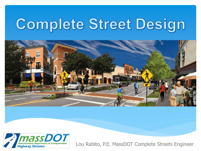
Lou Rabito, P.E. MassDOT Complete Streets Engineer What Are Complete Streets? A complete street is a facility that accommodates all users. As designers, planners, public officials and advocates, we have a responsibility to promote and improve public health, reduce traffic congestion, make places safer and more livable, and reduce environmental impacts. This philosophy expands on MassDOT’s current policy for Context Sensitive Design which is discussed in our 2006 Project Development and Design Guide. How do we design a complete street? I. Identify all factors that influence a design There is no one size fits all for complete street design. Designing a complete street can be challenging without first identifying all the factors that may influence the design. Other than money some of these factors include: Number and types of users (volumes of vehicles, bikes, pedestrians and buses) Available Right of Way Safety amenities (traffic signals, signage, lighting, bump outs, etc.) Community needs and desires Parking needs Utilities Public Transit II. Prioritize all the factors based on site specific needs Apply flexibility in the design by looking at several alternatives at times thinking outside the box. Evaluate how altering, adding or removing any design element will impact all users. Understand that higher priority elements are those which help the street meet the vision and context sensitive objectives of the community. They could vary from street to street, neighborhood to neighborhood, or city to city. Accept what the limitations are with the right of way. When the width of the Right of Way is insufficient to meet all the needs, go back to the previous steps and develop a series of alternatives for consideration or IF POSSIBLE seek out the additional right of way. III. Measure the effectiveness of our design The complete street design calls on the transportation planning process. By evaluating critical factors such as volumes, speeds, travel lanes, sidewalk widths, bicycle facilities, traffic signals, transit and several more, we can forecast a (Multimodal) level of service. Level-of-Service uses the letters A through F, with A being the best and F being the worst. The Highway Capacity Manual and AASHTO Geometric Design of Highways and Streets ("Green Book") list the following vehicular levels of service: A= Free flow B=Reasonably free flow C=Stable flow D=Approaching unstable flow E=Unstable flow F=Forced or breakdown flow III. Measure the effectiveness of our design (Cont.) LOS for At-Grade Intersections The Highway Capacity Manual defines level-of-service for signalized and unsignalized intersections as a function of the average vehicle delay. LOS may be calculated permovement or per-approach for any intersection configuration; however, LOS for the intersection as a whole is only defined for signalized and all-way stop configurations. LOS Signalized Intersection Unsignalized Intersection A ≤10 sec ≤10 sec B 10-20 sec 10-15 sec C 20-35 sec 15-25 sec D 35-55 sec 25-35 sec E 55-80 sec 35-50 sec F ≥80 sec ≥50 sec III. Measure the effectiveness of our design (Cont.) Multi-Modal Level of Service The 2010 Highway Capacity Manual (HCM) incorporates tools for multimodal analysis of urban streets to encourage designers to consider the needs of all users. The standalone chapters for the bicycle, pedestrian, and transit modes have been eliminated— instead, the methods applicable to bicycles, pedestrians, and transit have been incorporated into the analyses of the various roadway facilities. Multi-Modal Level of Service (MMLOS) measures the degree to which the urban street design and operations meets the needs of each major mode’s users. There are four level of service results for the street: Auto, Transit, Bicycle, Pedestrian. Note that one mode is not favored over another. III. Measure the effectiveness of our design (Cont.) Multi-Modal Level of Service The designer can use the MMLOS method to evaluate the tradeoffs of various street designs in terms of their effects on the auto driver’s, transit passenger’s, bicyclist’s, and pedestrian’s perceptions of the quality of service provided by the street. This is an example of a “Road Diet” where we rethink the use of a facility for all users. III. Measure the effectiveness of our design (Cont.) Multi-Modal Level of Service Design Parameters used in a Complete Street Design Functional Classification – Determined by the street type and characteristics of the vehicles using the street. A collector road is a low-to-moderate-capacity road which serves to move traffic from local streets to arterial roads. An arterial road is a high-capacity road. The primary function of an arterial road is to deliver traffic from collector roads to freeways, and between urban centers at the highest level of service possible. As such, many arterials are limited-access roads, or feature restrictions on private access. Design Parameters used in a Complete Street Design (Cont.) Speed – This is perhaps the most influential design control. Design speeds govern certain geometric features of a roadway. These include horizontal and vertical geometry, superelevation and sight distance. The greater the speed the greater the need to provide safe separate accommodations for all users. 17/20 9/20 1/20 Design Parameters used in a Complete Street Design (Cont.) Speed (Cont.) - What are some ways we can reduce driving speeds? Curb extensions (bump outs) Improved signal progression Center Medians (provides pedestrian refuge) Narrower travel lane widths On street parking (creates side friction) Raised crosswalks or speed tables Design Parameters used in a Complete Street Design (Cont.) Design Vehicle – What vehicles do we expect to see on this roadway. Is this a bus route? Is this a truck route? Are there facilities within this roadway that take deliveries (loading docks and on street deliveries)? These questions help us determine design elements such as lane width, turn lane and radii of turns at intersections. Design Parameters used in a Complete Street Design (Cont.) Sight Distance - This is defined as the distance that a drive can see ahead in order to observe and successfully react to a hazard, obstruction, decision point or maneuver. Adequate sight distance is a fundamental requirement in the design of complete streets. There are three types we look at when designing for complete streets: Intersection Sight Distance Horizontal Sight Distance Vertical Sight Distance Bicycles Pedestrian and Bicycle Requirements Chapter 85 MGL, Section 11B. “Every person operating a bicycle upon a way, as defined in section one of chapter ninety, shall have the right to use all public ways in the commonwealth except limited access or express state highways where signs specifically prohibiting bicycles have been posted,……..” Cities and towns may or may not allow the use of bicycles on the sidewalk. Some limit them to areas outside central or commercial business districts. (Refer to local zoning regulations) Bicycle advocacy is increasing in strength and momentum. These Groups are far more involved in the design process and weigh in regularly. MassDOT relies on their expertise and knowledge of project locations in ensuring a complete street design. Pedestrian and Bicycle Requirements (Cont.) Pedestrians – Who are they? Pedestrians include children, adults and seniors They may be able bodied, use a cane, a walker or a wheelchair They may be visually impaired and require the assistance of a cane or service dog They may also be cyclists who walk their bicycles Pedestrian and Bicycle Requirements (Cont.) How do we design for them? We design pedestrian facilities in accordance with Federal ADA requirements and State AAB Requirements. Supporting documents include (ADAAG) American With Disabilities Act Accessibility Guidelines, PROWAG (Public Rights of Way Accessibility Guidelines) and 521 CMR. MassDOT is currently working on a transition plan to inventory and reconstruct all substandard wheelchair ramps to ensure full compliance. Mass DOT is also working on improving ADA compliance during the construction process. Once in place this will require contractors to maintain a fully accessible and compliant pedestrian path(s) of travel within the project limits. On March of 2012 MassDOT issued “Notes On Walks and Wheelchair Ramps for Designers & Construction Engineers.” When we are not in compliance with ADA requirements it is the responsibility of the Architectural Access Board (AAB) to issue a complaint. MassDOT is required to respond to all complaints. Can’t get there from here! What guidelines should we follow when designing complete streets? Complete street guidelines must be comprehensive to ensure that the right of way is designed and operated to enable convenient and safe access for all users. All designs should be evaluated in terms of how they serve and affect all potential users. The publications below are the tools available to us to help design complete street projects. What happens when we can’t meet minimum requirements for a design element? I. 13 Controlling Criteria (Roads on the NHS) The Federal Highway Administration (FHWA) has identified these controlling criteria as having substantial importance to the operational and safety performance of any highway such that special attention should be paid to them in design decisions. FHWA requires a formal written design exception if any of these design criteria on the NHS are not met. 1. Design speed 2. Lane width 3. Shoulder width 4. Bridge width 5. Horizontal alignment 6. Superelevation 7. Vertical alignment 8. Grade 9. Stopping sight distance 10. Cross slope 11. Vertical clearance 12. Lateral offset to obstruction 13. Structural capacity What happens when we can’t meet minimum requirements for a design element? (Cont.) II. Design Exception Report (DER) Designer must prepare a report which justifies why any of the controlling criteria elements are not being met. Part of the report includes a list of impact associated with trying to meet these minimums. This report is submitted for review to the district office where the project is located as well as the Complete Streets Engineer. If approved it is then forwarded to the Chief Engineer for approval prior to being sent to FHWA for final approval. The DER is a critical part of designing Complete Streets. As is often the case, we do not have the adequate Right of Way to meet the desirable needs of all users. There are instances, where we look to go below the minimum requirements when it is safe to do so by preparing a DER. The DER is NOT intended to be used as a tool to seek out an exception for any design element, especially those which impact bicycles and pedestrians, without substantial justification. Example of a Complete Street Design – Beacon Street Somerville, MA Example of a Complete Street Design – Beacon Street Somerville, MA Courtesy of: Bayside Engineering, Inc. Example of a Complete Street Design – North End & Brightwood Springfield, MA Main Street Is this really a Complete Street? 1. Pedestrian pushbutton not near crossing 2. Bus shelter facing wrong way 3. Stop line should be offset from bike box 4. No tactile warning panels on ramps 5. No lighting is visible 6. Bike lane could be painted green 7. May not be best pace for trees 8. No pedestrian pushbutton visible All users benefit from a Complete Street by improving safety; reducing congestion; providing multi-modal options such as walking, biking and transit and reducing green house gas emissions.
