Trollstigen Jensen og Skodvin Arkitektkontor
advertisement

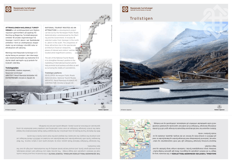
Havøysund Trollstigen Varanger Senja Andøya Meininga med Nasjonale turistvegar er å styrke Noreg sin posisjon i den internasjonale reiselivsmarknaden og medverke til å styrke lokalt næringsliv og gi grobotn for livskraft i distrikta. Trollstigplatået: Byggherre: Statens vegvesen, Nasjonale turistvegar Arkitekt: Reiulf Ramstad Arkitekter AS Entreprenør: Christie & Opsahl AS Lofoten NATIONAL TOURIST ROUTES AS AN ATTRACTION is a development project carried out by the Norwegian Public Roads Helgelandskysten Administration commissioned by the Storting and the Government. It includes 18 selected routes from Varanger in the north to Jæren in the south. The uniqueness of Atlanterhavsvegen these attractions lies in the spectacular Geiranger-Trollstigen Gamle StryneRondane architecture found at viewpoints, fjellsvegen Sognefjellet GaularValdresflye places of interest and visitors’ centres fjellet Aurlandsfjellet Hardangervidda Hardanger located amid magnificent scenery. 0837-12 grafisk.senter@vegvesen.no. ATTRAKSJONEN NASJONALE TURISTVEGAR er eit utviklingsarbeid som Statens vegvesen gjennomfører på oppdrag frå Storting og Regjering. Turistattraksjonen omfatter 18 utvalde vegstrekningar frå Varanger i nord til Jæren i sør. Spektakulær arkitektur i form av utsiktsplassar, stoppestader og servicebygg i storslått natur er attraksjonen sitt særpreg. Ryfylke The aim of the National Tourist Routes Jæren is to strengthen Norway’s position in the marketing of international tourism and to help promote local business activities as well as nurturing the vitality of rural districts. Trollstigen platform: Developer: Norwegian Public Roads Administration, National Tourist Routes Architec: Reiulf Ramstad Architects AS Contractor: Christie & Opsahl AS 0097-10 grafisk.senter@vegvesen.no Foto: Hege ReiulfLysholm Ramstad Foto: Reiulf Ramstad Jensen og Skodvin Arkitektkontor © Statens vegvesen © Statens vegvesen Lom Statens vegvesen har med attraksjonen Nasjonale turistvegar gjort sitt til å utvikle strekninga Geiranger-Trollstigen til eit endå meir spennande og komplett reisemål ved å nytte spektakulær arkitektur på rasteplassar, utsiktspunkt og servicebygg. E39 60 15 Stryn 60 Nasjonal turistveg Geiranger-Trollstigen går tett inntil nasjonalparkar og naturreservat. Vestnorsk fjordlandskap med Geirangerfjorden og Nærøyfjorden er med på UNESCO si verdsarvliste og femner om dei lengste, djupaste, smalaste og vakraste fjordane i verda. Langevatnet Hellesylt Geiranger E136 63 Volda The Geiranger-Trollstigen National Route passes close by national parks and a nature reserve. The West Norwegian Fjords with Geirangerfjorden and Nærøyfjorden are included on UNESCO’s World Heritage List and comprise the longest, the narrowest, the deepest and the most scenic fjords in the world. Ørsta 60 Stranda Sylte E39 Ålesund NASJONAL TURISTVEG GEIRANGER-TROLLSTIGEN er 106 kilometer lang og følgjer fv. 63 mellom Langevatn og Sogge bru. Reisa går gjennom frodige kulturlandskap, langs smaragdgrøne fjordar, i buktande svingar langs fjellsider og over høge snaufjell. With the National Tourist Routes as a key attraction, the Norwegian Public Roads Administration has helped make the stretch Geiranger-Trollstigen an even more captivating and complete travel destination by using spectacular architecture at picnic places, vantage points and service buildings. 15 63 Sykkylven Åndalsnes Sogge bru E136 64 62 Molde 64 E39 70 THE GEIRANGER-TROLLSTIGEN NATIONAL TOURIST ROUTE is 106 kilometres long and follows county road 63 between Langevatn and Sogge bridge. The journey takes you through lush cultural landscape, along emerald-green fjords, and around hairpin bends winding up the mountainsides, and high up over the bare mountains. Foto: Per Kollstad TROLLSTIGEN er legendarisk og gjennom nokre hektiske sommarmånader besøkjer eit stort tal menneskjer Trollstigen. For å byggje ein attraksjon som begeistrar og står seg over tid, er det viktig å ta i vare stemninga i dette unike naturlandskapet og ta omsyn til det barske klimaet. Stål og betong er grunnmaterialar i anlegget. Betongen framstår som vakker og levande gjennom fleire typar av overflatebehandling; frå vulkansk grove til silkemjuke flater. Hovedbygninga består av to huskroppar som foldar seg rundt kvarandre. Bygget inneheld mellom anna kafé og informasjon, men er også ein viktig synsstad ut mot landskapet og det rennande vatnet. Alle retningar i landskapet og alle fjelltoppar i nærleiken har vore med på å gi den komplekse geometrien til bygget. Den andre bygninga er forma som ein voll og fungerar som ein vernande barriere for elva Istra når ho er TROLLSTIGEN is legendary and attracts a large number of visitors during the few hectic months of summer. To build an attraction that is inspiring and that will endure over time, it is vital to retain the special atmosphere of this unique natural landscape and to make allowances for the rugged climate. Concrete and steel are the basic materials in the installation. The concrete emerges as a living and beautiful material through the use of different kinds of finishes: from the roughness of lava to satin-smooth surfaces. The main building consists of two building shells that enfold each other. The building houses both a café and an information centre, but at the same time it is also provides spectacular views of the landscape and the flowing water. The different directions of the landscape and the mountain tops in the near vicinity have all contributed to the complex geometry of the building. The other building is formed like a rampart and acts as a flood barrier for the River Istra when it reaches its highest Foto: Jiri Havran på sitt høgaste. Innvendig huser vollen toalett, kiosk og suvenirutsalg. Gangvegane og trappene fram til utsiktpunkta har jamn og god rytme og innbyr til vandring i og oppleving av det mektige landskapet. Den største utsiktsplattforma ligg dramatisk til i landskapet og stikk ut over ein kant med eit loddrett fall på ca 200 meter. Plattforma har forskjellige utsiktspunkt for den som ikkje tør å ta seg lengst ut. Vatnet har vore det viktigaste elementet i den arkitektoniske utforminga av staden. Nye tersklar med lengre vatnline enn breidda på vatnspegelet, er med og regulerer vassavrenninga. Mykje av den nordiske og spesielt den norske kulturen er tufta på tilhøvet til vatn. På Trollstigen kan vatnet opplevast som snø på fjella, som ein spegel, som rennande, som kontrollert fallande eller dramatisk som i eit fossefall. level. The building houses the service facilities, a kiosk and a souvenir shop. The walkways and steps out to the outlook points have an even, flowing rhythm and invite the traveller to stroll around and experience the mighty landscape. The largest viewing platform is dramatically located, jutting out over a ridge with a perpendicular drop of approximately 200 metres. This has different outlook points for those who dare not go out to the furthest point, while those who are bolder can go all the way to the tip of the platform where the railings end in a glass panel. Water has been the key element in the architectural design. A series of stepped pools with angular thresholds that widen the water’s surface help regulate the flow of the stream. Much of the uniqueness of Nordic culture, and Norwegian culture in particular, is based on our relationship to water. At Trollstigen, water can be experienced as snow on the mountains, as a glistening mirror, as a swirling but controlled cascade or as a dramatic waterfall. I 1905 KOM DET MIDLAR FOR Å BYGGJE EIN RIDEVEG over Stigfjellet, den såkalla Kløvstien. Men tankane om ein veg mellom Valldal og Rauma fanst der allereie. Trass i at mange meinte det var rein galskap å byggje veg over Stigfjellet, ga Stortinget i 1916 klarsignal og vegbygginga kom i gang eit par år seinare. På slutten av 1800-talet tok turismen til å vekse i området. Som eit klart marknadsføringstiltak fekk fjella rundt Trollstigen nye namn som Kongen, Dronninga, Bispen og Trollveggen. Knivsflåfossen i Geiranger vart til Dei sju systrene, og vegen over Stigfjellet vart altså til Trollstigen. Bygginga av sjølve fjellovergangen tok til i 1928 og var ei stor utfordring. I området var det bratt og rasfarleg, og mange gonger flaum og dårleg ver. På grunn av vinteren varte anleggsperioden frå midten av mai til september/oktober kvart år. Vegarbeidet gikk bra med få ulykker, og rallarane vart reine steinkunstnarar med veg- og bruarbeidet sitt. Den 31. juli 1936 opna Kong Haakon den nye vegen som da fikk namnet Trollstigen. Same år som Trollstigen opna i 1936, sto og Trollstigheimen klar på Alnesreset, det høgaste punktet på Trollstigen med 852 moh. Restauranten hadde plass til 180 gjestar. Huset vart fleire gonger skada av snøskred, seinast i 1963 og vart ikkje bygd opp att. I 1979 vart eit nytt serveringstilbod etablert på Stigrøra. For å kunne ta i vare staden sin verdi som ein av dei viktigaste turistattraksjonane i Noreg, er alle dei gamle anlegga rivne, og heile området framstår no i ei ny og moderne drakt. IN 1905 A LICENCE WAS GRANTED FOR THE BUILDING OF A HORSE TRAIL over Stigfjellet, the so-called Kløvstien track. But even then there were already thoughts of building a road between Valldal and Rauma. Although many people believed it was utter madness to build a road over Stigfjellet, in 1916 the Norwegian Parliament – the Storting – gave the go-ahead and the construction of the road commenced a couple of years later. At the end of the 19th century tourism in the area began to increase. As a deliberate marketing initiative, the mountains around Trollstigen were given new names such as Kongen (the King), Dronningen (the Queen), Bispen (the Bishop) and Trollveggen (the Troll Wall). The Knivsflåfossen waterfall in Geiranger was renamed De syv søstre (the Seven Sisters), and the road over Stigfjellet became Trollstigen (the Troll’s Ladder). The building of the mountain pass began in 1928 and was a huge challenge. The area was steep and prone to landslides, and often there was flooding and bad weather. Because of the long winter, the road construction period only lasted from the middle of May to September/October every year. The work went smoothly with few accidents, and the navvies showed their artistic skills as stonemasons in their work on the road and bridges. The new road, which was given the name Trollstigen, was opened on 31 July 1936 by King Haakon. In 1936, the same year as Trollstigen opened, Trollstigheimen was completed at Alnesreset, the highest point at 852 metres above sea-level. The restaurant could cater for 180 visitors. However, in 1963 the building was damaged in an avalanche and was not rebuilt. In 1979 a new restaurant was established at Stigrøra. In order to maintain the importance of the site as one of the prime tourist attractions in Norway, all the old buildings have been demolished, and the entire area has now emerged with a new and modern appearance.


