Atmospheric Structure 4
advertisement
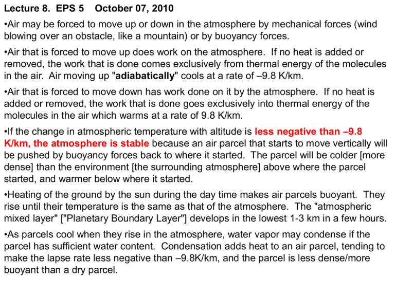
Lecture 8. EPS 5 October 07, 2010 •Air may be forced to move up or down in the atmosphere by mechanical forces (wind blowing over an obstacle, like a mountain) or by buoyancy forces. •Air that is forced to move up does work on the atmosphere. If no heat is added or removed, the work that is done comes exclusively from thermal energy of the molecules in the air. Air moving up "adiabatically" cools at a rate of –9.8 K/km. •Air that is forced to move down has work done on it by the atmosphere. If no heat is added or removed, the work that is done goes exclusively into thermal energy of the molecules in the air which warms at a rate of 9.8 K/km. •If the change in atmospheric temperature with altitude is less negative than –9.8 K/km, the atmosphere is stable because an air parcel that starts to move vertically will be pushed by buoyancy forces back to where it started. The parcel will be colder [more dense] than the environment [the surrounding atmosphere] above where the parcel started, and warmer below where it started. •Heating of the ground by the sun during the day time makes air parcels buoyant. They rise until their temperature is the same as that of the atmosphere. The "atmospheric mixed layer" ["Planetary Boundary Layer"] develops in the lowest 1-3 km in a few hours. •As parcels cool when they rise in the atmosphere, water vapor may condense if the parcel has sufficient water content. Condensation adds heat to an air parcel, tending to make the lapse rate less negative than –9.8K/km, and the parcel is less dense/more buoyant than a dry parcel. Question: Where does the energy come from for an air parcel to do this work on the atmosphere? The concept of atmospheric stability •The atmosphere is stable if air cannot move up or down spontaneously. A parcel that is displaced a little distance vertically tends to move back to where it started. •The atmosphere is unstable if air tends to move up or down spontaneously. A parcel that is displaced a little distance vertically tends to accelerate in the direction it was moved. •The atmosphere is neutral ("neutrally stable") if it neither tends to move back to where it started nor accelerates. Forces are balanced on both of these spheres. But one is stable, and the other unstable. The environment determines if the sphere (or an atmospheric air parcel) is stable, neutral, or unstable. The sphere is neutrally stable on a flat surface. Ambient lapse rates and parcel temperature changes. Schematic diagram showing stable (Curve A) and unstable (Curve B) temperature profiles for the ambient atmosphere, compared to the lapse rate followed by a parcel subjected to adiabatic vertical displacement. km Stability and lapse rates in the atmosphere 1 A 0 .5 B 290 295 300 ToK Heating of the ground and “dry convection”: Diagram of the lapse rate just before sunrise (stable) and in mid-afternoon (neutral or slightly unstable). Dry convection driven by solar heating stirs the lower atmosphere, creating the planetary boundary layer or mixed layer during daytime over land. DIURNAL CYCLE OF SURFACE HEATING/COOLING: ventilation of urban pollution z Subsidence inversion MIDDAY 1 km G Mixing depth 0 NIGHT MORNING T NIGHT MORNING AFTERNOON Vapor Pressure of Water Psat = A exp [B( 1/273.15 – 1/T)] A=6.11 mbar, B= 5308K. A=water vapor pressure at 0C. The pressure of H2O vapor in equilibrium with liquid water. ClausiusClapeyron relation. Water vapor pressure versus T. Moist pseudo-adiabatic lapse rate Air is heated by release of latent heat when water condenses: T will decline less rapidly than the dry adiabat Pressure (Mb) Temperature (C) -40 0 40 Ambient T -9.5 -6.4 -3.0 15 (->35) 600 4.2km -9.3 -5.4 1000 -13 200 11.8km -8.6 Dry Adb. -9.8 -58 -9.8 -9.8 G= -g/(cp +λ Dw/DT ) λ= latent heat of vaporization (J/kg); Dw/DT=change in spec humidity/K dew pt dew pt Atmospheric temperature and dewpoint for a typical summer day shows the "planetary boundary layer" or "atmospheric mixed layer", that develops as the sun heats the ground in the daytime. This graph is drawn from actual data obtained by Harvard's Forest and Atmosphere Studies group during an experiment (code name "COBRA") over North Dakota in August, 2000. What you see… Puffy little clouds, called fair weather cumulus, occurring over land on a typical afternoon. The lapse rate in the mixed layer is approximately adiabatic, and air parcels heated near the ground are buoyant. Each little cloud represents the top of a buoyant plume. (Photograph courtesy University of Illinois Cloud Catalog). Convective cloud over Amazonia 3 Z km latent heat release 2 1 Tdew 0 283 293 303 Temperature K [Photo: S. Wofsy, Manaus, Brazil, 1987.] cloud base Tdew = Tair Franconia Notch, NH, 09 Oct 2010 Solving a practical problem with EPS 5: What was the temperature at the summit of Mount Lafayette (but I forgot my thermometer) ? Franconia Notch, NH, 09 Oct 2010 summit – 150 m summit – in the clouds SUBSIDENCE INVERSION typically 2 km altitude Atmospheric lapse rates Altitude (km) Suppose the atmosphere has the structure at the left. 1. What are the scale heights at the surface and at 1.5 km? 2. What is the atmospheric lapse rate from 0 to 1.5 km? Is the atmosphere stable, unstable or neutral? 3. How high can a dry air parcel rise that is heated to 310 K at the ground? 4. How high will a wet air parcel rise from the ground, heated to 310K? Assume condensation starts at 290.2 K, and above that level the parcel lapse rate is -4.8 K/km. 1.5 0 285.3 300 Temperature (k) An example problem, worked out. Scale height = kT/mg = 29.34 x T = 8800 m (T=300) and 8370 m (T=285.3) Lapse rate = ( 285.3 – 300 ) / 1.5 = -9.8 K/km; neutral How high will a dry parcel rise: The parcel will cool at the rate of –9.8 K/km. When it cools to 285.3 K, it will have the same temperature as the environment, and this will be its equilibrium level. ( 285.3 – 310) / (-9.8) = 2.5 km. How high will a wet parcel rise: Solve the problem in two steps: first determine how high the parcel rises at the dry adiabat to the point where condensation starts. Then determine how high it has to go, cooling at the wet adiabat, to reach the atmospheric temperature. The parcel will cool at the rate of –9.8 K/km up to 290.2 K. That's –19.8 K temperature change, which it will reach at 2 km. When it cools to 285.3 K, it will have cooled by an additional 4.8 K, which requires 1 km more rise. The wet parcel will move up 3 km. Lecture 8. EPS 5 October 06, 2010 •Air may be forced to move up or down in the atmosphere by mechanical forces (wind blowing over an obstacle, like a mountain) or by buoyancy forces. •Air that is forced to move up does work on the atmosphere. If no heat is added or removed, the work that is done comes exclusively from thermal energy of the molecules in the air. Air moving up "adiabatically" cools at a rate of –9.8 K/km. •Air that is forced to move down has work done on it by the atmosphere. If no heat is added or removed, the work that is done goes exclusively into thermal energy of the molecules in the air which warms at a rate of 9.8 K/km. •If the change in atmospheric temperature with altitude is less negative than –9.8 K/km, the atmosphere is stable because an air parcel that starts to move vertically will be pushed by buoyancy forces back to where it started. The parcel will be colder [more dense] than the environment [the surrounding atmosphere] above where the parcel started, and warmer below where it started. •Heating of the ground by the sun during the day time makes air parcels buoyant. They rise until their temperature is the same as that of the atmosphere. The "atmospheric mixed layer" ["Planetary Boundary Layer"] develops in the lowest 1-3 km in a few hours. •As parcels cool when they rise in the atmosphere, water vapor may condense if the parcel has sufficient water content. Condensation adds heat to an air parcel, tending to make the lapse rate less negative than –9.8K/km, and the parcel is less dense/more buoyant than a dry parcel. FORCES BEHIND THE ATMOSPHERIC CIRCULATION 1. The pressure-gradient force – application to the sea breeze. 2. The Coriolis force We want to explain circulation patterns like these, which take place over large enough scales that the rotation of the earth has an effect on moving air parcels: Sea-breeze effect driven by the pressure-gradient force Coriolis force: fictitious force due to Earth’s rotation …must be taken into account because our frame of reference is the rotating Earth! latitude λ distance from axis r = Rcos λ An observer fixed in space sees a point on Earth at latitude λ moving with a translational velocity V = (2πRcos λ)/t where t = 24 h At the latitude of Boston (42o ), V = 1250 km h-1 (fast!) Define angular velocity ω = 2π/t so that V = ωr THE CORIOLIS FORCE: fictitious force applied to moving bodies in rotating frame of reference Consider an observer at the North Pole (O) shooting a ball at a target T: From the observer’s perspective (rotating frame of reference), the ball has been deflected to the right while the target has remained fixed; an observer fixed in space would see the target move and no deflection of the ball Coriolis Force applied to meridional motion 1 In the absence of torque, a spinning object (here the ball) conserves its angular momentum L = mvr where v is its velocity and r is its distance from the rotation axis. 1. Consider a ball at rest at latitude λ1 ; its velocity is v1 = V(λ1 ) 2. Throw it to latitude λ2 ; it conserves its angular momentum L1 L2 mv1r1 mv2 r2 v2 V (1 ) cos 1 V (1 ) V (2 ) cos 2 3. Therefore the ball acquires an eastward velocity in the rotating frame of reference as it moves northward; it is deflected to the right. 4. Similar deflection to the right takes place if ball is thrown from λ2 to λ1 Coriolis force applied to longitudinal motion Equilibrium of forces for a ball at rest on Earth’s surface Earth is not a perfect sphere! = mv2 /r Equatorial diameter = 12,756 km Polar diameter = 12,714 km 1. For a ball at rest, v = V(λ) 2. Throw the ball eastward; v > V(λ) so the centrifugal force increases; ball is deflected to the right. 3. Throw the ball westward: v < V(λ) so the centrifugal force decreases; ball is deflected to the right. GENERAL FORMULATION OF CORIOLIS FORCE • Coriolis force is perpendicular to direction of motion, to R in northern hemisphere and to L in southern Coriolis hemisphere 2 v sin c Acceleration Angular velocity of Earth (2/24h) Latitude Speed of moving object In rotating frame of reference • Coriolis force is zero at equator, strongest at the poles; sign change—acts to the right of the velocity in the NH, the left in the SH • Coriolis force is weak and important only for large scales of motion: examples of a basketball vs. a missile. GEOSTROPHIC FLOW: equilibrium between P-gradient force (p) and Coriolis force (c) Isobar • steady • parallel to isobars • speed ~ pressure gradient N hemisphere example Geostrophy For air in motion, not on the equator, not near the surface •Coriolis Force ≈ Pressure gradient force •Air motion is ≈ parallel to isobars The geostrophic approximation is a simplification of complicated atmospheric motions. This approximation is applied to synoptic scale systems and circulations, roughly 1000 km. (It is easiest to think about measuring the pressure gradient at a constant altitude, although other definitions are more rigorous. ) Circulation of air around regions of high and low pressures in the Northern Hemisphere. Upper panel: A region of high pressure produces a pressure force directed away from the high. Air starting to move in response to this force is deflected to the right (in the Northern Hemisphere), giving a clockwise circulation pattern. Lower panel: A region of low pressure produces a pressure force directed from the outside towards the low. Air starting to move in response to this force is also deflected to the right, rotating counter-clockwise. Directions of rotation of the wind about high or low centers are reversed in the Southern Hemisphere, as explained earlier in this chapter. Low P add mean W wind Low pressure (cyclonic) circulation, embedded in the Jet Stream Low P The effect of friction around a high pressure region is to slow the wind relative to its geostrophic velocity. This causes the pressure force to slightly exceed the Coriolis force. The three forces add together as shown in the figure. Air parcels gradually drift from higher to lower pressure, in the case shown here, from the center of a high pressure region outward. An analogous flow (inward) occurs in a lowpressure region. Air converges near the surface in low pressure centers, due to the modification of geostrophic flow under the influence of friction. Air diverges from high pressure centers. At altitude, the flows are reversed: divergence and convergence are associated with lows and highs respectively, closing the circulation through analogous processes noted in the sea breeze example March 02, 2008 http://www.weather.com/maps/maptype/currentweatherusnational/index_large.html Goes East Movie: Oct 2010
