Introduction - Information Technology
GEOS 115
Introduction to Oceanography
What is Oceanography?
• The goal of understanding the oceans through the physical, geological, chemical and biological sciences
• The common fields of science involved in the study of the oceans include
Geology
Geography
Geophysics
Physics
Chemistry
Geochemistry
Mathematics
Meteorology
Botany
Zoology
2
Geological Oceanography
History of the ocean basins
Plate tectonics
Sediments and rocks of the seafloor
Coastal/shoreline processes
• Beaches/ Barrier Islands
• Deltas
• Estuaries
• Reefs
3
Physical Oceanography
Currents and circulation
Wave and tidal dynamics
Meteorology (Ocean-Atmosphere coupling)
• Heat transfer
• Water cycle
4
Chemical Oceanography
Composition of seawater
Origin of seawater
Interaction between water and other systems
• Geological
• Biological
Effects of river discharge and sea water
5
Biological Oceanography
Study of marine organisms
• Plantic
Phyto and zooplankton
• Nektic
Marine vertebrates (fish, reptiles)
• Benthic
Sessile and mobile
Mostly invertebrates and algae and plants
Relationship between organisms and the oceanic environment
6
The Nature of Science
Systematic process of asking questions and testing answers
Gathering data
Interpreting data
Forming tentative answers (hypotheses)
Experimenting (manipulating) in nature or laboratory
Based on the assumption that rules that govern nature are immutable
7
8
History of Oceanography
Paleolithic
• Development of barbed spears, harpoons, fish hooks
• Settlements along coasts (kitchen middens)
Egyptians
• Nets, boats
• First recorded ocean voyage (Snefru 3200 B.C.E)
• First exploration 2750 B.C.E. (Hannu)
Phoenicians (1200 B.C.E. – 146 B.C.E)
• Trade and commerce
• Navy
• Exploration (circumnavigated Africa 590 B.C.E.)
9
Navigational
Chart
Pacific
Islanders
•Migration along SW Pacific
2500 B.C.E.
•Extensive migrations in 1500
B.C.E.
•By 450-600 C.E. Polynesians had colonized the Pacific from
New Zealand to Hawaii to
Easter Island
•Navigation
•Observation of stars
•Observation of waves, clouds, birds and distinctive land smells
10
The Greeks
Herodotus (450 B.C.E.) view of the world
• Mediterranean Sea, Europe, Asia and Libya, surrounded by a continuous ocean Thallassa
Pytheas; sailed to Iceland (325 B.C.E.) and worked out a method of determining latitude
Eratosthenes (264-194 B.C.E.), librarian at
Alexandria, Egypt, determined the earth’s circumference, also ‘invented’ latitude and longitude
• 40,000Km (24,840 mi) vs 40,031 Km (24,860 mi)
11
The World of Herodotus
12
Pytheas- Determining Latitude
• Measure the angle between the horizon and the North Star,
Polaris (a star directly above the North Pole) or the Southern Cross for the southern hemisphere
• Latitude north of the equator is the angle between the two sightings
13
Erastosthenes’ Determination of the Circumference of the Earth
14
Hipparchus: Chart with Latitude &
Longitude
15
The Romans
Strabo (63 B.C.E-24 C.E.) observed volcanic activity and concluded that land periodically rose and sank causing the sea to retreat and advance from the continents. He also determined that rivers eroded the continents and brought and deposited sediment to the sea
Pliny the Elder (23-79 C.E.) related the phases of the moon to tides as well as reported on the currents through the
Strait of Gibraltar
16
The Romans
Ptolemy (127-151 C.E.) produced the first
“world” atlas. He introduced regularly spaced lines of latitude and longitude in in degrees, minutes and seconds of arc, but he accepted a circumference of only
29,000 Km for the earth. It established the Roman world view from the British
Isles and northern Europe to Asia and
Africa. It was a mayor catalyst for exploration in subsequent centuries (i.e.
Columbus)
Christianity identified Alexandria's library with paganism and burned it in 415 C.E.; western intellectual development in ocean sciences declined during Dark Ages
17
Ptolemy’s Geographica
18
The Middle Ages- The Arabs
The Arabs (Moors of North Africa 700-1492)
• Dominated trade and commerce in the
Mediterranean and east after the fall of the Roman empire and the rise of Christianity in Europe the
Prophet Muhammad encouraged travel even "as far as China" for learning. The wealth of cities depended upon trade. And the faith of Islam asked of the faithful the most powerful of all reasons for travel, the Pilgrimage.
• Employed the Chinese compass
• Invented the astrolabe which was used to read the position of the stars and planets
• The dhow (sailing vessel) utilized the winds of the monsoons to go north in the summer and south in the winter. Dhows went up and down the coast of
East Africa, and from the Red Sea to the "Spice
19
Islands" of Indonesia, and to Southeast Asia
The Dhow
20
The Middle Ages- The Arabs
El-Mas’ude (d. 956), first description of the reversal of the currents due to the seasonal monsoon winds
Al-Idrisi made a globe or sphere of silver weighing 400 kilograms for the Christian King
Roger II of Sicily. Some scholars regard him as the greatest geographer and mapmaker of the
Middle Ages. He put together a geographical encyclopedia with many maps
21
Arab Trade Routes
22
The Middle Ages-The Chinese
Ming Dynasty 1405 – 1433 significant
Chinese contributions
Invented the compass
Zheng commanded a fleet, 317 ships
37,000 men to Indian ocean, Indonesia, around Africa to the Atlantic
Chinese made several other inventions including, central rudder, water tight compartments and sophisticated sails on multiple masts.
Unfortunately contributions ended in 1433 because they believed other cultures could not contribute anything else to them
23
The Middle Ages- The
Europeans
Increase knowledge in navigation with harbor-finding charts (portolanos)
The Venerable Bede (673-735) illustrated his account of the tides with data from
British coast
Abbot Wallingford of St. Albans (1200) followed Bede’s work by collecting tidal data for London (“Flod at London Brigge”)
By 1300 Europeans had established successful trade routes
24
The Middle Ages- The Vikings
Engaged in extensive exploration, trade and colonization (793-1066) during a warm period (greenhouse)
Sailed to Iceland in 871, up Russian rivers, through central and eastern Europe and western Asia and to the
Mediterranean
Erik the Red (982) sailed to Greenland
Leif Eriksson reached North America
(Newfoundland) in 1002, founded a colony
(Vinland) that lasted until 1020
By the 13 th century climate began to cool again and marked an end of Viking exploration 25
The Age of Discovery- Portugal
Prince Henry the Navigator of Portugal (1394-
1460), established a naval observatory at
Sagres for the teaching of navigation, astronomy and cartography (1450)
• Sent countless expeditions down the west coast of
Africa to secure trade routes and establish colonies
Bartholomeu Dias rounded the Cape of Good
Hope in 1487
Vasco da Gama, followed Dias and charted the east coast of Africa to India in 1498
By 1511 the Portuguese conquered the spice routes had access to the Spice Island and extended trade to China and Japan in 1513
26
27
The Age of Discovery- Spain
Christopher Columbus (1451-1506) made
4 voyages west to find a route to the indies.
• On October 12, 1492 he came upon the new world at San Salvador Island, Bahamas
Amerigo Vespucci (1454-1512) made several voyages to the new world for
Spain and Portugal and explored
10,000Km of S. American coastline. In
1507 the cartographer Martin
Waldseemuller applied the name ‘America’ to the continent
28
29
The Age of Discovery
The ‘northwest passage’
• Martin Frobisher (1576, 1577, 1578),
Henry Hudson (1607,1608, 1609, 1610) and William Baffin (1615, 1616)
Sir Francis Drake (1540-1596) and the Golden Hinde completed circumnavigation 1580 after plundering Spanish shipping, exploring the west coast of N.
America
30
Sir Francis Drake’s ship
The Golden Hinde
A replica in Southwark section of London
31
32
Johannes Van Keulen’s
Great New and Improved Sea-Atlas or
Water-World 1682-1684
33
Navigational Aids
Compass
• Chinese
Sextant
• Halley
Chronometer
• John Harrison
Charts
• Hydrographic offices France (1720) and
England (1795)
34
Instrumentation
Arabic Astrolabe
Harrison’s H4 Chronometer
Early Astrolabe
Read altitude of Sun or stars against a curved scale
Sextant c. 1792
35
Greenwich Observatory
East and West- The Prime Meridian at Greenwich
Officially Established in 1884 at a conference in
Washington, DC
Shepard Gate Clock, 1852
First to provide Greenwich Mean
Time (GMT) to the public
36
MARINE SCIENCE:BEGINNINGS
To maintain marine superiority, British undertook voyages of discovery Captain James
Cook made 3 voyages to map Pacific between
1768 - 1779.
• 1768 voyage of the Endeavor Primary mission was to flex military muscle in south seas. Transported scientists to Tahiti. Searched for southern continent. Charted New
Zealand, Great Barrier Reef and many small islands.
• Later on the Resolution, charts Tonga and Easter Island.
Sails as far south as 71 degrees but never sees
Antarctica.
• In 1776 Cook attempts to find Northwest Passage around Alaska and Canada. Charts Hawaii and West
Coast of N.A. Returns to Hawaii and is killed in 1779.
• conquered scurvy - vitamin C deficiency
• Made soundings, observations on winds, currents, temperatures.
37
38
The Cutty Sark
39
MARINE SCIENCE:BEGINNINGS
Benjamin Franklin (1706-1790) and
Timothy Folger- The Gulf Stream chart 1769
Thomas Jefferson and the creation of the US Coast and Geodetic Survey
(1807)
The US Naval Hydrographic Office
(1830)
40
Franklin-Folger Map of the Gulf
Stream 1769
SST Satellite Map for 1996
41
Lt. Matthew
Maury
Chart of the Gulf Stream
Lt. Matthew Maury (1806-1873) founded Naval
Depot of Charts and Instruments (1842), began systematic collection of wind and current data.
Published The Physical Geography of the Sea
(1855) the first true oceanographic text
42
Oceanography: The Science Begins
Alexander von Humboldt (1769-1859) author of Cosmos, made observation
(1799-1804) on the north flowing current off the western coast of S. America
Charles Darwin (1809-1882) entered scientific scene as a naturalist on the voyage of the HMS Beagle, a British survey ship, from 1831 - 1836. Best know for theory of evolution published in Origin
of Species. He also published structure and distribution of coral reefs which described how subsidence of oceanic islands produces progressive changes in reef from fringing reef to atoll formation.
43
44
The Challenger Expedition
1st. large scale voyage to study the Marine environment in 1872 under chief scientist C.
Wyville Thompson. To investigate:
• 1) Physical conditions of deep sea in ocean basins.
• 2) Chemical composition of SW at all depths.
• 3) Physical and chemical characteristics of sea floor and its origin.
• 4) Distribution of life at all depths and seafloor.
3.5 yr voyage logging 69000 mile took deep sea soundings, bottom dredges, open water trawls and water temperature observations.
• netted and classified 4717 new species of organisms, deepest sounding in Marianas trench 26,850 ft. collected Manganese Nodules
45
The Cruise of the Challenger
1872-1876
46
The Challenger Expedition
Dredging and sounding
Sieving bottom samples
47
The Challenger Expedition
Zoological Laboratory
Chemical Lab
In the equatorial mid-Atlantic Biological Dredge
48
Deep sea deposits, shells of microscopic organisms that make-up the muds and clays of the seafloor from the
Challenger
Expedition
49
Scientific Equipment - Early
Oceanographic Tools
Benthic Dredge
Trawl
Sounding Device
Dredging
50
Collection Cup
The Rise of the Oceanographic
Institutions
Stazione Zoologica at Naples, Italy 1870’s
Marine Biological Laboratory (MBL) 1880
Woods Hole, MA
Scripps Institution of Oceanography 1903
(1925) La Jolla, CA
Prince Albert I of Monaco established an oceanographic institute in Paris and the
Musee Oceanographique at Monaco, 1910
Woods Hole Oceanographic 1930
Institution (WHOI) Woods Hole, MA
Numerous others in other countries
51
SCRIPPS
52
WHOI
53
Oceanography in the 20
th
Century
In 1934, deep-sea researcher William Beebe and
Barton made their world record descent to a half a mile (3,028 feet) beneath the surface of the ocean off Nonsuch Island, Bermuda in the Bathysphere, a hollow steel ball only 4' 9'' in diameter. He and two other men dove in this submersible, lowered and raised by a thin steel cable affixed to a winch on a barge. Beebe observed deep-sea fish and other marine organisms in their deep-sea habitat, an environment that no one else had ever explored firsthand
In 1943, when Jacques-Yves Costeau and Emile
Gagnan perfected the fully automatic compressed air
Aqualung, the precursor to modern-day SCUBA systems. This technological advance opened the exploration of shallow-water ocean habitats to thousands of researchers from around the world.
54
Oceanography in the 20
th
Century
Plate Tectonic theory is born in 1960's
The development of submersibles allowed the finding of hydrothermal vents by Alvin (1977) and further documentation of sea floor events; similarly ROVs and AUVs have allowed greater sea exploration (e.g., Titanic discovery)
In 1978 the first satellite dedicated to ocean studies was launched and subsequent satellites now provide data on circulation, currents, temperatures, ice cover, color, and topography of the ocean surface
From the 1968-1983 the Glomar Challenger discovers much information about the ocean's bottom through drilling activities through the
Deep Sea Drilling Program
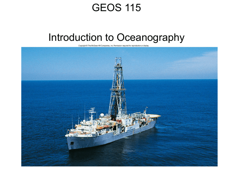
Since 1985 the work of the Ocean Drilling
Program continued with the JOIDES Resolution 55
Glomar Challenger
56
Submersibles
57
JOIDES Resolution
Satellite Oceanography
Seasat Geosat Topex
ERS-2 Seastar
59
False Color Satellite Imagery
60
High to Low (Red to purple) concentrations of phytoplankton
61
Figure 1.17b
62
