LAKE BAIKAL - World of Teaching
advertisement
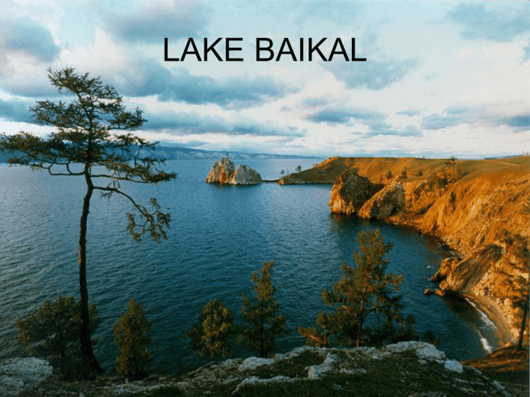
LAKE BAIKAL LAKE BAIKAL • Situated in south-east Siberia, the 3.15million-ha Lake Baikal is the oldest (25 million years) and deepest (1,700 m) lake in the world. It contains 20% of the world's total unfrozen freshwater reserve. Known as the 'Galapagos of Russia', its age and isolation have produced one of the world's richest and most unusual freshwater faunas, which is of exceptional value to evolutionary science. GANGES RIVER GANGES RIVER GANGES RIVER • Ganges River, Hindi Ganga, great river of the plains of northern India. Although officially as well as popularly called the Ganga in Hindi and in other Indian languages, internationally it is known by its conventional name, the Ganges. From time immemorial it has been the holy river of Hinduism. For most of its course it is a wide and sluggish stream, flowing through one of the most fertile and densely populated regions in the world. Despite its importance, its length of 1,560 miles (2,510 km) is relatively short compared with the other great rivers of Asia or of the world. HUANG HO RIVER HUANG HO RIVER • Traditionally, it is believed that the Chinese civilization originated in the Yellow River basin. The Chinese refer to the river as "the Mother River" and "the cradle of the Chinese civilization". During the long history of China, the Yellow River has been considered a blessing as well as a curse and has been nicknamed both "China's Pride" INDUS RIVER INDUS RIVER • It is one of the world’s longest rivers, with a length of 1,800 mi (2,900 km). Its annual average flow of 272 billion cu yd (207 billion cu m) is twice that of the Nile. It rises in southwestern Tibet and flows northwest through valleys of theHimalayas. After crossing into the Kashmir region, it continues northwestward through the Indian- and Pakistani-administered areas and then turns south into Pakistan IRRAWADDY RIVER IRRAWADDY RIVER • The Irrawaddy River or Ayeyarwady River is a river that flows from north to south through Burma(Myanmar). It is the country's largest river and most important commercial waterway. Originating from the confluence of the N'mai and Mali rivers, it flows relatively straight North-South before emptying through the Irrawaddy Delta into the Andaman Sea. TIGRIS AND EUPHRATES TIGRIS AND EUPHRATES TIGRIS AND EUPHRATES • The Tigris (Arabic, Shatt Dijla; Turkish, Dicle) rises in a lake in the mountains north of Diyarbakir, in southeastern Turkey. It picks up major tributaries, the Zab rivers, downstream from Mosul, then the Diyala, just past Baghdad - flowing some 1,180 miles (1,900 km). It ends at the confluence of the Euphrates, in southeast Iraq, to form the Shatt al-Arab, which empties into the Gulf. With its short tributaries flowing directly from the mountains, it floods in April, about one month before the Euphrates, and with about 50 percent greater flow. The Euphrates (Arabic, Furat; Turkish, Firat) also originates in Turkey, from a spring in the Taurus mountains. It flows for 1,740 miles (2,800 km), passing through northern Syria and providing that country with an important water source. In 1973, Syria completed construction of the large Euphrates Dam. From Syria, the Euphrates flows into Iraq, where it joins the Tigris. YANGTZE RIVER YANGTZE RIVER • The Yangtze River (Changjiang), over 6,300 kilometers long, is the largest and longest river in China, and the third-longest in the world, next only to the Nile in northeast Africa and the Amazon in South America. The source of the Yangtze River lies to the west of Geladandong Mountain, the principal peak of the Tanggula Mountain chain in the Qinghai-Tibetan Plateau, southwest of China. The river flows from west to east through provinces of Qinghai, Tibet, Sichuan, Yunnan, Sichuan, Hubei, Hunan, Jiangxi, Anhui and Jiangsu as well as the city of Shanghai, finally emptying into the East China Sea. With plenty of rainfall all year round, the Yangtze River is named the golden watercourse. SALWEEN RIVER SALWEEN RIVER • Salween River forming the boundary between Burma and Thailand. Steep canyon walls line the swift, powerful andundammed Salween, one of the longest free-flowing rivers in the world. Its extensive drainage basin supports a biodiversity comparable with the Mekong and is home to about 7 million people. MEKONG RIVER MEKONG RIVER • In English the river is called "the Mekong River", derived from "Mae Nam Khong", a term of both Thai and Lao origin. In the Lao-Thai toponymy, all great rivers are considered "mother rivers" signalled by the prefix "mae", meaning "mother", and "nam" for water. In the Mekong's case, Mae Nam Khong means Khong, Mother of Water.[3] "Khong" is derived from the Sanskrit "ganga", meaning the Ganges. Many Northern Thai and Laos locals refer to it as the "River Khong" CASPIAN SEA CASPIAN SEA • The Caspian Sea, the largest lake in the world, is located in the northern Iran. The Caspian Coast including the three littoral provinces of Gilân (center Rasht), Golestân (center Gorgân) and Mâzanderân (center Sâri), with its thick forests and intensive rice cultivation presents a striking contrast to the dry inner plateau of Iran. The picturesque provinces of Golestân, Mâzanderân and Gilân bound by the Caspian Sea in the north and, Alborz(Elborz) Range in the south, are divided into a multitude of valleys whose rivers drain into the sea. DEAD SEA DEAD SEA • There are no fish or any kind of swimming, squirming creatures living in or near the water. There are, however, several types of bacteria and one type of algea that have adapted to harsh life in the waters of the Dead Sea. What you'll see on the shores of the Sea is white, crystals of salt covering EVERYTHING. And this is no ordinary table salt, either. The salts found in the Dead Sea aremineral salts, just like you find in the oceans of the world, only in extreme concentrations. The water in the Dead Sea is deadly to most living things. Fish accidentally swimming into the waters from one of the several freshwater streams that feed the Sea are killed instantly, their bodies quickly coated with a preserving layer of salt crystals and then tossed onto shore MT. EVEREST MT. EVEREST • is the world'shighest mountain at 8,848 metres (29,029 ft) abovesea level. Everest is in the Mahalangur section of theHimalaya on the Nepal-China (Tibet) border. Its massifincludes neighboring peaks Lhotse (8516m), Nuptse(7855m), and Changtse (7580m). K-2 K-2 • K2 is the second-highest mountain on Earth, afterMount Everest. With a peak elevation of 8,611 m (28,251 feet), K2 is part of the Karakoram Range, and is located on the border[2] between Gilgit, in GilgitBaltistan of Pakistan and the Taxkorgan Tajik Autonomous County of Xinjiang, China.[3][note] It is more hazardous to reach K2 from the Chinese side; thus, it is mostly climbed from the Pakistani side. DASHT – E KAVIR DASHT – E KAVIR • Dasht-e Kavir ( دشت كويرin Persian), also known asKavir-e Namak or Great Salt Desert is a large desert lying in the middle of the Iranian plateau. It is about 800 kilometers (497 mi) long and 320 kilometers (198 mi) wide with a total surface area of about 77,600 square kilometers (~30,000 mi²), making it the world's 23rd largest desert[2]. The area of this desert stretches from the Alborz mountain range in the north-west to the Dasht-e Lut ("Emptiness Desert") in the south-east and is partitioned between the Iranian provincesof Khorasan, Semnan, Tehran, Isfahan and Ya zd. It is named after the salt marshes (kavirs) located there. DASHT – E LUT DASHT – E LUT • Dasht-e Lut, also spelledDasht-i-Lut, is a large saltdesert in southeasternIran and is theworld's 25th largest desert. • Iran is climatically part of the Afro-Asian belt of deserts that stretch from the Cape Verde islands off West Africaall the way toMongolia nearBeijing, China. The patchy, elongated, light-colored feature in the foreground (parallel to the mountain range) is the northernmost of the Dasht dry lakes that stretch southward 300 kilometers (186 miles). In near-tropical deserts, elevated areas capture most precipitation. As a result, the Dasht-e Lut is generally considered to be an abiotic zone. KARAKUM KARAKUM • TheKarakum Desert, also spelledKaraKumand Gara Gum(“Black Sand”) (Turkmen:Garagum,Russian: Каракумы) is a desert in Central Asia. It occupies about 70 percent, or 350,000 km², of the area of Turkmenistan. GOBI GOBI • Gobi is a large desert region in Asia. It covers parts of northern and northwestern China, and of southern Mongolia. The desert basins of the Gobi are bounded by the Altai Mountains and the grasslands and steppes of Mongolia on the north, by the Hexi Corridor and Tibetan Plateau to the southwest, and by the North China Plain to the southeast. The Gobi is most notable in history as part of the great Mongol Empire, and as the location of several important cities along the Silk Road. RUB – AL KHALI RUB – AL KHALI • is one of the largest sand deserts in the world,[1] encompassing most of the southern third of the Arabian Peninsula, including southern Saudi Arabia, and areas of Oman, the United Arab Emirates and Yemen. The desert covers some 650,000 square kilometres (250,000 sq mi) (the area between long. 44°30′ −56°30′E., andlat. 16°30′ −23°00′N)[2] THAR - SINDH THAR - SINDH • Sindh (pronounced [sɪnd̪ʱ]: Sindhi: سنڌ, Urdu: )سندھis one of the five provinces of Pakistan and historically is home to the Sindhi people. It is also locally known as the "Mehran" ( ;مهراڻRiver). Sindhi Muslims are the largest population in the province, but other cultural, religious and ethnic groups also reside in Sindh. The neighboring regions of Sindh are Balochistan to the west and north, Punjab to the north, Gujarat andRajasthan to the southeast and east, and the Arabian Sea to the south. The main language spoken isSindhi. The name is derived from the Indus River that courses through it, and was known to the Assyrians(as early as the seventh century BC) as Sinda, to theGreeks as Indos, to the Romans as Indus, to thePersians as Abisind, to the Arabs as Al-Sind, and to the Chinese as Sintow. To the Javanese the Sindhis have long been known as the Santri. DECCAN PLATEAU DECCAN PLATEAU • Deccan Plateau is a large plateau in India, making up the majority of the southern part of the country. It rises a hundred meters high in the north, rising further to more than a kilometre high in the south, forming a raised triangle nested within the familiar downward-pointing triangle of the Indian subcontinent's coastline. IRANIAN PLATEAU IRANIAN PLATEAU • Iranian plateau (or in much less common use: the Persian plateau,[1][2] is a geological formation inSouthwest Asia. It is the part of the Eurasian Platewedged between the Arabian and Indian plates, situated between the Zagros mountains to the west, the Caspian Sea and the Kopet Dag to the north, theHormuz Strait and Persian gulf to the south and theIndus River to the east in Pakistan. TIBETAN PLATEAU TIBETAN PLATEAU • Plateau is a vast, elevated plateau inCentral Asia[1][2][3][4] covering most of the Tibet Autonomous Region and Qinghai, in addition to smaller portions of western Sichuan, southwesternGansu, and northern Yunnan in Western China andLadakh in Indiacontrolled Kashmir. It stretches approximately 1,000 kilometres (620 mi) north to south and 2,500 kilometres (1,600 mi) kilometers east to west. The average elevation is over 4,500 metres (14,800 ft), and all 14 of the world's 8,000 metres (26,000 ft) and higher peaks are found in the region. Sometimes called "the roof of the world," it is the highest and biggest plateau, with an area of 2.5 million km2 (0.97 million sq. mi., or about four times the size of France).
