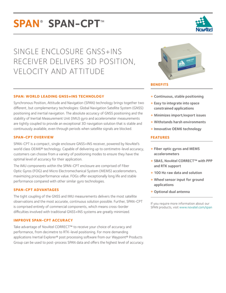
SPAN® SPAN-CPT™
SINGLE ENCLOSURE GNSS+INS
RECEIVER DELIVERS 3D POSITION,
VELOCITY AND ATTITUDE
BENEFITS
SPAN: WORLD LEADING GNSS+INS TECHNOLOGY
++ Continuous, stable positioning
Synchronous Position, Attitude and Navigation (SPAN) technology brings together two
different, but complementary technologies: Global Navigation Satellite System (GNSS)
positioning and inertial navigation. The absolute accuracy of GNSS positioning and the
stability of Inertial Measurement Unit (IMU) gyro and accelerometer measurements
are tightly coupled to provide an exceptional 3D navigation solution that is stable and
continuously available, even through periods when satellite signals are blocked.
++ Easy to integrate into space
constrained applications
SPAN-CPT OVERVIEW
FEATURES
SPAN-CPT is a compact, single enclosure GNSS+INS receiver, powered by NovAtel’s
world class OEM6® technology. Capable of delivering up to centimetre-level accuracy,
customers can choose from a variety of positioning modes to ensure they have the
optimal level of accuracy for their application.
++ Fiber optic gyros and MEMS
accelerometers
The IMU components within the SPAN-CPT enclosure are comprised of Fiber
Optic Gyros (FOG) and Micro Electromechanical System (MEMS) accelerometers,
maximizing price/performance value. FOGs offer exceptionally long life and stable
performance compared with other similar gyro technologies.
++ 100 Hz raw data and solution
SPAN-CPT ADVANTAGES
The tight coupling of the GNSS and IMU measurements delivers the most satellite
observations and the most accurate, continuous solution possible. Further, SPAN‑CPT
is comprised entirely of commercial components, which means cross-border
difficulties involved with traditional GNSS+INS systems are greatly minimized.
IMPROVE SPAN-CPT ACCURACY
Take advantage of NovAtel CORRECT™ to receive your choice of accuracy and
performance, from decimetre to RTK-level positioning. For more demanding
applications Inertial Explorer® post processing software from our Waypoint® Products
Group can be used to post-process SPAN data and offers the highest level of accuracy.
++ Minimizes import/export issues
++ Withstands harsh environments
++ Innovative OEM6 technology
++ SBAS, NovAtel CORRECT™ with PPP
and RTK support
++ Wheel sensor input for ground
applications
++ Optional dual antenna
If you require more information about our
SPAN products, visit www.novatel.com/span
SPAN-CPT™
SPAN SYSTEM PERFORMANCE1
PHYSICAL AND ELECTRICAL
ENVIRONMENTAL
Horizontal Position Accuracy
(RMS) Dimensions
152 x 168 x 89 mm
Weight
2.28 kg
Power
Power consumption 16 W max
Input voltage +9 to +18 VDC
Antenna Port Power Output
Output voltage +5 VDC
Maximum current 100 mA
Connectors
Power and I/O
MIL-DTL-38999 Series 3
Antenna Input
TNC Female
Temperature
Operating -40°C to +65°C
Storage -50°C to +80°C
Humidity 95% non-condensing
Waterproof
MIL-STD-810F, 506.4,
Procedure I
COMMUNICATION PORTS
• GPS-700 series antennas
(dual-frequency required)
• ANT series antennas (dualfrequency required)
• RF cables–5, 10 and 30 m
lengths
• Inertial Explorer postprocessing software
Optional Dual Antenna7
Single point L1/L2
1.2 m
NovAtel CORRECT™
»»SBAS2
60 cm
»»DGPS
40 cm
»»PPP3
4 cm
»»RTK
1 cm + 1 ppm
Data Rate
GPS measurement
20 Hz
GPS position
20 Hz
IMU measurement
100 Hz
INS solution
Up to 100 Hz
4
Time Accuracy 20 ns RMS
Max Velocity5
515 m/s
IMU PERFORMANCE 6
Gyroscope Performance
Gyro technology
FOG
Output range
±375°/s
Bias20°/hr
Bias stability
±1°/hr
Scale factor
1500 ppm
Angular random walk
0.0667°/√hr (max)
Accelerometer Performance
Range
±10 g
Bias
50 mg
Bias stability
±0.75 mg
Scale factor
4000 ppm
RS-232 UART COM
2
USB Device
1
CAN1
Event Input Trigger
1
Configurable PPS
1
0 s
10 s
60 s
• Combined I/O and power
cable
China 0086-21-68882300
OPTIONAL ACCESSORIES
SE Asia and Australia
61-400-883-601
VELOCITY ACCURACY
(M/S) RMS
Accuracy
0.4°
0.2°
0.1°
Europe 44-1993-848-736
Version 11 Specifications subject to change
without notice.
©2016 NovAtel Inc. All rights reserved.
NovAtel, Inertial Explorer, Waypoint, SPAN and
OEM6 are registered trademarks of NovAtel Inc.
SPAN-CPT and NovAtel CORRECT are trademarks
of NovAtel Inc.
D12768 May 2016
Printed in Canada.
Statements related to the export of products are
based solely on NovAtel’s experience in Canada,
are not binding in any way and exportability
may be different with respect to the export
regulations in effect in another country. The
responsibility for re-export of product from a
Customer’s facility is solely the responsibility of
the Customer.
ATTITUDE ACCUR ACY
(DEGREES) RMS
Positioning
Mode
Horizontal
Vertical
Horizontal
Vertical
Roll
Pitch
Heading
RTK8
0.02
0.03
0.015
0.010
0.020
0.020
0.060
SP
1.00
0.60
0.020
0.010
0.020
0.020
0.060
PP9
0.01
0.02
0.015
0.010
0.008
0.008
0.035
RTK8
0.25
0.18
0.045
0.025
0.030
0.030
0.080
SP
1.20
0.75
0.050
0.025
0.030
0.030
0.080
PP9
0.02
0.02
0.015
0.010
0.008
0.008
0.035
RTK8
6.10
2.05
0.255
0.080
0.045
0.045
0.100
SP
7.00
2.60
0.260
0.080
0.045
0.045
0.100
PP9
0.23
0.11
0.020
0.012
0.013
0.013
0.038
1. Typical values. Performance specifications subject to GPS system
characteristics, US DOD operational degradation, ionospheric and tropospheric
conditions, satellite geometry, baseline length, multipath effects and the
presence of intentional or unintentional interference.
2. GPS-only.
3. Requires subscription to TerraStar data service. Subscriptions available from
NovAtel.
4. Time accuracy does not include biases due to RF or antenna delay.
sales@novatel.com
1-800-NOVATEL (U.S. and
Canada) or 403-295-4900
PERFORMANCE DURING GNSS OUTAGES 1
Outage
Duration
novatel.com
INCLUDED ACCESSORIES
Baseline
0.5 m
1.0 m
2.0 m
POSITION ACCURACY
(M) RMS
For the most recent details of
this product:
www.novatel.com/products/
span-gnss-inertial-systems/
span-combined-systems/spancpt/
5. Export licensing restricts operation to a maximum of 515 metres/second.
6. Supplied by IMU manufacturer.
7. Dual antenna requires a second NovAtel receiver to be paired with the
SPAN-CPT.
8. 1 ppm should be added to all values to account for additional error due to baseline
length.
9. Post-processing accuracy using Inertial Explorer processing software.

