Unit 1 Geosphere Review Book
advertisement
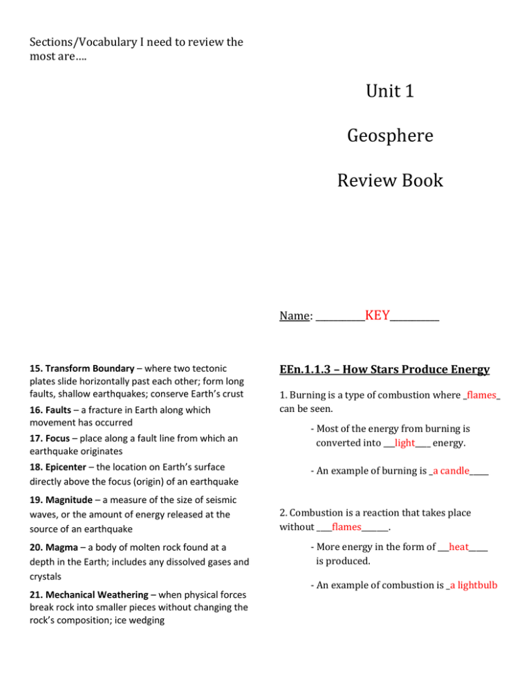
Sections/Vocabulary I need to review the most are…. Unit 1 Geosphere Review Book Name: ___________KEY___________ 15. Transform Boundary – where two tectonic plates slide horizontally past each other; form long faults, shallow earthquakes; conserve Earth’s crust 16. Faults – a fracture in Earth along which movement has occurred 17. Focus – place along a fault line from which an earthquake originates 18. Epicenter – the location on Earth’s surface directly above the focus (origin) of an earthquake 19. Magnitude – a measure of the size of seismic waves, or the amount of energy released at the source of an earthquake 20. Magma – a body of molten rock found at a depth in the Earth; includes any dissolved gases and crystals 21. Mechanical Weathering – when physical forces break rock into smaller pieces without changing the rock’s composition; ice wedging EEn.1.1.3 – How Stars Produce Energy 1. Burning is a type of combustion where _flames_ can be seen. - Most of the energy from burning is converted into ___light____ energy. - An example of burning is _a candle_____ 2. Combustion is a reaction that takes place without ____flames_______. - More energy in the form of ___heat_____ is produced. - An example of combustion is _a lightbulb Unit 1 Objectives EEn.1.1.3 – Explain how the Sun produces energy which is transferred to the Earth by radiation. EEn.2.1.1 – Explain how the rock cycle, plate tectonics, volcanoes and earthquakes impact the lithosphere. EEn.2.1.2 – Predict the locations of volcanoes, earthquakes and faults based on information contained in a variety of maps. EEn.2.1.3 – Explain how natural actions such as weathering, erosion (wind, water and gravity), and soil formation affect Earth’s surface. EEn.2.1.4 – Explain the probability of and preparation for geohazards such as landslides, avalanches, earthquakes and volcanoes in a particular area based on available data Nuclear Fission: 23. Erosion – movement of weathered materials from one location to another 24. Deposition – final stage of erosion process when sediments are laid down on the ground or settle to the bottom of a body of water 25. Foliation – a zone of weakness in a sedimentary rock 26. Mass movement – movement of loose sediments and weathered rock due to the force of gravity 27. Soil – a combination of minerals, organic matter, water and air; produced over long periods of time by the processes of weathering, erosion and deposition 8. Igneous Rock – crystallize from magma; examples are obsidian and basalt - nuclei are ___split_____ - process used in _nuclear__ 22. Chemical Weathering – the process where the internal structure of a mineral/rock is altered by the removal/addition of elements; dissolving of limestone by acid rain __power__ plants - Draw a simple picture of nuclear fission: 9. Sedimentary Rock – form from compacted and cemented sediments; examples are sandstone and shale 10. Plate Tectonics – theory that explains the structure of Earth’s crust as rigid plates that move slowly over the underlying mantle 11. Mantle Convection – transfer of thermal energy by movement of heated matter; ridge push and slab pull Nuclear Fusion : - nuclei are ___combined______ - the way in which the _Sun___ produces energy - Draw a simple picture of nuclear fusion: 12. Lithosphere – rigid outer shell of Earth including the crust and solid uppermost part of the mantle 13. Convergent Boundary – where two tectonic plates are moving toward each other; form trenches, island arcs, folded mountains; destroy Earth’s crust 14. Divergent Boundary – where two tectonic plates are moving away from each other; form volcanoes, earthquakes, high heat flow; create Earth’s crust Electromagnetic Spectrum/Waves: Unit 1 Vocabulary: 1. Nuclear Fission – when large nuclei are split into smaller nuclei; emit neutrons and heat energy; process used in nuclear power plants Label the diagram from largest to smallest 2. Nuclear Fusion – when smaller nuclei combine into larger nuclei; emits massive amounts of energy; process used by stars to produce energy 3. Radiation – the transfer of heat energy through space by electromagnetic waves - Waves with ___small__ wavelengths and ____high____ frequencies have the most energy. 4. Electromagnetic Waves/Spectrum – the arrangement of electromagnetic radiation according to wavelengths - Humans can only see the __visible___ light part of the spectrum with the naked eye. 5. Cosmic Rays – immensely high energy radiation; mainly originate outside the Solar System 6. Rock Cycle – the model that illustrates the origin of the three basic rock types and the relationships between Earth materials and processes - On Earth, only some _infrared, some ultraviolet, some __radio_ and all __visible___ light wavelengths make it to the surface. 7. Metamorphic Rock – form from changes in temperature and pressure; examples are slate and marble Mass Movement: It is the _movement__ of rock and soil _down__ __slope__ due to __gravity__ and caused by _weathering___ and __erosion__ . Water Over-steepened Slopes Removal of Saturating surfaces creating mudflows Water cuts under the bank of a river Taking away plants and roots Energy Transfer in Stars: Remember the dance… #1 _nuclear_ __fusion__ in the Sun’s __core__ . #2 Energy is passed from one particle to another through _conduction___. #3 Energy rises to the surface by __convection__ . #4 _Radiatioin_ of energy out into space by electromagnetic waves. Draw a sketch of this process below: Vegetation See diagram on the board Earthquakes Shake loose soil creating a landslide Energy transfer: Types of Mass Movement: Conduction – energy transfer when particles __touch___ each other. Based on the kind of __material__, how it _moves__ and _the speed__ of movement. Example: The bottom of a pot gets hot when it’s set on the eye of a stove. Examples are (list 5): Rockfall, slides, slumps, creep, flows Types of Geohazards: Convection – energy transfer through a _fluid__ ( __liquids__ and __gases__) It is impossible to know exactly when and where a geohazard will occur, so being __PREPARED__ is extremely important! Example: Water boiling in a pot Examples of geohazards include: earthquakes, volcanoes, mudslides, landslides, avalanches, floods, falling rock Radiation – energy transfer by _electomagnetic_ _waves___ Example: Movement of energy from the Sun to Earth Things that can be done to protect against geohazards include (list at least 5): Dams, levees, wire netting, breaks, special building codes, seismographs, having an emergency plan Solar Forces: Erosion is the __movement___ of __eroded__ MUST be in equilibrium (balance)! The inward force of __gravity_ of a star must be in balance with the outward push of _thermal__ _pressure__ from nuclear fusion in the core. material from _one__ location to __another_ . Rates of erosion are _slower__ in areas where there is a lot of vegetation (grass, trees, etc.), but are _faster____ in areas with sparse vegetation. Human activities that _remove____ vegetation help to __increase___ erosion rates. Examples of human activities that can impact erosion rates include (list at least 4 of each): Positive Impact planting trees responsible land use pasture rotation contour plowing Negative Impact deforestation poor construction practices overgrazing unsustainable farming practices Label the Soil Profile: O–Organics - layer of organic material A–Topsoil – organic & mineral material mix EEn.2.1.1 The Rock Cycle, Plate Tectonics, Volcanoes and Earthquakes B–Subsoil – parent material in sediment form C–Substrate – parent material in large chunks R–Bedrock – parent material in huge slabs How Soil Forms: Soil formation requires five things: _parent__ _material____ , _topography__ , __climate___ , __organisms___ and ____time______ Soil creates __soil___ ___horizons____ __Energy____ is needed to changes rocks from one type to the next. __Sedimentary____ rocks are made from __sediments____ . The energy for this process is external and comes from the ___Sun____ . __Igneous_____ rocks are made from ___magma____. The energy for this process is internal and comes from _Earth’s__ __core__ . __Metamorphic__ rocks are made from other ___rocks________. The energy for this process is also internal and also comes from _Earth’s___ _core___. Draw and label the Rock Cycle: Importance of topography in soil formation: Because mountain areas tend to have steep slopes, soil tends to __erode___ __away____ resulting in very ___thin___ soil. See diagram on board __Valleys___ tend to collect the sediments washed away from mountainsides often resulting in very __thick____ , ____rich____ soil. Importance of climate in soil formation: Areas that are cool and dry with very little _vegetation_ tend to have mostly __physical___ weathering. Areas that are warm and moist with _abundant___ vegetation tend to have mostly __chemical___ weathering. Label the Earth’s main layers: Soil: Is an _important__ product of __weathering___ . Support __plant___ growth. CRUST Oceanic = younger rocks Continental = older rocks MANTLE Contains ____82_____% of Earth’s total volume OUTER CORE _____liquid___ due to extreme heat INNER CORE ___solid___ due to extreme pressure There are four major components: 1. __mineral__ matter 2. __organic__ matter (decayed things) 3. _water__ 4. __air_____ Different ratios of these components contribute to the creation of different types of soil. Rate of Weathering: Continental Drift: Rates of weathering are dependent on three factors: Theory proposed by __Alfred__ __Wegener__ in 1915 (over 100 years ago!) 1. Rock characteristics – what does the rock look like (is it big, does it have a smooth surface or are there a lot of cracks and pits, etc.). This was the accepted theory before __plate__ _tectonics__ . 2. Climate – what is the average _temperature__ and _moisture_ levels where the rock is found. This theory states that continents had once been joined together into a super-continent called _Pangaea___. 3. _differential__ ___weathering__ - different parts of a rock may weather at different rates depending on the rock’s composition EEn.2.1.2 – Predicting Earthquakes and Volcanoes from Maps In the 1950s/1960s, continental drift was replaced by the theory of _plate__ _tectonics__. In the _short__ term, it is very difficult to predict exactly when and where a volcano or earthquake will happen. This new theory took into account the motion of the continents by __tectonic___ activity and _mantle__ __convection__ . In the __long___ term, however, it is possible to predict if an earthquake or volcanic activity is likely in an area over the next 30 – 100 years. Plate tectonics is caused by mantle convection. The _Ring__ of __Fire__ is an area along plate boundaries around the rim of the _Pacific__ Ocean where earthquakes and volcanoes are most likely to occur. Earthquakes and volcanoes are possible anywhere two __tectonic__ _plates__ meet. _rising_ mantle = __divergent__ boundary = __ridge___ push __falling__ mantle = _convergent___ boundary = __slab___ pull Evidence for Continental Drift Theory: 1. continental _jigsaw_ __puzzle___ 2. _matching__ __fossils___ 3. similar _rock__ __types__ and __structures__ EEn.2.1.3 – Weathering, Erosion & Soil Mechanical weathering – when _physical_ _forces_ break down rocks (_temperature_ & _pressure_) 1. _frost_ _wedging__ 2. _unloading____ 3. __biological___ _activity_ 4. similar _ancient__ climates Chemical weathering - _transformation__ of a rock from one form to _another___ 1. water ( _hydrolysis_ ) 2. oxygen ( _oxidation__ ) 3. carbon dioxide ( _carbonic_ acid ) 4. _acid__ rain Types of Boundaries: Where volcanoes form: Convergent Boundary: Divergent Boundaries: - Where two tectonic plates move _together__. - _destroy___ the Earth’s crust. - Land formations found at these boundaries are: - The magma chamber is _close_ to the surface. - Form __shield___ volcanoes. - This type of volcano looks like: SEE DIAGRAM ON BOARD trenches, island arcs, folded mountains Convergent Boundaries: - Examples of places where this boundary type is found include (list at least 5): Cascade Mountain Range, Himalayas, Mariana Trench, Japan, Aleutian Islands Draw a sketch of this type of boundary: SEE DIAGRAM ON BOARD - The magma chamber is formed from a melted __subducted__ plate. - Form _cinder____ _cone___ volcanoes. - This type of volcano looks like: SEE DIAGRAM ON BOARD Volcanoes: Divergent Boundary: There are three factors that affect the force of a volcanic eruption… - Where two tectonic plates move __apart__. 1. magma _composition___ - _create____ the Earth’s crust. - Land formations found at these boundaries are: more _silica___ = __thicker__ lava more iron/magnesium = __thinner_ lava 2. magma __temperature_____ hotter magma = a more forceful explosion 3. amount of _dissolved___ gasses upwelling, rift valleys, shallow seas, ocean ridges (seafloor spreading) - Examples of places where this boundary type is found include (list at least 5): Black Hills, SD; East African Rift Valley; Red Sea; Mid-Atlantic Ocean Ridge; Draw a sketch of this type of boundary: the higher the gas content the more explosive the eruption SEE DIAGRAM ON BOARD _viscosity___ is a substance’s resistance to flow. Triangulation of an Earthquake’s Epicenter: Earthquakes: Must use the data from a minimum of _three___ seismographic stations. Occur at _faults__ between tectonic plates. The data is used with a time-distance__ graph to plot a distance from the seismograph station. Draw an example of a triangulation given the stations below: Focus = point _inside_ the Earth where an earthquake occurs. Epicenter = point on Earth’s _surface__ directly above the _focus___ . Label the focus and epicenter on the diagram A below: B EEpicenter C FFocus Transform Boundary: Destructive Earthquake Forces: - Where two tectonic plates move _past___ each other. Magnitude – a measure of the amount of energy released at the __focus____ . - __conserve____ the Earth’s crust. - can ONLY be measured at the earthquake’s __location__ - Land formations found at these boundaries are: long, shallow faults - Examples of places where this boundary type is found include (list at least 5): San Andreas, Alpine (New Zealand), Chaman (Pakistan), North Anatolian (Turkey), Dead Sea Draw a sketch of this type of boundary: SEE DIAGRAM ON BOARD Intensity – a measure of the amount of __shaking__ that occurs during an earthquake. - can be measured _anywhere__ on Earth. - Generally, the deeper the focus and lower the magnitude, the less damage and earthquake does. - Circle the scenario that would do the MOST damage… A – shallow focus, 3.6 magnitude B – shallow focus, 7.1 magnitude Types of Faults: __foreshocks happen before an earthquake. Convergent Boundary = __reverse__ fault Color the picture of this fault type ___aftershocks happen after an earthquake. A __seismograph__ is an instrument used to record the vibrations of an earthquake. Wave Types: 1. Surface waves – travel along Earth’s _surface__ Divergent Boundary = __normal____ fault Color the picture of this fault type - They are the _slowest__ moving, so they are the _last__ to arrive at a seismograph station. 2. Body waves – travel through the Earth - P-waves: _fastest_ moving; arrive at a station _first__ ; __push_-_pull__ through the Earth’s layers Transform Boundary = _strike-slip___ fault Color the picture of this fault type - S-waves: arrive at a station _second__; move at right angles (cause particles to _shake___).
