Chapter 13 Learning Guide – Urban Patterns
advertisement
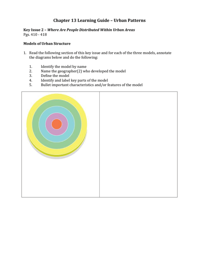
Chapter 13 Learning Guide – Urban Patterns Key Issue 2 – Where Are People Distributed Within Urban Areas Pgs. 410 - 418 Models of Urban Structure 1. Read the following section of this key issue and for each of the three models, annotate the diagrams below and do the following: 1. 2. 3. 4. 5. Identify the model by name Name the geographer(2) who developed the model Define the model Identify and label key parts of the model Bullet important characteristics and/or features of the model 2. What are census tracts? 3. What three (3) types of data are reported by the U.S. Census Bureau regarding the population of each census tract? 4. What is social area analysis? 5. What two (2) things can we deduce by combining all three models rather than considering them independently? Applying the Models Outside North America 6. What are the advantages of living in the inner-ring near the city center? 7. List three (3) points about the conditions of European suburbs, where the poor live. 8. Cities in Africa, Asia and Latin America resemble European cities in their structure. This is not a coincidence because…. 9. Draw and label a sketch of a “pre-colonial city” 10. Colonial cities often contained a new “European sector” to the side of the precolonial city. Contrast their various elements in the table below. “Old Quarters” – pre-colonial city “European district” – colonial addition 11. Describe the elite spine sector developed in Latin American cities. 12. What are the causes of squatter settlement? 13. Define squatter settlements. 14. Describe services and amenities in a typical squatter settlement. 15. Make a simple flowchart which depicts stages in the development of a squatter settlement. Chapter 13 Learning Guide – Urban Patterns Key Issue 2 – Where Are People Distributed Within Urban Areas Pgs. 410 - 418 Models of Urban Structure 1. Read the following section of this key issue and for each of the three models, annotate the diagrams below and do the following: 6. 7. 8. 9. 10. Identify the model by name Name the geographer(2) who developed the model Define the model Identify and label key parts of the model Bullet important characteristics and/or features of the model 1. CBD – nonresidential activities 2. Zone of transition – industry & poor quality housing 3. Zone of independent workers – modest older homes occupied by middle class families 4. Zone of better residences – newer, larger homes for middle class families 5. Commuter’s Zone – small towns for people who drive into the city for work Concentric Zone Model by E.W. Burgess City grows outward from a central area in a series of rings 1. 2. 3. 4. 5. CBD Transportation & Industry Low class residential Middle class residential High class residential Better housing found in a corridor from downtown to city edge Industry & retail develop along transport lines Sector Model by Homer Hoyt City develops in sectors that branch out from CBD 1. 2. 3. 4. 5. 6. 7. 8. 9. CBD Wholesale, light manufacturing Low class residential Middle class residential High class residential Heavy manufacturing Outlying business district Residential suburb Industrial suburb Some activities are attracted to particular nodes while some avoid them Multiple Nuclei Model by Harris & Ullman City is complex structure that includes more than one center which activities revolve Ex. University node attracts book stores; Airport node attracts hotels 2. What are census tracts? Urban areas that contain about 5,000 residents & correspond to neighborhood boundaries 3. What three (3) types of data are reported by the U.S. Census Bureau regarding the population of each census tract? - # of non-whites - median income - % of adults who finish high school 4. What is social area analysis? Comparing people of similar living standards, ethnic background and lifestyle within an urban area 5.What two (2) things can we deduce by combining all three models rather than considering them independently? - People tend to reside in certain locations depending on particular personal characteristics - People prefer to live near others who have similar characteristics Applying the Models Outside North America 6. What are the advantages of living in the inner-ring near the city center? Proximity to shops, restaurants, cafes & cultural facilities 7. List three (3) points about the conditions of European suburbs, where the poor live. - 8. Long commutes on public transportation Poorer shops & schools Crime, violence & drug dealing Cities in Africa, Asia and Latin America resemble European cities in their structure. This is not a coincidence because…. European colonial policies helped develop cities in LDCs 9. Draw and label a sketch of a “pre-colonial city” 4 Concentric rings labeled as follows Ring 1 (inner circle) – High status businesses related to religious practices located near mosque Ring 2 – Secular businesses such as leather works, tailors, jewelers Ring 3 – Food products Ring 4 (outer circle) – Blacksmiths, basket makers, potters 10. Colonial cities often contained a new “European sector” to the side of the precolonial city. Contrast their various elements in the table below. “Old Quarters” – pre-colonial city - 11. narrow winding streets little open space cramped residences “European district” – colonial addition - grid street plan church or central plaza walls around houses wider streets lower population density Describe the elite spine sector developed in Latin American cities. Elite residential sector with offices, shops & amenities for wealthy people; water & electricity readily available 12. What are the causes of squatter settlement? Population increase and migration from rural areas for jobs; housing shortage for large number of urban immigrants 13. Define squatter settlements. Area in a city in an LDC where people illegally establish residences on land they don’t own or rent 14. Describe services and amenities in a typical squatter settlement. Latrines designated by settlement leaders; water carried from a well; electricity stolen by running wire to power line 15. Make a simple flowchart which depicts stages in the development of a squatter settlement. Camp on land or sleep in street Severe weather – camp in markets or warehouses Families build shelter with cardboard, wooded boxes, crushed cans Build on a roof & partition space into rooms for more permanent settlement
